
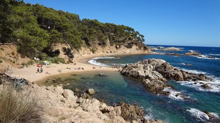
Cala Estreta is a small sandy cove on the Costa Brava coast of Palamós, about 1.5 km east of the Platja de Castell, inside the protected Castell–Cap Roig natural area. There is no road to the sand: you park at Castell and walk the coastal path (camí de ronda), or walk in from Cala Canyers. The cove is undeveloped, sheltered by rocks and pines, and naturism is common here and on the neighbouring coves. It suits walkers and people who want a wild beach; skip it if you need a car park by the sand, shade, toilets or step-free access.
Quick facts
- Names: Cala Estreta (Catalan for “narrow cove”); in Spanish sometimes Playa Cala Estreta. Not to be confused with the Cala Estreta near Artà in Mallorca.
- Where: Palamós, Baix Empordà (Girona), on the coast between the Platja de Castell and Calella de Palafrugell, in the Castell–Cap Roig protected area.
- Coordinates: 41.8654, 3.1728.
- Size: 34 m long and 16 m wide (spain.info). Catalan Wikipedia gives 46 m by 12 m; small coves change with storms.
- Surface: golden sand (spain.info).
- Character: isolated, no buildings on the beach; spain.info rates occupancy as high.
- Services: bins and cleaning only (spain.info).
- Entry: free.
Access and parking
By car: from Palamós, head north-east towards the Platja de Castell; the Camí de la Platja del Castell road leads to the beach car park. spain.info names the C-31 as the nearest main road. Beyond it, OpenStreetMap shows the tracks into the protected area as permit-only for motor vehicles.
Parking: the Aparcament Cala Castell, tagged as paid on OpenStreetMap with ticket machines at the entrance, is about 1.5 km from Cala Estreta in a straight line. OpenStreetMap also shows a separate area for drivers with reduced mobility near Castell beach. We could not confirm the parking prices or season, because the Palamós town and tourism websites could not be reached when we checked. OpenStreetMap marks a small unsigned parking area about 200 m above the cove, at the end of a forest track; we could not confirm whether the public may drive there, so plan on parking at Castell.
On foot: spain.info says you reach the cove on foot from Cala Canyers, and rates the access as easy (spain.info). From Castell, the coastal path and the GR 92 long-distance path run east through pine woods past the coves of Canyers, Corbs and Senià. Allow a little more than the straight-line 1.5 km, as the path climbs and drops between coves. Wear proper shoes: parts are rough ground and steps.
By boat: spain.info notes that pleasure boats often anchor off the cove.
What to expect
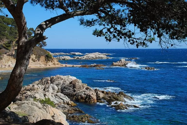
Cala Estreta is one of a string of small coves between the Punta dels Canyers and the Cap de Planes: Cala Estreta, Cala d’en Remendon, Cala de Roca Bona and Cala del Cap de Planes, separated by rocks running into the sea (OpenStreetMap). The Illes Formigues islets lie offshore, about a kilometre out according to Catalan Wikipedia. spain.info describes the bathing conditions as moderate swell, and lists diving and fishing.
The cove is backed by granite rocks and pine-covered slopes, and an old fishermen’s hut (barraca) stands near the beach. There are no buildings, bars or showers on the sand; Catalan Wikipedia notes that a small kiosk is often set up in summer, which we could not confirm. OpenStreetMap tags Cala Estreta and its neighbours as naturist beaches, so expect nude bathing.
Practical details
- Bring everything: water, food, sun protection and a bag for your rubbish. There are no confirmed shops, taps or toilets at the cove.
- Shade: the beach itself is open; the pines are behind and above it.
- In the water: spain.info lists diving and fishing here. If you snorkel along the rocks, keep well clear of anchored boats.
- Protected area: the cove is in the Castell–Cap Roig natural area. Stay on the paths and take your rubbish with you.
- Official information: the Palamós tourist office runs the town’s beach information; its website could not be reached from our checks, so confirm summer services with the office.
Accessibility and safety
Cala Estreta is not accessible for wheelchairs or pushchairs: you reach it only on foot along an unpaved coastal path with steps and slopes. We could not confirm any lifeguard service; treat the cove as unsupervised. spain.info describes the sea as moderate swell, so take care on windy days and on the rocks. In summer the woods carry a fire risk, and access rules in the protected area can change.
Best time to visit
June and September give warm water and fewer people. spain.info rates the cove’s occupancy as high, so in July and August arrive early: the Castell car park and the small coves fill up. Spring and autumn are good for walking the coastal path itself, when it is cooler.
Nearby alternatives
- La Fosca, 2.7 km away: Palamós’s sheltered sandy bay with services, reached by road.
- Calella de Palafrugell, 2.7 km away: the fishing village with small beaches, reached along the same coast to the north-east.
- Llafranc, 3.6 km away: a sandy bay and promenade in Palafrugell.
- Cork Museum of Palafrugell, 5.9 km away: an indoor option for a hot or windy day.
- Platja d’Aiguablava (Begur), 8.4 km away: a sandy cove with full summer services.
- Platja de Castell, 1.4 km west: the large undeveloped sandy beach where most walkers park.
Distances are in a straight line from the cove.
FAQ
How do I get to Cala Estreta?
Only on foot. Park at the Platja de Castell in Palamós and walk east on the coastal path, or walk in from Cala Canyers. It is about 1.5 km from the Castell car park in a straight line.
Is there parking at Cala Estreta?
Not at the cove. The nearest public car park is the Aparcament Cala Castell, which OpenStreetMap marks as paid. We could not confirm prices.
Is Cala Estreta a nudist beach?
OpenStreetMap tags it as a naturist beach, as it does the neighbouring coves, and nude bathing is common. It is not a formally signed naturist beach as far as we could confirm.
Are there lifeguards or facilities?
We could not confirm a lifeguard service. spain.info lists only bins and cleaning, so bring water and food.
Is Cala Estreta sandy?
Yes. spain.info describes golden sand; the cove is about 34 m long and 16 m wide.
Sources and freshness
Checked 6 November 2026 · 3 sources Show
Checked 6 November 2026. The Palamós town hall and Visit Palamós websites could not be reached from our network, so we used the official national tourism portal: spain.info, Cala Estreta (Palamós) (size, sand, swell, occupancy, access, services, boats, diving). Background: Catalan Wikipedia, Cala Estreta (protected area, alternative size, kiosk). Location, coves, paths, car parks, naturist tags and distances: OpenStreetMap contributors (ODbL). Photos: Wikimedia Commons, licences as credited.
How this page is made. CostaMap is written with an AI editorial system run by Ebizapple. This page is based on the sources listed above. Last updated 6 November 2026. Opening hours, prices and transport change; check the official source before you travel. How we work · Partner links and ads