
Barcelona province · Catalonia, Spain
Costa de Barcelona travel guide: the city beaches, Maresme and Garraf
Barcelona’s city beaches, the Maresme to the north and the Garraf to the south: Gaudí, Roman Mataró, Sitges and trains along the shore.
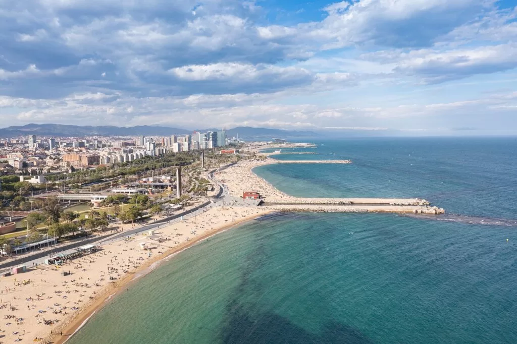
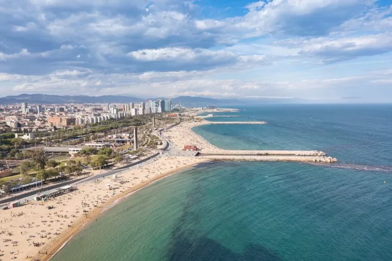
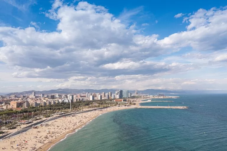
Nova Icària, Barcelona · Photo: dronepicr, CC BY 2.0
The Costa de Barcelona is the coast of Barcelona province in Catalonia, between the Costa Brava to the north and the Costa Daurada to the south. Catalonia’s tourist board uses the name for around thirty coastal municipalities, from the Maresme in the north through Barcelona to the Baix Llobregat and the Garraf (Catalunya.com). This guide is the overview: the city beaches, the Besòs and the Llobregat beaches in detail, with the Maresme and the Garraf as short areas that link to their own guides.
At a glance
- Where the coast of Barcelona province, Catalonia, between the Costa Brava to the north and the Costa Daurada to the south.
- The brand Catalonia’s tourist board groups around thirty coastal municipalities as Costa de Barcelona, with the Maresme to the north and the Garraf and Baix Llobregat to the south.
- City beaches about four kilometres of beaches in Barcelona itself, from Sant Sebastià to the Fòrum.
- On CostaMap two coastal town guides, 10 places on the coast and one campsite on the coast.
- Airport Barcelona-El Prat (BCN), beside the Remolar lagoon south-west of the city, with the R2 North train at T2 and metro L9 at both terminals.
- Trains Rodalies R1 runs north along the Maresme coast and R2 South runs to Castelldefels, Sitges and Vilanova i la Geltrú.
Map of the Costa de Barcelona
The map shows the places on this coast that have a CostaMap page. Tick a place type to filter it, and click a marker to open the page. The full-screen version is the Costa de Barcelona map; the Maresme and the Garraf have maps of their own.
Place type
Area · next level
 Coast guide
Costa de Barcelona
Click a marker to see the place here. Five areas from the Maresme to the Garraf, with Manresa and Montserrat inland.
Choose your areaOpen the full Costa de Barcelona map →
Choose your area
The coast is split here into five areas. Barcelona sits in the middle; the Besòs river marks its north-eastern edge and the Llobregat delta, with the airport, its south-western one. Beyond them the Maresme runs north towards the Costa Brava and the Garraf runs south towards the Costa Daurada. Only places on or near the sea are in the lists; the inland towns follow as day trips.
Barcelona and the city beaches
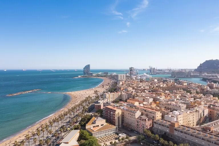
The City Council’s beaches run from Sant Sebastià, the most westerly, to the Fòrum bathing area; Mar Bella was created for the 1992 Olympic Games. The old town and Montjuïc are a short walk behind.
- Barcelona – about four kilometres of city beaches, several listed by the City Council with a Blue Flag, plus the Gaudí buildings and the Gothic cathedral.
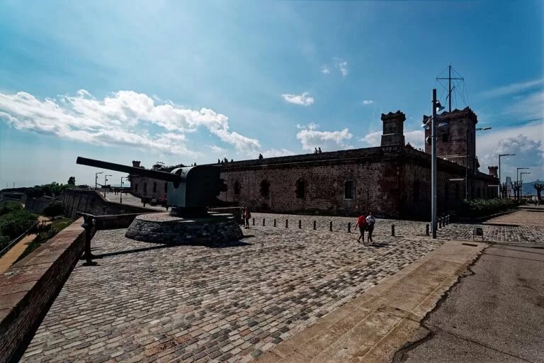
- Montjuïc Castle – the 18th-century fortress on the hill above the port, free every Sunday from 3 pm.
- Museu Picasso – five medieval palaces on Carrer de Montcada, a short walk from the Barceloneta beach.
The Besòs: Sant Adrià
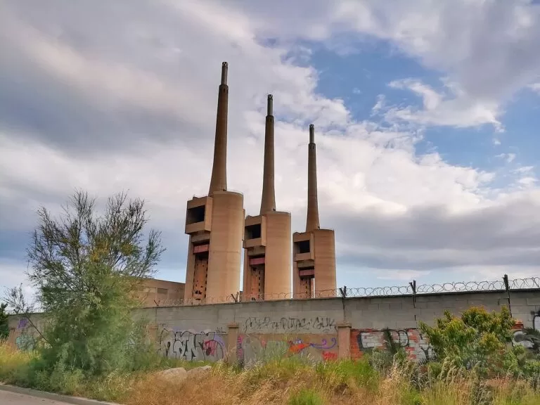
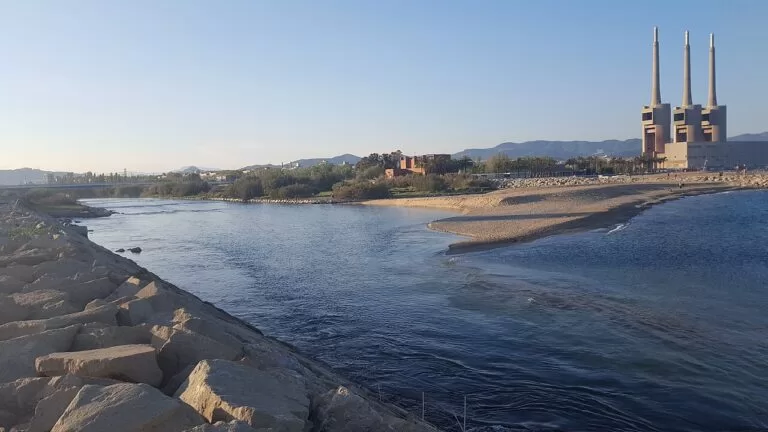
Where the city ends to the north-east: two beaches either side of the mouth of the Besòs, under the Three Chimneys of the old power station.
- Sant Adrià de Besòs – the Parc del Litoral and Fòrum beaches, one on each side of the river mouth; bathing water is usually good or excellent except after heavy rain.
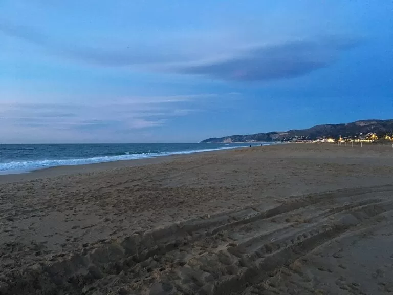
South: the Llobregat beaches
Past the airport the delta gives long, flat beaches with pine woods behind, bird lagoons and two sights on the hills above.
- Castelldefels Castle – 60 m above the town and the five kilometres of Castelldefels beach, with an original 10th-century church.
- Gavà Mines – Neolithic galleries dug about 6,000 years ago for variscite, a green stone for jewellery.
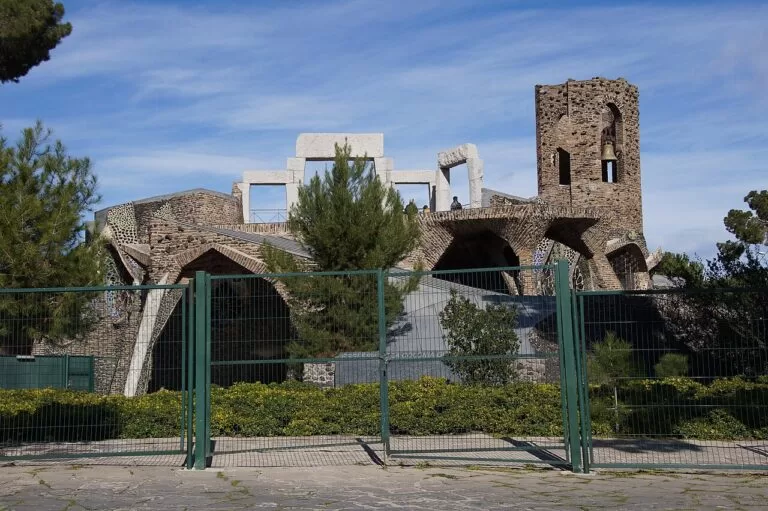
- Church of Colònia Güell – Gaudí’s crypt at the Colònia Güell, one of his seven UNESCO-listed works, about 20–25 minutes by FGC train from Plaça Espanya.
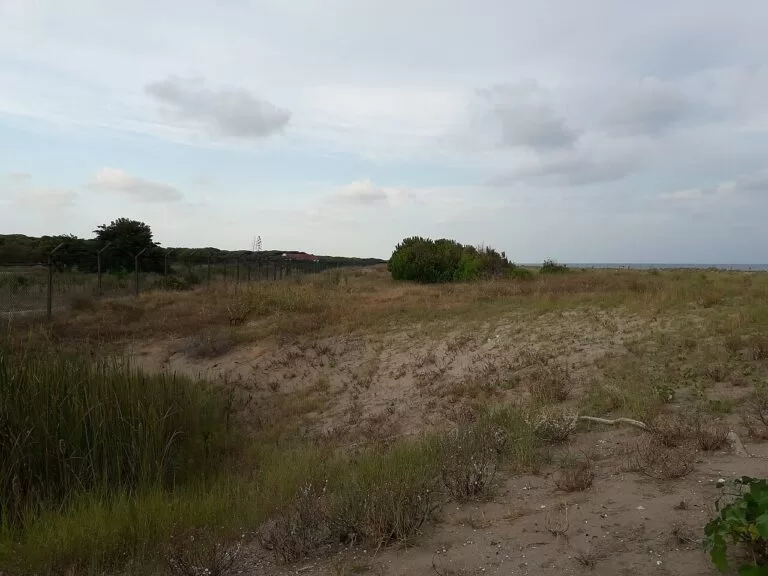
- El Prat, Viladecans and Gavà – 5.5 km, 2.4 km and 2,730 m of beach between the Llobregat mouth and the Garraf, with parts closed for nesting birds in spring.
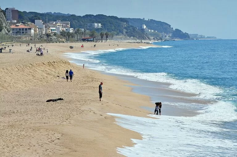
North: the Maresme
A narrow strip between the sea and the coastal hills, with the R1 train along the shore. The Maresme gets its own guide; this is the short version.
- Mataró – the capital of the Maresme, built over the Roman city of Iluro, at the end of the first railway in the Iberian Peninsula (1848).
- Arenys de Mar – a working fishing port where you can watch the fish auction in the fishermen’s market hall.
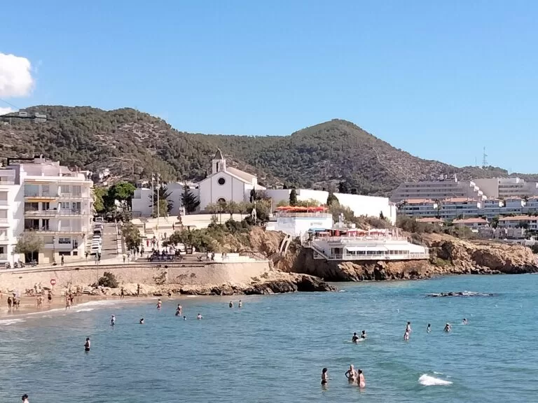
South: the Garraf
Beyond Castelldefels the Garraf massif reaches the sea, and the R2 South train tunnels through it to Sitges and Vilanova. The Garraf gets its own guide.
- Sitges – the Catalan municipality with the most Blue Flag beaches, the Cau Ferrat museum and the film festival every October.
- Vilanova i la Geltrú – one of Catalonia’s main fishing ports, with the Catalan Railway Museum in the old locomotive depot.
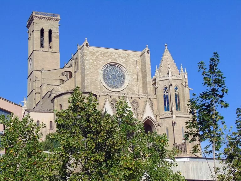
Inland day trips
The brand also covers the Vallès and, for day trips, the Bages around Manresa. None of these towns is on the sea, so their pages are not in the lists above:
- Manresa – La Seu basilica, begun in 1328, and the cave where Saint Ignatius wrote his Spiritual Exercises; the R4 starts here.
- Santpedor – a Bages town near Manresa where Pep Guardiola was born in 1971.
- Sallent – the birthplace of Saint Anthony Mary Claret, now an interpretation centre.
- Mollet del Vallès – the Gallecs rural area, almost 734 hectares of protected, largely organic farmland.
- Montcada i Reixac – the chapel of Sant Pere de Reixac, consecrated in 1048, just north of the city.
Explore by interest
Six ways into the coast. Each tile opens the part of this guide that covers it.
Best beaches and coves
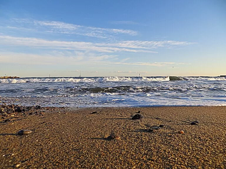
The selection below is ours, from the city centre to the south-west. Lengths and Blue Flags are as listed by the city and town councils, checked in October 2026. In 2026 Barcelona’s high bathing season ran from 30 May to 13 September, with lifeguards on every city beach from 10.30 am to 7.30 pm (Barcelona City Council).
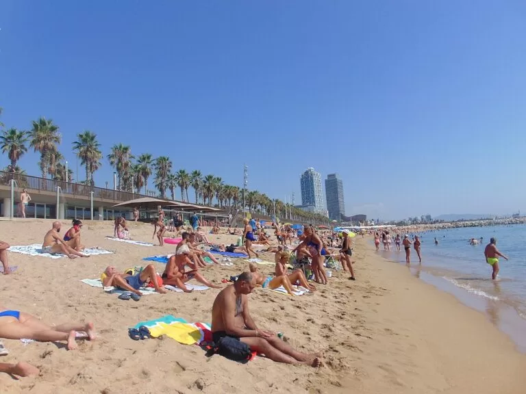
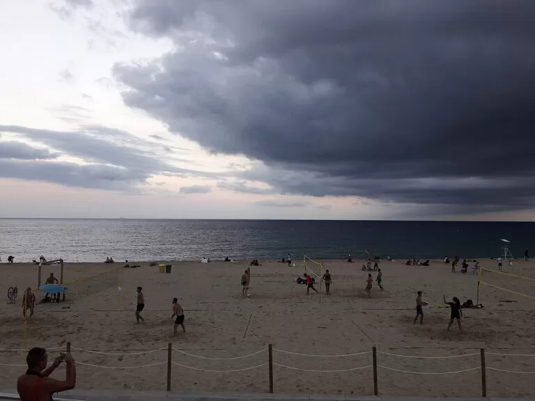
Nova Icària
415 m of sand, listed by the City Council with a Blue Flag (Barcelona City Council).
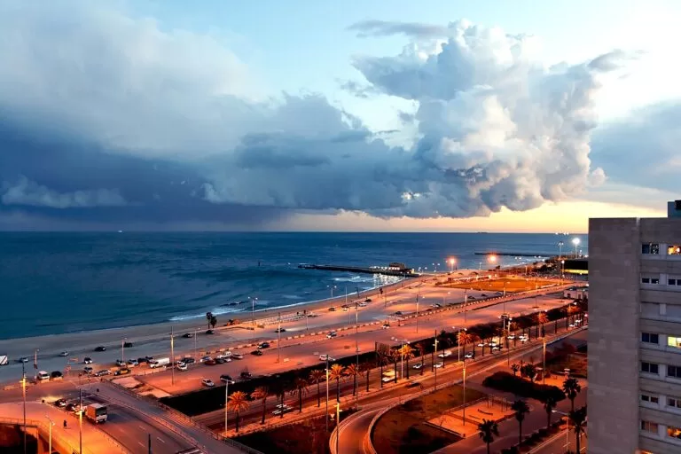
Bogatell
At 702 m the longest city beach, upgraded when the seafront was rebuilt in the 1990s and listed with a Blue Flag (Barcelona City Council).
Mar Bella
About 512 m, created for the 1992 Olympic Games, with a Blue Flag and a naturist area 500 m long (Barcelona City Council).
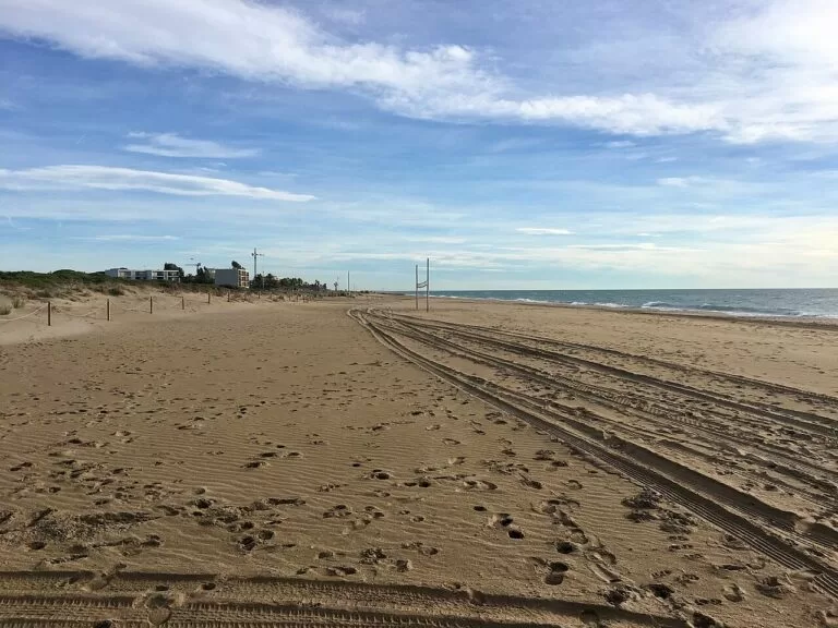
Parc del Litoral, Sant Adrià
One of two beaches either side of the Besòs mouth; the town reports bathing water that is usually good or excellent, except after heavy rain (Sant Adrià town council).
Castelldefels
Five kilometres of coast between the protected Llobregat delta and the Garraf massif, and a Blue Flag beach (Catalunya.com).
Also on the city front: Somorrostro (about 522 m, with a beach library in summer), Nova Mar Bella (about 420 m) and Llevant, the newest beach (2006), with an area for dogs in summer. The Fòrum bathing area is 375 m of paved terraces with steps into the water instead of sand. South of the airport, El Prat has 5.5 km of shore of which 3 km are open to the public, Viladecans has 2.4 km, partly closed for nesting birds from 15 March to 31 July, and Gavà has 2,730 m of fine sand backed by a pine wood.
Where to stay by town
What decides the base is the train line: the metro and the R2 for the city and the airport, R2 South for the Llobregat beaches and Sitges, R1 for the Maresme.
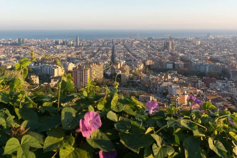
Barcelona
The Gaudí buildings, the Gothic cathedral and about four kilometres of beaches, 32 minutes from the airport by metro.
A city break with a beach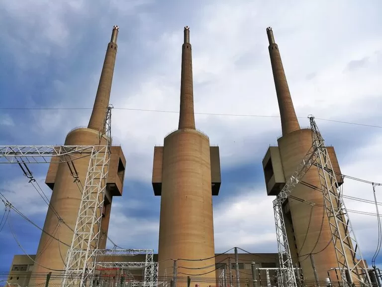
Sant Adrià de Besòs
Two beaches at the Besòs mouth, right next to Barcelona’s Fòrum and the eastern city beaches.
Next to the city, on the sea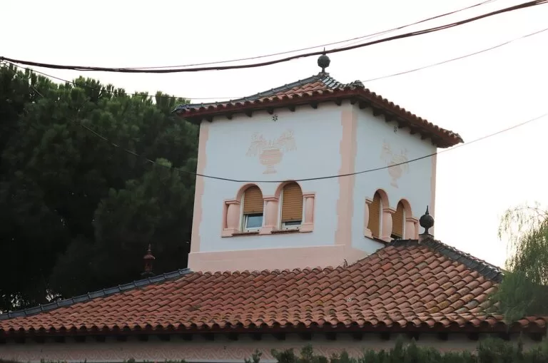
Castelldefels
Five kilometres of coast, a castle on the hill and the R2 South train; the airport is close by.
Long beach days, short transfers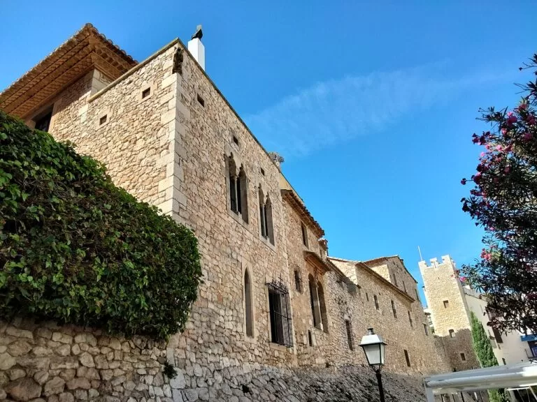
Sitges
More Blue Flag beaches than any other Catalan municipality, the Cau Ferrat and the October film festival.
Beaches, museums and nightlife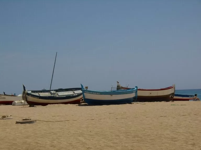
Mataró
The Maresme capital on the R1, with the Roman villa of Torre Llauder; trains run every 15 minutes at peak.
The Maresme without a carCampsites
One campsite on this coast has a CostaMap page. HolaCamp Barcelona is in Gavà, on the C-31 at km 186.2, 4.5 km from El Prat airport by the campsite’s own figures; from the airport the L77 bus runs from Terminal 1, and buses L94 and L95 run from Barcelona (HolaCamp). More campsites are on the Maresme and Garraf maps.
HolaCamp Barcelona
50 m from the beach, 4.5 km from the airport and 18.2 km from central Barcelona, by the campsite’s own figures.
See the campsite →Things to do
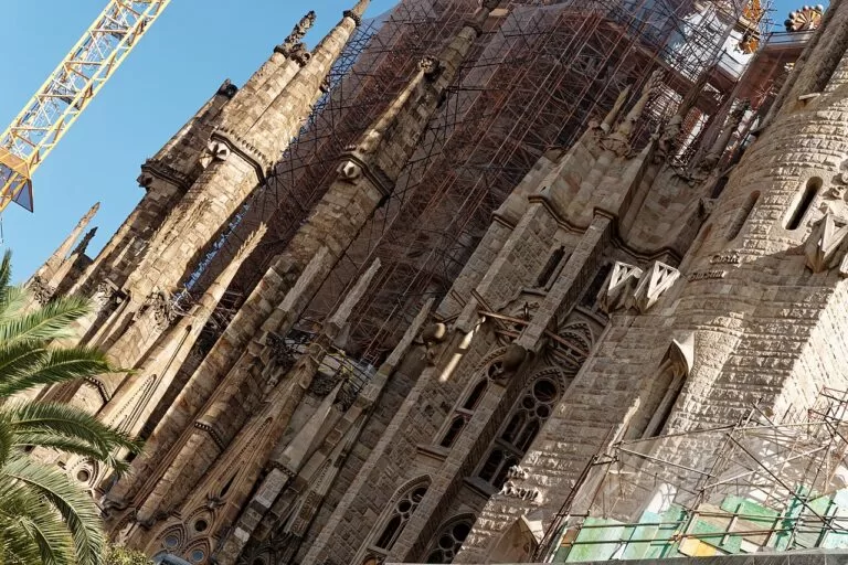
Gaudí’s Barcelona
UNESCO lists seven works by Antoni Gaudí (1852–1926) in and near Barcelona, inscribed in 1984 and extended in 2005 (UNESCO). The Sagrada Família began in 1882 and Gaudí took it over in 1883; it was consecrated in 2010, and the tower of Jesus Christ, the tallest, was topped out on 20 February 2026 (Sagrada Família).
Casa Batlló, at Passeig de Gràcia 43, is an 1877 house that Gaudí fully remodelled in 1904–1906 (Casa Batlló). Park Güell began in 1900 as a housing scheme; only two of sixty houses were built, and the city opened it as a park in 1926 (Park Güell).
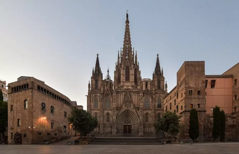
The Gothic cathedral and Picasso
Work on Barcelona Cathedral, the Catedral de la Santa Creu i Santa Eulàlia, began on 1 May 1298 and the cloister was finished in 1448; thirteen white geese live in the cloister garden (Catedral de Barcelona).
The Museu Picasso opened in 1963 and fills five medieval palaces on Carrer de Montcada, with some 5,000 works. General admission is €15; entry is free on the first Sunday of the month, and free slots must be booked in advance (Barcelona museums, checked Oct 2026).
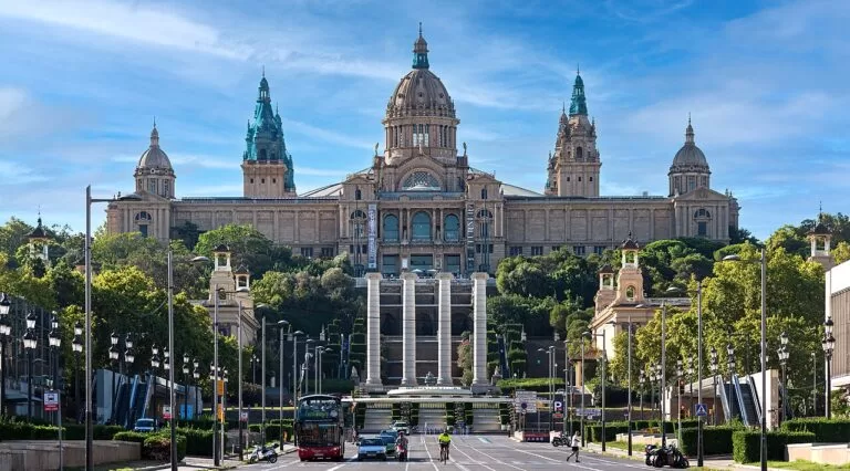
Montjuïc: art and the fortress
The Museu Nacional d’Art de Catalunya is in the Palau Nacional, built for the 1929 International Exposition, and holds what it calls the world’s best collection of Romanesque mural painting (MNAC).
Further up, the fortress of Montjuïc Castle was built from 1753 to 1799; general entry is €12, reduced €8, and free every Sunday from 3 pm (Barcelona City Council, checked Oct 2026).
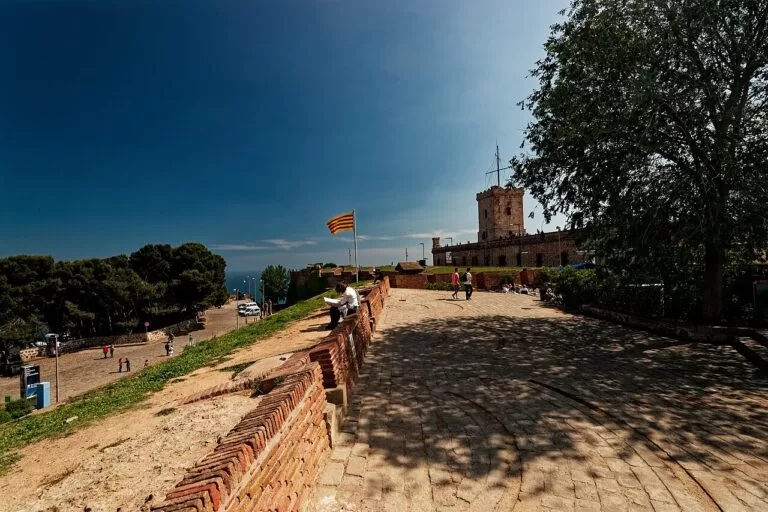
Montjuïc Castle
Built from 1753 to 1799; general entry €12, free every Sunday from 3 pm.
Read the guide →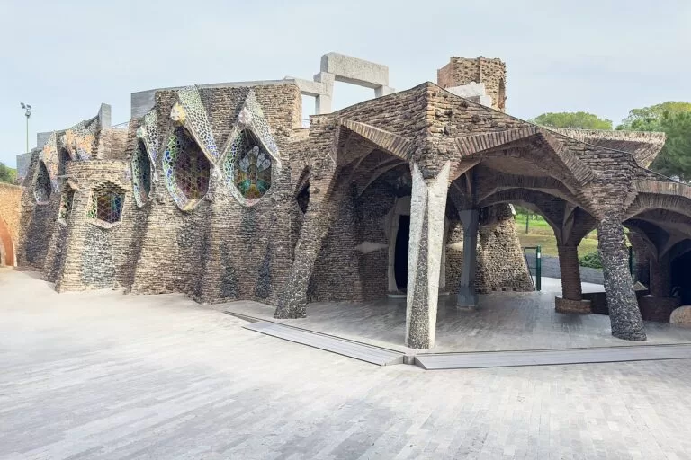
Church of Colònia Güell
Gaudí’s crypt, open all year; €10 with an audio guide in 10 languages.
Read the guide →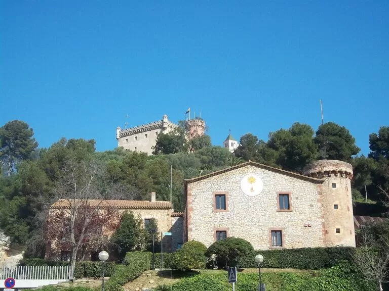
Castelldefels Castle
Restored from 1897, owned by the town since 1988; €10 for adults.
Read the guide →Gavà Mines
A network over 200 hectares, the oldest gallery mines in Europe dug for variscite.
Read the guide →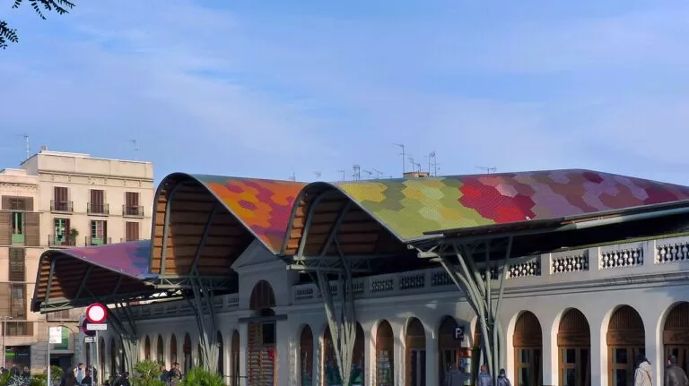
Markets and Catalan cooking
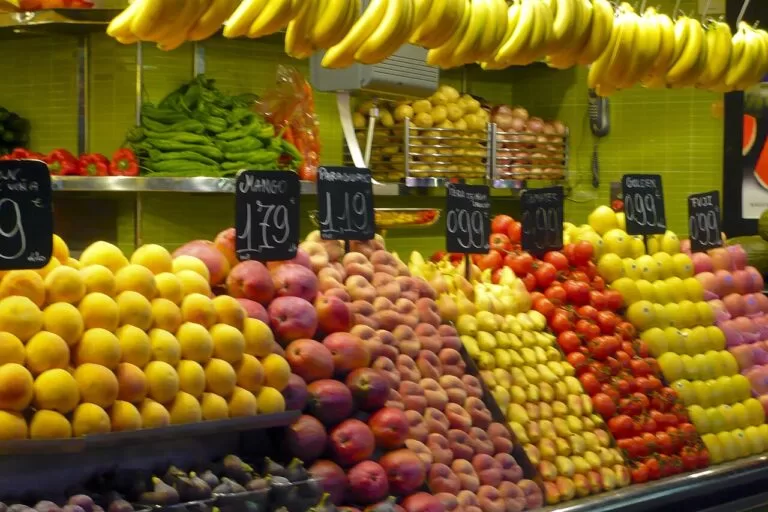
The Boqueria on La Rambla is first documented in 1217; its iron roof dates from 1914 (Barcelona markets). Santa Caterina became the city’s first covered market in 1848 and now has a wavy, colourful roof by Enric Miralles and Benedetta Tagliabue.
Look for pa amb tomàquet (bread rubbed with tomato), escalivada of roasted peppers and aubergines, and crema catalana (Barcelona Turisme); in season, calçots are grilled over a flame and dipped in romesco sauce. South-west of the city, Penedès wines and cava are the star of the table.
Hills behind the beaches
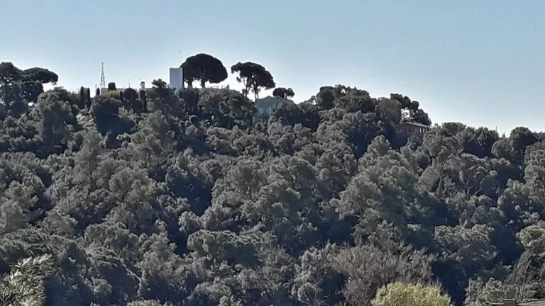
Collserola, the range behind Barcelona, became a natural park of 8,259 ha in 2010 (Parc Natural de Collserola), and the Carretera de les Aigües runs along its seaward side as one long viewpoint. In 2026 access was restricted to contain African swine fever, so check the park’s website first. In the city, Turó de la Rovira keeps a Civil War anti-aircraft battery and is free to visit.
South of Castelldefels, the Garraf park covers 12,376 ha of dry limestone hills (Diputació de Barcelona). On the delta, the Remolar-Filipines lagoon has a bird observation point.
When to go
Average temperature and rainfall at Barcelona airport, from Spain’s weather agency AEMET for 1981–2010 (AEMET).
The annual mean is 16.1 °C with 588 mm of rain, and October is the wettest of the months above. January averages 151 hours of sunshine and July 305. Lifeguards work the city beaches from late May to mid-September; in low season there is no lifeguard service. Sitges holds its fantastic film festival in October (8–18 October in 2026).
Itineraries
Both plans use only places with their own CostaMap page, and every day works by public transport.
Three days
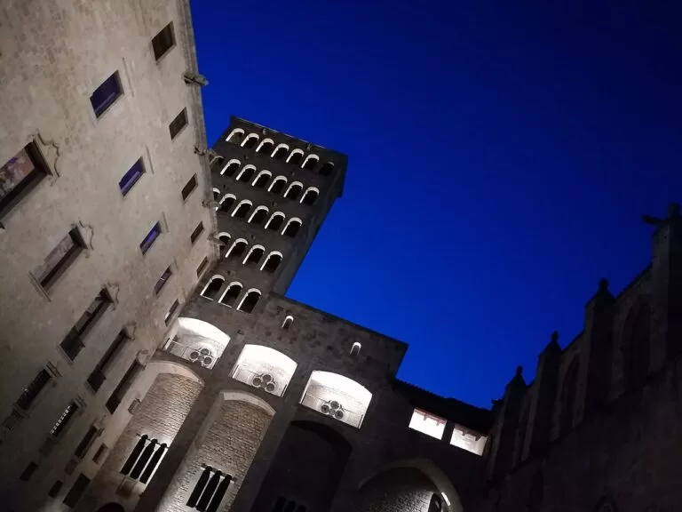
Day 1
The old town and the beach
Start at the Gothic cathedral, begun in 1298; its cloister, finished in 1448, keeps thirteen white geese for Santa Eulàlia. A short walk away, the Museu Picasso fills five medieval palaces on Carrer de Montcada; general admission is €15, and free-entry slots, such as the first Sunday of the month, must be booked in advance. After lunch, walk down to Barceloneta and follow the seafront to Bogatell, 702 m of sand with a Blue Flag. From 30 May to 13 September lifeguards are on duty from 10.30 am to 7.30 pm.
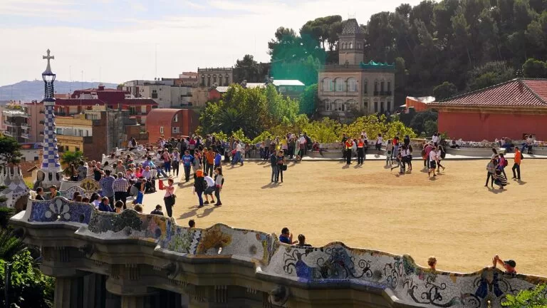
Day 2
Gaudí
Begin at the Sagrada Família with a timed ticket. Benedict XVI consecrated the basilica in 2010, and the tower of Jesus Christ, the tallest, was topped out on 20 February 2026. Around midday, go on to Casa Batlló at Passeig de Gràcia 43, the house Gaudí renovated between 1904 and 1906 for the textile industrialist Josep Batlló. Spend the late afternoon in Park Güell, begun in 1900 as a housing estate: only two of the sixty planned houses were built, and the city opened it as a public park in 1926.
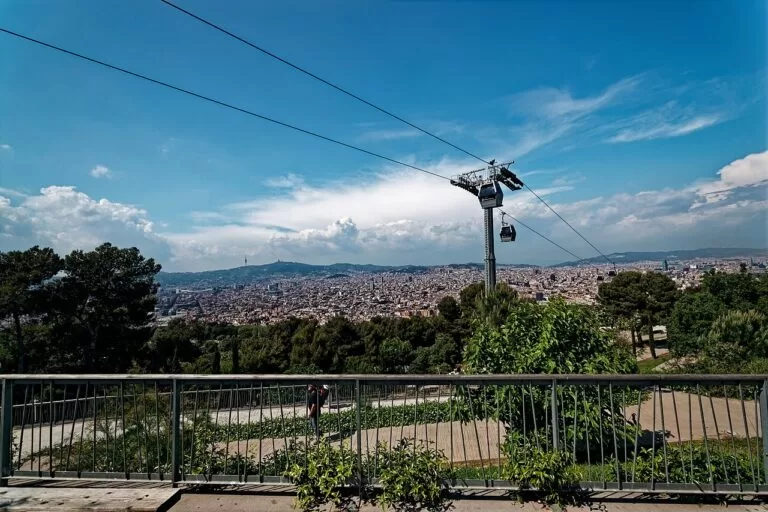
Day 3
Montjuïc
Spend the morning at the MNAC in the Palau Nacional, built for the 1929 International Exposition; the museum calls its Romanesque mural paintings the best collection in the world. In the afternoon carry on up the hill to Montjuïc Castle, the fortress built from 1753 to 1799, where Catalan President Lluís Companys was executed in 1940. General entry is €12 and reduced entry €8; it is free every Sunday from 3 pm and on the first Sunday of the month. Walk back down towards the port in the evening.
Seven days
Days 1–3: as above, based in Barcelona.
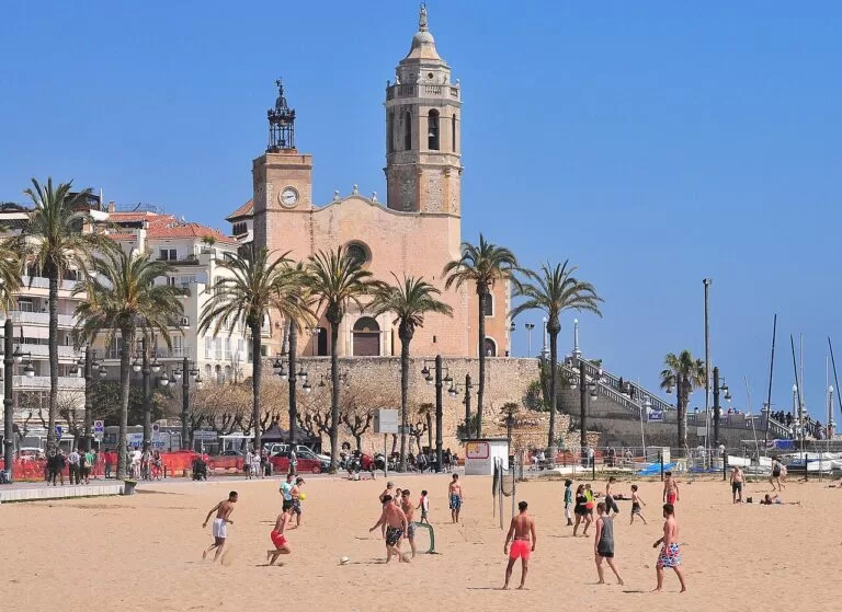
Day 4
Sitges
Take the R2 South, the Garraf Line, from Estació de França; trains run every 15 minutes at peak and every 30 off-peak, through tunnels under the Garraf hills on a railway that dates from 1881. In Sitges, start at the Cau Ferrat, Santiago Rusiñol’s house-studio and a public museum since 1933, then the Palau Maricel, built from 1910 to 1921 for the collector Charles Deering. Spend the afternoon on the beach: Sitges has more Blue Flag beaches than any other Catalan municipality, and all of them are smoke-free.
Day 5
Colònia Güell and Castelldefels
In the morning take an FGC train (S3, S4, S8 or S9) from Plaça Espanya to Colònia Güell, about 20–25 minutes, for Gaudí’s crypt, one of his seven UNESCO-listed works. It opens Monday to Friday 10:00–17:00 and at weekends 10:00–15:00; entry with the audio guide is €10. In the afternoon go on to Castelldefels, by R2 South or the E95 and L95 buses, for the castle 60 m above the town: €10 for adults, and outside July and August open only at weekends and on holidays, 11:00–19:00. End the day on the beach below.
Day 6
Montserrat and Manresa
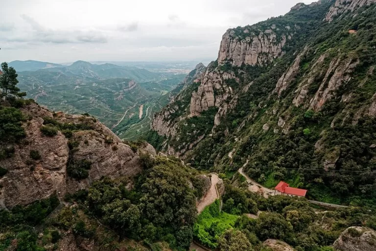
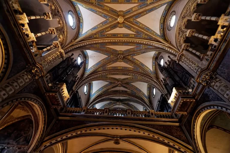
FGC trains leave Plaça d’Espanya every hour for Montserrat; the trip takes about 90 minutes, 60 of them on the train and the rest on the rack railway and the change. An adult rack railway ticket costs €9 single or €15 return. Abbot Oliba founded the monastery in 1025, and at the top funicular station the Sant Joan viewpoint is nearly 1,000 metres high. On another day, the R4 runs to Manresa every 15 minutes at peak, for La Seu, begun in 1328, and the cave where, by tradition, Saint Ignatius wrote his Spiritual Exercises.
Day 7
Along the Maresme
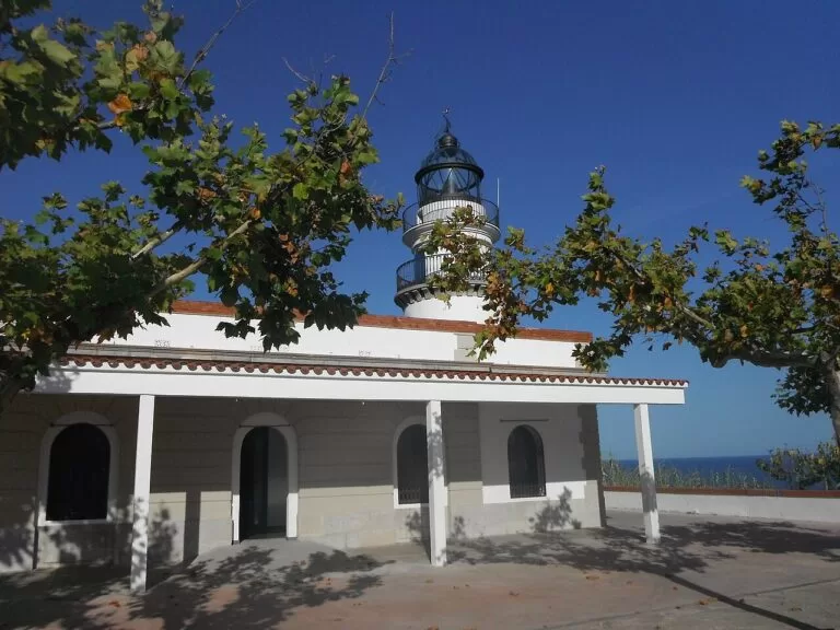
Take the R1 north along the shore; L’Hospitalet–Calella trains run every 15 minutes at peak, and the line to Mataró was the first railway in the Iberian Peninsula, opened on 28 October 1848. In Mataró the Roman villa of Torre Llauder, from the time of Augustus, is free to visit and opens on Saturdays. In the afternoon ride on to Calella and its lighthouse, completed in 1859 and now an interpretation centre with general entry at €2. Sit on the sea side of the train.
Getting there and around
By air
Barcelona-El Prat (BCN) lies beside the Remolar lagoon, south-west of the city. Metro L9 stops at both terminals and reaches the centre in 32 minutes, with its own Airport Ticket; the R2 North train stops at T2, and the Aerobús runs to Plaça Catalunya 24 hours a day. Girona-Costa Brava (GRO) and Reus (REU) are other options.
By train
Rodalies R1 follows the Maresme coast, 95.1 km with 31 stations, every 15 minutes at peak; the line from Barcelona to Mataró, opened in 1848, was the first railway in the Iberian Peninsula. R2 South, the Garraf line, runs to Castelldefels, Sitges and Vilanova i la Geltrú, and R4 to Manresa (Rodalies de Catalunya).
By car
Every area in this guide is on a train line, so a car is mainly useful for the Garraf hills and the Bages. Colònia Güell has free parking off the B-2002 between Sant Boi and Santa Coloma de Cervelló.
Practical and safety
- Fire: from 15 March to 15 October no fire may be lit on forest land in Catalonia, or in a 500 m strip around it, without authorisation (Generalitat de Catalunya).
- Pickpockets: they concentrate where tourists go; the Mossos d’Esquadra advise carrying only the documents you need (Mossos d’Esquadra). The emergency number is 112.
- Lifeguards: on Barcelona’s beaches only in the bathing season; outside it, call 112.
- Collserola: access to the natural park was restricted in 2026 because of African swine fever; check before you go.
- Free entry: the Museu Picasso’s free slots must be booked in advance; Montjuïc Castle is free on Sundays from 3 pm.
FAQ
Where is the Costa de Barcelona?
In Catalonia, north-east Spain: it is the coast of Barcelona province, between the Costa Brava to the north and the Costa Daurada to the south, with the city of Barcelona in the middle.
Is Sitges on the Costa de Barcelona?
Yes. The Garraf county, with Sitges and Vilanova i la Geltrú, is part of the Costa de Barcelona brand. Sitges is on the R2 South train line from Barcelona.
Can you swim in Barcelona?
Yes. The city has about four kilometres of beaches, with lifeguards from late May to mid-September; the City Council lists a Blue Flag for Sant Sebastià, Sant Miquel, Somorrostro, Nova Icària, Bogatell, Mar Bella, Nova Mar Bella and the Fòrum bathing area.
Is there a map of the Costa de Barcelona?
Yes. The map above shows every place on this coast with a CostaMap page, the full-screen version is on the Costa de Barcelona map page, and the Maresme and the Garraf have their own maps.
How do I get from the airport to the beaches?
Metro L9 reaches the centre in 32 minutes, and the R2 North train stops at T2. For Castelldefels and Sitges, take R2 South; for the Maresme, R1 from the city.
Costa de Barcelona or Costa Brava?
The Costa de Barcelona has the city, long sandy beaches and trains along the shore. The Costa Brava is the coast of Girona province to the north; its own guide covers the coves around Cadaqués.
Neighbouring costas
Costa del Maresme
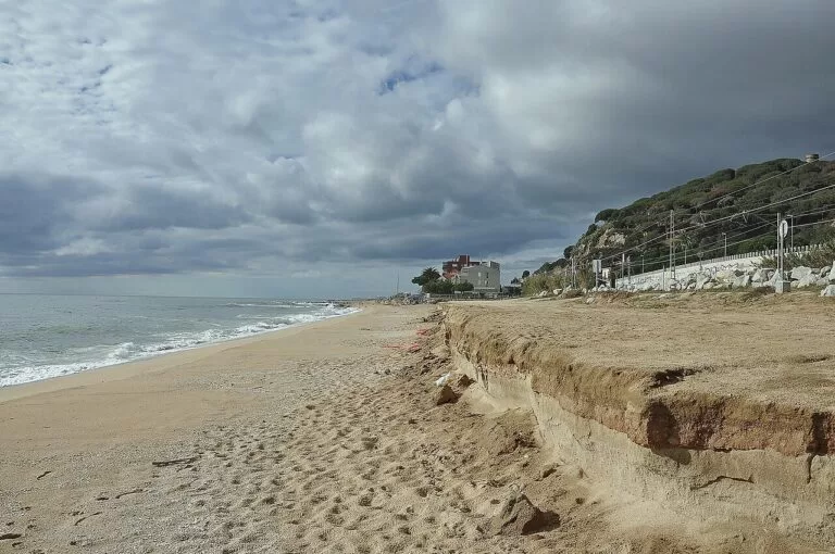
Mataró, Arenys, Calella and the beaches along the R1 train, on its own map and guide.
Costa del Maresme map →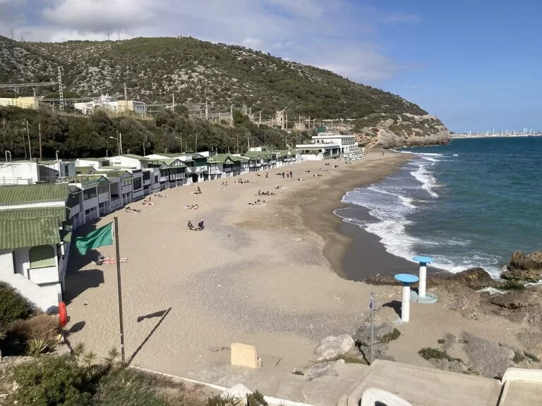
Costa del Garraf
Sitges, Vilanova i la Geltrú and the Garraf cliffs on the R2 South line.
Costa del Garraf map →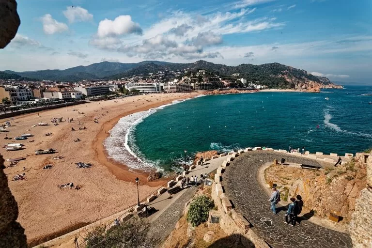
Costa Brava
Girona province, beyond the Maresme, with coves, Cadaqués and Girona airport.
Costa Brava guide →Sources and freshness
Checked 5 October 2026. Official: Catalunya.com on the Costa de Barcelona, Gavà, Arenys de Mar and Catalan dishes. Barcelona City Council on the beaches (overview, Sant Sebastià, Sant Miquel, Somorrostro, Nova Icària, Bogatell, Mar Bella, Nova Mar Bella, Llevant, Fòrum, bathing season, summer 2026), the cathedral, Montjuïc Castle (history), the Museu Picasso (visit, 60 years), the markets (Boqueria, Santa Caterina), Turó de la Rovira and safety; Barcelona Turisme on the open air and Catalan cooking. Sights: UNESCO, Sagrada Família, Park Güell, Casa Batlló, Catedral de Barcelona, MNAC (building, museum), Colònia Güell, Gavà mines, Castelldefels (castle, history, access, beach), HolaCamp Barcelona. Beaches and nature south of the city: Gavà, Viladecans, El Prat (beach, river), Sant Adrià, UIA 2026; the Three Chimneys from Viquipèdia. Parks: Collserola (park, history), Garraf. Maresme and Garraf: Mataró, Calella lighthouse, Canet de Mar, Sitges (beaches, film festival, Cau Ferrat), Vilanova railway museum. Inland: Montserrat (history, cable car, rack railway, fares), Manresa (La Seu, the cave), Sallent, Santpedor, Mollet del Vallès, Montcada i Reixac (history, the town). Transport: Aena on trains, metro, buses, history and natural spaces; Aerobús; TMB; Rodalies R1, R2 South and R4. Safety: Generalitat (fire), Mossos d’Esquadra. Climate: AEMET, 1981–2010. Airports: OurAirports for Barcelona, Girona and Reus; straight-line distances from CostaMap’s own coordinates.
Photos from Wikimedia Commons, not altered except for cropping: Nova Icària, Barcelona by dronepicr (CC BY 2.0); Barceloneta, Barcelona by dronepicr (CC BY 2.0); Tres Xemeneies, Sant Adrià de Besòs by Enric (CC BY-SA 4.0); Castelldefels beach by Thomas Woodtli from Zürich, Switzerland (CC BY-SA 2.0); Arenys de Mar, Maresme by Alberto-g-rovi (CC BY 3.0); Sitges by Enric (CC BY-SA 4.0); La Seu, Manresa by Josep Maria Viñolas Esteva (CC BY-SA 4.0); Barcelona beaches by dronepicr (CC BY 2.0); Castell de Montjuïc by Txllxt TxllxT (CC BY-SA 4.0); Mercat de la Boqueria by Andy Mitchell from Glasgow, UK (CC BY-SA 2.0); Serra de Collserola by pere prlpz (CC BY-SA 3.0); Montserrat by Txllxt TxllxT (CC BY-SA 4.0); Platja de la Pineda, Viladecans by pere prlpz (CC BY-SA 3.0); Platja de la Barceloneta by Nicholas Gemini (CC BY-SA 4.0); Platja de la Nova Icària by Mister No (CC BY 3.0); Platja del Bogatell by pere prlpz (CC BY-SA 3.0); Platja de la Nova Mar Bella by Gogo69 (CC BY-SA 3.0); Besòs river mouth, Sant Adrià de Besòs by Jordiferrer (CC BY-SA 4.0); Castelldefels beach by Thomas Woodtli from Zürich, Switzerland (CC BY-SA 2.0); Barcelona by Alexey Komarov (CC BY-SA 4.0); Sant Adrià de Besòs by Enric (CC BY-SA 4.0); Castelldefels by Martinge636 (CC BY-SA 4.0); Sitges by Enric (CC BY-SA 4.0); Mataró by maczopikczu (CC BY 3.0); Sagrada Família by Txllxt TxllxT (CC BY-SA 4.0); Barcelona Cathedral by Jose María Ligero Loarte (CC BY-SA 4.0); Palau Nacional, Montjuïc by Didier Descouens (CC BY-SA 4.0); Castell de Montjuïc by Txllxt TxllxT (CC BY-SA 4.0); Cripta de la Colònia Güell by Kent Wang (CC BY-SA 4.0); Castell de Castelldefels by Simon Burchell (CC BY-SA 3.0); Mercat de Santa Caterina by patano (CC BY-SA 3.0); Plaça del Rei, Barcelona by Enric (CC BY-SA 4.0); Park Güell by Mickey Løgitmark (CC BY 3.0); Montjuïc by Txllxt TxllxT (CC BY-SA 4.0); Sitges by Mike McBey (CC BY 2.0); Cripta de la Colònia Güell by DagafeSQV (CC BY-SA 3.0); Montserrat Monastery by Txllxt TxllxT (CC BY-SA 4.0); Far de Calella by Albert Pujadas (CC BY-SA 3.0); Platja de la Musclera, Arenys de Mar by Alberto-g-rovi (CC BY 3.0); Garraf by Mattsjc (CC BY 4.0); Tossa de Mar by Txllxt TxllxT (CC BY-SA 4.0).