Place type
Area · next level
Place in focusLoading map…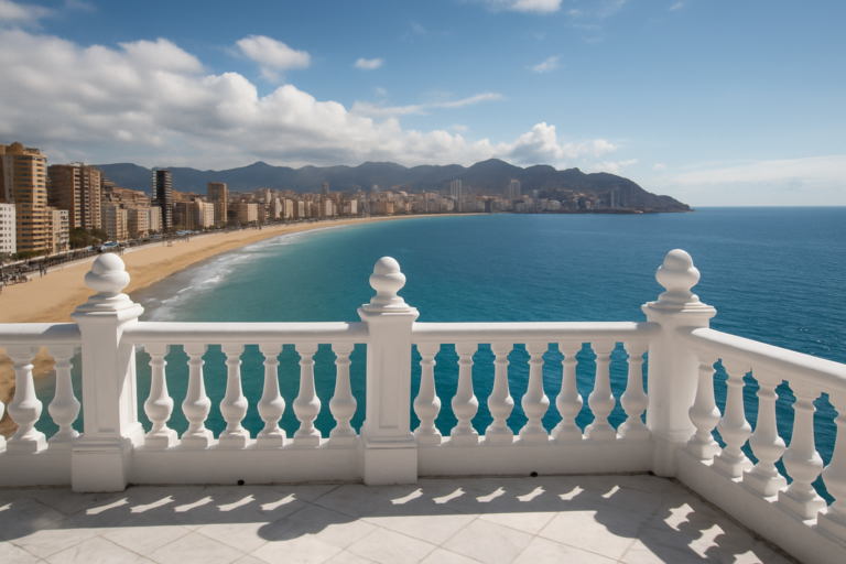 Benidorm
BenidormBalcó de la Mediterrània
Benidorm’s famous viewpoint, with panoramic views over the Mediterranean and the town beaches.
Read more →Discover the Spanish coast
Pick a costa, refine the map by what you want to find, and dive into the places worth knowing.
Spain’s coastline is divided into costas — named stretches of shore, each with its own character. The Costa Blanca’s turquoise coves and palm-lined promenades; the wild cliffs of the Costa Brava; the sun-soaked beaches of the Costa del Sol. CostaMap gathers the places worth knowing — not just the famous beaches, but the quiet coves, hilltop villages, nature reserves and lookout points — and puts them on a single, honest map.
Choose your stretch of coast — the Costa Blanca is live now, with the rest on the way.
Beaches, coves, viewpoints, hilltop villages, nature reserves, marinas and more — refine the map to your trip.
Open any marker for the story, photos and practical details — one honest guide per place.
One map, every kind of place
Every kind of place — beaches, coves, towns, villages, natural parks, viewpoints, historic sites, marinas, museums and more. Tap a place type to filter the map.
Pick your stretch of coast
Seventeen costas, mapped one by one. The Costa Blanca is live with forty destinations — the rest are on the way.
BenidormBenidorm’s famous viewpoint, with panoramic views over the Mediterranean and the town beaches.
Read more →On the Costa Blanca
BenidormBalcó de la MediterràniaBenidorm’s famous viewpoint, with panoramic views over the Mediterranean and the town beaches.Read more →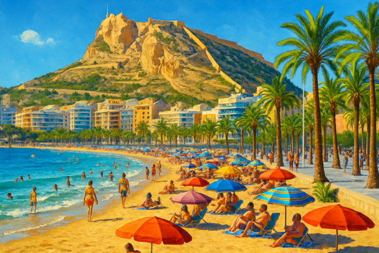 AlicantePlaya del PostiguetAlicante’s main city beach, right below Santa Bárbara Castle and steps from the old town.Read more →
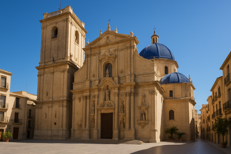 ElcheBasílica de Santa MaríaA baroque church in Elche, home of the UNESCO-listed Misteri d’Elx mystery play.Read more →
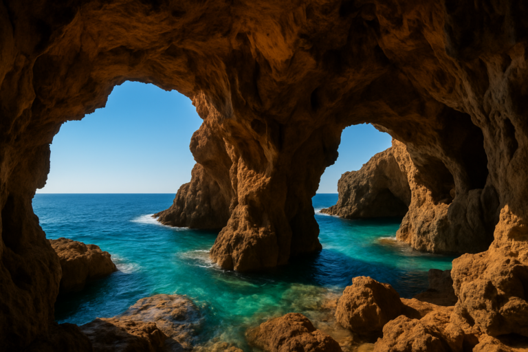 DéniaCova TalladaA vast sea cave between Dénia and Jávea, reached by a scenic coastal hike along the cliffs.Read more →
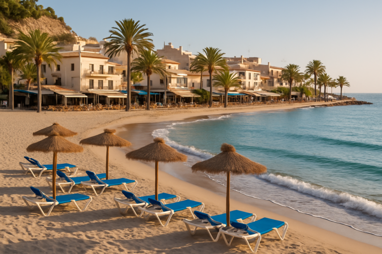 FinestratCala de FinestratCala de Finestrat is a relaxed, sandy cove beach just south of Benidorm, known for its beautiful sunsets.Read more →
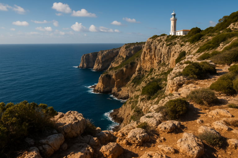 JáveaCap de la NauCap de la Nau offers dramatic coastal views and a historic lighthouse at Costa Blanca's easternmost point.Read more →
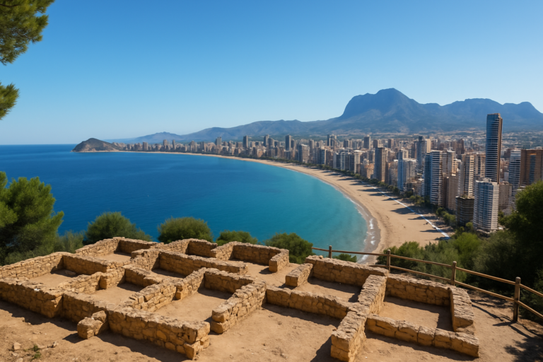 BenidormTossal de la CalaTossal de la Cala in Benidorm is a hilltop site with Roman ruins and panoramic views of the bay.Read more →
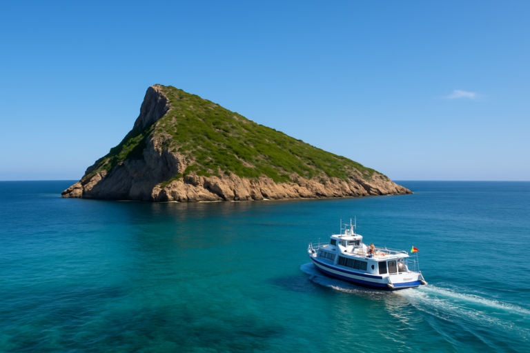 BenidormBenidorm IslandA small uninhabited island off Benidorm, reached by a short boat trip, with a walking path to the summit, clear snorkelling water and a marine reserve.Read more →
Every beach, cove and viewpoint on the Costa Blanca — in one place, free to explore.
Open the map