
Galicia · North-west Spain
Rías Baixas travel guide: the southern coast of Galicia
Long sea inlets, white-sand beaches, Albariño vineyards and the car-free islands of a national park, from Muros down to the Portuguese border.
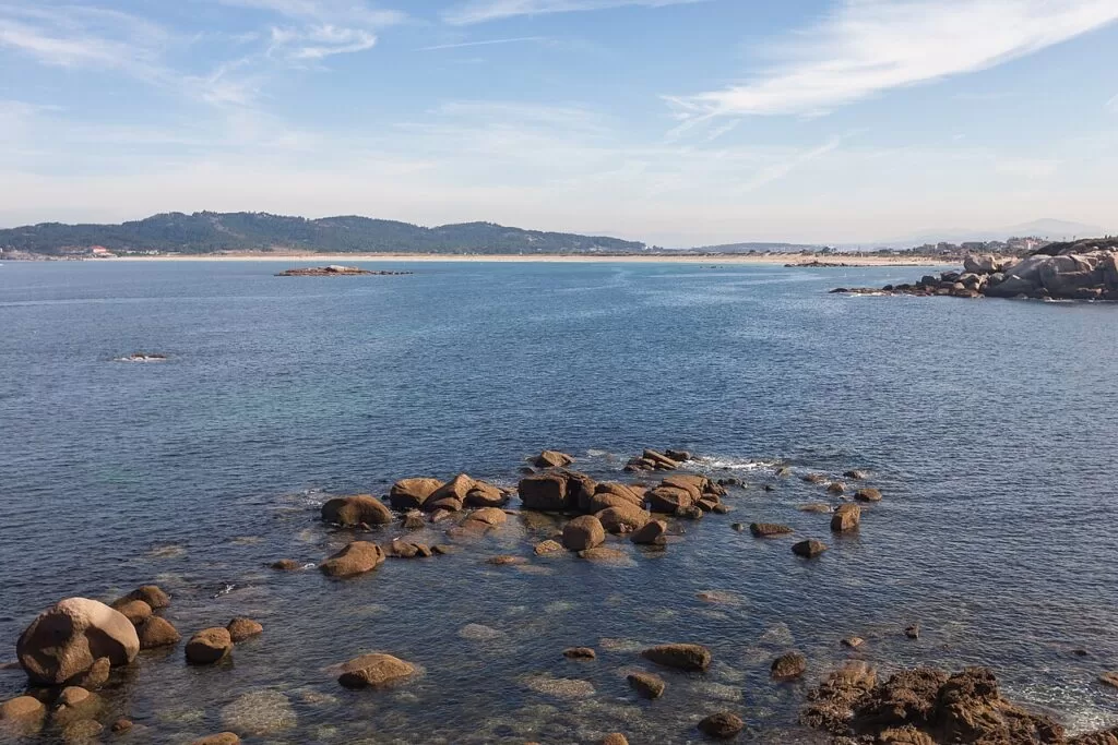
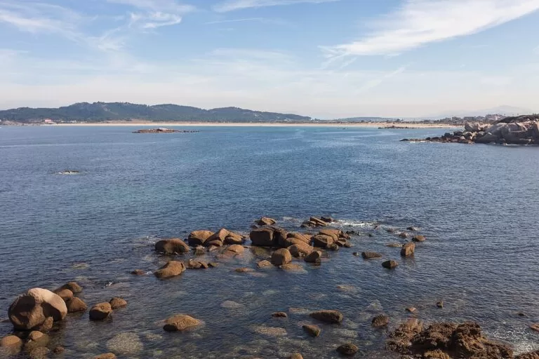
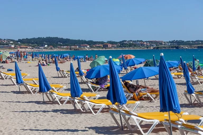
A Lanzada from Noalla · Photo: Luis Miguel Bugallo Sánchez (Lmbuga), CC BY-SA 4.0
The Rías Baixas are the southern coast of Galicia in north-west Spain: a run of long, sheltered sea inlets, or rías, that the tourist board describes as covering the whole coast of the province of Pontevedra and part of the Atlantic coast of A Coruña (Turismo Rías Baixas). This guide covers the stretch from the Ría de Muros e Noia south through the rías of Arousa, Pontevedra and Vigo to A Guarda, where the Miño, the largest river in Galicia, forms the border with Portugal (Turismo Rías Baixas). At the mouths of the rías lie the Cíes, Ons, Sálvora and Cortegada, the four archipelagos of the Atlantic Islands of Galicia National Park (MITECO). Below are the three stretches of coast, the beaches, the island permits, the weather and three routes.
At a glance
- Where the south-west coast of Galicia, from the Ría de Muros e Noia to the mouth of the Miño at A Guarda, on the Portuguese border.
- Fly to Vigo Airport (VGO), 10 km from the centre of Vigo, or Santiago (SCQ), which the tourist board lists 70 km away.
- Climate an annual mean of 14.8 °C and 1,586 mm of rain at Pontevedra (AEMET, 1991–2020), with July and August the driest months.
- National park Cíes, Ons, Sálvora and Cortegada: 8,480 ha of sea and land, declared in 2002. Cíes and Ons need a free permit in high season.
- Known for seafood from the rías, Albariño white wine from the Rías Baixas designation of origin, and granite villages with hórreos on the shore.
- On CostaMap Eleven places on this coast, from the Cíes Islands to the old town of Pontevedra.
Map of the Rías Baixas
The map shows the places on this coast that have a CostaMap page. Tick a place type to filter it, and click a marker to see the place in the panel. The areas below follow the coast from north to south, one ría at a time.
Place type
Area · next level
 Coast map
Rías Baixas
Click a marker to see the place here. Three areas from Muros e Noia and Arousa to Pontevedra, Vigo and the Miño, with the islands of the national park.
Choose your areaChoose your area
We split the coast into three stretches, from north to south. The tourist board counts 398 km of coast in the province of Pontevedra alone, but the distances are short: the province measures 113 km from north to south (Turismo Rías Baixas). Places with a CostaMap page are linked; the others are listed so you know what is there.
Muros e Noia and the Ría de Arousa
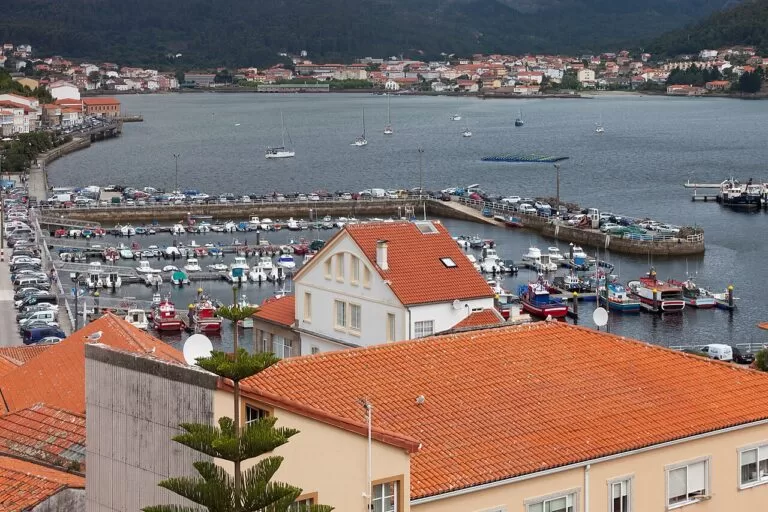
Two medieval towns on a quiet ría, the great dune of Corrubedo, and Arousa, the largest of the Galician rías, with Cambados, O Grove and the islands of Sálvora and Cortegada.
- Muros – a medieval old town at the foot of Monte Louro, with a tide mill that is one of the largest in Spain.
- Noia – “the little Compostela”, with more than two hundred guild gravestones in Santa María a Nova.
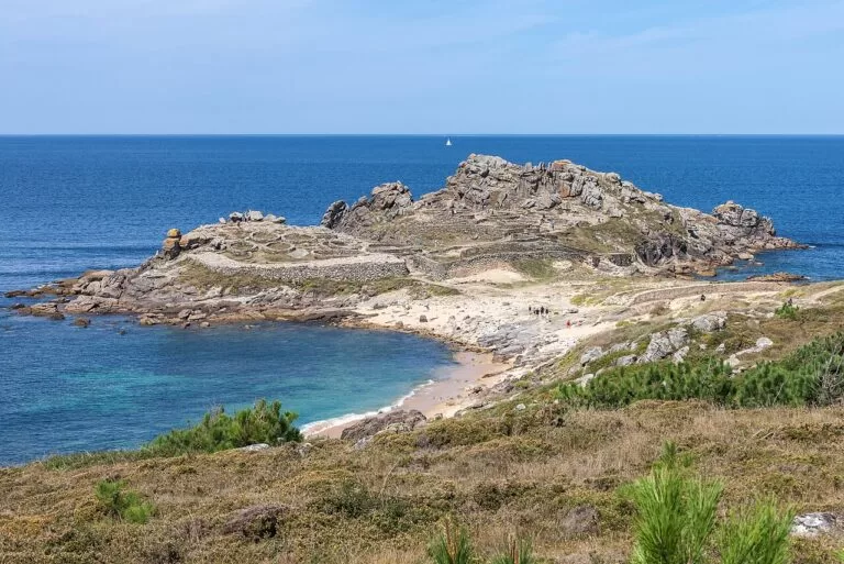
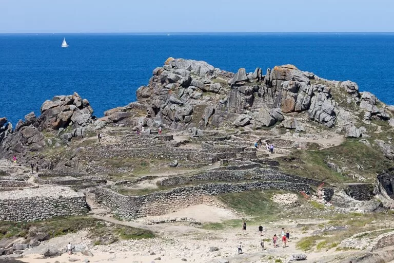
- Castro de Baroña – an Iron Age hillfort on a rocky point over the sea near Porto do Son.
- Corrubedo – the largest dune in Galicia, in a natural park with two lagoons.
- Torres de Oeste – medieval towers on the Ulla at Catoira, with a Viking landing every August.
- Cambados – the capital of Albariño, around the square of the Pazo de Fefiñáns.
- A Illa de Arousa – an island reached by a 2 km bridge, with 11 km of beaches.
- O Grove and A Toxa – a fishing port on its own peninsula, the October seafood festival and a shell-covered chapel on A Toxa.
Ría de Pontevedra
The provincial capital at the head of the ría, the beach resorts of Sanxenxo and A Lanzada on the north shore, the granaries of Combarro and the island of Ons at the mouth.
- A Lanzada Beach – more than 2 km of white sand between Sanxenxo and O Grove.
- Sanxenxo and Silgar – the resort town of the north shore, with Silgar beach in the centre.
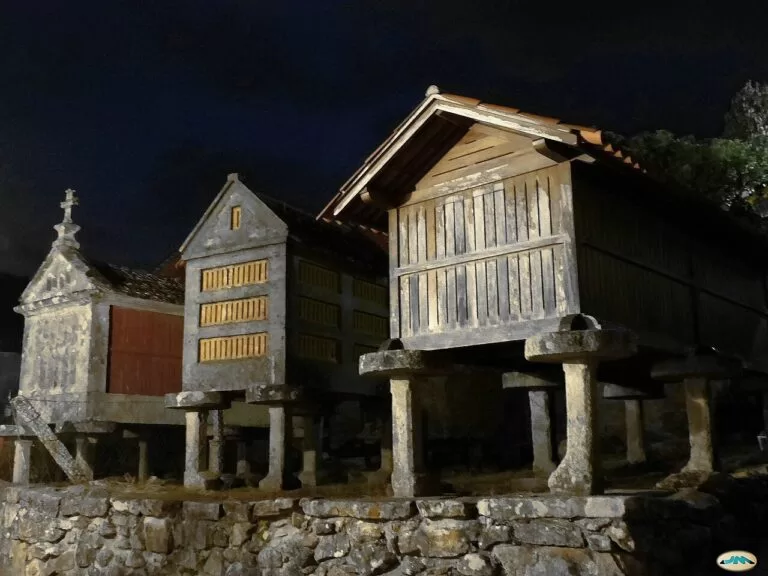
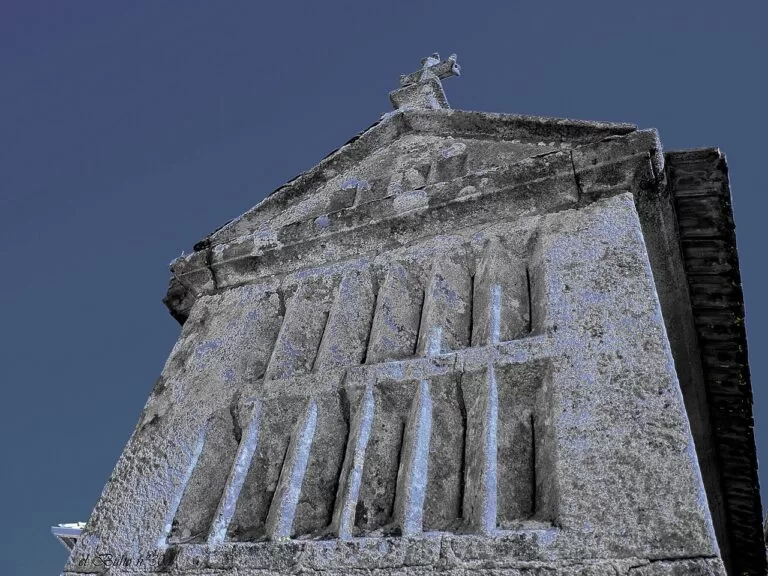
- Combarro – hórreos on the shore, stone crosses and fishermen’s houses on the Ría de Pontevedra.
- Pontevedra Old Town – the second most important historic quarter in Galicia, after Santiago’s.
- O Hío – a Baroque stone cross (cruceiro) on the south shore of the ría.
- Ons Island – the only island of the national park with a permanent population; boats from Portonovo, Sanxenxo, Bueu and Marín.
Ría de Vigo and the Baixo Miño
Galicia’s largest city, the Cíes Islands at the mouth of its ría, the walled town of Baiona and, at the end of the coast, A Guarda and the hillfort of Santa Trega above the Miño.
- Cangas and Nerga – a ferry ride from Vigo, with beaches facing the Cíes.
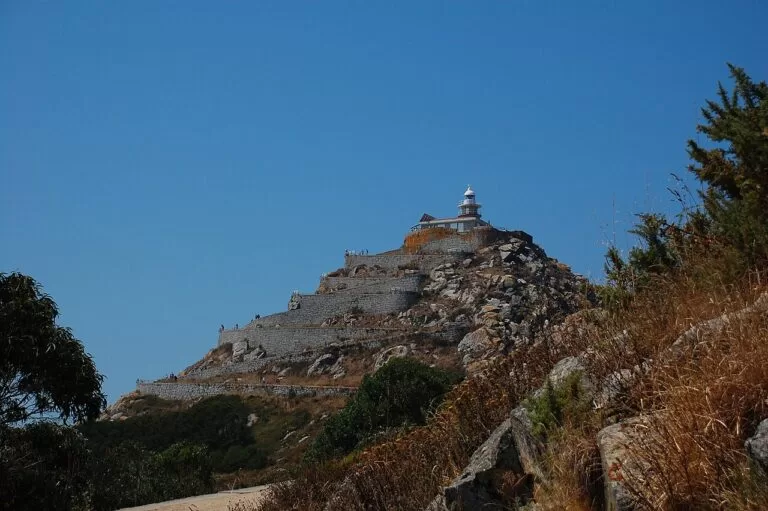
- Cíes Islands – Rodas beach, the Monte Faro lighthouse and a daily visitor limit in high season.
- Vigo – Galicia’s largest city: oysters in A Pedra and the view from O Castro.
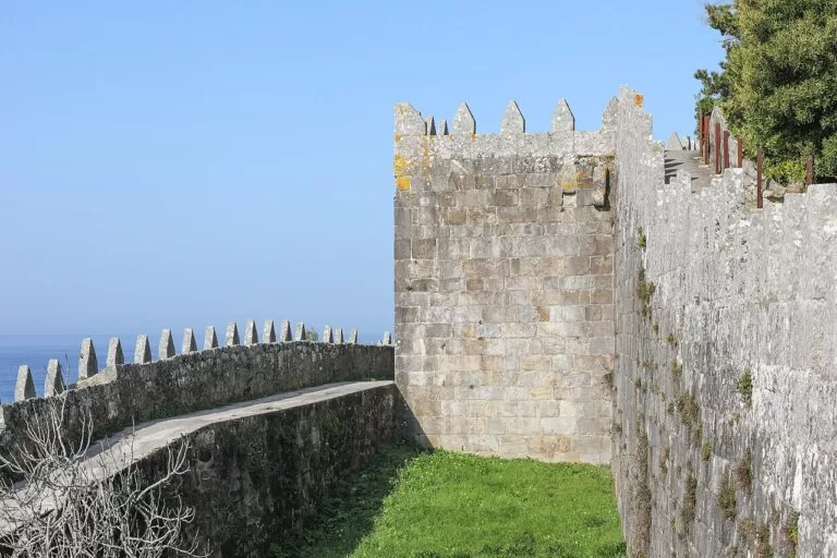
- Baiona – the Monterreal fortress and the port where the Pinta brought the news of America.
- Monte Santa Trega – one of the largest hillforts in Galicia, above the mouth of the Miño.
Places on CostaMap in the Rías Baixas
These 11 places on this coast have their own CostaMap guide, with access, practical details and sources.
Castro de Baroña
Iron Age hill fort on a rocky Atlantic peninsula near Porto do Son: two walls, about 20 round houses and beaches right beside it.
Castro de Baroña guide →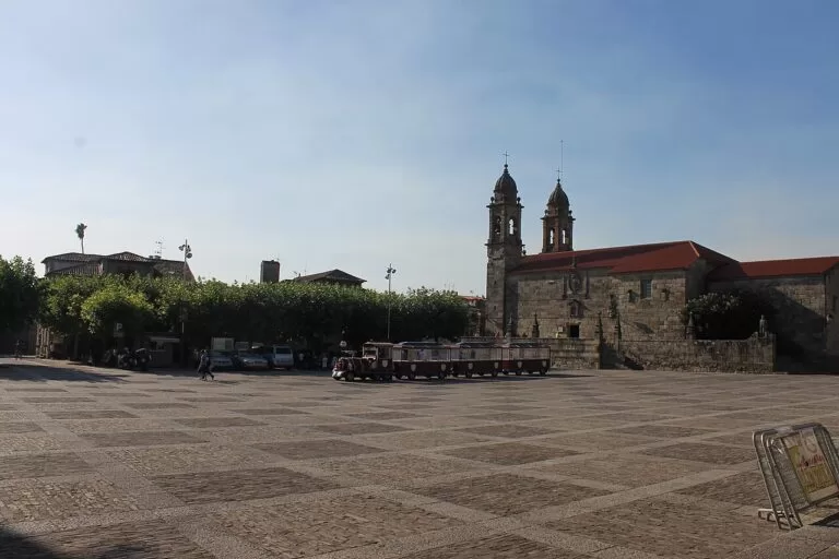
Cambados
Albariño wine town on the Ría de Arousa: Praza and Pazo de Fefiñáns, Santa Mariña Dozo ruins, wineries and the early-August wine festival.
Cambados guide →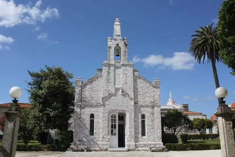
O Grove and A Toxa
Seafood town on the Ría de Arousa and its spa island, linked by a 146 m bridge; shell-covered chapel and the October Seafood Festival.
O Grove guide →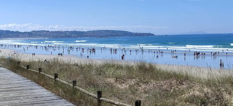
A Lanzada Beach
2.3 km Blue Flag Atlantic beach on the O Grove isthmus, with dunes, a boardwalk, a free car park and the Lanzada chapel.
A Lanzada guide →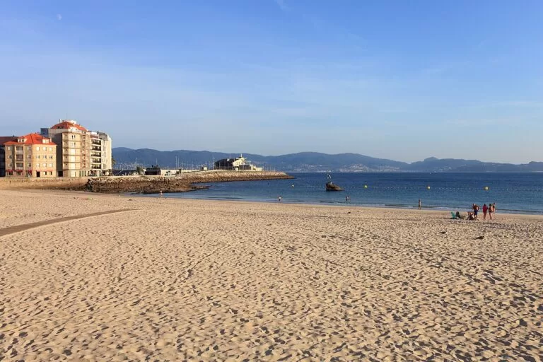
Sanxenxo and Silgar
Busy beach town on the Ría de Pontevedra; Silgar is its calm Blue Flag town beach of fine sand by the promenade and marina.
Sanxenxo guide →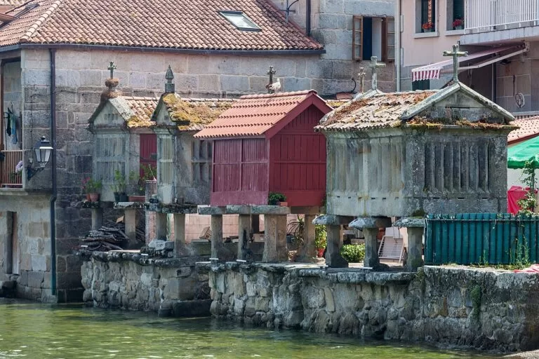
Combarro
Fishing village on the Ría de Pontevedra with more than 60 hórreos, about 30 of them by the sea; a protected historic site since 1972.
Combarro guide →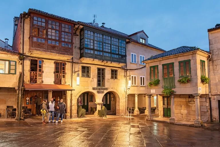
Pontevedra Old Town
Car-free granite old town of the Rías Baixas capital: arcaded squares, the Peregrina sanctuary and a free museum, protected since 1951.
Pontevedra guide →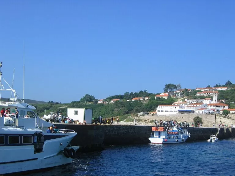
Ons Island
Inhabited national park island off the Ría de Pontevedra: a free Xunta permit and then a boat at Easter and from 15 May to 15 September.
Ons guide →
Cíes Islands
Three car-free granite islands off Vigo with Praia de Rodas; free Xunta permit and then a ferry at Easter and from 15 May to 15 September.
Cíes Islands guide →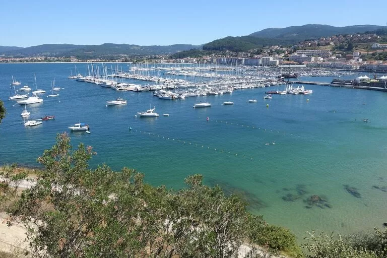
Baiona
Walled port at the mouth of the Ría de Vigo: Monterreal fortress with 3 km of walls, the La Pinta replica museum and boats to the Cíes.
Baiona guide →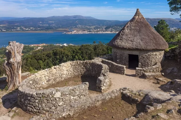
Monte Santa Trega
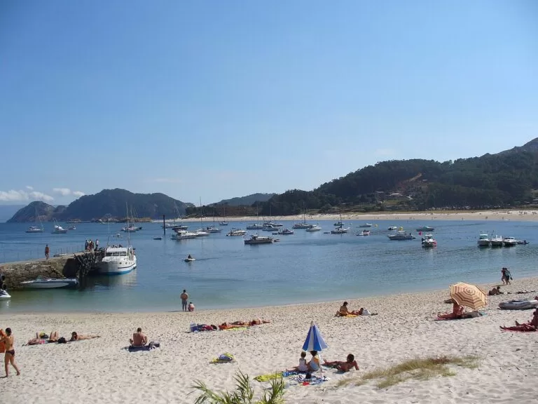
341 m hill above A Guarda with an Iron Age hillfort village of round stone houses, the MASAT museum and views over the Miño mouth to Portugal.
Santa Trega guide →Explore by interest
Pick a theme. Each tile opens the part of this guide that covers it.
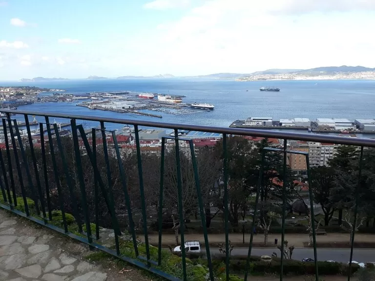
Best beaches
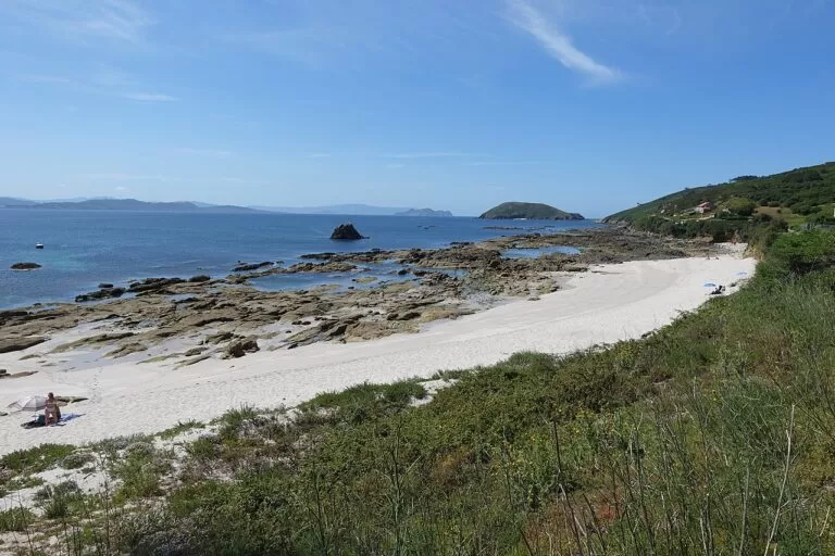
The selection below is ours, from north to south, with descriptions as given by the regional and provincial tourist boards, checked in November 2026. The open Atlantic beaches can be windy; the inner shores of the rías are calmer.
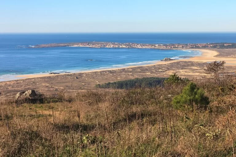
Corrubedo
The beach of a natural park between the Arousa and Muros e Noia rías, behind which stands a shifting dune more than a kilometre long and up to 20 m high in winter, the largest in Galicia (Turismo de Galicia).
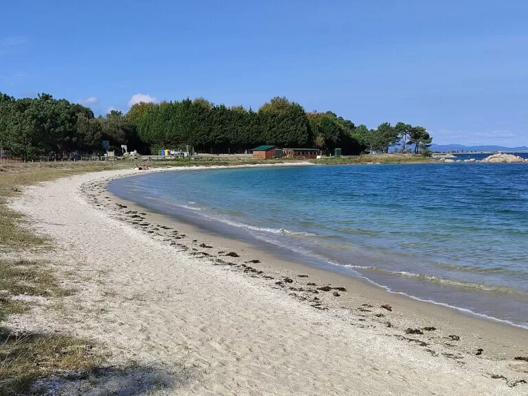
A Illa de Arousa
An island in the middle of the Ría de Arousa, joined to the mainland by a 2 km bridge, with some 36 km of coast, 11 km of it beaches of fine white sand such as Area da Secada, O Bao, Xastelas and Sualaxe (Turismo Rías Baixas). Area da Secada, by the lighthouse, is backed by a forest and a dune held by its plants (Turismo Rías Baixas).
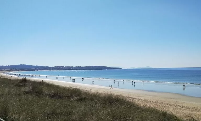
A Lanzada
More than 2 km of fine white sand shared by Sanxenxo and O Grove, popular for water sports, next to the Umia–O Grove intertidal wetland and the chapel of A Lanzada (Turismo Rías Baixas).
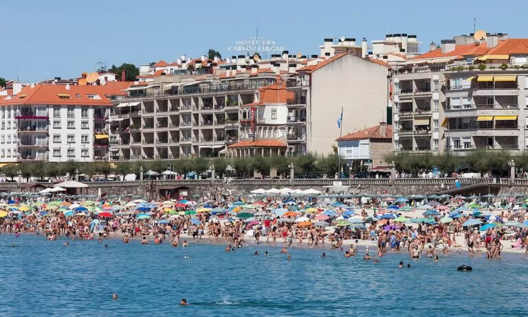
Silgar
The town beach of Sanxenxo and, says the tourist board, one of the most crowded in the Rías Baixas, for its location and its suitability for swimming and water sports (Turismo Rías Baixas).
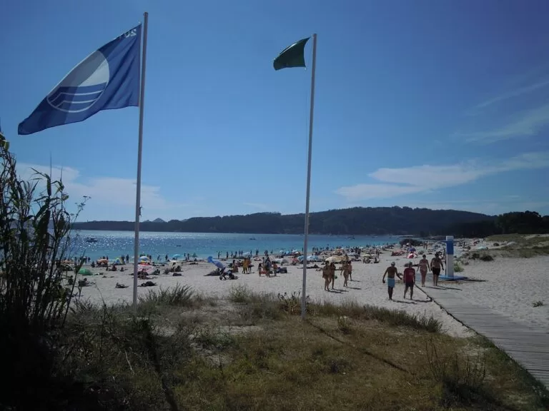
Nerga
On the southern flank of Cabo Home, in the protected Cabo Home–Barra–Costa da Vela area, backed by pine and eucalyptus woods and dunes and facing the Cíes (Turismo Rías Baixas).
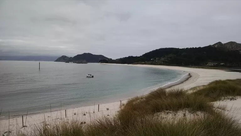
Rodas
The beach that joins the north and middle islands of the Cíes, called the best beach in the world by The Guardian, as the tourist boards still point out; the water is cold (Turismo de Galicia).
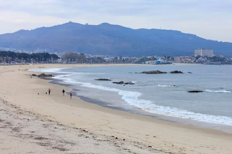
Samil
The longest beach in the city of Vigo, in a fully urban setting, with a promenade, shaded picnic areas, playgrounds and swimming pools (Turismo Rías Baixas).

Playa América and Panxón
Two beaches in Nigrán joined by a coastal path through a restored dune system, signed as a Blue Trail because it links Blue Flag beaches (Turismo Rías Baixas).
Also worth knowing: in the Ría de Muros e Noia, Turismo de Galicia names the beaches of Ancoradoiro, San Francisco, Aguieira, As Furnas and Basoñas, most of them of white sand (Turismo de Galicia). Montalvo, near Sanxenxo, is a straight beach with soft dunes in a windy spot that suits water sports (Turismo Rías Baixas). On the Cíes, Figueiras, also called the Germans’ beach, is about 350 m long, to the right of the ferry pier (Turismo Rías Baixas). O Vao in O Grove, at the mouth of the Umia, has two bird hides over a wetland with international protection (Turismo Rías Baixas).
Where to stay by town
These are the towns we would base a trip in, from north to south, with what each one is known for. We do not name hotels; the tourist board keeps a register of quality-certified accommodation (Turismo Rías Baixas).

Muros and Noia
Two medieval old towns, both declared historic complexes; the writer Otero Pedrayo called Noia “the little Compostela”.
Quiet ría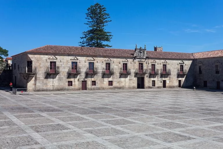
Cambados
The capital of Albariño wine, a granite town of manor houses around the square of the Pazo de Fefiñáns.
Wine and stone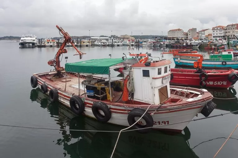
O Grove
A fishing port on its own peninsula, with A Toxa island and its spas, boat trips on the ría and the October seafood festival.
Seafood base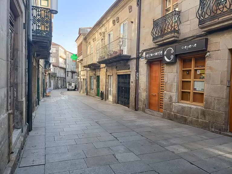
Pontevedra
The capital of the Rías Baixas, with the second most important historic quarter in Galicia after Santiago’s, and trains along the coast.
City base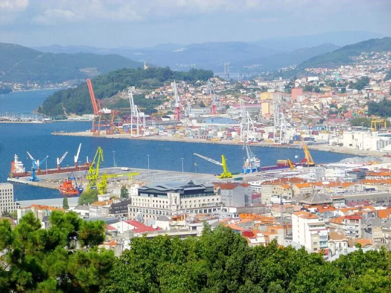
Vigo
Galicia’s largest city and Spain’s most important fishing port: oysters in A Pedra, the views from O Castro and boats to the Cíes.
City and islands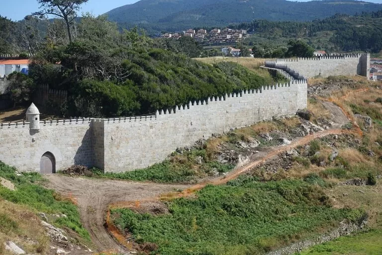
Baiona
A protected old town around the Monterreal fortress, and the port where the caravel Pinta brought the news of America.
Walled harbourThings to do
The Atlantic Islands National Park
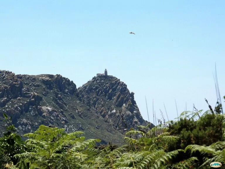
The Maritime-Terrestrial National Park of the Atlantic Islands of Galicia was declared on 1 July 2002. It covers 8,480 ha, of which 1,194.8 ha are land: Cíes at the mouth of the Ría de Vigo, Ons at the mouth of the Ría de Pontevedra, Sálvora at the entrance to the Ría de Arousa and Cortegada inside it (MITECO). The Cíes were made a natural park in 1980, and of the four archipelagos only Ons still has a permanent population, of fewer than 20 people (MITECO).
On the Cíes, the zigzag climb from the pier to Monte Faro is about 7 km there and back, past bird hides and a colony of about 22,000 breeding pairs of yellow-legged gulls. On Ons, paths lead from the village of O Curro to the lighthouse, north to the beach of Melide and south past the Buraco do Inferno, a sea cave where you hear the sea roar below (Turismo de Galicia). Boats run to the Cíes from Vigo, Baiona and Cangas in high season, and to Ons from Portonovo, Sanxenxo, Bueu and Marín; Cortegada is visited with a guide from Carril, and Sálvora has no regular boat (Turismo de Galicia). Cortegada holds a laurel forest that the tourist board calls the largest in Europe (Turismo Rías Baixas).
Albariño, mussels and the seafood festival
Cambados is the capital of Albariño, and the area around the mouths of the Ulla and Umia produces some of Spain’s best white wines within the Rías Baixas designation of origin (Turismo de Galicia). The Albariño wine festival in Cambados began in 1953, was declared of tourist interest in 1977 and given international status in 1990; the regulatory council of the designation, set up in 1988, organises it with the town (Turismo Rías Baixas).
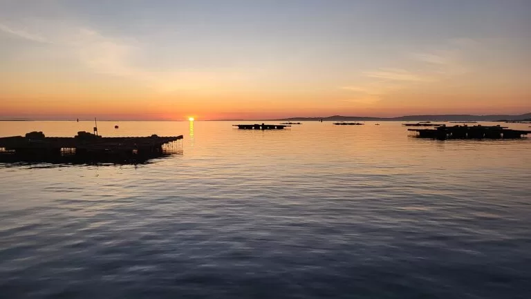
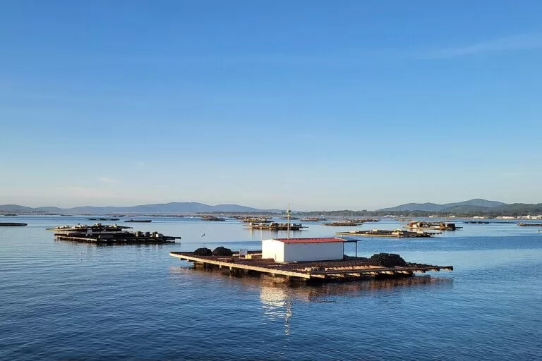
O Grove has held its Fiesta del Marisco every October since 1963: ten days of marquees in the square of O Corgo by the fishing port, with clams, razor shells, oysters, mussels, velvet crabs, barnacles and octopus, and an average of 200,000 visitors in recent years (Turismo Rías Baixas). The mussels of the area are grown on ropes hung from rafts (Turismo Rías Baixas), and Carril, in Vilagarcía, is known for its clams (Turismo de Galicia). In Vigo, oyster sellers work the street of A Pedra in the old town (Turismo de Galicia).
Old towns: Pontevedra, Noia, Muros, Combarro and Baiona
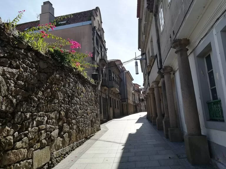
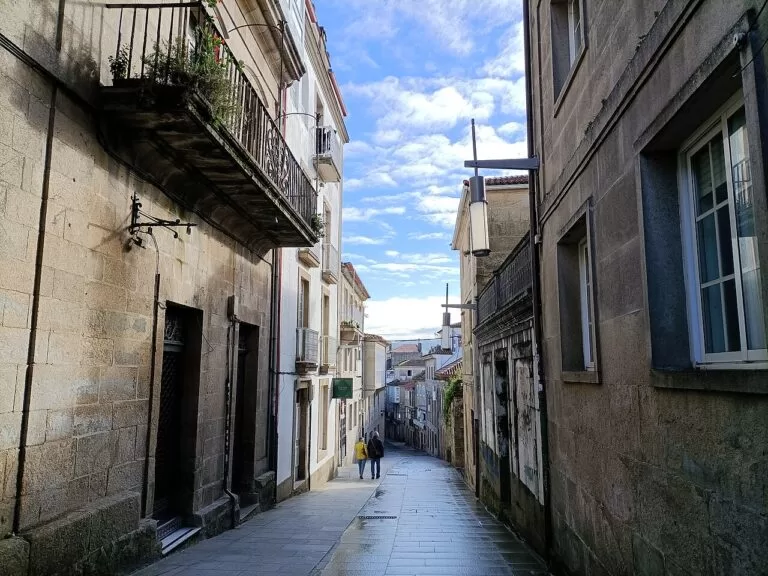
Pontevedra has the most important historic centre in Galicia after Santiago’s. The church of A Peregrina, on the Portuguese Way to Santiago, has a floor plan in the shape of a scallop shell, and the Museum of Pontevedra holds gold and silver pieces up to 4,000 years old (Turismo de Galicia). Noia and Muros both have old towns declared historic complexes; Noia’s church of Santa María a Nova keeps more than two hundred gravestones carved with the tools of medieval trades, and Muros has a tide mill, one of the largest in Spain (Turismo de Galicia).
Combarro, on the Ría de Pontevedra, is built on the granite by the sea and is defined by its hórreos (granaries), stone crosses and fishermen’s houses; the provincial tourist board counts more than 30 hórreos (Turismo Rías Baixas). The old town of Baiona was declared a historic site in 1993, the fifth centenary of the arrival of the caravel Pinta with the news of America (Turismo Rías Baixas). Its Monterreal fortress, with 3 km of walls, was bought by the state in 1963 to become a Parador (Turismo Rías Baixas).
Hillforts, towers and the Battle of Rande
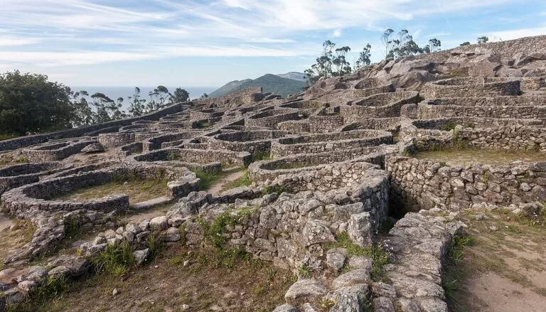
On Monte Santa Trega above A Guarda, a Gallaecian-Roman settlement occupied from the 4th century BC to the 1st century AD covers an area of 700 by 300 m, one of the largest hillforts in Galicia; access to the hill was €1 for adults and €0.50 for children when we checked in November 2026 (Turismo Rías Baixas). The museum on the summit was designed by Antonio Palacios (Turismo Rías Baixas). Further north, the Castro de Baroña stands by the sea in Porto do Son (Turismo de Galicia).
At Catoira, the Torres de Oeste guarded the River Ulla in the Middle Ages, and on the first Sunday of every August the town re-enacts a Viking landing there (Turismo Rías Baixas). In the Ría de Vigo, the Battle of Rande in October 1702 sank a Spanish treasure fleet of 19 galleons escorted by 23 French warships, attacked by British and Dutch forces (Turismo Rías Baixas).

Dunes, lagoons and viewpoints
The Corrubedo natural park, in Ribeira, covers about 1,000 ha: the dunes, the beach and two lagoons, Vixán of fresh water and Carregal of salt water. Turismo de Galicia calls it the most visited natural park in Galicia, with nearly 300,000 visitors a year. Paths and boardwalks start at the Casa da Costa visitor centre in O Vilar, with car parks at Olveira, O Vilar, A Ladeira beach and Vixán (Turismo de Galicia).
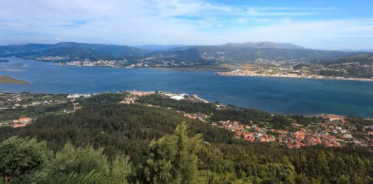
For views over the Ría de Arousa, Turismo de Galicia points to the lookout of A Curota in A Pobra do Caramiñal (Turismo de Galicia). In Vigo, the hill of O Castro keeps the remains of a hillfort and a 17th-century fortress and looks over the city, the ría and the Cíes (Turismo de Galicia). At the southern end of the coast, the Miño estuary runs for about 15 km between A Guarda and O Rosal as the border with Portugal (Turismo Rías Baixas).
When to go
Average temperature and rainfall at the Pontevedra observatory (108 m), for 1991–2020, from AEMET data as tabulated on Spanish Wikipedia.
The annual mean is 14.8 °C, with 1,586 mm of rain on 130 days and 2,265 hours of sunshine; July has only 41 mm of rain and five rainy days (Spanish Wikipedia, from AEMET). For the islands, the season that matters is the high season at Easter and from 15 May to 15 September, when the regular boats run and you need a permit (Turismo Rías Baixas). In 2022 the Xunta set the daily maximum at 1,800 people for the Cíes and 1,300 for Ons (Xunta de Galicia). For the food, October brings the seafood festival in O Grove; in August, the Viking landing at Catoira falls on the first Sunday; and Pontevedra holds its medieval Feira Franca on the first weekend of September (Turismo de Galicia).
Itineraries
We plan these with a car and the ferries. Book the island boat first in summer, since the permit and ticket decide which day you can go.
Three days

Day 1
Vigo
Start on the hill of O Castro, with the remains of a hillfort, a 17th-century fortress and a view over the city, the ría and the Cíes. Walk down to the Berbés, the old fishermen’s quarter with its arcades, and on to the street of A Pedra, where oyster sellers offer them to eat on the spot. Then see the Collegiate Church of Santa María and the Porta do Sol. In the afternoon head up to the park of Castrelos, some 24 hectares around the Pazo de Quiñones de León, which houses the municipal museum. End the day on Samil, the city’s longest beach.
Day 2
The Cíes Islands
With your Xunta permit and ferry ticket, sail from Vigo to the Cíes. From the pier, walk to Rodas, the beach between the north and middle islands, and the lagoon behind it. Then take the zigzag path to the Monte Faro lighthouse, about 7 km there and back, past the bird hides and the gull colony. Bring water and food: only the Cíes and Ons have a restaurant, and you take your rubbish home. Your ticket fixes the date and time of your return boat.
Day 3
Baiona and A Guarda
Drive south to Baiona. Walk the walls of the Monterreal fortress, now a Parador, and the old town, entered from the Santa Liberata square or at the Trinidade cross, which dates from the 15th century. Continue along the coast to A Guarda and drive up Monte Santa Trega: the hillfort, one of the largest in Galicia, the museum by Antonio Palacios and the view over the mouth of the Miño into Portugal. End by the fishing port of A Guarda, where sections of the medieval wall lead to the old clock tower.
Seven days
Days 1–3: as above, based in Vigo.
Day 4
Pontevedra and Combarro
Base yourself in Pontevedra. Start at the basilica of Santa María a Maior, built in the 16th century and paid for by the seafarers’ guild, then walk through the squares to A Peregrina and the ruins of Santo Domingo. The Museum of Pontevedra holds gold and silver pieces up to 4,000 years old. In the afternoon drive to Combarro on the north shore of the ría, where the hórreos line the water, and walk its lanes among the granaries, the stone crosses and the fishermen’s houses.
Day 5
A Lanzada and O Grove
Spend the morning on A Lanzada, more than 2 km of white sand between Sanxenxo and O Grove, and see the chapel of A Lanzada by the beach, linked to old fertility rites. Cross to the O Grove peninsula. Look for birds from the hides at O Vao, then visit A Toxa island, with its chapel covered in scallop shells and its spas. In the evening, take a boat trip on the ría from the port of O Corgo, then eat seafood by the port.
Day 6
Cambados and the Ría de Arousa
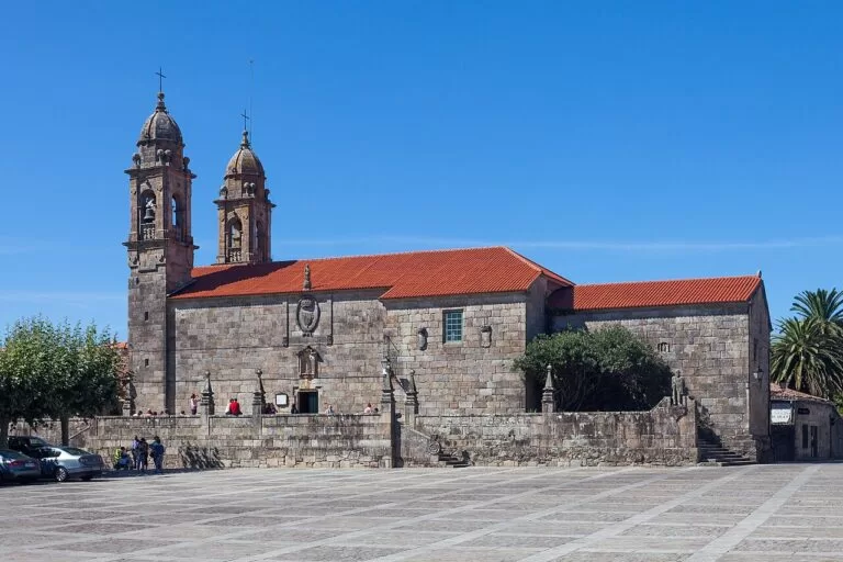
Cambados grew from three villages: noble Fefiñáns, the fishing quarter of Santo Tomé with its defence tower, and Cambados itself, with its squares and the ruins of Santa Mariña Dozo. Walk all three, then taste Albariño. In the afternoon cross the 2 km bridge to A Illa de Arousa, which has 11 km of beaches, and finish at Area da Secada by the lighthouse.

Day 7
Corrubedo and Muros e Noia
Drive round the Arousa ría to Corrubedo. Park at the Casa da Costa in O Vilar and follow the boardwalks to the great dune and the lagoons of Carregal and Vixán. Continue north on the AC-550 to the Castro de Baroña by the sea. End in Noia, the little Compostela, and its church of Santa María a Nova with more than two hundred guild gravestones, or in Muros at the tide mill.
Getting there and around
By air
Vigo Airport (VGO) is 10 km from the centre of Vigo (Wikipedia). The tourist board lists direct flights to Madrid, Barcelona, Bilbao, Valencia and Palma, and seasonal routes such as Paris and London (Turismo Rías Baixas). Santiago (SCQ), 12 km east of Santiago de Compostela, is the busiest airport in Galicia (Wikipedia); Porto (OPO) is the other option from the south.
By train and bus
Trains link Pontevedra, Vilagarcía de Arousa and the two Vigo stations, Urzáiz and Guixar, with Santiago, A Coruña and Ourense, and the Celta train runs from Porto to Vigo. Buses from Alsa, Monbus and other operators connect the coastal towns (Turismo Rías Baixas). From Vigo Airport, city bus line A runs to Vigo-Urzáiz station every 30 minutes (Wikipedia).
By car and boat
The AP-9 motorway runs from A Coruña through Santiago, Pontevedra and Vigo to the Portuguese border, the A-52 comes in from Benavente and central Spain, and the A-55 links Vigo with Tui and Valença (Turismo Rías Baixas). Ferries cross the Ría de Vigo to Cangas and Moaña (Turismo de Galicia), and boats run to the islands in high season.
Practical and safety
- Emergencies: 112 for emergencies, 091 for the National Police and 061 for ambulances; maritime rescue in Pontevedra is on 986 845 300 (Turismo Rías Baixas).
- Cíes and Ons permits: at Easter and from 15 May to 15 September you first request a free authorisation from the Xunta de Galicia at autorizacionillasatlanticas.xunta.gal, then buy a ferry ticket (Turismo Rías Baixas). The authorisation is personal, carries a QR code and is confirmed once you buy the ticket (Xunta de Galicia).
- Sálvora and Cortegada: visits are on guided routes run by authorised companies, with a limit of 250 people a day on each all year (Xunta de Galicia).
- Cold water: the beaches look Caribbean “until you put a finger in the water”, as Turismo de Galicia puts it (Turismo de Galicia). We found no official figures for sea temperature, currents or lifeguard dates, so check the flags and ask at the beach.
- On the islands: take your cans and packaging back with you, keep out of the sea-bird breeding areas, and note that there is no boat between islands (Turismo de Galicia).
FAQ
Where are the Rías Baixas?
On the south-west coast of Galicia, in north-west Spain: the rías of Muros e Noia, Arousa, Pontevedra and Vigo, between the Costa da Morte to the north and the Miño and Portugal to the south.
Do I need a permit for the Cíes Islands?
Yes, at Easter and from 15 May to 15 September. Request the free Xunta authorisation online first, then buy a ferry ticket from Vigo, Baiona or Cangas. The same applies to Ons.
Which airport is closest?
Vigo (VGO), 10 km from the city centre, for the south. Santiago (SCQ) suits the northern rías, and the tourist board lists Porto (OPO) 167 km away.
What is the best beach in the Rías Baixas?
The tourist boards point to Rodas on the Cíes, which The Guardian once called the best in the world, and A Lanzada, more than 2 km of white sand between Sanxenxo and O Grove.
Is the sea warm enough to swim?
It is the Atlantic, and the tourist board itself warns that the water is cold. July and August are the warmest and driest months, with average temperatures of about 20 °C at Pontevedra.
When is the O Grove seafood festival?
Every October, for about ten days, in the square of O Corgo by the fishing port. It has been held since 1963.
Neighbouring costas
Galician coast
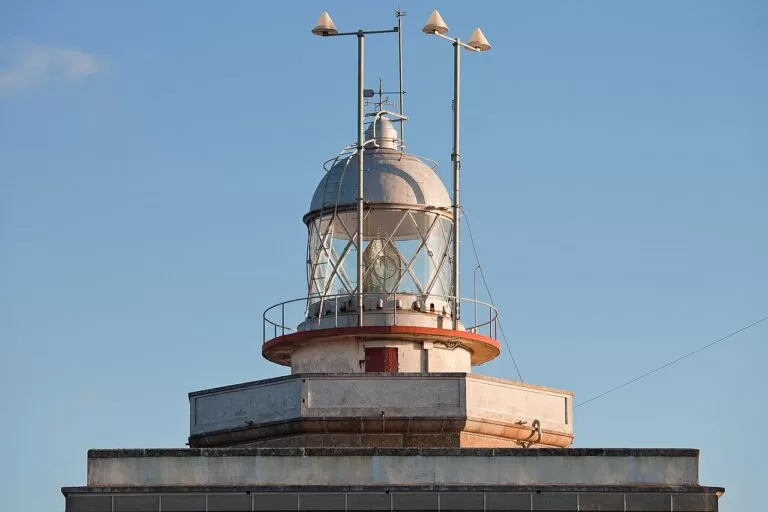
North of Muros: the Costa da Morte from Carnota and Fisterra to Malpica, A Coruña and the Rías Altas east to Ribadeo on the Eo.
Galician coast guide →Sources and freshness
Checked 6 November 2026. Turismo Rías Baixas, the tourist board of the Provincial Council of Pontevedra, on getting there, getting around, frequent questions and the island permits and useful phone numbers; on the beaches of A Lanzada, Silgar, Montalvo, O Vao, Area da Secada, Nerga, Samil, Figueiras and Playa América–Panxón; on the Cíes, Ons, Cortegada, A Illa de Arousa and the Ría de Vigo; on Cambados, Combarro, Baiona, Monterreal, A Guarda, Santa Trega and its museum, the Torres de Oeste, the Miño estuary and the Portuguese Way; and on the Albariño festival and the O Grove seafood festival (English, Spanish). Turismo de Galicia on the rías of Muros e Noia, Arousa, Pontevedra and Vigo, the Muros e Noia geodestination, the national park, Corrubedo and the cities of Vigo and Pontevedra. MITECO on the Atlantic Islands National Park (overview, fact sheet, history). Xunta de Galicia on the high-season permits and daily limits (May 2022). Transport: Wikipedia on Vigo Airport and Santiago Airport. Climate: AEMET normals 1991–2020 for the Pontevedra observatory, as tabulated on Spanish Wikipedia. We could not open the Xunta permit portal or the national park’s own website, and we found no official source for sea temperature, currents, lifeguard dates or ferry fares, so none are given here.
Photo credits · 47 photos from Wikimedia Commons Show
Photos from Wikimedia Commons, not altered except for cropping: A Lanzada from Noalla by Luis Miguel Bugallo Sánchez (Lmbuga) (CC BY-SA 4.0); Port of Muros by Luis Miguel Bugallo Sánchez (Lmbuga) (CC BY-SA 4.0); Combarro by juantiagues (CC BY-SA 2.0); Monterreal, Baiona by Lmbuga (Luis Miguel Bugallo Sánchez) (CC BY-SA 4.0); Castro de Baroña by Luis Miguel Bugallo Sánchez (Lmbuga) (CC BY-SA 4.0); Praza de Fefiñáns, Cambados by El fosilmaníaco (CC BY-SA 3.0 es); Chapel on A Toxa by Lameiro (CC BY-SA 4.0); A Lanzada boardwalk by Lameiro (CC BY-SA 4.0); Silgar, Sanxenxo by Luis Miguel Bugallo Sánchez (Lmbuga) (CC BY-SA 4.0); Combarro by Luis Miguel Bugallo Sánchez (Lmbuga) (CC BY-SA 4.0); Praza da Leña, Pontevedra by Jorge Franganillo (CC BY 4.0); Ons pier and O Curro by Txo (Public domain); Praia de Rodas, Cíes by Mario Sánchez (CC BY-SA 2.0); Monterreal, Baiona by Joseolgon (CC BY 4.0); Castro de Santa Trega by Luis Miguel Bugallo Sánchez (Lmbuga) (CC BY-SA 4.0); Praia de Rodas by Mário José Martins (CC BY 2.0); Illa de Ons by Joseolgon (CC BY 4.0); Ría de Arousa by Urs Schönholzer (CC BY 4.0); Pontevedra by MJSB73MP (CC BY-SA 4.0); Santa Trega by Luis Miguel Bugallo Sánchez (Lmbuga) (CC BY-SA 4.0); Ría de Vigo from O Castro by Teresafs (CC BY-SA 4.0); Corrubedo by Luis Miguel Bugallo Sánchez (Lmbuga) (CC BY-SA 4.0); Praia de Xastelas, A Illa de Arousa by Lameiro (CC BY-SA 4.0); A Lanzada by Lameiro (CC BY-SA 4.0); Silgar, Sanxenxo by Luis Miguel Bugallo Sánchez (Lmbuga) (CC BY-SA 3.0); Praia de Nerga by Adrián Estévez (gl:User:Estevoaei) (CC BY-SA 4.0); Praia de Rodas by Gwaihhir (CC BY-SA 3.0 es); Samil, Vigo by Luis Miguel Bugallo Sánchez (Lmbuga) (CC BY-SA 4.0); Praia América and Panxón by Luis Miguel Bugallo Sánchez (lmbuga) (CC BY-SA 3.0); San Martiño, Noia by Luis Miguel Bugallo Sánchez (CC BY-SA 4.0); Pazo de Fefiñáns, Cambados by Luis Miguel Bugallo Sánchez (Lmbuga) (CC BY-SA 4.0); Port of O Grove by Luis Miguel Bugallo Sánchez (Lmbuga) (CC BY-SA 3.0); Rúa Real, Pontevedra by Domi402 (CC BY-SA 4.0); Vigo by Zarateman (CC0); Monterreal, Baiona by Joseolgon (CC BY 4.0); Faro de Cíes by juantiagues (CC BY-SA 2.0); Mussel rafts, Ría de Arousa by Urs Schönholzer (CC BY 4.0); Rúa Isabel II, Pontevedra by Domi402 (CC BY-SA 4.0); Castro de Baroña by Luis Miguel Bugallo Sánchez (Lmbuga) (CC BY-SA 4.0); Corrubedo natural park by JensKunstfreund (CC BY-SA 4.0); Ría de Vigo from A Guía by Estevoaei (CC BY-SA 4.0); Monte Faro, Cíes by Iago Casabiell González (CC BY-SA 4.0); Mouth of the Miño from Santa Trega by Luis Miguel Bugallo Sánchez (Lmbuga) (CC BY-SA 4.0); Hórreo, Combarro by el Buho nº30 (CC BY-SA 2.0); A Lanzada by Lmbuga (CC BY-SA 3.0); San Bieito, Cambados by Luis Miguel Bugallo Sánchez (Lmbuga) (CC BY-SA 4.0); Corrubedo from Pedra da Ra by Luis Miguel Bugallo Sánchez (Lmbuga) (CC BY-SA 3.0); Fisterra lighthouse by Luis Miguel Bugallo Sánchez (CC BY-SA 3.0).
Every place we have mapped on the Rías Baixas
18 towns, beaches, coves and landmarks, kept up to date automatically.
- A Lanzada Beach (Sanxenxo and O Grove)
- Baiona (Monterreal and La Pinta, Rías Baixas)
- Cambados (Albariño capital, Rías Baixas)
- Camping Cabeiro
- Camping Moreiras
- Camping Playa Ría de Arosa
- Camping Rural Ria de Arosa 2
- Castro de Baroña (Porto do Son)
- Cíes Islands (Illas Cíes, Vigo)
- Combarro (Poio, Rías Baixas)
- Monte Santa Trega and Castro (A Guarda)
- O Grove and A Toxa Island (Rías Baixas)
- Ons Island (Illa de Ons, Bueu)
- Pontevedra Old Town (Rías Baixas)
- Portosín Camper Park
- Praia América (Nigrán)
- Sanxenxo and Praia de Silgar (Rías Baixas)
- Vigo Old Town and Monte do Castro