
Galicia · North-west Spain
Galician coast travel guide: Costa da Morte and the Rías Altas
Shipwreck capes and lighthouses, the city of A Coruña and the high cliffs and estuaries of the north, from Carnota and Fisterra to Ribadeo on the Eo.
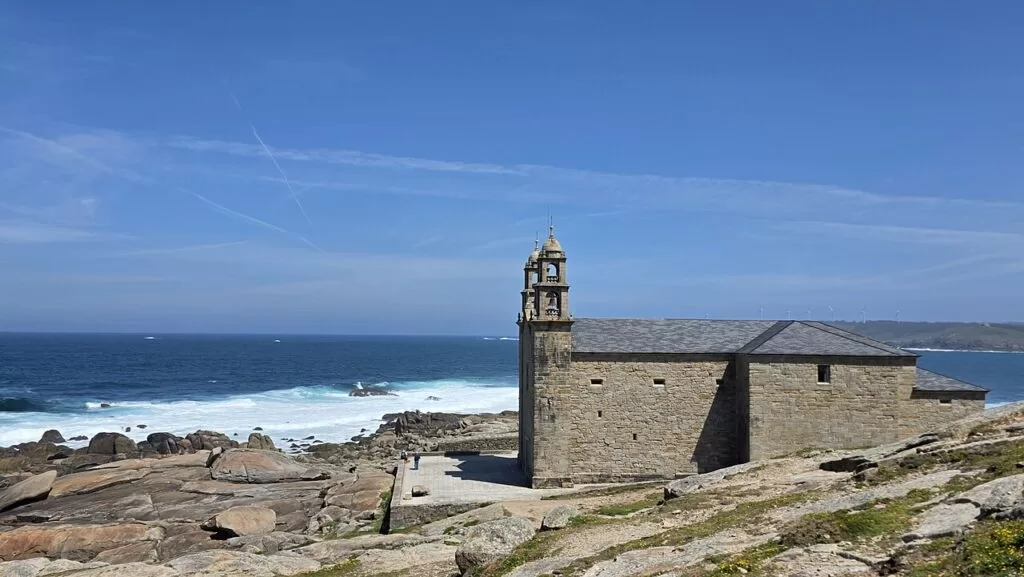
Muxía · Photo: JensKunstfreund, CC BY-SA 4.0
The Galician coast north of the Rías Baixas is the Atlantic and Bay of Biscay shore of the provinces of A Coruña and Lugo in north-west Spain. It runs from Carnota and Cape Fisterra on the Costa da Morte, which Turismo de Galicia says takes its name from the many shipwrecks along it (Turismo de Galicia), past the cities of A Coruña and Ferrol, to Estaca de Bares, the northernmost point of the Iberian Peninsula (Turismo de Galicia), and on to Ribadeo on the Eo estuary, the border with Asturias (Turismo de Galicia). Along the way are the Roman lighthouse of the Tower of Hercules, some of the highest cliffs in Europe in the Serra da Capelada (Turismo de Galicia) and the rock arches of Praia das Catedrais, Cathedrals Beach. Turismo de Galicia calls the estuaries of the north the Rías Altas, the high estuaries, as against the Rías Baixas further south (Turismo de Galicia). This guide covers the three stretches of coast, the beaches, the weather and routes by car.
At a glance
- Where the north and west coast of Galicia, from Carnota on the Costa da Morte to the Eo estuary on the border with Asturias.
- Fly to A Coruña Airport (LCG), about 7 km from the city centre, or Santiago de Compostela (SCQ), 12 km east of Santiago.
- Climate an annual mean of 15.1 °C and 1,018 mm of rain at the A Coruña observatory (AEMET, 1991–2020).
- Known for lighthouses on shipwreck capes, the end of the Way of St James at Fisterra, and barnacles from the rocks of Roncudo.
- On CostaMap 12 places on this coast, all on the map below.
Map of the Galician coast
The map shows the places on this coast that have a CostaMap page. Tick a place type to filter it, and click a marker to see the place in the panel. The areas below follow the coast from south-west to east, from Carnota to Ribadeo.
Place type
Area · next level
 Coast map
Galician coast
Click a marker to see the place here. Three areas from Carnota and Fisterra to A Coruña, Ferrol and Ribadeo on the Eo.
Choose your areaChoose your area
We split the coast into three stretches: the Costa da Morte in the west, A Coruña and the Golfo Ártabro in the middle, and the Rías Altas and A Mariña in the north. Places with a CostaMap guide are linked; the others are described from Turismo de Galicia.
Costa da Morte: Carnota to Malpica
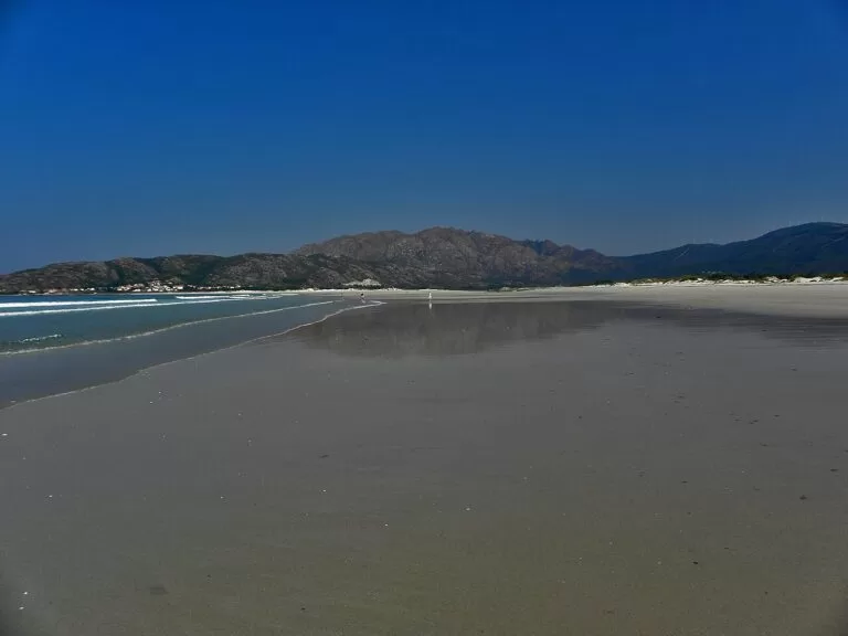
Seventeen municipalities, from the 7 km beach of Carnota past Fisterra, Muxía and Camariñas to Laxe and Malpica (Turismo de Galicia).
- Carnota – the longest beach in Galicia and, in the village, the largest hórreo (granary) in Galicia, 35 metres long.
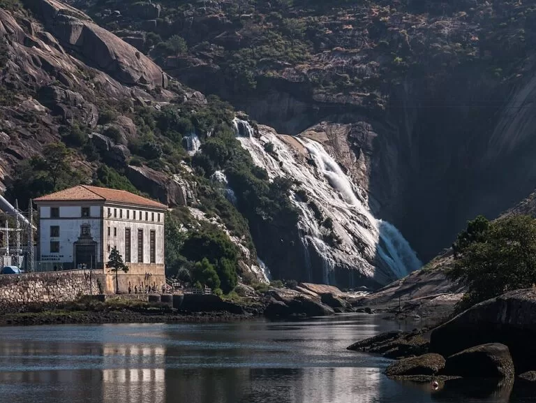
- Ézaro waterfall – the River Xallas falls about 40 m into the sea at the foot of Monte Pindo.
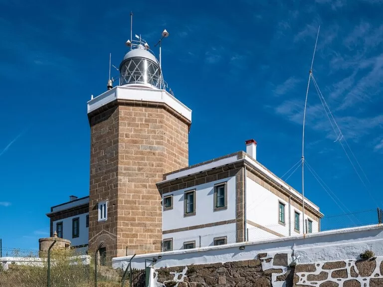
- Cape Finisterre – the cape the Romans took for the end of the world, with a lighthouse from 1853 where the Way of St James ends.
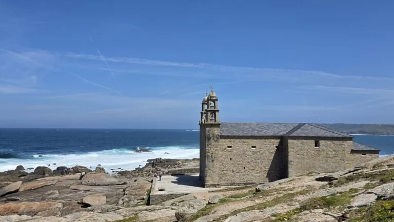
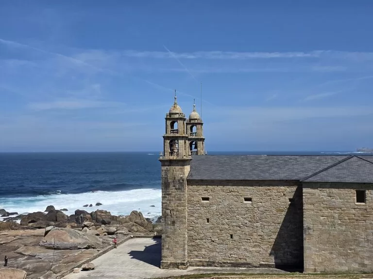
- Muxía – the shrine of the Virxe da Barca on the rocks by the sea, on the southern bank of the Camariñas estuary.
- Camariñas – bobbin lace, the encaixes, and a sheltered estuary of white beaches and coves.
- Cabo Vilán – the 1896 lighthouse, the first in Spain with electric light, and the English Cemetery of HMS Serpent.
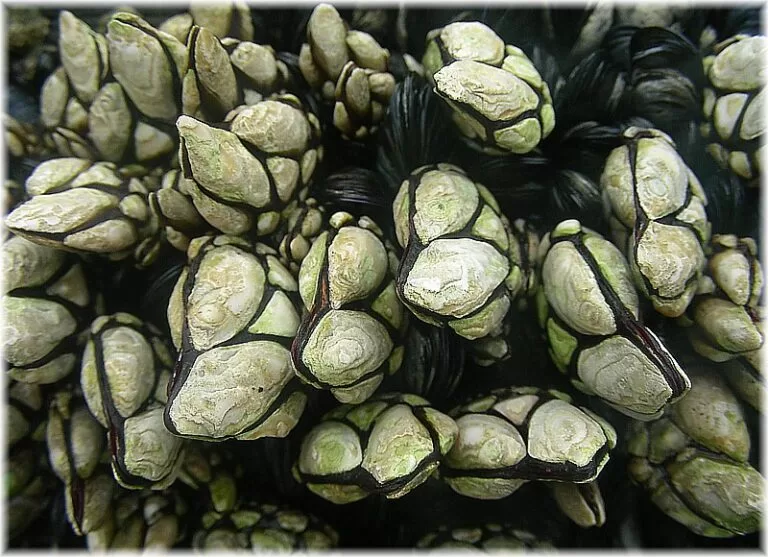
- Laxe and Corme – a 1,400 m beach in the middle of Laxe, and the barnacle rocks of Punta do Roncudo.
- Malpica – the chapel of Santo Hadrián on its cape, facing the Sisargas Islands.

A Coruña and the Golfo Ártabro
The city of A Coruña and the estuaries of A Coruña, Ares-Betanzos and Ferrol, whose mouths can all be seen from the lighthouse at Mera (Turismo de Galicia).
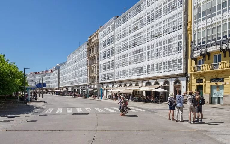
- A Coruña – the old town, glazed galleries, the city beaches of Riazor and Orzán and a seafront promenade that goes almost all the way round.
- Tower of Hercules – the Roman lighthouse on the headland, the oldest working lighthouse in the world.
- Betanzos – a historic centre, once walled, between the Mendo and Mandeo rivers, at the head of its estuary.
- Pontedeume and the Fragas do Eume – one of the best-preserved riverside Atlantic forests in Europe, with the monastery of Caaveiro.
- Mugardos and Ares – the octopus fair of Mugardos, and houses in Ares with balconies for hanging up fishing nets.
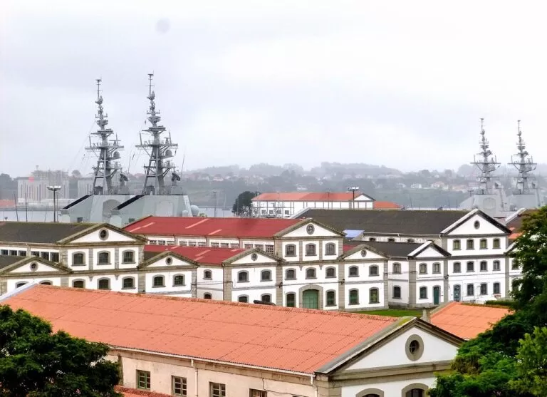
- Ferrol – the 18th-century Magdalena quarter and the Arsenal, the only military port of the Enlightenment left intact in Europe.
- Valdoviño – Pantín beach, which regularly hosts surfing world championships, and the A Frouxeira lagoon.
Rías Altas and A Mariña: Cedeira to Ribadeo
Cliffs, small estuaries and fishing ports from Cedeira round Estaca de Bares to the Mariña of Lugo, about 100 km of coast on the Bay of Biscay (Turismo de Galicia).
- Cedeira – a small estuary below cliffs, with the crescent-shaped beach of Vilarrube.
- San Andrés de Teixido – the pilgrimage shrine on the Capelada cliffs: whoever does not go in life goes after death.
- Garita de Herbeira and Cabo Ortegal – the Serra da Capelada rising to 620 m at Vixía Herbeira, and the lighthouse above the rocks of Os Aguillóns.
- Ortigueira – Morouzos beach and the Ortigueira Celtic music festival, held since 1978.
- O Barqueiro and Bares – a white port at the mouth of the Sor, and Estaca de Bares, the northernmost point of the peninsula.
- Viveiro – a medieval old quarter with the Porta de Carlos V, and the fishing port of Celeiro.
- Foz – a former whaling port with almost 15 km of beaches along its estuary.
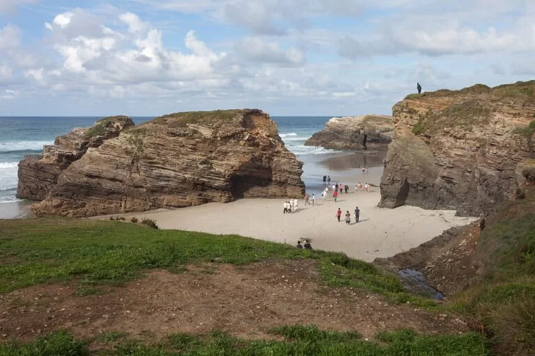
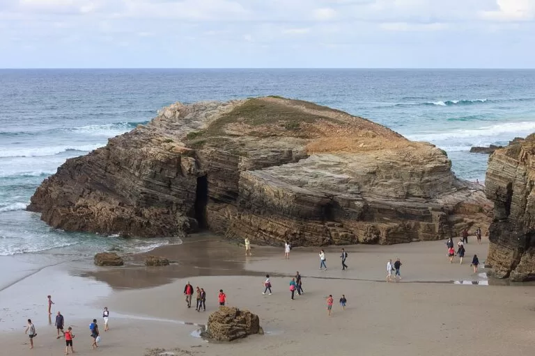
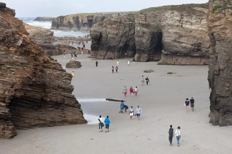
- Cathedrals Beach – rock arches and sea caves you can walk among at low tide, with a free booking in summer.
- Ribadeo – a stately port on the Eo estuary, facing Asturias, and the usual base for Cathedrals Beach.
Explore by interest
Pick a theme. Each tile opens the part of this guide that covers it.
Best beaches
The selection below is ours, from south-west to east. Lengths, beach types and Blue Flag listings are as given by Turismo de Galicia, checked in November 2026. Several of the wildest beaches on this coast are open to the Atlantic and are not safe for swimming, so read the notes before you go in.
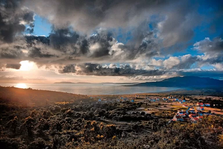
Carnota
An open beach of fine sand, 7,000 m long (Turismo de Galicia) and up to a kilometre wide at low tide, with Monte Pindo above it (Turismo de Galicia).
See the beach guide →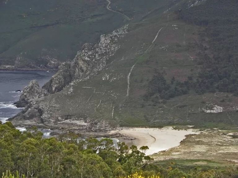
Mar de Fóra
A 700 m open beach on the Fisterra peninsula (Turismo de Galicia), between Cape Fisterra and Cabo da Nave. It is not a swimming beach: Turismo de Galicia calls it dangerous (Turismo de Galicia).
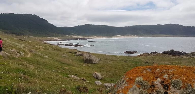
Area de Trece
A 500 m open beach (Turismo de Galicia) reached on foot or by bike along the path from the Cabo Vilán road, below a climbing dune (Turismo de Galicia).
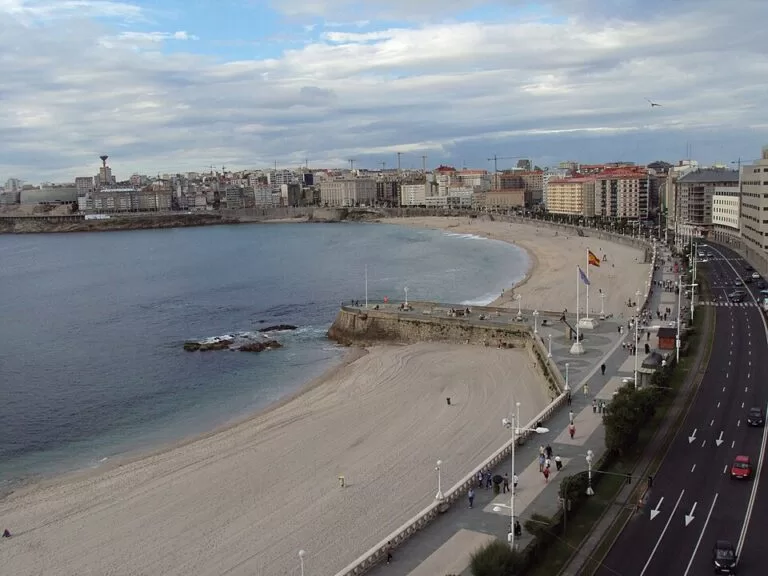
Riazor and Orzán
The two city beaches of A Coruña, separated by a breakwater, with waves for surfing (Turismo de Galicia). The promenade from the Tower of Hercules ends here (Spain.info).
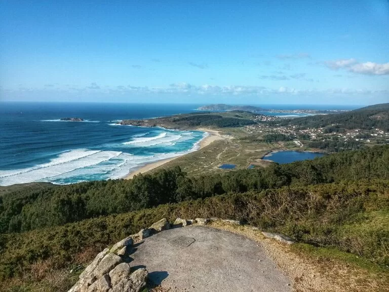
Doniños
A 1,700 m open beach of fine sand in Ferrol, listed with a Blue Flag and on the English Way to Santiago (Turismo de Galicia). The Doniños lagoon behind it is a haven for waterfowl (Turismo de Galicia).
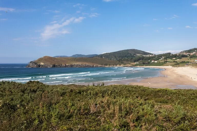
Pantín
A 950 m beach of fine sand in Valdoviño (Turismo de Galicia) that regularly hosts surfing world championships (Turismo de Galicia).
Morouzos
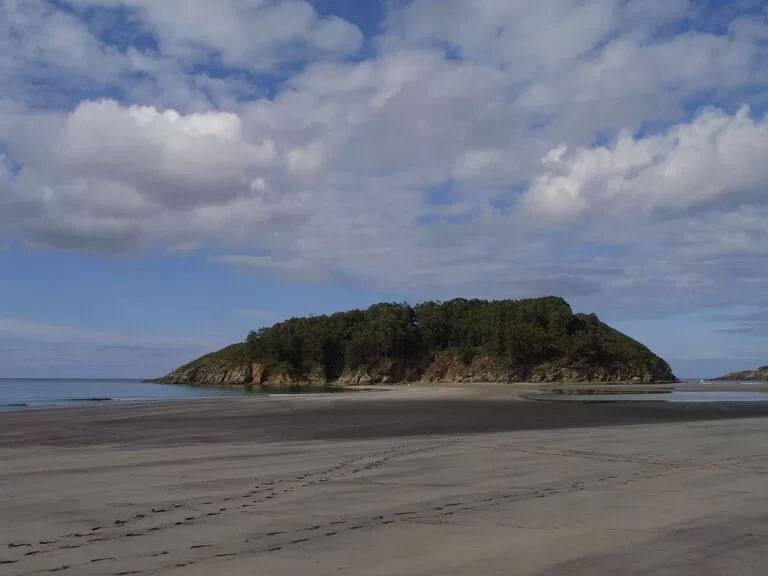
More than 2 km of sand facing the island of San Vicente, which you can walk to at low tide, backed by pine wood (Turismo de Galicia). About four kilometres on foot from the port of Ortigueira (Turismo de Galicia).
Praia das Catedrais
Cathedrals Beach, between Augasantas and Carricelas: rock buttresses up to 30 metres high, sea caves and arches, on the sand only at low tide. A free authorisation is needed from 1 July to 30 September and in Holy Week (Turismo de Galicia).
See the beach guide →Also worth knowing: Balarés in Ponteceso is a sheltered 350 m beach with a Blue Flag (Turismo de Galicia); Bares in Mañón is a sheltered 1,500 m beach below Estaca de Bares (Turismo de Galicia); and Covas in Viveiro is a sheltered 1,500 m beach on the estuary (Turismo de Galicia).
Where to stay by town
These are the towns we would base a trip in, from south-west to east, with what each one is known for. We do not list hotels.
Fisterra
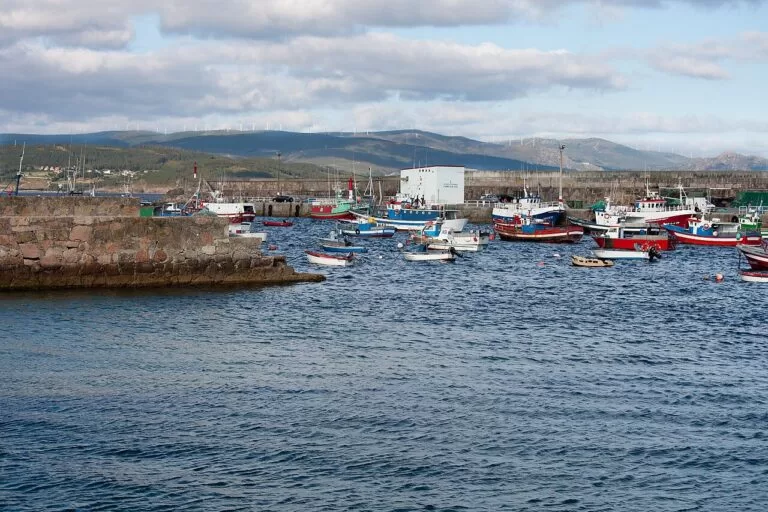
The town at the end of the Way of St James, around the Praza da Ara Solis, with the lighthouse and the beaches of Mar de Fóra and O Rostro close by.
Sunsets and the Camino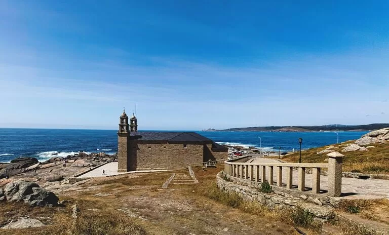
Muxía
A fishing town on the Camariñas estuary, with the Virxe da Barca shrine and an easy drive to Cabo Touriñán and Cabo Vilán. Muxía guide
Base for the capes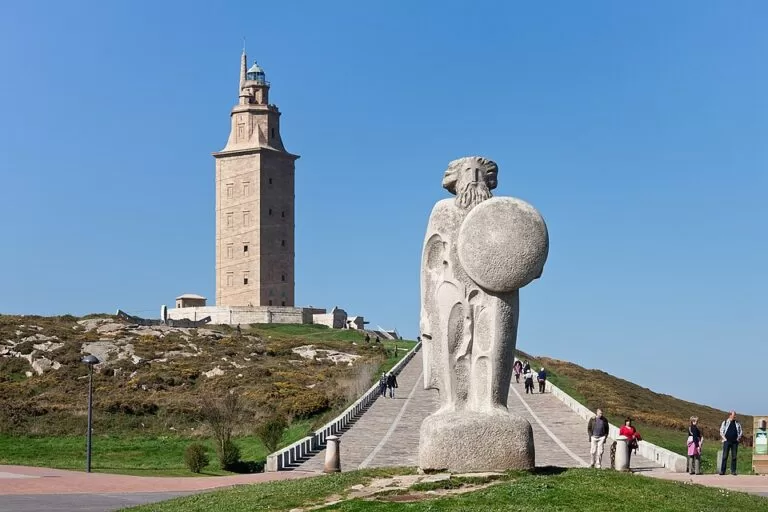
A Coruña
The Glass City: galleried houses on the Marina, the old town, museums, two city beaches and the Tower of Hercules. A Coruña guide
City and beach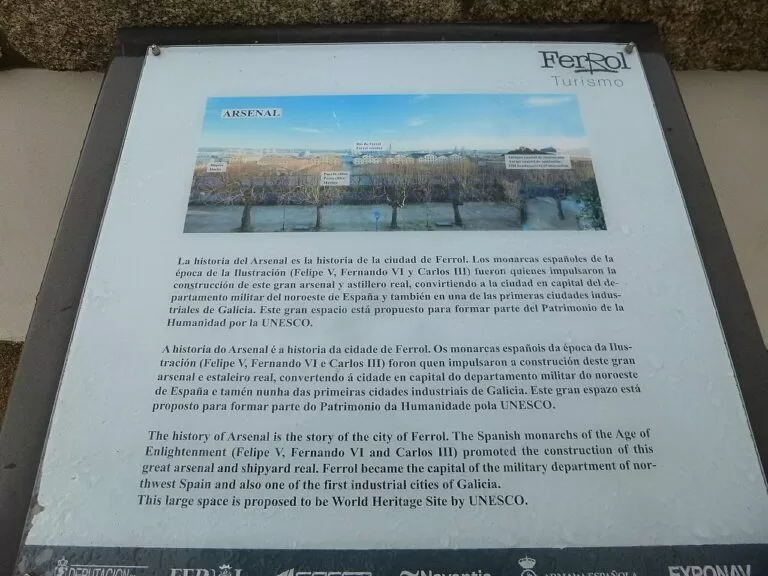
Ferrol
A naval city laid out in the 18th century, with the Magdalena quarter, the Arsenal and the beaches of Doniños and Pantín within reach.
History and surf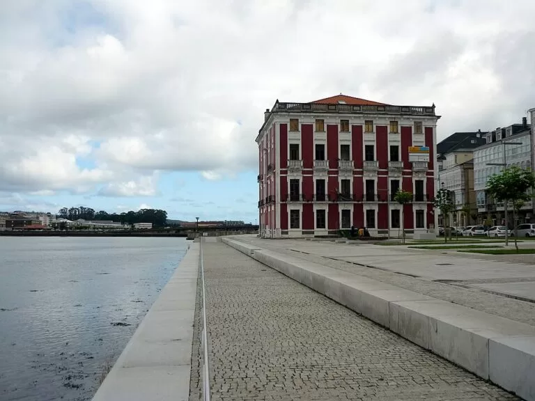
Viveiro
The main town of A Mariña, with remains of its medieval wall, estuary beaches and fresh fish from the port of Celeiro. Viveiro guide
Old town by the sea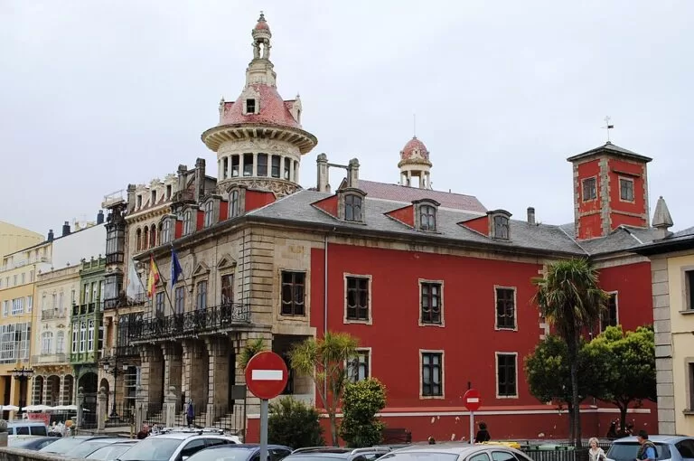
Ribadeo
A stately port on the Eo estuary built up by emigrants returned from the Americas, close to Rinlo and Cathedrals Beach. Ribadeo guide
Base for the CatedraisThings to do
Lighthouses and capes of the Costa da Morte
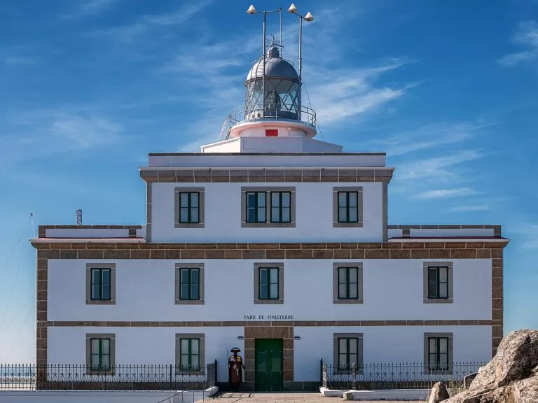
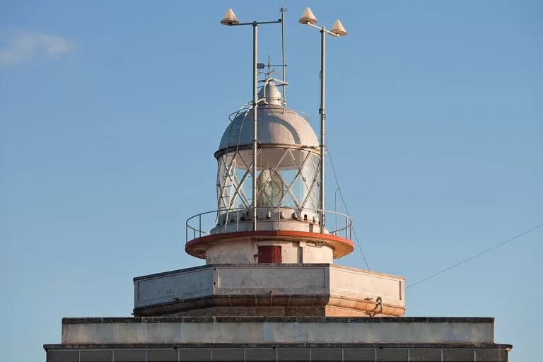
The Fisterra lighthouse was built in 1853, 138 m above sea level; Turismo de Galicia calls it the westernmost lighthouse in Europe, and its light reaches 65 km (Turismo de Galicia). The cape is traditionally regarded as the westernmost point of the continent, although strictly speaking it is not (Turismo de Galicia). Cabo Touriñán in Muxía reaches 9º 18′ 19” West and is surpassed in Galicia only, and by very little, by Cabo da Nave in Fisterra (Turismo de Galicia).
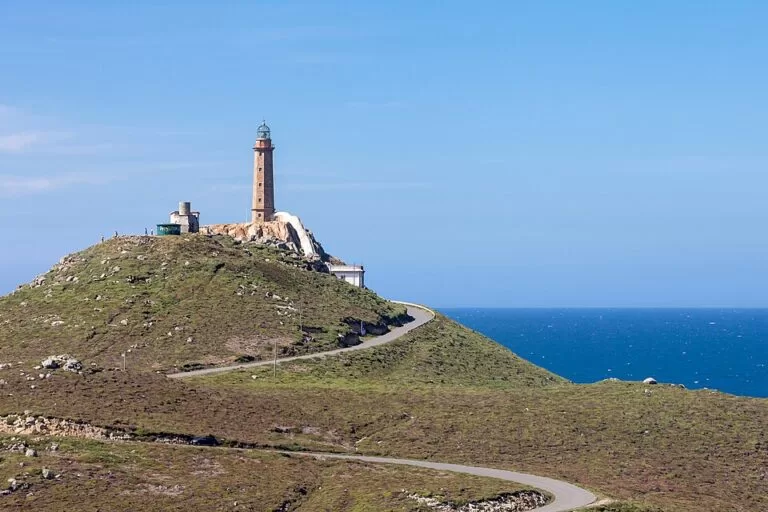
At Cabo Vilán in Camariñas, the present lighthouse of 1896 was the first in Spain to work with electric light: its tower is 25 metres high on a rock 105 metres above the sea (Turismo de Galicia), and it now holds a museum of shipwrecks. More than 150 wrecks have been recorded on this stretch, the best known being HMS Serpent on 10 November 1890; apart from three survivors, its 172 crew are buried in the Cemiterio dos Ingleses (Turismo de Galicia).
Shrines and legends by the sea
In Muxía, the sanctuary of A Virxe da Barca stands on the rocks at the water’s edge. Legend says the Virgin arrived here by boat to encourage St James; the Pedra de Abalar is said to be its hull and the Pedra dos Cadrís its sail (Turismo de Galicia), and the Romaría de Nosa Señora da Barca is a National Tourism Event (Turismo de Galicia). On the way there, the Romanesque monastery of San Xián de Moraime has stood since the 12th century (Turismo de Galicia).
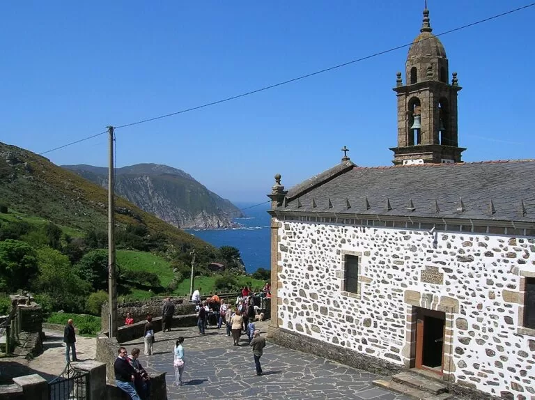
In the north, Santo André de Teixido is one of Galicia’s most important places of pilgrimage. The saying goes that “those who do not go in life, go after death”; the church was built between the 16th and 18th centuries (Turismo de Galicia), and the main pilgrimage is on 8 September (Turismo de Galicia). Tradition is to leave a stone on the milladoiros, the small cairns along the road (Turismo de Galicia).
A Coruña and Ferrol
The Tower of Hercules, a Roman lighthouse from the 2nd century AD, is the oldest working lighthouse in the world and a World Heritage Site; it can be visited and has a museum inside (Turismo de Galicia). Its present facade dates from the 1791 reform (Turismo de Galicia). In the city, the María Pita square, the 12th-century Church of Santiago, the San Carlos gardens with the tomb of Sir John Moore, and the Archaeological Museum in the castle of San Antón are all on the walk round the old town (Turismo de Galicia).
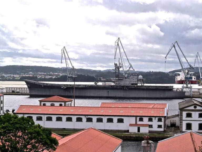
Ferrol is 52 km from A Coruña (Spain.info). Its Magdalena quarter follows the plans approved by Carlos III in 1761, and the Arsenal was built in 1750 to a design by Julián Sánchez Bort (Turismo de Galicia). The inside of the dockyard can only be visited with prior permission; the Naval Museum and Exponav, an exhibition on shipbuilding, are open to visitors (Turismo de Galicia).
Cliffs, waterfalls, forests and birds
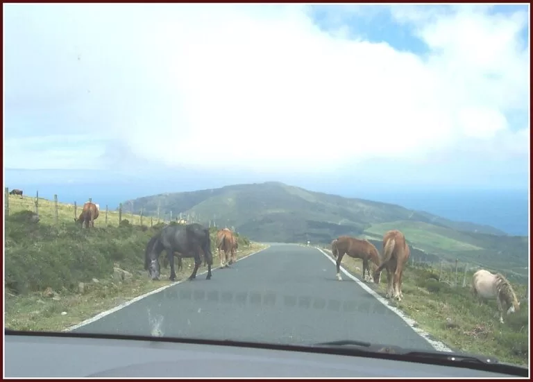
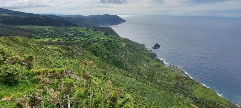
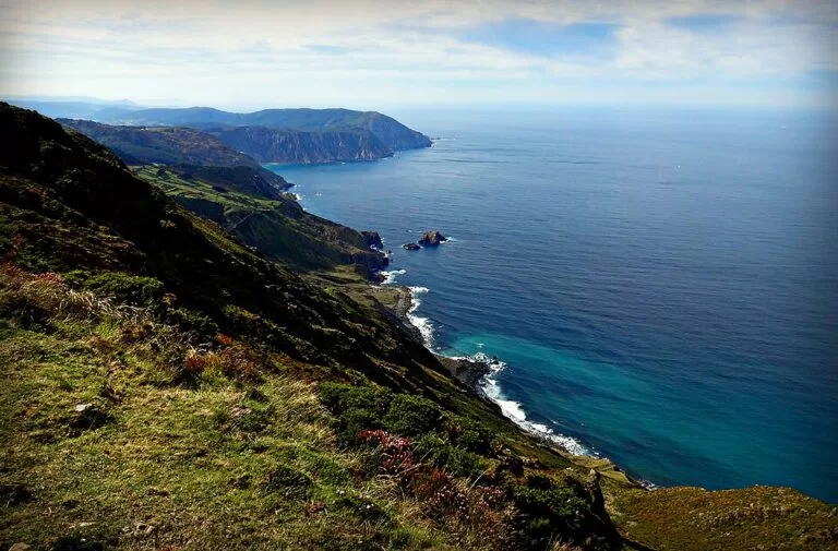
The Serra da Capelada has some of the highest cliffs in Europe, reaching 620 metres at Vixía Herbeira and falling to the sea at more than 80 degrees (Turismo de Galicia). At Cabo Ortegal the waves break on Os Aguillóns, rocks that Turismo de Galicia counts among the oldest on earth (Turismo de Galicia). Estaca de Bares is one of the best birding spots in Europe, with a permanent ornithological station; most birds pass from September to December (Turismo de Galicia).
In the south-west, Monte Pindo rises to 627 metres two kilometres from the sea, and at Ézaro the River Xallas falls into the sea from 40 metres; the sluices are opened in the tourist season (Turismo de Galicia). Inland from Pontedeume, the Fragas do Eume natural park covers 9,000 hectares of riverside Atlantic forest, with fewer than 500 inhabitants and the monastery of Caaveiro at its heart (Turismo de Galicia).
Barnacles, octopus and lobster rice
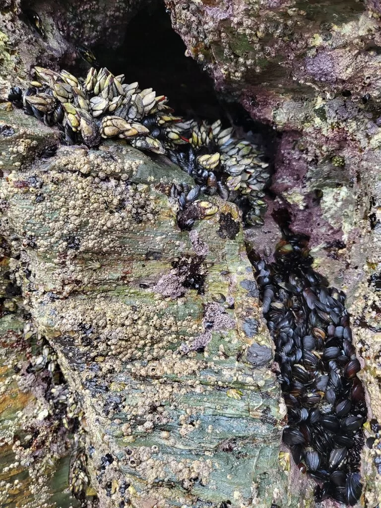
Turismo de Galicia says the best barnacles in the world grow on the cliffs of Punta do Roncudo near Corme, where white crosses remember the percebeiros, the barnacle gatherers, who died there (Turismo de Galicia). At Cabo Touriñán in summer you can watch them at work at low tide (Turismo de Galicia). Mugardos holds an octopus fair, the Feira do Polbo (Turismo de Galicia), and Rinlo, near Ribadeo, is known for lobster with rice (Turismo de Galicia).
On land, the Costa da Morte grows potatoes with the Pataca de Galicia Protected Geographical Indication (Turismo de Galicia), and the star product of the Mariña of Lugo is the Faba de Lourenzá bean, also with a PGI (Turismo de Galicia).
When to go
Average temperature and rainfall at the A Coruña observatory (58 m), for 1991–2020, from AEMET data as published in the climate table of the Spanish Wikipedia (Wikipedia).
The annual mean is 15.1 °C, with 1,018 mm of rain on 127.3 days and 2,119 hours of sunshine; July is the driest month, with 31 mm, and November the wettest, with 150 mm (Wikipedia). Summer brings the Ortigueira festival of Celtic music on Morouzos beach on the second weekend of July (Turismo de Galicia) and, in A Coruña, the bonfires of San Juan on the night of 23–24 June (Turismo de Galicia). Autumn is the season for birds at Estaca de Bares, from September to December (Turismo de Galicia), and the main pilgrimage to Santo André de Teixido is on 8 September (Turismo de Galicia).
Itineraries
Both plans are by car, because the capes and the wild beaches are at the end of small roads. Check the tide before Cathedrals Beach, and book the free authorisation if you go between July and September.
Three days on the Costa da Morte
Day 1
Fisterra
Start at the beaches of O Rostro, over two kilometres long, and Mar de Fóra; they are not for swimming, but they are an obligatory stop. In Fisterra, see the castle of San Carlos from 1757, now the Fishing Museum, and the Romanesque church of Santa María das Areas with its Christ of the Golden Beard. Climb Monte Facho, 242 m, to the ruins of the chapel of San Guillerme, then walk out to the lighthouse for the sunset. The building beside it is the foghorn, known as the Cow of Fisterra, which on foggy days can be heard 25 miles away.
Day 2
Muxía, Touriñán and Cabo Vilán
Stop at the 12th-century monastery of San Xián de Moraime, then walk round the sanctuary of the Virxe da Barca and its rocks in Muxía. Drive to Cabo Touriñán, a small peninsula that sticks out almost a kilometre into the sea. In the afternoon go on to Cabo Vilán, the first electric lighthouse in Spain, and its museum of shipwrecks. From the lighthouse road a path leads to the Cemiterio dos Ingleses, where the crew of HMS Serpent were buried in 1890, and to the wild beach of Trece.
Day 3
Ézaro, Monte Pindo and Carnota
Drive up the steep road to the Ézaro viewpoint, a natural balcony over the mouth of the Xallas, Monte Pindo and Cape Fisterra in the distance. In the tourist season the sluices are opened and the river falls 40 metres into the sea. Fit walkers can climb A Moa, the top of Monte Pindo at 627 m, in about two hours; take care on the way down. Finish on Carnota beach, 7 km of sand, and see the Carnota granary, at 35 metres the largest in Galicia.
Seven days from Fisterra to Ribadeo
Days 1–3: as above, based in Fisterra or Muxía.

Day 4
A Coruña
Begin in María Pita square, with its Modernist town hall, and walk through the old town past the Church of Santiago to the San Carlos gardens, where Sir John Moore, who died at the Battle of Elviña in 1809, is buried. Continue to the castle of San Antón, now the Archaeological Museum, and along the promenade to the Tower of Hercules and the Finisterrae Aquarium. End on Orzán beach, or with the sunset at the tower.
Day 5
Ferrol and the Fragas do Eume
Walk the straight streets of the Magdalena quarter to the Herrera gardens, the viewpoint over the Arsenal, and see the Naval Museum; Turismo de Galicia gives its hours as Tuesday to Friday 09.30–13.30 and weekends and holidays 10.30–13.30, closed on Mondays (checked November 2026). In the afternoon drive to the Fragas do Eume near Pontedeume. From the bridge of A Figueira it is about fifteen minutes on foot up to the monastery of Caaveiro, where entry is free; vehicles are restricted at weekends.
Day 6
Teixido, Capelada and Estaca de Bares
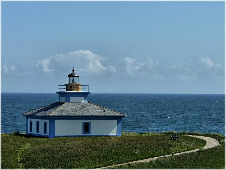
From Cedeira go up to Santo André de Teixido and leave a stone on a milladoiro. Drive over the Serra da Capelada to the Garita da Herbeira and Vixía Herbeira, then down to Cabo Ortegal and its red and white lighthouse above Os Aguillóns. After a lunch of skate stew or scrambled eggs with sea urchins and seaweed in Cariño, continue to Estaca de Bares, walk past the old semaphore along the line of mills, and end the day in the port of Bares.
Day 7
Viveiro to Ribadeo
Walk through the old quarter of Viveiro and the Porta de Carlos V, then follow the coast east past Foz to Rinlo for lobster rice. Time the afternoon for low tide at Praia das Catedrais: at high tide you can see the beach from the top of the cliff, at low tide you go down the steps to the sand. Finish in Ribadeo at the Santa Cruz viewpoint, almost 200 metres above the sea, looking over the flysch and the two lighthouses of Illa Pancha.
Getting there and around
By air
Galicia has three international airports, at Santiago (Lavacolla), A Coruña (Alvedro) and Vigo (Peinador) (Turismo de Galicia). A Coruña Airport (LCG) is in Culleredo, about 7 km from the city centre (Wikipedia). Santiago (SCQ) is 12 km east of the city, and the AP-9 links it with A Coruña (66 km) and Ferrol (88 km) (Wikipedia).
By train and bus
Renfe links Galicia with other Spanish cities and runs services between the Galician cities (Turismo de Galicia). From Santiago station, 12 km from the airport and linked to it by city bus every 30 minutes, trains run to A Coruña and Ferrol (Wikipedia). We found no bus information for the capes, so we plan these routes by car.
By car
The A-8 connects Galicia with the north of Spain, the A-6 and A-52 with Madrid, and the AP-9 runs along most of the Galician coast to Portugal (Turismo de Galicia). For Cathedrals Beach, leave the N-634 between San Miguel de Reinante and Rinlo (Turismo de Galicia).
Practical and safety
- Emergencies: 112 is free and works throughout Spain; the emergency services can trace the location of the call, and there is a translation service in several languages (Spain.info).
- Cathedrals Beach: from 1 July to 30 September and in Holy Week you need an authorisation, which is free and requested online (Turismo de Galicia). You can walk on the sand only at low tide; take care in the caves, and check the tide times with MeteoGalicia (Turismo de Galicia).
- Open Atlantic beaches: the Costa da Morte has strong currents and sudden storms (Turismo de Galicia), and O Rostro and Mar de Fóra are not summer swimming beaches because they are dangerous (Turismo de Galicia). Swim on sheltered beaches inside the estuaries.
- Cliffs and wind: the climb to A Moa on Monte Pindo takes about two hours and needs care on the way down (Turismo de Galicia); on the Lugo coast, go equipped for the strong north-east wind (Turismo de Galicia).
- Fragas do Eume: vehicles are restricted at weekends, with public transport to the A Figueira bridge; the park has four entrances with no link between them, and the monastery’s hours change with the season (Turismo de Galicia).
FAQ
Where is the Costa da Morte?
On the Atlantic coast of the province of A Coruña in Galicia, from Carnota and Fisterra north to Malpica. Turismo de Galicia counts 17 municipalities in it, including Fisterra, Muxía, Camariñas, Laxe and Malpica.
Why is it called the Coast of Death?
Turismo de Galicia says it takes its name from the many shipwrecks on a coast of cliffs, strong currents and sudden storms; more than 150 wrecks have been recorded on the stretch around Cabo Vilán alone.
Do I need to book Cathedrals Beach?
From 1 July to 30 September and in Holy Week, yes: you need a free authorisation, requested online. The sand and the arches can only be reached at low tide.
Is Cape Finisterre the westernmost point of Europe?
Not strictly. It is traditionally regarded as the end of the continent, but Cabo da Nave, also in Fisterra, is further west, Cabo Touriñán in Muxía comes very close, and Cabo da Roca in Portugal is further west still.
Which airport is best for this coast?
A Coruña (LCG), about 7 km from the city, for A Coruña, Ferrol and the north; Santiago (SCQ), 12 km from Santiago, also works for the Costa da Morte.
Where is the northernmost point of mainland Spain?
Estaca de Bares in Mañón, which Turismo de Galicia calls the northernmost point of the Iberian Peninsula and the divide between the Atlantic and the Bay of Biscay.
Neighbouring costas

Rías Baixas
South of Carnota: the estuaries of Muros e Noia, Arousa, Pontevedra and Vigo, with the Cíes and Ons islands, down to A Guarda on the Miño.
Rías Baixas guide →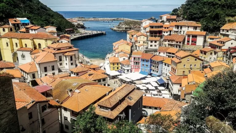
Costa Verde
Across the Eo estuary from Ribadeo: the coast of Asturias, with fishing villages such as Cudillero and the Picos de Europa behind it.
Costa Verde guide →Sources and freshness
Checked 6 November 2026. Turismo de Galicia on the geodestinations of Costa da Morte, As Mariñas, Ferrolterra and A Mariña Lucense; the cities of A Coruña and Ferrol; Cabo Fisterra, Praia das Catedrais, the Tower of Hercules and the rías; the natural areas of the Fragas do Eume, Carnota and Monte Pindo and Estaca de Bares; the estuaries of Corcubión, Camariñas, Corme and Laxe, A Coruña, Ares and Betanzos, Cedeira, Ortigueira, O Barqueiro, Viveiro, Foz and Ribadeo; the routes Lighthouses and beaches at the end of the world, The cathedrals of the sea, Walking the north of the north, Atlantic sanctuaries, Serra da Capelada and Ferrol of the Enlightenment; the resource pages for Cabo Touriñán, Cabo Vilán lighthouse, Santo André de Teixido and the Ézaro viewpoint; the beach pages for Carnota, Mar de Fóra, Area de Trece, Doniños, Pantín, Balarés, Bares and Covas; and how to get to Galicia. Spain.info on A Coruña, Ferrol, Ribadeo, Viveiro, Muxía, the Costa da Morte and safety and the 112 number. Airports: Wikipedia on A Coruña Airport and Santiago–Rosalía de Castro Airport. Climate: AEMET normals 1991–2020 for the A Coruña observatory, as given in the Spanish Wikipedia article on A Coruña. Turismo de Galicia gives conflicting heights for the Serra da Capelada (600 m on one page, 620 m at Vixía Herbeira on another); we use 620 m. We found no official source for sea temperatures on this coast, so the guide gives none.
Photo credits · 38 photos from Wikimedia Commons Show
Photos from Wikimedia Commons, not altered except for cropping: Muxía by JensKunstfreund (CC BY-SA 4.0); Praia de Carnota by amaianos from Galicia (CC BY 2.0); Tower of Hercules by Diego Delso (CC BY-SA 4.0); Praia das Catedrais by Luis Miguel Bugallo Sánchez (Lmbuga) (CC BY-SA 3.0); Praia das Catedrais by Luis Miguel Bugallo Sánchez (Lmbuga) (CC BY-SA 3.0); Cape Fisterra by Basotxerri (CC BY-SA 4.0); Muxía by JensKunstfreund (CC BY-SA 4.0); A Coruña by C messier (CC BY-SA 4.0); Serra da Capelada by amaianos from Galicia (CC BY 2.0); Percebes, Augas Santas by Xemenendura (CC BY-SA 4.0); Praia de Carnota by Noel Feans (CC BY 2.0); Mar de Fóra by amaianos (CC BY 2.0); Praia do Trece by Alfonso Márquez (CC BY-SA 4.0); Orzán and Riazor by Luis Carrera (CC BY 2.0); Praia de Doniños by Carlossoy (CC0); Praia de Pantín by Luis Miguel Bugallo Sánchez (Lmbuga) (CC BY-SA 4.0); Praia de Morouzos by Iago Casabiell González (CC BY-SA 4.0); Praia das Catedrais by Luis Miguel Bugallo Sánchez (Lmbuga) (CC BY-SA 3.0); Porto de Fisterra by Luis Miguel Bugallo Sánchez (CC BY-SA 3.0); Muxía by Xosema (CC BY-SA 4.0); Tower of Hercules park by Luis Miguel Bugallo Sánchez (Lmbuga) (CC BY-SA 3.0); Ferrol by Zarateman (CC0); Viveiro by Certo Xornal (CC BY-SA 2.0); Ribadeo by HombreDHojalata (CC BY-SA 3.0); Cape Fisterra lighthouse by Basotxerri (CC BY-SA 4.0); San Andrés de Teixido by Juan José Hernández Rodríguez (CC BY 2.0); Ferrol Arsenal by Oilisab (CC BY-SA 4.0); Serra da Capelada by Sustiputo (CC BY-SA 4.0); Percebes de Galicia by Jose Luis Cernadas Iglesias (CC BY 2.0); Fisterra lighthouse by Luis Miguel Bugallo Sánchez (CC BY-SA 3.0); Cabo Vilán by Luis Miguel Bugallo Sánchez (Lmbuga) (CC BY-SA 3.0); Ézaro by Basotxerri (CC BY-SA 4.0); Praza de María Pita by Diego Delso (CC BY-SA 4.0); Ferrol Arsenal by Zarateman (CC0); Vixía Herbeira by carrodeguas (CC BY-SA 3.0); Illa Pancha, Ribadeo by Jose Luis Cernadas Iglesias (CC BY 2.0); Cíes Islands by Mario Sánchez (CC BY-SA 2.0); Cudillero by Vilanchelo (CC BY-SA 4.0).
Every place we have mapped on the Galician coast
15 towns, beaches, coves and landmarks, kept up to date automatically.
- A Coruña (city guide)
- Cabo Vilán Lighthouse (Camariñas)
- Camping A Camposa
- Camping As Nevedas
- Cape Finisterre (Cabo Fisterra lighthouse)
- Carnota Beach (Praia de Carnota)
- Cathedrals Beach (Praia das Catedrais, Ribadeo)
- Ézaro Waterfall (Fervenza do Ézaro, Dumbría)
- Garita de Herbeira and Cabo Ortegal (Serra da Capelada)
- Muxía (Santuario da Virxe da Barca)
- Ribadeo (Lugo, Galicia)
- Rinlo Costa Camping
- San Andrés de Teixido (Cedeira)
- Tower of Hercules (A Coruña)
- Viveiro (Lugo, Galicia)