
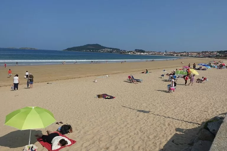
Praia América is a long, urban sandy beach in Nigrán, on the bay of Baiona at the southern mouth of the Ría de Vigo, about 14 km south-west of central Vigo and 3 km across the bay from Baiona. Spain’s official tourism site gives it 1,500 m of white sand and a full set of services, and it runs on into Panxón beach at its southern end. You reach it by car on the Vigo–Baiona road or on foot along the seafront, with free car parks behind the dunes. It suits families, walkers and water-sports fans; skip it on a hot August weekend if you dislike crowds.
Quick facts
- Names: Praia América in Galician, Playa América in Castilian. OpenStreetMap notes the older names Praia de Lourido and Praia de Area Loura; the name América came with the Hotel América and the first housing estate here in the 1930s.
- Where: Nigrán (Pontevedra), on the bay of Baiona, between the Vigo–Baiona road and the sea.
- Coordinates: 42.1349, -8.8178.
- Size: 1,500 m long and 100 m wide, white sand (spain.info). Galician Wikipedia gives 1,300 m; the figure depends on where Panxón is counted from.
- Conditions: moderate waves, windy (spain.info).
- Occupancy: high; an urban beach (spain.info).
- Entry: free.
Access and parking
By car: the nearest main road is the Vigo–Baiona road, and the beach is easy to reach on foot or by car (spain.info). OpenStreetMap shows a free surface car park at the northern end, about 400 m from the middle of the beach, an unpaved car park by the central toilets, and street parking along Paseo Lourido and Avenida Praia América at the southern end (OpenStreetMap).
By boat: the nearest marina is at Panxón, about 2 km away (spain.info).
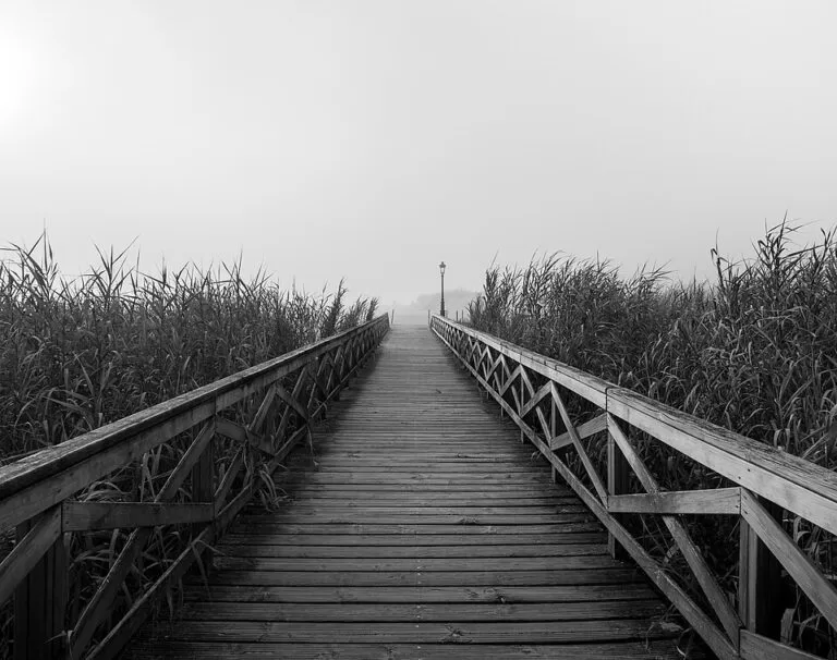
On foot: a coastal path, the Sendero Litoral del Ecosistema Dunar de Playa América–Panxón, runs along the back of both beaches. The Rías Baixas tourist board lists it as a Blue Trail, linking Blue Flag beaches (Turismo Rías Baixas).
What to expect
Spain.info calls it one of the most popular beaches in Galicia. It looks across the bay to Baiona and the Estelas islands. When the tide rises, small channels form in the sand, and small wooden walkways cross them. You can rent boats for water-skiing and jet skis, and practise other water sports; there is a surf area.
Behind the sand is a dune system that has been restored. The coastal trail was built as part of that work, to let the dunes and leisure use live side by side (Turismo Rías Baixas). Along the path, OpenStreetMap maps a series of information boards on the history of the beach, how dunes form, dune plants, birds and the regeneration project. Keep to the boardwalks and paths to protect the dunes.
Practical details
- Services listed by spain.info: sun lounger and water-craft rental, toilets, showers, yacht club, tourist office, litter bins, cleaning, sports area, children’s play area and a surf area.
- Toilets and showers: OpenStreetMap shows free toilets, tagged wheelchair accessible, in the middle of the beach, more toilets at the southern end and outdoor showers.
- Food: cafés and restaurants line the southern end of the seafront (OpenStreetMap).
- Blue Flag: the tourist board describes the beaches on the trail as Blue Flag beaches; we could not confirm the 2026 award.
Accessibility and safety
The central toilets are tagged as wheelchair accessible, but we could not confirm a ramp or beach walkway onto the sand. Spain.info rates swimming conditions as moderate waves and windy, and the Atlantic water is cold. We could not confirm lifeguard dates or hours. At high tide the channels across the sand fill; use the wooden walkways.
Best time to visit
Summer is the beach season, but spain.info rates occupancy as high, so arrive early in July and August. Spring and autumn are better for the dune walk to Panxón. There is a surf area, and windy days suit surfers more than swimmers.
Nearby alternatives
- Baiona, 3 km south-west across the bay: the Monterreal fortress, the La Pinta replica and boats to the Cíes.
- Cíes Islands, 12 km north-west: national park islands with Praia de Rodas, by boat with a free Xunta permit in high season.
- Vigo Old Town and Monte do Castro, 14 km north-east: the city’s old quarter and its hill-top fort.
Distances are in a straight line from the middle of the beach.
FAQ
Is there parking at Praia América?
Yes. OpenStreetMap shows a free car park at the northern end, another by the central toilets and street parking at the southern end.
How long is Praia América?
Spain.info gives 1,500 m long and 100 m wide; it continues into Panxón beach to the south.
Can you swim at Praia América?
Yes, but expect moderate waves, wind and cold Atlantic water. We could not confirm lifeguard hours.
How do I get to Praia América from Vigo?
Drive south-west towards Baiona on the Vigo–Baiona road; the beach is about 14 km from central Vigo in a straight line.
Can you walk from Praia América to Panxón?
Yes, along the coastal dune trail that runs behind both beaches.
Sources and freshness
Checked 6 November 2026 · 4 sources Show
Checked 6 November 2026. Official: spain.info, America beach (Nigrán) (size, sand, conditions, services, access); Turismo Rías Baixas, Playa América–Panxón dune trail. Background: Galician Wikipedia (length). Car parks, toilets, showers, information boards, name history and distances: OpenStreetMap contributors (ODbL). The Nigrán town hall site could not be reached. Photos: Wikimedia Commons, licences as credited.
How this page is made. CostaMap is written with an AI editorial system run by Ebizapple. This page is based on the sources listed above. Last updated 6 November 2026. Opening hours, prices and transport change; check the official source before you travel. How we work · Partner links and ads