
Besòs River Park (Parc Fluvial del Besòs)
Natural parkThe Besòs River Park (Parc Fluvial del Besòs) is a 115-hectare park in the bed of the river Besòs on the north-eastern edge of Barcelona, with about 5 km of flat asphalt paths for walking and cycling between Santa Coloma de Gramenet and the sea at Sant Adrià de Besòs. You can join it from Sant Adrià station on the R1 at the southern end, from the Sant Andreu district of Barcelona, or from Can Zam in Santa Coloma at the northern end. It suits cyclists, runners, families and birdwatchers who want a long car-free route close to the city; skip it if you want shade and scenery, because this is an open, engineered riverbed between motorways and housing blocks.
Quick facts
- Names: Parc Fluvial del Besòs in Catalan, Parque Fluvial del Besòs in Spanish; Barcelona City Council calls it the Besòs River Park.
- Where: the last 9 km of the river Besòs, from where the Ripoll joins it at Montcada i Reixac to the mouth at Sant Adrià de Besòs (Catalan Wikipedia). The park is shared by Barcelona, Santa Coloma de Gramenet, Sant Adrià de Besòs and Montcada i Reixac (Barcelona City Council).
- Coordinates: 41.4401, 2.2096 (the park in the riverbed between Santa Coloma and Sant Andreu, OpenStreetMap).
- Size: 115 ha in total, of which the public area runs for about 5 km and includes 22 ha of lawn (Barcelona City Council, Catalan Wikipedia).
- Opened: 2004, after a clean-up and environmental project begun in 1995 with largely European funding (Barcelona City Council).
- Managed by: the Diputació de Barcelona since 2000, as part of its network of protected parks (Catalan Wikipedia).
- Entry: we found no entry charge mentioned in the sources.
Access and parking
Southern end, Sant Adrià: the public paths finish at the railway bridge in Sant Adrià de Besòs (Catalan Wikipedia). Sant Adrià de Besòs station on the Rodalies R1 and the Estació de Sant Adrià tram stop are next to the coast, about 2.5 km in a straight line from the middle of the park (OpenStreetMap).
Middle, Sant Andreu (Barcelona): Barcelona City Council lists three entrances on the Barcelona bank, one in Baró de Viver and two in Bon Pastor, and gives Plaça del Turó de la Trinitat, 1 as the park’s address.
Northern end, Santa Coloma: on the left bank the public area starts at Can Zam Nord, and on the right bank at the B-20 bridge (Catalan Wikipedia). Can Zam station is about 2 km north-west of the middle of the park (OpenStreetMap).
From Barcelona’s seafront: in January 2025 the Sant Martí district opened four signposted routes of about 2 km each, on foot or by bike, from Rambla de Prim to the park, one of them along the coast past the Parc del Fòrum to the river mouth (Barcelona City Council).
Parking: we found no official park car parks in the sources. Arriving by train, metro, tram or bike is easier.
What to expect
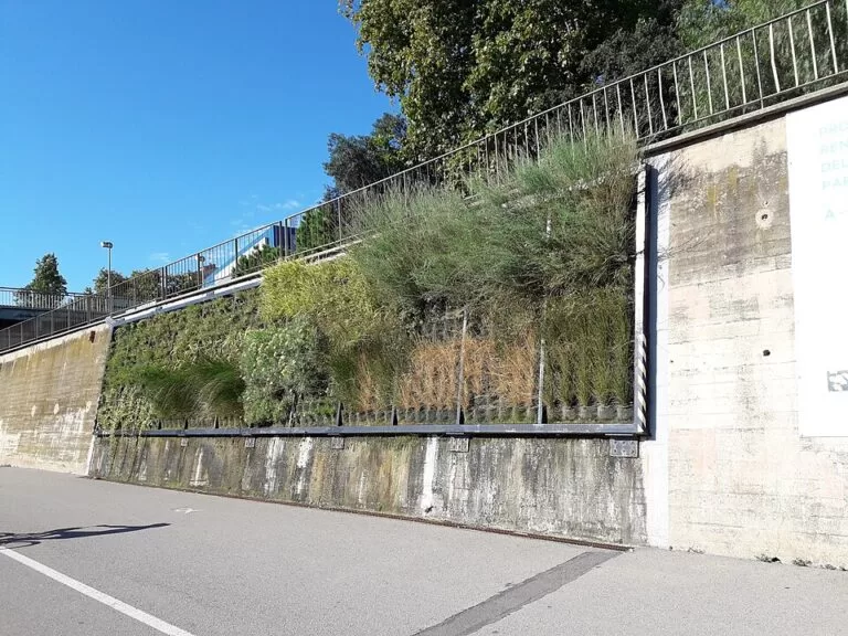
The river runs in a wide, walled channel. Inside it, the public area has lawns, asphalt paths and a bike track; on the left bank the path is wide enough for a signposted cycle lane (Barcelona City Council, Catalan Wikipedia). Eleven inflatable dams hold the water level up in the river channel. The park has three parts: the restricted wetlands upstream, the public area in the middle, and the river mouth (Barcelona City Council).
Wetlands: the northern 3.8 km, from Montcada i Reixac to Santa Coloma, are closed to the public. They hold 60 plots, 8 ha in all, of constructed reed wetlands that give tertiary treatment to about 30% of the outflow of the Montcada sewage plant (Catalan Wikipedia). At Montcada i Reixac a circular route linked to the Casa de les Aigües lets you see this area, and in Santa Coloma a bike lane outside the park follows the wetlands along the left bank.
River mouth: the last 450 m before the sea are also closed, to protect their environmental role (Catalan Wikipedia). In Sant Adrià a route takes in viewpoints at the Parc del Litoral, the Parc de la Pau and the Maristany bridge.
Wildlife: more than 200 bird species have been recorded, and viewing points at the north and south of the park help you see them (Barcelona City Council). Catalan Wikipedia also lists eels, tree frogs, natterjack toads and the Mediterranean pond turtle, and otters in the upper river.
Practical details
- Distances: Can Zam to Sant Adrià station is about 4.6 km in a straight line (OpenStreetMap); there and back along the paths makes a 10 km ride or a long walk.
- Bikes: Catalunya.com calls the park a very common place for cycling in the Barcelonès. Bring your own or hire one in Barcelona.
- Facilities: we could not confirm toilets, drinking fountains or kiosks inside the riverbed. Carry water in summer.
- Guided activities: Barcelona’s 2026 architecture-capital programme ran a guided bike tour of about 9.5 km from the Casa de les Aigües in Montcada i Reixac to the Mirador Parc Besòs, led by Guiding Architects Barcelona; it has finished, so check the Barcelona and Diputació agendas for new dates (Barcelona City Council).
Accessibility and safety
The paths are flat and asphalted, which suits wheelchairs, pushchairs and children on bikes, but ramps into the channel vary between entrances and we could not confirm step-free access at each one. The most important safety point is flooding: the park sits inside the riverbed, and safe use depends on the Besòs hydrological alert system (SAHBE), which watches weather and river data and warns managers and users of possible floods. Staff on bicycles clear the park when the river rises (Catalan Wikipedia). Leave immediately when told, never enter on days of heavy rain, and remember that the wetlands and the river mouth are off limits.
Best time to visit
Spring and autumn are the most pleasant seasons for long walks and rides. In summer go early or late, as the open riverbed gets hot. Avoid the park during and just after heavy rain, when it may be closed. Sant Adrià’s Festa Major in September brings activities to the banks of the Besòs (Catalunya.com).
Nearby alternatives
- Tres Xemeneies (Sant Adrià) – the 200 m chimneys of the old power station beside the river mouth, about 2.6 km south-east.
- Badalona – Roman Baetulo, the old town and the beaches, about 3.4 km east.
- Bunkers del Carmel (Barcelona) – a hilltop viewpoint over the city, about 4.6 km south-west.
- Sagrada Família – Gaudí’s basilica, about 5 km south-west.
- Port Olímpic (Barcelona) – the city’s Olympic marina, about 6.1 km south.
FAQ
Can you cycle in the Besòs River Park?
Yes. The public area has about 5 km of asphalt paths for walking and cycling, with a signposted bike lane on the left bank (Barcelona City Council, Catalan Wikipedia).
How do I get to the Besòs River Park?
Take the Rodalies R1 or the tram to Sant Adrià for the southern end, use the Sant Andreu entrances at Baró de Viver and Bon Pastor, or start at Can Zam in Santa Coloma for the northern end.
Is the Besòs River Park safe when it rains?
No. The park lies in the riverbed and is cleared when the river rises; an alert system and staff on bikes manage evacuation. Stay out on days of heavy rain.
Can you see birds in the Besòs River Park?
Yes. More than 200 bird species have been recorded, with viewing points at the north and south of the park (Barcelona City Council).
Can you walk to the sea along the Besòs?
The public paths end at the railway bridge in Sant Adrià; the last 450 m of the river mouth are closed, but viewpoints at the Parc del Litoral and Parc de la Pau overlook it.
Sources and freshness
Checked 9 November 2026 · 7 sources Show
Checked 9 November 2026. Barcelona City Council on the Besòs River Park (size, municipalities, areas, birds, history, entrances) and the four new routes from Sant Martí (20 January 2025) and the 2026 guided cycling tour. Catalunya.com on Sant Adrià de Besòs and the Barcelonès. Background: Catalan Wikipedia, Parc Fluvial del Besòs (management, public area, wetlands, mouth, flood alert, fauna, routes). Location and distances: OpenStreetMap contributors. The Diputació de Barcelona parks website and the AMB site could not be reached while checking. Not confirmed: opening hours, toilets and fountains, car parks, step-free access at each entrance.
This place is part of our Costa de Barcelona travel guide: the city beaches, Maresme and Garraf — see every town, beach and cove we have mapped on that coast.
How this page is made. CostaMap is written with an AI editorial system run by Ebizapple. This page is based on the sources listed above. Last updated 9 November 2026. Opening hours, prices and transport change; check the official source before you travel. How we work · Partner links and ads