
Flecha del Rompido (El Rompido, Huelva)
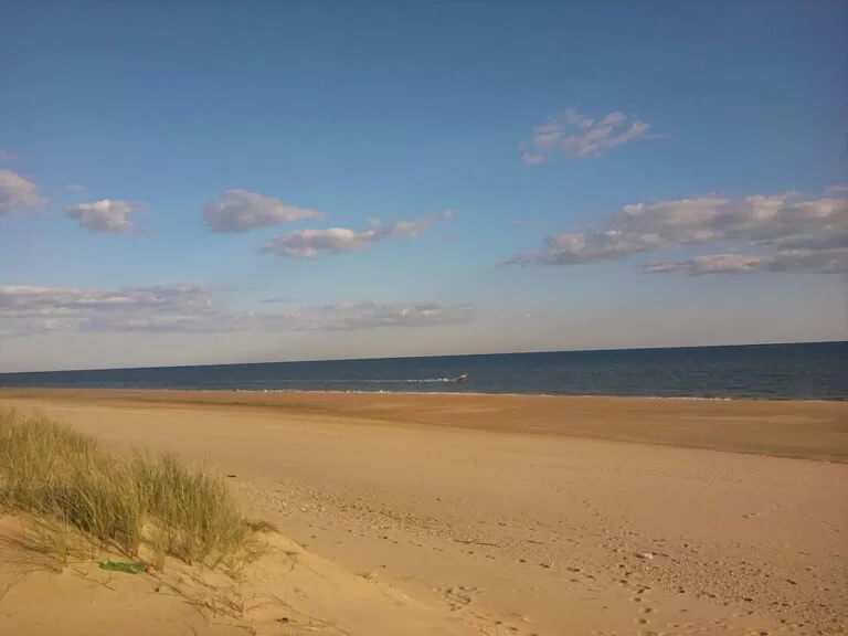
BeachThe Flecha del Rompido is a sand spit of more than 12 km at the mouth of the Río Piedras, opposite the fishing village of El Rompido (Cartaya) on the Huelva coast, with an undeveloped Atlantic beach on its ocean side. There is no road onto it: you cross the river on the small passenger ferry from El Rompido, a trip of about 15 minutes, or on boats from El Portil at the eastern end. The spit is part of a protected natural area with marshes, dunes and birds. It suits walkers, birdwatchers and anyone after a long empty beach; skip it if you need a car at the beach or full facilities.
Quick facts
- Names: Flecha del Rompido or La Flecha in Spanish; on the Lepe side the beach is called Playa de Nueva Umbría. The protected area is the Paraje Natural Marismas del Río Piedras y Flecha del Rompido.
- Where: mouth of the Río Piedras, between the municipalities of Cartaya and Lepe (Huelva), opposite El Rompido.
- Coordinates: 37.2075, -7.1509 (the ocean beach on the spit, south-west of El Rompido).
- Length: more than 12 km, unique for its size on the Andalusian coast; over the last century it grew by more than 30 m a year on average (Andalusia tourism).
- Protected since: 27 July 1989, as a paraje natural.
- Access: by boat only; passenger ferry from El Rompido (about 15 minutes) and boats from El Portil.
- Facilities on the spit: none confirmed; take everything you need.
Access and parking
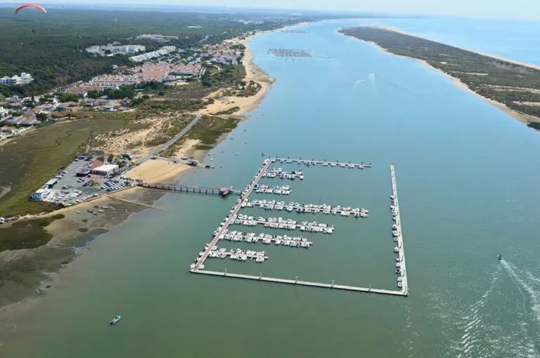
Getting to El Rompido: El Rompido is part of the municipality of Cartaya, about 8 km from the main town, on the left bank of the Río Piedras (Wikipedia, Spanish). OpenStreetMap shows a car park at the fishing port, the Puerto de El Rompido, close to the ferry piers.
The ferry: the Andalusia tourist board says the Flecha is reached by the boat services that leave from the river beaches. OpenStreetMap maps a foot-passenger ferry, the Transbordador El Rompido – Nueva Umbría, from the piers in front of El Rompido across the river to a landing on the spit, about 1.7 km and 15 minutes. Flechamar, a family company based at the El Rompido fishing port since 2005, runs ferries and boat trips (Andalusia tourism). Further east, at El Portil, OpenStreetMap marks two more ferry points to the beach. We could not confirm 2026 timetables or fares; ask at the port or at the El Rompido tourist office before you cross, and check the time of the last boat back.
Without a boat: there is no road or bridge onto the spit from El Rompido.
What to expect
The spit is two worlds back to back. On the river side lie the calm channel and the marshes of the Río Piedras; on the ocean side is open Atlantic beach. In between runs a ridge of dunes. Andalusia tourism describes white sand, untouched beaches, salt marsh, estuaries and dune systems, and calls the beach one of the best preserved in Europe. Its blog speaks of about 12 km of virgin beach for walking.
According to Wikipedia, the spit began to form after the Lisbon earthquake of 1755, built up from sediment carried by the river, the tides and the south-westerly winds. On the spit stand the ruins of the Real de la Almadraba de Nueva Umbría, a tuna-fishing settlement that was lived in until the tuna fishing ended (Wikipedia; OpenStreetMap).
Wildlife: the area is important for wintering and passage spoonbills and for many waders. Andalusia tourism lists white storks, Montagu’s and marsh harriers, cattle egrets, oystercatchers, red-crested pochards in winter, cormorants and gulls, and the common chameleon in the dune vegetation. A footpath leads into the spit through the dune belt.
Practical details
- Bring: water, food, shade and sun protection. We found no official information on bars, toilets or bins on the spit, so plan as if there are none and take your rubbish back with you.
- Activities: kayak routes through the marshes and paddleboard hire are offered from El Rompido, and there are guided horse rides and quad tours in the natural area (Andalusia tourism blog). El Rompido itself has water sports, river trips, sport fishing, diving and windsurfing.
- In El Rompido: El Rompido’s own town beach is about 600 m long (Andalusia tourism). The village grew up as a fishing settlement at the mouth of the river and has two lighthouses; OpenStreetMap shows the old one, 13 m high, disused since 1976, and the current Faro de El Rompido, 29 m high, from 1976.
- Naturism: according to Wikipedia, the town of Lepe declared a 5 km naturist zone on the Nueva Umbría beach in 2013.
Accessibility and safety
Getting onto the spit means boarding a small boat and then walking on soft sand and over dunes, so it is not suitable for wheelchairs. We found no information on lifeguards on the spit; treat the ocean beach as unsupervised and take care near the river mouth. Keep an eye on the time so you do not miss the last boat back.
Best time to visit
For a beach day, late spring to early autumn is the obvious window; we could not confirm whether the ferries run all year, so check before you go outside summer. For birds, the marshes are at their best with the wintering and migrating species in autumn, winter and spring.
Nearby alternatives
- Lepe, 7 km away: the town on the western side of the natural area.
- Cartaya, 8 km away: the municipality that El Rompido belongs to.
- Isla Cristina, 15 km away: a coastal town to the west.
- Punta Umbría, 17 km away: a beach town to the east.
- Huelva, 19 km away: the provincial capital.
Distances are in a straight line from the beach on the spit.
FAQ
How do you get to the Flecha del Rompido?
By boat. A small passenger ferry crosses the Río Piedras from El Rompido to the spit in about 15 minutes, and boats also leave from El Portil. There is no road onto the spit.
Is there parking for the Flecha del Rompido ferry?
Yes, OpenStreetMap shows a car park at the El Rompido fishing port, close to the ferry piers. We could not confirm whether it is free.
Can you swim at the Flecha del Rompido?
Yes. The river side is calm water; the ocean side is open Atlantic. We found no information on lifeguards, so swim with care.
Are there bars or toilets on the spit?
We found none in official sources. Bring water, food and shade, and take your rubbish back with you.
Is the Flecha del Rompido the same as Nueva Umbría?
Yes, it is the same spit. The beach on the Lepe side is called Playa de Nueva Umbría, and the protected area takes in both names.
Sources and freshness
Checked 6 November 2026 · 8 sources Show
Checked 6 November 2026. Official: Andalusia tourism on the Marismas del Río Piedras y Flecha del Rompido (length, growth, protection date, wildlife, trail), El Rompido beach (boat access), El Rompido village, Flechamar and the Andalusia tourism blog (activities). Background: Wikipedia on the spit and Nueva Umbría and El Rompido. Ferry route and time, piers, car park, lighthouses and distances: OpenStreetMap. The Cartaya town hall and ferry operator websites could not be opened from our research setup, so timetables and fares are not confirmed.
This place is part of our Costa de la Luz, Spain: beaches, towns, sherry and map — see every town, beach and cove we have mapped on that coast.
How this page is made. CostaMap is written with an AI editorial system run by Ebizapple. This page is based on the sources listed above. Last updated 6 November 2026. Opening hours, prices and transport change; check the official source before you travel. How we work · Partner links and ads