
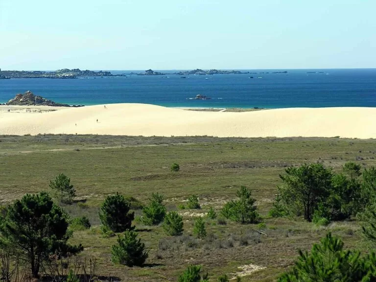
Corrubedo Dunes Natural Park is a protected stretch of open Atlantic coast in Ribeira (A Coruña), at the tip of the Barbanza peninsula between the Ría de Arousa and the Ría de Muros e Noia. Its main sight is the largest shifting dune in Galicia, more than a kilometre long and up to about 20 metres high, which you see from boardwalks and paths rather than climb. You reach it by car on the AC-550 coast road: there is a car park for the dune at Olveira and another at the visitor centre in O Vilar, about 5 km west of Ribeira town. It suits walkers, birdwatchers and beach lovers; skip it if you want to run up a sand dune, as the dune itself is off limits.
Quick facts
- Names: Parque Natural do Complexo Dunar de Corrubedo e Lagoas de Carregal e Vixán (Galician); Parque Natural de las Dunas de Corrubedo (Spanish); in English, Corrubedo Dunes Natural Park.
- Where: municipality of Ribeira, A Coruña province, on the open coast of the Barbanza peninsula.
- Coordinates: 42.5782, -9.0485 (the dune, OpenStreetMap).
- Size: 996.25 hectares; the wider protected Natura 2000 site covers 9,265 hectares and includes the island of Sálvora (Turismo de Galicia).
- The dune: more than 1 km long on its curved front, about 200–250 m wide and up to 20 m high in the hardest winter months.
- The lagoons: Carregal, salt water and open to the sea; Vixán, fresh water.
- Visitors: nearly 300,000 a year, which Turismo de Galicia says makes it the most visited natural park in Galicia.
- Entry: no ticket is mentioned by the official page; the park is crossed by public paths.
Access and parking
By car: from the south, take the Barbanza dual carriageway from Padrón; along the coast, the AC-550 road between Noia and Santa Uxía de Ribeira has turn-offs towards the park. Turismo de Galicia lists two direct entrances with parking: one for the shifting dune at Olveira and one for the visitor reception centre at O Vilar.
Parking: the official page lists car parks at Olveira, O Vilar, Praia da Ladeira and Vixán. On OpenStreetMap the Olveira car park, about 800 m north-east of the dune, is tagged as free. The O Vilar car park is beside the Casa da Costa.
Distances (straight line): Ribeira town 5 km, A Pobra do Caramiñal 9.5 km, Santiago de Compostela 53 km.
Without a car: we could not confirm a bus service to either entrance.
What to expect
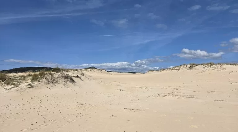
The dune is the reason most people come. Turismo de Galicia describes it as long and low on the sea side, “like the back of an animal”, and steep on the land side, where nothing holds the sand and it moves inland by two to three centimetres a year. Old records claim it was more than 60 metres high at the end of the 19th century, which the tourist board itself places between legend and exaggeration.
A network of paths and footbridges keeps visitors off the dunes while showing as much of the park as possible. Three self-guided routes, the water route, the sea route and the wind route, start from the Casa da Costa. OpenStreetMap marks the dune itself as no access, and several signs along the paths mark restricted crossings: keep to the marked routes.
- Casa da Costa: the visitor reception centre at O Vilar (tel. +34 881 867 645, per Turismo de Galicia).
- CIELGA: the Galician Coastal Ecosystems Interpretation Centre, a small museum on the nature, geology and history of the park. OpenStreetMap tags it as free.
- Lagoa de Carregal: the salt-water lagoon, linked to the ocean by a channel through which the tide flows in and out, with mudflats around it.
- Lagoa de Vixán: the fresh-water lagoon, fed by the small Muíño stream, so its level changes with the seasons.
- Beaches: Corrubedo beach runs along the park, split by the Carregal channel; Praia do Vilar and Praia da Ladeira are mapped on OpenStreetMap.
- Viewpoint: the Castrocidá lookout gives views over the whole stretch of coast.
Wildlife
The lagoons and mudflats are wetlands of international importance. Turismo de Galicia counts around 3,000 waterfowl in the park, including teals, curlews, shovelers, sandpipers and plovers, and mentions otters. It singles out the Kentish plover and the western yellow wagtail. The dunes carry specialist plants, and the mudflats reeds and rushes. There are bird-watching hides and information panels, so bring binoculars.
Practical details
- Food: the official page lists a cafeteria-restaurant and a recreation area at O Vilar. We could not confirm its season or hours.
- Opening hours: we could not confirm hours for the Casa da Costa or CIELGA. Call ahead if the centres matter to your visit.
- Time needed: allow half a day to walk one of the routes and see both lagoons.
- Toilets: not confirmed outside the centres.
Accessibility and safety
Keep to the paths and footbridges and do not walk on the dunes or into the fenced areas: this is a protected space, and trampling damages the dune plants that hold the sand. The beaches face the open Atlantic; we found no official information on lifeguards here, so swim only in calm conditions and stay out of the Carregal channel, where the tide runs in and out. We could not confirm step-free routes; parts of the paths are sand.
Best time to visit
Spring and autumn are good for birds and quieter paths. Summer brings the beach crowds; come early for parking. In winter the dune is at its highest, according to Turismo de Galicia, but the coast is exposed to Atlantic storms and wind.
Nearby alternatives
- Castro de Baroña, 13 km away: an Iron Age hill fort on a rocky point, which Turismo de Galicia recommends with the park.
- O Grove and A Toxa, 17.6 km away across the mouth of the Ría de Arousa: a seafood town and spa island.
- A Lanzada Beach, 20.2 km away: another long Atlantic beach with dunes and a boardwalk.
- Cambados, 20.4 km away: the Albariño wine town on the Ría de Arousa.
- Carnota Beach, 28.3 km away: a 7 km Atlantic beach with dunes and marsh below Monte Pindo.
Closer still, the Dolmen de Axeitos, a Neolithic burial chamber, is about 3.6 km north-east of the dune, and As Furnas beach, where the film Mar adentro was shot, is on the AC-550 north towards Porto do Son.
FAQ
Can you walk on the Corrubedo dune?
No. The dune is protected and marked as no access; you see it from the paths and footbridges that start at Olveira and at the Casa da Costa in O Vilar.
Is there parking at Corrubedo Dunes Natural Park?
Yes. Turismo de Galicia lists car parks at Olveira (for the dune), O Vilar (for the visitor centre), Praia da Ladeira and Vixán. OpenStreetMap tags the Olveira car park as free.
How do I get to the Corrubedo dunes?
By car via the Barbanza dual carriageway from Padrón or the AC-550 coast road between Noia and Ribeira, then follow the turn-offs to Olveira or O Vilar. The park is about 5 km west of Ribeira town.
Is it free to visit?
The official page mentions no entrance fee, and OpenStreetMap tags the interpretation centre as free. We could not confirm the centres’ opening hours.
Can you swim at Corrubedo beach?
The beaches are open Atlantic and can have strong waves. We found no official lifeguard information, so check conditions on the day and avoid the lagoon channel.
Sources and freshness
Checked 9 November 2026 · 3 sources Show
- Checked 9 November 2026. Turismo de Galicia: Complexo dunar de Corrubedo e lagoas de Carregal e Vixán (dune, lagoons, size, access, parking, facilities, wildlife)
- Turismo de Galicia: Barbanza-Arousa
- Turismo de Galicia: Dolmen de Axeitos. Map data, car parks and distances: OpenStreetMap. Not confirmed: opening hours of the Casa da Costa and CIELGA, buses, lifeguards and step-free routes
How this page is made. CostaMap is written with an AI editorial system run by Ebizapple. This page is based on the sources listed above. Last updated 9 November 2026. Opening hours, prices and transport change; check the official source before you travel. How we work · Partner links and ads