
Playa de los Genoveses walk from San José (Cabo de Gata)
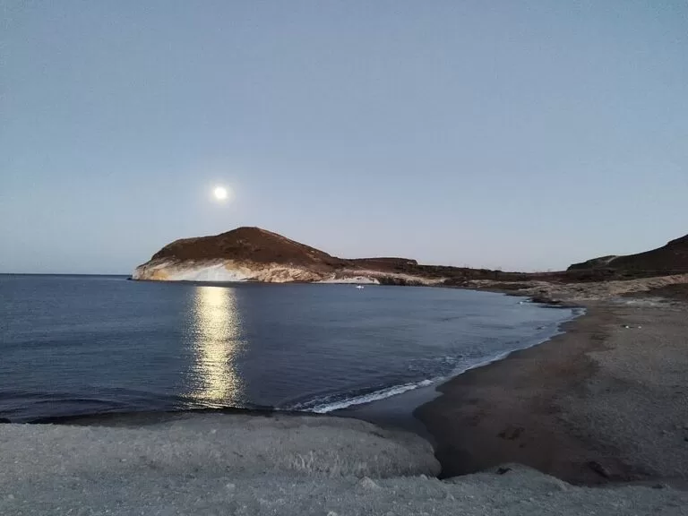
Hiking trailPlaya de los Genoveses, one of the best-known beaches in the Cabo de Gata-Níjar Natural Park, is a short walk from the village of San José, in Níjar: a coastal path leads from San José beach over a low headland to the sand. Measured on OpenStreetMap, it is about 2.1 km one way from the south end of San José beach to the north end of Los Genoveses, following the waymarked Senda Azul; the beach itself is 1,180 m long, with the Morrón de los Genoveses headland at the far end. The route mixes village lanes, a dirt track and a stony path through dry scrub, and the valley behind the beach has almost no buildings and no asphalt road. It suits most walkers, families with older children and anyone who prefers to leave the car behind. Skip it in the midday heat of summer: there is no shade on the way.
Quick facts
- Names: Playa de los Genoveses (Genoveses beach); the valley behind it is the Campillo del Genovés. The waymarked coastal route is the Senda Azul de Cabo de Gata.
- Where: San José, municipality of Níjar (Almería), inside the Cabo de Gata-Níjar Natural Park.
- Start coordinates: 36.7586, -2.1089, at the south end of San José beach.
- Distance: about 2.1 km one way to the north end of the beach, measured on OpenStreetMap; add 1.2 km to walk the length of the beach to the Morrón. spain.info gives 2 km from San José marina; Spanish Wikipedia gives about 3 km from the village centre.
- Height: the path skirts the Cerro del Ave María (133 m on OpenStreetMap) and passes the Molino del Collado de los Genoveses windmill; the Morrón de los Genoveses at the far end of the beach rises to 73 m.
- The beach: 1,180 m long and 50 m wide, golden sand, calm water, no development (spain.info).
- Official time and difficulty: we could not open the park’s own route sheet, so we give none.
- Entry: free.
Access and parking
Start in San José: leave the car in the village and walk to the south end of San José beach (36.7586, -2.1089). OpenStreetMap shows several car parks and street parking around the village centre and seafront, and a free public toilet about 600 m north of the start. There are bus stops in the village; we could not confirm a timetable.
The route: from the end of the beach, follow the lanes south past the small Playa de La Calilla, then a dirt track and a path across the shoulder of the Cerro del Ave María, passing near the old windmill, and down to the Cala del Ave María at the north end of Los Genoveses. On OpenStreetMap, roughly 0.9 km is on village streets, 0.4 km on track and 0.4 km on footpath.
By car: an unpaved road leads to the free Playa Genoveses car park, about 300 m behind the beach (OpenStreetMap). Access for cars to the natural-park beaches can be restricted in summer; we could not confirm the current rules, so check in San José before you drive.
What to expect
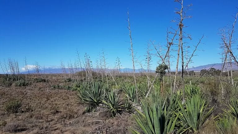
spain.info describes the approach as “a walk through wild desert plants and low dunes of sand and rock”. The walk is short and mostly gentle. Expect a stony, uneven surface on the path section and full sun.
The beach is a wide arc of fine sand in an undeveloped valley, with low dunes behind. OpenStreetMap marks a fossil dune near the southern end. At the far end, the Morrón de los Genoveses has cliffs worth seeing (spain.info). Some areas of the beach are used by naturists. The bay has history: the name is said to come from a Genoese fleet that landed here in 1147 to help Alfonso VII against Almería, and the dunes have been used for many film shoots (Spanish Wikipedia).
Practical details
- Bring water, sun hat and sun cream. spain.info lists only litter bins and cleaning at the beach, so there are no bars or toilets on the sand.
- Wear shoes with some grip for the stony path; sandals are fine on the lanes and beach.
- The beach is popular: spain.info rates its occupancy as high.
- The bay is a scuba-diving area (spain.info), and anchoring is allowed (Spanish Wikipedia), so watch for boats when you snorkel.
- Take all rubbish home; this is a protected natural park.
- For a longer walk, the waymarked Senda Azul continues beyond the Morrón (OpenStreetMap).
Accessibility and safety
The footpath section is stony and not suitable for wheelchairs or most pushchairs. The beach can be reached by car on an unpaved road, with the car park about 300 m from the sand. There is no shade on the route or the beach and no lifeguard service is listed by spain.info. In summer, walk early or late in the day and carry plenty of water.
Best time to visit
Spring and autumn are the most comfortable seasons for the walk. In summer, go early in the morning: you avoid the heat and the busiest hours. The water is described as calm (spain.info), but check the wind before swimming.
Nearby alternatives
- San José, at the start: our guide to the village, its beach and marina.
- Cabo de Gata-Níjar Natural Park: our overview of the park that protects this coast.
- Cabo de Gata, 8.5 km away: the cape at the south-west end of the park.
- Rodalquilar, 12 km away: a village in the park, to the north-east.
- Agua Amarga, 25.5 km away: a beach village further north-east along the park’s coast.
Distances are in a straight line from the south end of San José beach.
FAQ
How far is Playa de los Genoveses from San José?
About 2.1 km on foot from the south end of San José beach to the north end of Los Genoveses, measured on OpenStreetMap. spain.info gives 2 km from the marina.
Is there parking at Playa de los Genoveses?
Yes. OpenStreetMap shows a free unpaved car park about 300 m behind the beach. Car access may be restricted in summer; check locally.
Are there facilities on the beach?
No bars or toilets. spain.info lists litter bins and cleaning only. Bring water and shade.
Is Los Genoveses a nudist beach?
Some areas of the beach are used by naturists, according to spain.info.
Is the walk suitable for children?
Yes for children who walk well: it is short, but the path section is stony and there is no shade.
Sources and freshness
Checked 6 November 2026 · 5 sources Show
Checked 6 November 2026. The Junta de Andalucía natural-park pages, the park’s route sheet and andalucia.org could not be opened when we checked, so no official time, difficulty or car-access rules are given. Beach facts and description: spain.info, Los Genoveses. Background: Spanish Wikipedia, Playa de los Genoveses. Route line, distances, heights, parking, toilets and bus stops: OpenStreetMap, Senda Azul de Cabo de Gata and Playa Genoveses car park; map data © OpenStreetMap contributors (ODbL). Photos: Wikimedia Commons, licences as credited.
How this page is made. CostaMap is written with an AI editorial system run by Ebizapple. This page is based on the sources listed above. Last updated 6 November 2026. Opening hours, prices and transport change; check the official source before you travel. How we work · Partner links and ads