
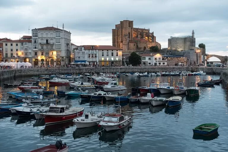
Castro Urdiales (Castro-Urdiales) is a harbour town on the east coast of Cantabria, the first Cantabrian town on the A-8 coming from Bilbao, which is about 26 km away in a straight line. The reason to stop is the headland at the end of the harbour: the Gothic church of Santa María de la Asunción, the Castillo de Santa Ana with its lighthouse, and a medieval bridge, all within a few minutes’ walk of the tourist office. Add the town beaches of Brazomar and Ostende and the Roman remains of Flaviobriga under the old town. It suits a half-day stop or a base for the Basque and Cantabrian coast; skip it if you want a quiet village, as the town is large and busy in summer.
Quick facts
- Names: Castro-Urdiales officially, often written Castro Urdiales or just Castro; the Roman town was Flaviobriga.
- Where: eastern coast of Cantabria, on the Bay of Biscay, next to the border with Bizkaia (Basque Country).
- Coordinates: 43.3846, -3.2157 (the church of Santa María on the headland, at the edge of the old town).
- Population: 33,450 registered residents (INE 2025, via Wikipedia); in summer the town fills with second-home owners and visitors.
- Old town: declared a historic site (conjunto histórico) in 1978.
- Main sights: church of Santa María de la Asunción (13th–15th centuries, national monument since 1931), Castillo de Santa Ana and lighthouse, medieval bridge, Flaviobriga remains.
- Beaches in town: Brazomar, Ostende (also called Urdiales) and El Fraile (Spain.info).
Getting there and parking
By car: the A-8 Autovía del Cantábrico and the N-634 both pass the town (Wikipedia). Bilbao airport is about 45 km away and Santander airport about 65 km.
By bus: there is no railway; the old line closed in the 1960s. Buses link the town with Bilbao (a direct line and one along the N-634) and Barakaldo, and ALSA runs to Santander, Laredo and along the coast. Local Castrobus lines serve the outlying villages.
Parking: OpenStreetMap shows a free surface car park about 175 m west of the church, near the harbour, and the paid underground car park of Amestoy about 250 m south, next to the tourist office. Expect the harbour streets to be full on summer weekends.
What to see
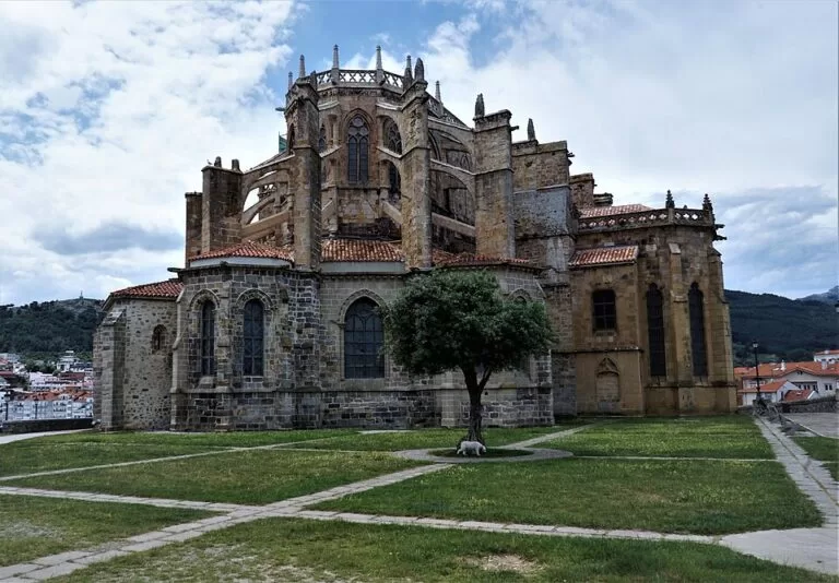
Santa María de la Asunción. Spain.info calls it the most significant example of Gothic architecture in Cantabria. It was begun under Alfonso VIII of Castile in the 13th century and finished in the 15th, a basilica with three naves; inside are the White Virgin, a reclining Christ and three Gothic carvings of the Magi (Wikipedia). Opposite the church stands a Roman milestone from AD 61. It is a parish church, so visiting hours vary; check at the tourist office.
Castillo de Santa Ana and the lighthouse. Next to the church, the castle from the 13th–14th centuries has a pentagonal plan and carries a working lighthouse, first lit under Isabel II. A medieval stone bridge links it to the harbour (Wikipedia). OpenStreetMap marks a free exhibition room inside the castle-lighthouse; we could not confirm its opening hours.
The harbour and Santa Ana. Below the little Santa Ana chapel on its rock is San Guillén, where boats are repaired and where locals traditionally swim. Around the harbour the old town keeps tall houses with rows of glazed wooden balconies and narrow streets of medieval origin (Spain.info). The free Museo del Mar Calafate, a small sea museum, is near the church (OpenStreetMap).
Flaviobriga. The Roman colony was founded in AD 74 under the emperor Vespasian, probably to mine local iron. Its remains lie under the whole old town, about 2 m deep (Spain.info), and OpenStreetMap shows a free interpretation centre for the Flaviobriga site about 260 m south-west of the church.
Later Castro. The town received its charter in 1163, was destroyed by the French in 1813 and grew rich again on iron mining and fish canning after 1879; it became a city in 1909. Modernist buildings by the local architect Eladio Laredo, such as the Ocharan palace and its neo-Gothic castle-observatory of 1914, date from that boom. West of town, the Peña del Cuco cave has Upper Palaeolithic engravings of deer, horses and goats.
Beaches
Brazomar is the main town beach, at the end of a seafront walk; Ostende, also called Urdiales, lies north-west of the harbour, about 0.9 km from the church; El Fraile is the third beach Spain.info names. The municipality has almost 20 km of coast, the longest in Cantabria, with more beaches at Oriñón, Arenillas and Dícido (Mioño) (Wikipedia).
Practical details
- Tourist office: in the town centre, about 250 m south of the church (OpenStreetMap). Hours on OpenStreetMap, which we could not confirm with the town: 1 July to 15 September daily 09:00–20:00; shorter split hours the rest of the year.
- Climate: Atlantic and humid, with rain through the year; summer highs rarely pass 30 °C (Wikipedia).
- Population in summer: registered residents are only part of it; local estimates put the real population far higher, much of it from the Basque Country.
Accessibility and safety
The harbour front and seafront are flat, but the headland around the church and the castle has slopes, steps and cobbled streets, and the medieval bridge is paved with setts. OpenStreetMap marks the tourist office and the Amestoy car park as wheelchair accessible. The Cantabrian sea can be rough; swim only on supervised beaches and follow the flags.
Best time to visit
June and September give long days without the August crowds. In July and August the town is at its busiest, and parking gets hard. On a winter day, the headland is still worth the stop for the view of the church, castle and harbour, but bring a raincoat.
Nearby alternatives
- San Juan de Gaztelugatxe, 35.5 km away: the hermitage on an islet off Bermeo, joined to the coast by a bridge and 241 steps.
- Mundaka, 41.9 km away: the Basque fishing village at the mouth of the Urdaibai estuary.
- Isla de Santa Marina, 42.7 km away: the largest island of the Cantabrian Sea, off Loredo.
- Isla de Izaro, 43.2 km away: the flat-topped bird island off Bermeo.
- Isla de Mouro, 44.7 km away: the lighthouse island at the entrance to the bay of Santander.
Distances are in a straight line from the church of Santa María.
FAQ
How far is Castro Urdiales from Bilbao?
About 26 km in a straight line. The A-8 and the N-634 connect the two, and buses run to Bilbao both directly and along the N-634.
Is there a train to Castro Urdiales?
No. The town’s railway closed in the 1960s; travel by bus or car.
What is there to see in Castro Urdiales?
The Gothic church of Santa María de la Asunción, the Castillo de Santa Ana with its lighthouse, the medieval bridge, the harbour and old town, the Flaviobriga Roman remains and the beaches of Brazomar and Ostende.
Where can I park in Castro Urdiales?
OpenStreetMap shows a free car park near the harbour, about 175 m west of the church, and the paid underground Amestoy car park next to the tourist office.
Does Castro Urdiales have beaches?
Yes. Brazomar and Ostende (Urdiales) are in town, El Fraile is nearby, and the municipality has more beaches at Oriñón, Arenillas and Dícido.
Sources and freshness
Checked 6 November 2026 · 4 sources Show
Checked 6 November 2026. Official: Spain.info, Castro Urdiales (Flaviobriga, beaches, historic site, Santa María, castle-lighthouse, Peña del Cuco). The Cantabria tourism and town websites could not be reached while checking. Background: Wikipedia, Castro Urdiales and Wikipedia (Spanish), Castro-Urdiales (history, population, church, castle, bridge, transport, airports, beaches, climate). Location, parking, tourist office and museums: OpenStreetMap contributors (ODbL). Photos: Wikimedia Commons, licences as credited.
How this page is made. CostaMap is written with an AI editorial system run by Ebizapple. This page is based on the sources listed above. Last updated 6 November 2026. Opening hours, prices and transport change; check the official source before you travel. How we work · Partner links and ads