
Camí de Ronda: Calella to Tamariu (Palafrugell)
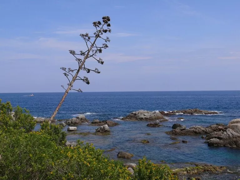
Hiking trailThe Camí de Ronda between Calella de Palafrugell and Tamariu is the coastal path that links Palafrugell’s three seaside villages. It starts at the old fishing quarter of Port Bo in Calella, follows the shore to Llafranc, climbs to the Sant Sebastià lighthouse and comes back down to the beach at Tamariu. This stretch is part of the GR 92 long-distance path. Measured on OpenStreetMap, the walk is about 6.8 km one way, and the high point by the lighthouse is at about 178 m. It suits fit walkers who are fine with steps and a steady climb. Skip it if you need step-free paths, or if you only want a flat stroll: in that case, walk Calella to Llafranc and stop there.
Quick facts
- Route: Calella de Palafrugell (Port Bo) – Llafranc – Sant Sebastià lighthouse – Tamariu, one way. All three villages belong to the municipality of Palafrugell (Baix Empordà, Girona).
- Waymarking: this section is part of the GR 92, the long-distance path along Catalonia’s Mediterranean coast, marked in red and white. OpenStreetMap maps it as the Begur–Palamós stage.
- Start coordinates: 41.8885, 3.1852 (Port Bo, Calella).
- Distance: about 6.8 km one way, measured along the GR 92 on OpenStreetMap. That is about 1.3 km from Calella to Llafranc beach, 1.6 km from there up to the lighthouse and 4.0 km on to Tamariu beach.
- High point: an IGN survey point beside the Sant Sebastià hermitage, at 178 m (OpenStreetMap). The lighthouse’s light stands at 167 m above the sea.
- Time, total climb and official difficulty: we could not open the Palafrugell tourism pages to check the official figures, so we leave them out. Plan on a half-day walk with stops.
- Surface: mixed. Streets, paving and steps in Calella and Llafranc; about 1.2 km of asphalt road up to the lighthouse; earth, gravel and rock path for most of the way to Tamariu.
- Entry: free; it is a public path.
Access and parking
Start: the walk starts at Port Bo, the old fishing quarter of Calella with its arcaded houses. The town’s tourist office, in the Sa Perola centre, is about 60 m from the start (Wikipedia; location from OpenStreetMap).
Parking: OpenStreetMap shows small car parks and street parking 80–150 m from Port Bo, and a paid multi-storey car park, the Aparcament del Carrer Chopitea, about 350 m inland. In Tamariu, OpenStreetMap shows a paid unpaved car park about 240 m from the beach and a free one about 280 m away. Prices could not be confirmed.
By bus: OpenStreetMap maps bus line L1 Palafrugell – Tamariu – Llafranc – Calella, run by Moventis-Sarbus, as a loop. The Port Bo stop is about 90 m from the start, and the Tamariu stop is about 100 m from the beach. That makes a one-way walk possible. We could not confirm the timetable, so check it locally before you rely on it, especially out of season.
What to expect
Calella to Llafranc (about 1.3 km). From Port Bo the route passes Platja del Canadell, then climbs a series of steps and lanes over the headland and comes down the Escales de Garbí stairs to Llafranc. The 16th-century Torre de Calella is on this stretch (Wikipedia). It is short and mostly paved.
Llafranc to the lighthouse (about 1.6 km). Walk along the seafront past the beach towards the marina. The GR 92 then climbs the Passeig de Pau Casals, a tarmac road, to the top of Sant Sebastià. Watch for cars.
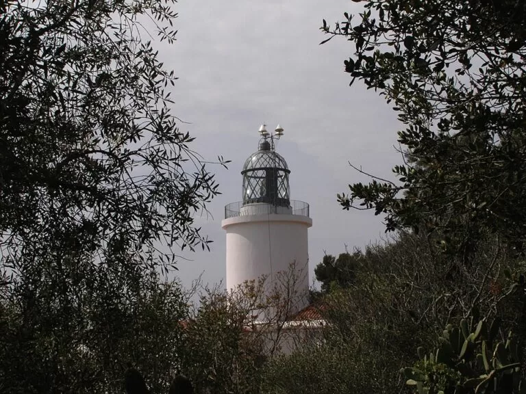
At the top. OpenStreetMap maps the following on the summit: the lighthouse; the Ermita de Sant Sebastià de la Guarda (a hermitage); the remains of the Iberian settlement of Sant Sebastià de la Guarda; the Joaquim Turró i Roselló viewpoint; an information board; a hotel; and a couple of restaurants.
Lighthouse to Tamariu (about 4.0 km). This is the longest and most natural section. Beyond the summit the path drops onto the marked Camí de Ronda, partly earth path and partly gravel track. It follows the coast and ends on the seafront promenade in Tamariu. OpenStreetMap grades almost all of it as ordinary hiking (the easiest grade on its scale), with one very short rougher bit. Expect uneven rock, roots and short steep steps rather than any scrambling.
Practical details
- Bring water. There are bars and restaurants in Calella, Llafranc and Tamariu, and on top at the lighthouse, but nothing on the path between the lighthouse and Tamariu.
- Toilets: OpenStreetMap shows a free public WC about 100 m west of Port Bo in Calella and a free WC at Tamariu beach, with a drinking fountain beside it. We did not check opening hours.
- Follow the red-and-white GR 92 marks. Where the Camí de Ronda forks to coves, the GR is the through route.
- Want a shorter walk? Calella to Llafranc and back covers the easy coastal part. Llafranc to the lighthouse and back covers the climb and the view.
Accessibility and safety
The route is not suitable for wheelchairs or pushchairs. Between Calella and Llafranc there are long flights of steps, and there are more steps and rocky sections after the lighthouse. The path runs above cliffs in places: keep children close and stay on the marked line. Part of the climb to the lighthouse is on a road shared with cars. In summer, start early. The climb and the long middle section to Tamariu are hard work in the heat, and we could not confirm how much shade there is.
Best time to visit
Spring and autumn are the most comfortable seasons for the full walk. In July and August, go early in the morning. The Cap Roig Festival in the gardens south of Calella brings extra visitors in those months (Wikipedia). After rain, the rock and earth sections can be slippery.
Nearby alternatives
- Calella de Palafrugell, at the start: the fishing village, Port Bo and its coves.
- Llafranc, 0.9 km away: the beach and marina at the foot of the lighthouse climb, and the natural halfway stop.
- Cork Museum of Palafrugell, 3.7 km away: the town museum in Palafrugell itself.
- Begur, 7.6 km away: the hill town to the north, where the same GR 92 stage begins.
- La Fosca, 5 km away: a beach on the southern continuation of the coastal path towards Palamós.
Distances are in a straight line from the start at Port Bo.
FAQ
How long is the Camí de Ronda from Calella to Tamariu?
About 6.8 km one way, measured along the GR 92 on OpenStreetMap: about 1.3 km to Llafranc, 1.6 km up to the lighthouse and 4.0 km down to Tamariu. We could not check an official figure from Palafrugell tourism.
Is the walk hard?
Calella to Llafranc is short and easy, with a lot of steps. The climb to the lighthouse, which tops out at about 178 m, and the earth and rock path on to Tamariu need normal walking fitness and good shoes. There is no scrambling.
Can I get back by bus?
OpenStreetMap maps bus line L1 (Moventis-Sarbus) linking Palafrugell, Tamariu, Llafranc and Calella, with stops near both ends of the walk. Check the current timetable before you set off; we could not confirm it.
Where do I start and park?
Start at Port Bo in Calella (41.8885, 3.1852). There are small car parks and street parking within about 150 m, and a paid multi-storey car park about 350 m inland on Carrer Chopitea.
Is it suitable with a pushchair or wheelchair?
No. There are many steps between Calella and Llafranc, and the section after the lighthouse is uneven earth and rock path.
Sources and freshness
Checked 6 November 2026 · 7 sources Show
Checked 6 November 2026. The Palafrugell and Costa Brava tourism websites could not be opened when we checked, so the official distance, time and difficulty are not given. Route line, distances, surfaces and difficulty grades: OpenStreetMap relations GR 92 Begur–Palamós and Camí de Ronda. Lighthouse, survey point, summit sites, parking, toilets and bus stops: OpenStreetMap. Bus line: OpenStreetMap relation for L1. All map data © OpenStreetMap contributors (ODbL). Background: Wikipedia on Calella de Palafrugell and Llafranc. Photos: Wikimedia Commons, licences as credited.
How this page is made. CostaMap is written with an AI editorial system run by Ebizapple. This page is based on the sources listed above. Last updated 6 November 2026. Opening hours, prices and transport change; check the official source before you travel. How we work · Partner links and ads