
Puerto Sherry (El Puerto de Santa María)
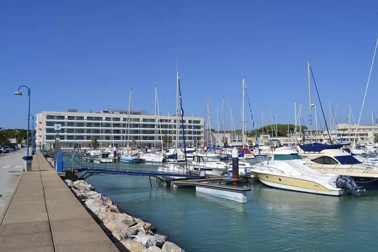
MarinaPuerto Sherry is the big marina of El Puerto de Santa María, on the Bay of Cádiz, about 2.5 km west of the town centre at the end of the Avenida de la Libertad. You can drive in and park by the pontoons, take a taxi from El Puerto’s train station (about 10 minutes, the marina says), or walk 40 minutes along the Guadalete river and the beach. The operator lists 872 berths for boats up to 71 m, a boatyard, a 167 m launching ramp for dinghies, a hotel and a cluster of restaurants and beach clubs. It suits sailors, people taking sailing or watersports courses, and anyone wanting a seaside meal with the bay in view. Skip it if you want the old-town feel of El Puerto: that is 2.5 km away by the river.
Quick facts
- Names: Puerto Sherry, also Marina Puerto Sherry or Puerto Deportivo Puerto Sherry; run by Marina Puerto de Santa María S.A.
- Where: the Aculadero inlet between Punta Santa Catalina and the west breakwater of the Guadalete river, El Puerto de Santa María (Cádiz), on the Atlantic side of the Costa de la Luz.
- Coordinates: 36.5810, -6.2550.
- Berths: 872, in 11 berth types, for boats up to 71 m long (operator’s berths page; the home page counter shows 874).
- Depth: 3.5 m, according to the operator.
- Radio: VHF channel 9 for the marina crew.
- On site: a four-star hotel and 33 apartment suites, which the operator puts at 250 beds, plus 10 restaurants and 4 beach clubs.
- Contact: marina reception +34 956 870 103.
Access and parking
By car: take the A-4 motorway to El Puerto de Santa María, then the N-IV, and follow the Avenida de la Libertad to its end (Puerto Sherry, how to get here). Berth holders can park in front of their pontoon.
Parking: OpenStreetMap marks the street parking along the quay as for customers, with several disabled bays. Other open car parks sit 0.4–0.6 km from the basin, towards the Playa de la Muralla side and behind the Dunas de San Antón beach; we could not confirm whether they charge.
By train and bus: El Puerto’s railway station is in the town centre and has long-distance trains. From there the marina suggests a taxi; OpenStreetMap marks two taxi ranks at the marina. The nearest town bus stop on OpenStreetMap is Pago La Alhaja, about 1 km north-east, on urban line 5.
On foot or by bike: from the town centre, follow the Avenida de la Bajamar along the Guadalete river to the end of the promenade and keep the Playa de La Puntilla on your left. The marina puts the walk at about 40 minutes and the ride at 10–15 minutes.
What to expect
A large, modern yacht harbour built as part of a residential and holiday complex of the same name. Spain’s Andalusian tourist board calls it one of the best marinas in Europe and notes that it sits close to El Puerto’s shops and the rest of the Bay of Cádiz (Andalucía tourist board). Restaurants, bars and the hotel line the land side of the basin.
Puerto Sherry is a regatta venue. Its own list includes world sailing championships of the ISAF in 1992 and 2003, the RS:X windsurfing world championships in 2012 and 2021 and the Andalusian Olympic Week every February or March since 2005 (Puerto Sherry, about us).
The asphalt launching ramp, the playa asfáltica, is 167 m long; the marina calls it the largest in Spain. It serves dinghies, catamarans, windsurfers and paddle boards, next to a club building with changing rooms and showers for members and marina clients (Puerto Sherry, launching ramp).
Services for visiting boats
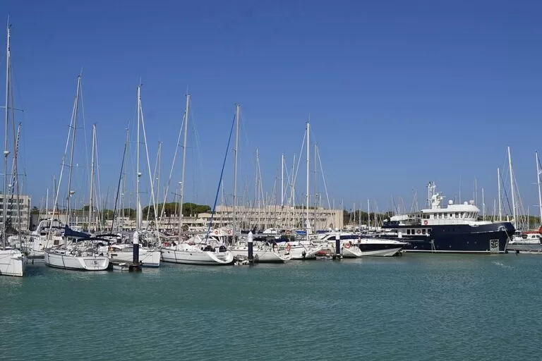
Transit boats must stop at the waiting pontoon near the control tower, which you see to port as you come in, and stay there until the marina assigns a berth. The marina’s crew help with berthing round the clock on VHF channel 9, and many berths have side fingers. Security staff patrol 24 hours a day (Puerto Sherry, berths and services).
- Fuel: OpenStreetMap marks a Repsol fuel berth at the south end of the basin.
- Boatyard: 50 t and 150 t travel lifts, a 10 t forklift and three haul-out pits; the large pit takes boats up to 35 m long and 7.45 m wide, the small one 23 m by 6 m. The 22,000 m² yard has independent repair workshops (Puerto Sherry, boatyard).
Prices and opening
The marina’s quay, restaurants and promenade are open to visitors, and we found no entry charge. The marina publishes its 2026 berth rates as a PDF (Puerto Sherry tariffs 2026, checked November 2026). Daily transit rates, before VAT, include:
- 10 m boat: €12.20 a day from November to April, €20.42 in May, June, September and October, and €26.70 in July and August, plus €2.05 a day for water, power and Wi-Fi.
- 12 m boat: €16.70, €27.39 and €35.50 for the same seasons, plus €3.80 a day for services.
- Multihulls pay 1.5 times the rate for their length. A day counts as 24 hours from arrival, and stays are paid in advance.
Transit rates exclude the Bay of Cádiz port authority’s charge on leisure boats. For stays over 90 days, ask the marina.
Accessibility and safety
The quays around the basin are flat, and OpenStreetMap shows disabled parking bays by the shops. The tourist board lists the marina as accessible for disabled visitors, but we could not confirm step-free access onto the pontoons, which are for boat crews. Keep children back from the quay edges, and do not climb on the breakwaters. The marina names the easterly Levante and the westerly Poniente as the prevailing winds; check the forecast before going out in a small boat.
Best time to visit
Any time of year. For sailors, transit berths are cheapest from November to April and dearest in July and August. Regattas run through the year, with the Andalusian Olympic Week in February or March. In summer the beach clubs and nearby beaches are at their busiest.
Nearby alternatives
- El Puerto de Santa María town guide, 2.5 km away: sherry bodegas, the riverside and seafood.
- Castle of San Marcos, 3.1 km away: El Puerto’s medieval castle in the old town.
- Cádiz city guide, 6.6 km away across the bay; OpenStreetMap shows the passenger ferry leaving from El Puerto’s riverside.
- La Caleta beach, 7.1 km away: the city beach of Cádiz between two castles.
- Rota, 10.5 km away: the next town west along the bay.
- Bahía de Cádiz Natural Park, 14.1 km away: salt marshes and birdlife around the bay.
Distances are in a straight line from the marina.
FAQ
How do I get to Puerto Sherry?
By car, follow the Avenida de la Libertad in El Puerto de Santa María to its end. From the train station a taxi takes about 10 minutes, or you can walk about 40 minutes along the Guadalete river.
Is there parking at Puerto Sherry?
Yes. OpenStreetMap marks customer parking along the quay and other car parks 0.4–0.6 km from the basin. We could not confirm the charges.
How many berths does Puerto Sherry have?
The operator’s berths page lists 872 berths for boats up to 71 m, with 3.5 m of depth.
Can you swim near Puerto Sherry?
Not in the harbour. The Playa de la Muralla lies 0.7 km to the west and the Dunas de San Antón beach 0.6 km to the east, with La Puntilla beach 1.4 km away.
Sources and freshness
Checked 6 November 2026 · 10 sources Show
Checked 6 November 2026. Operator: Puerto Sherry on berths and services (berths, maximum length, depth, VHF, security), the home page (hotel beds, restaurants, beach clubs, contact), how to get here, the boatyard, the launching ramp, about us (events, winds) and the 2026 tariffs. Official tourism: Andalucía tourist board, Puerto Sherry. Location, parking, taxi ranks, bus stop and line, fuel berth, beaches and distances: OpenStreetMap (OpenStreetMap contributors, ODbL). Photos: Wikimedia Commons, licences as credited.
This place is part of our Costa de la Luz, Spain: beaches, towns, sherry and map — see every town, beach and cove we have mapped on that coast.
How this page is made. CostaMap is written with an AI editorial system run by Ebizapple. This page is based on the sources listed above. Last updated 6 November 2026. Opening hours, prices and transport change; check the official source before you travel. How we work · Partner links and ads