
Mirador de la Amatista (Cabo de Gata)
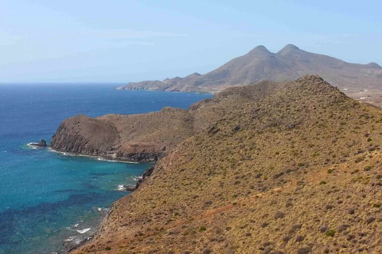
ViewpointThe Mirador de la Amatista is a roadside viewpoint on a high cliff above the sea in the Cabo de Gata-Níjar Natural Park, at km 3 of the AL-4200 between La Isleta del Moro and Rodalquilar (Níjar, Almería). You drive up, park free beside it, and look out over the volcanic coast of the park; a small park information kiosk stands next to it. It suits anyone driving the coast road between San José and Rodalquilar; skip it if you are looking for a beach: this is a clifftop stop, not a place to spend the day.
Quick facts
- Names: Mirador de la Amatista (“Amethyst viewpoint”); also written Mirador de las Amatistas. The information kiosk beside it is the Punto de Información La Amatista.
- Where: Carretera AL-4200 (La Isleta del Moro–Rodalquilar), km 3, Níjar (Almería), inside the Cabo de Gata-Níjar Natural Park.
- Coordinates: 36.8271, -2.0390.
- Distances: 1.8 km from La Isleta del Moro and 2.3 km from Rodalquilar in a straight line (OpenStreetMap).
- Setting: a viewpoint on a high cliff (Wikipedia) with views over the volcanic coast of the park (Andalucía tourist board).
- Facilities: park information kiosk selling publications and souvenirs, free car park, picnic spot.
- Kiosk phone: +34 950 380 299 (Andalucía tourist board listing).
- Entry: free; no ticket or booking is mentioned by the official sources.
Access and parking
By car: the viewpoint is on the AL-4200, the coast road that runs north from La Isleta del Moro towards Rodalquilar. The tourist board puts it at km 3 (Andalucía tourist board). Coming from San José, you pass Los Escullos (3.4 km away in a straight line) and La Isleta del Moro before you reach the viewpoint.
Parking: OpenStreetMap shows a free surface car park right beside the information kiosk, about 80 m from the viewpoint point, and a second free car park about 600 m to the south-west along the road. The viewpoint is beside a two-lane road with no lighting, so take care crossing and pulling out.
Without a car: OpenStreetMap shows no bus stop within about 450 m of the viewpoint. Plan on a car, a bike or a taxi.
What to expect
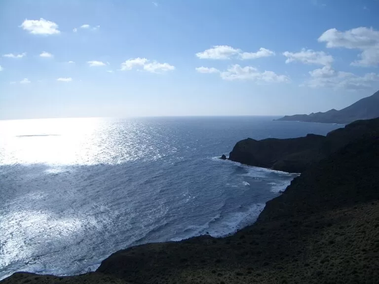
A lookout perched over the sea, with the road behind you and open coast in front. The Andalusian tourist board describes the place as a spot of great scenic beauty, with views of the volcanic nature of the Almería coast, and in a 2024 round-up of the park singles out “the spectacular Amatista viewpoint” among its miradores (Andalucía tourist board, 2024).
The rocks here are volcanic. Spain.info explains that the Cabo de Gata range is of volcanic origin, with volcanic plugs, dikes, calderas and domes, which makes this one of the most scenically valuable strips of the Spanish Mediterranean coast. The park covers 49,512.2 hectares and has been a biosphere reserve since 1997 (Spain.info).
On the map around you: the Cerro de la Amatista, a 105 m hill about 470 m to the south-west, which shares the viewpoint’s name; and the small Cala de los Monteses beach about 500 m to the north-east (OpenStreetMap). La Isleta del Moro, a small fishing village beside a large rock and the islet that gives it its name, lies just south along the coast.
Practical details
- Information kiosk: the Punto de Información La Amatista is a small kiosk where you can get general and detailed information about the natural park and buy its publications and souvenirs (Andalucía tourist board). Its opening hours are on a Junta de Andalucía page that we could not reach, so do not count on it being open; the listing gives the phone number +34 950 380 299.
- Walks: two signposted trails run nearby, according to the same listing: the Requena trail and the Caldera de Majada Redonda trail. We could not confirm their length or start points from an official page.
- Picnic: OpenStreetMap marks a picnic site and a nature information board next to the car park.
- Food, water and toilets: none is listed at the viewpoint. The nearest villages, La Isleta del Moro and Rodalquilar, are each a few minutes’ drive away.
The Spain.info park page warns that access to some of the park’s beaches and coves may be restricted in the warmer months. That is about beaches; the viewpoint sits on the public road.
Accessibility and safety
The viewpoint is a short walk from the car park. We could not confirm step-free access, the surface or the height of the railings. The lookout is on a high cliff: keep children close and stay back from unfenced edges. There is no shade, and the AL-4200 is an unlit two-lane road, so watch for traffic when you walk between the car park and the lookout.
Best time to visit
Any time of year: it is an open viewpoint beside a public road. In summer, stop early or late in the day, when it is cooler and the car park is less busy. If you want the kiosk open, phone ahead, as we could not confirm its hours.
Nearby alternatives
- Rodalquilar, 2.8 km away: the former gold-mining village in a circular valley, with a park information point in the old workers’ social building.
- Cabo de Gata-Níjar Natural Park, 7.3 km away: the overview of the whole protected area.
- San José, 9.6 km away: the village in the south of the park.
- Cala de San Pedro, 10 km away: a remote cove further north in the park.
- Playa de los Genoveses walk from San José, 9.8 km away: a coastal walk from San José to a natural sandy beach.
- Mirador de las Sirenas, 18 km away: another viewpoint in the park, by the Cabo de Gata lighthouse.
Distances are in a straight line from the viewpoint.
FAQ
Where is the Mirador de la Amatista?
At km 3 of the AL-4200 between La Isleta del Moro and Rodalquilar, in the municipality of Níjar (Almería), inside the Cabo de Gata-Níjar Natural Park. Coordinates: 36.8271, -2.0390.
Is there parking at the Mirador de la Amatista?
Yes. OpenStreetMap shows a free car park right beside the information kiosk, about 80 m from the lookout, and another free car park about 600 m south-west along the road.
Can you get there by bus?
OpenStreetMap shows no bus stop near the viewpoint. Plan on a car, a bike or a taxi.
Can you swim at the Mirador de la Amatista?
No, it is a clifftop viewpoint. The nearest mapped beach is the small Cala de los Monteses, about 500 m to the north-east.
Do you need tickets for the Mirador de la Amatista?
No. It is an open viewpoint beside a public road, and no official source mentions a fee or booking.
Sources and freshness
Checked 6 November 2026 · 7 sources Show
Checked 6 November 2026. Official: Andalucía tourist board on the La Amatista information point (location, kiosk, trails, phone), Cabo de Gata viewpoints (2024), La Isleta del Moro and Rodalquilar; Spain.info on the natural park (geology, size, biosphere reserve). Background: Wikipedia, La Isleta del Moro. The Junta de Andalucía visitor page linked from the listing could not be reached. Location, parking, picnic site, bus stops and distances: OpenStreetMap contributors (ODbL). Photos: Wikimedia Commons, licences as credited.
How this page is made. CostaMap is written with an AI editorial system run by Ebizapple. This page is based on the sources listed above. Last updated 6 November 2026. Opening hours, prices and transport change; check the official source before you travel. How we work · Partner links and ads