
Costa Tropical · East
Castell de Ferro to La Rábita travel guide: castles, coves and fishing villages
The quiet eastern end of the Costa Tropical: two castle villages, a string of small beaches and coves under the Sierra de Lújar and the Contraviesa, and greenhouses down to the sea.
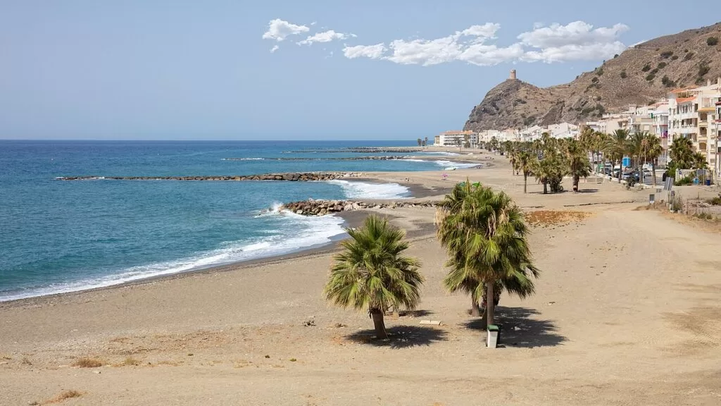
La Mamola beach · Photo: Werner Wilmes, CC BY 2.0
Part of the Costa Tropical guide · East: Castell de Ferro to La Rábita
The stretch from Castell de Ferro to La Rábita is the eastern third of the Costa Tropical, the coast of Granada province in Andalusia: about 17 km in a straight line from Castell de Ferro, east of Calahonda, to La Rábita, 4 km before the border with Almería province. It runs through the coastal villages of five small municipalities, Gualchos, Rubite, Polopos, Sorvilán and Albuñol, whose main villages sit in the hills behind; Castell de Ferro and La Rábita are two of the five tourist centres that spain.info names on the Costa Tropical.
At a glance
- Where the eastern Costa Tropical, Granada province, from Castell de Ferro (Gualchos) to La Rábita and El Pozuelo (Albuñol), between Motril and Adra.
- Towns Castell de Ferro, El Lance and Casarones, Castillo de Baños, La Mamola, Los Yesos, Melicena, La Rábita and El Pozuelo; inland Gualchos, Rubite, Polopos, Sorvilán and Albuñol.
- Best for a quiet beach stay, two coastal castles and watchtowers, small coves without services, and fish and Contraviesa wine.
- Getting there the A-7 motorway and the N-340 coast road run along the whole stretch. Granada airport (GRX) is about 64 km from Castell de Ferro and Almería airport (LEI) about 72 km from La Rábita, in a straight line.
- On CostaMap guides to Castell de Ferro and La Rábita, with Calahonda and Motril next door in the middle area.
Map of Castell de Ferro to La Rábita
The map shows the places on this stretch that have a CostaMap page. Tick a place type to filter, and click a marker to see the place in the panel.
Place type
Area · next level
 Area map
Castell de Ferro to La Rábita
Click a marker to see the place here. The eastern Costa Tropical, from the castle of Castell de Ferro to the fishing village of La Rábita.
Towns and villagesTowns and villages
From west to east. Most municipalities here have two halves: a small village in the hills and a newer settlement on the coast, linked by a winding road. Descriptions are from Andalucía.org, Andalusia’s official tourism site, with background from Spanish Wikipedia.
Castell de Ferro
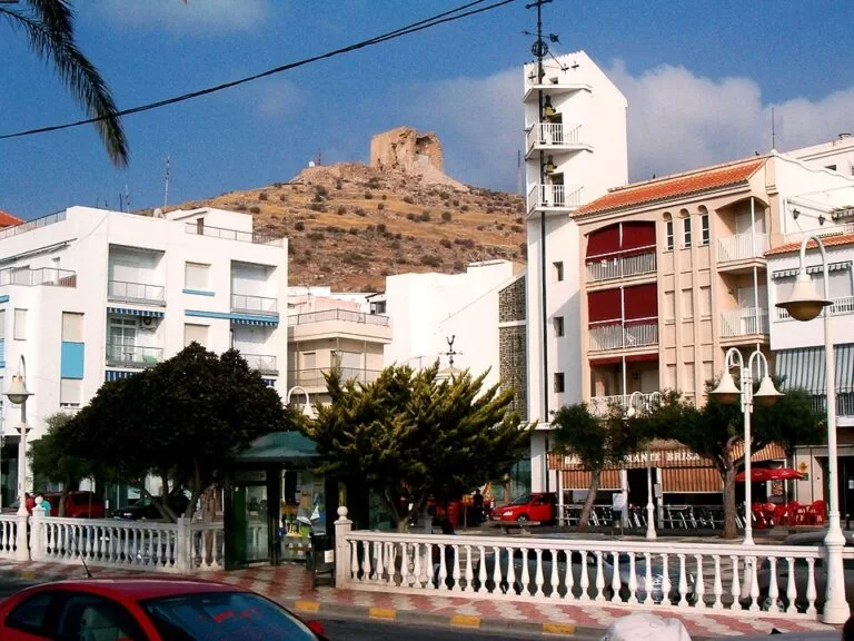
Castell de Ferro is the coastal village and seat of the town hall of Gualchos, at the mouth of the Gualchos rambla. Andalucía.org describes a seafaring village with a mild subtropical climate and calls it one of the pioneers of tourism on the Granada coast; its castle on the hill has watched over the beach for centuries (Andalucía.org). It had 3,078 inhabitants in 2022 (Spanish Wikipedia). Playa del Sotillo, the town beach, has a promenade and lifeguards, and the coves of La Rijana and Cambriles lie to the west and east. The name comes from the older Castil de Ferro; Spanish Wikipedia links the change to Catalan fishermen who settled here in the 19th century. See our Castell de Ferro guide.
Gualchos
The hill village of Gualchos lies about 330 m up at the foot of the Sierra de Lújar, 7 km from the coast (Andalucía.org). The municipality has 5,284 inhabitants (INE 2025), and Spanish Wikipedia says the number can triple in the tourist season. The church of San Miguel stands where the mosque was, and the Gualchos viewpoint looks over the Sierra de Lújar and the castle of Castell de Ferro to the sea. A small heritage centre, the Banco de Sensaciones, shows a traditional house of the lower Alpujarra with tools and furniture given by residents (Andalucía.org).
El Lance, Casarones and Rubite
East of Castell de Ferro the N-340 passes El Lance and Casarones, the coastal hamlets of Rubite. Rubite itself is a small mountain village at 789 m between the Sierra de Lújar and the Contraviesa, with 419 inhabitants (INE 2025), about 17 km from Castell de Ferro by road (Spanish Wikipedia). Andalucía.org describes it as a village of the lower Alpujarra whose land was used for vines and figs, and whose Arab name, Rubayt, means a small rábita (Andalucía.org). On the coast, greenhouses reach almost to the beach.
Castillo de Baños and La Mamola
Polopos opens to the sea at Castillo de Baños and La Mamola; the town hall and municipal services are now in La Mamola (Andalucía.org). La Mamola, with 986 inhabitants in 2024, sits at the foot of a hill crowned by the Torre de Cautor. Spanish Wikipedia says most jobs are in greenhouse farming and that the fishing fleet moved to Motril and Barcelona in the 1980s, leaving fishing as a pastime. Its beach, shared with Sorvilán, has a promenade, lifeguards, toilets and shade (Andalucía.org). Castillo de Baños has a narrow stony beach next to a large campsite.
Los Yesos and Melicena
Sorvilán, a hill village of the Contraviesa with 521 inhabitants (INE 2025), reaches the sea at Los Yesos and Melicena (Andalucía.org). Melicena is a small fishing village at the foot of the Peñón de San Patricio, at the mouth of the Santa Catalina rambla; its patron’s festival, the Virgen del Carmen, is held on the third weekend of August (Spanish Wikipedia). Spanish Wikipedia also notes that the Nasrids built a fortified tower at Melicena in the 14th century, and that the vines of the lower slopes around Melicena and Los Yesos were grown for raisins. Playa Melicena is a quiet village beach with some facilities (Andalucía.org).
La Rábita and El Pozuelo
La Rábita is the coastal village of Albuñol and the eastern end of the Costa Tropical, about 4 km from the Almería border. It takes its name from a Nasrid ribat, a fortress-monastery; the castle that replaced it still stands in the village, and an 18th-century watchtower above it is the best preserved on this stretch (Andalucía.org). Andalucía.org mentions its small fishing fleet (Albuñol). The gravel beach has lifeguards and toilets, and the naturist cove of El Ruso is about 1 km west. El Pozuelo, just east, has a long narrow beach. See our La Rábita guide.
Albuñol
Albuñol, the municipality’s main village, sits about 244 m up in a valley of the Sierra de la Contraviesa, 5 km inland from La Rábita; the municipality has 7,388 inhabitants (INE 2025, Spanish Wikipedia). In the Nasrid period it was the capital of the Gran Cehel, the larger coast of the Kingdom of Granada. In the 19th century its wine and raisins were shipped abroad from La Mamola and La Rábita. Its Cueva de los Murciélagos produced finds from the transition between the Neolithic and the Bronze Age, among them a gold crown (Andalucía.org).
Beaches and coves
Small beaches of gravel, coarse dark sand and rock, many squeezed between the N-340 and the sea. Facilities are from Andalucía.org, which lists lifeguards, public toilets and shade only at the village beaches of Castell de Ferro, La Mamola and La Rábita. The coves have no services.
Playa del Sotillo
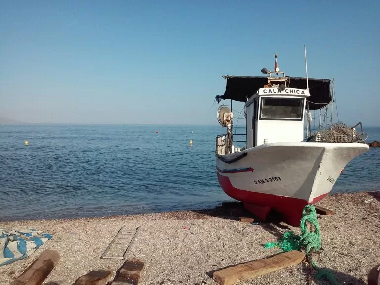
The long town beach of Castell de Ferro, with breakwaters along parts of it, a promenade, lifeguards, toilets and shade (Andalucía.org). Cambriles, just east, is quieter with few services.
See the Castell de Ferro guide →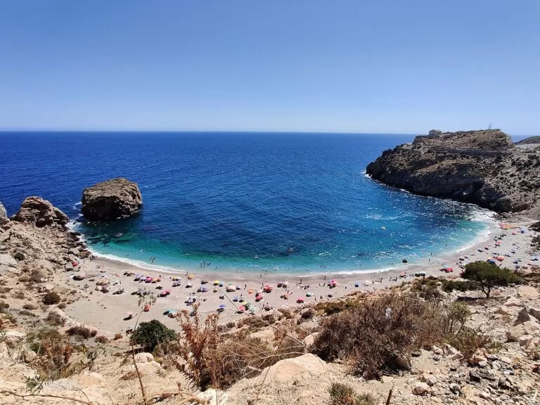
La Rijana
A small, isolated cove beside the N-340, about 3 km west of Castell de Ferro, with no facilities (Andalucía.org). A watchtower stands on the rock above.
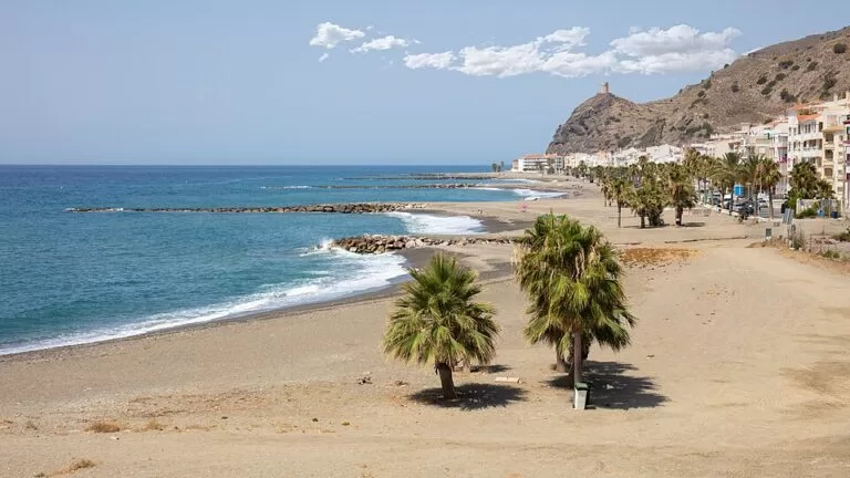
La Mamola
A village beach with a seafront promenade, good access, calm water, lifeguards, toilets and shade (Andalucía.org). Melicena, further east, is a quiet village beach with some facilities.
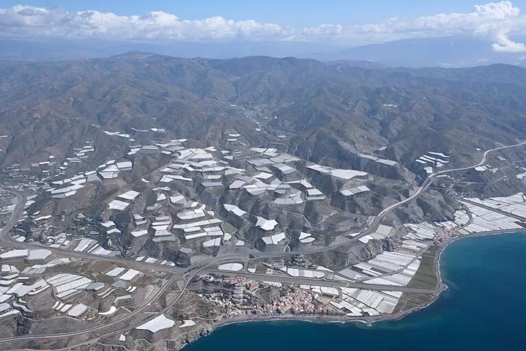
La Rábita and El Ruso
La Rábita’s gravel beach has lifeguards, toilets and shade (Andalucía.org). El Ruso, about 1 km west, is an isolated cove reached on foot from the N-340 (Andalucía.org), and the one spain.info recommends to nature lovers.
See the La Rábita guide →Other beaches on the stretch, west to east: El Lance, a narrow strip of dark sand by the N-340 with some facilities and bars (Andalucía.org); Casarones, a small, narrow beach of rocks and gravel among greenhouses (Andalucía.org); Castillo de Baños, narrow and stony, next to a large campsite (Andalucía.org); Cala Chilches, an isolated gravel and sand cove west of La Rábita (Andalucía.org); and El Pozuelo, long and narrow with some facilities, in surroundings Andalucía.org calls rather degraded (Andalucía.org).
Things to do
History: castles and watchtowers
This coast was the sea frontier of the Kingdom of Granada and was guarded against Berber pirates by castles and towers. The castle of Castell de Ferro stands on the hill above the village; Andalucía.org says it is of Roman origin (Andalucía.org). The castle of La Rábita, in the village centre, combines Arab work reformed in the 16th century with an 18th-century artillery bastion, and the 18th-century Torre de La Rábita above it is the best preserved of the watchtowers of Punta Negra, La Rábita and Huarea (Andalucía.org). La Mamola sits under the Torre de Cautor. We could not confirm opening times for either castle.
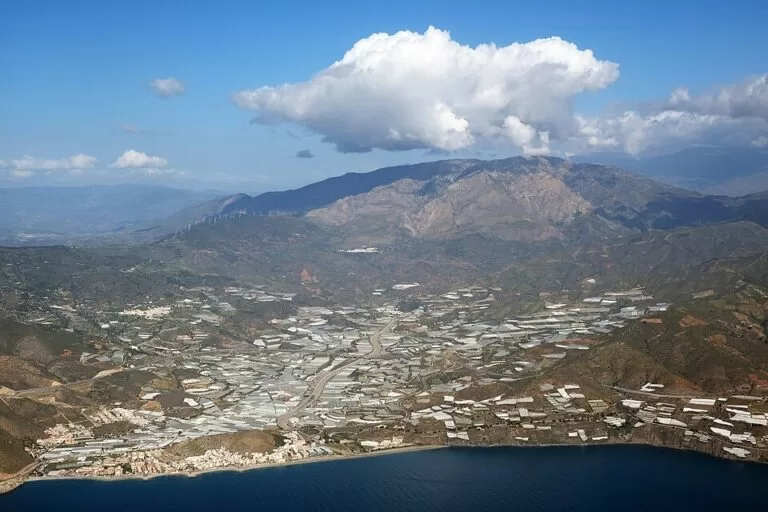
Nature: two sierras and the sea
Behind the coast rise the Sierra de Lújar, which climbs quickly to about 700 m above Gualchos, and the Sierra de la Contraviesa, which reaches 1,411 m in Rubite (Spanish Wikipedia). The land falls steeply to the sea in ramblas and ravines, and most of the coast is cliffs with small coves; spain.info notes diving over Posidonia seagrass along the Costa Tropical (spain.info). The lower slopes are covered in greenhouses, so expect plastic as well as views.
Food and wine: fish, raisins and Contraviesa wine
The villages of the Contraviesa have long grown vines and figs, and Andalucía.org mentions the well-known wine of these hills (Andalucía.org). The Museo Enológico de La Contraviesa, in the oldest part of a winery in Murtas, shows the tools of local winemaking (Andalucía.org). On the coast, fish is the staple; La Rábita still has a small fishing fleet (Andalucía.org).
Where to stay by town
We do not name hotels. These are the three coastal villages we would choose as a base, west to east.
Castell de Ferro
The largest village on the stretch, with a promenade beach, a health centre with emergency service and the shortest drive to Motril and Granada.
Families, a first visitLa Mamola
A small village with a promenade beach in the middle of the stretch, between Castillo de Baños and Melicena.
Quiet beach daysLa Rábita
The eastern base, with a castle and watchtower, a fishing beach and the El Ruso cove; the closest to Adra and Almería.
Castles, coves, AlmeríaGetting there and around
By air
Granada airport (GRX) is about 64 km from Castell de Ferro and 73 km from La Rábita; Almería airport (LEI) is about 89 km from Castell de Ferro and 72 km from La Rábita; Málaga (AGP) is about 102 km from Castell de Ferro. All are straight-line distances (OpenStreetMap); road distances are longer.
By car
The A-7 Autovía del Mediterráneo and the old N-340 run along the whole stretch. Spanish Wikipedia gives road distances from Castell de Ferro of 23 km to Motril, 82 km to Granada and 91 km to Almería. Local roads climb to the hill villages: the GR-5206 from Castell de Ferro to Rubite, and the A-345 from La Rábita to Cádiar in the Alpujarra.
By bus
We could not confirm current bus routes and timetables along this stretch. Motril, about 15 km west of Castell de Ferro, has the bus station of the Costa Tropical (see our Costa Tropical guide). A car makes the coves and hill villages much easier.
A two-day route
By car, west to east, with a night in Castell de Ferro or La Mamola.
Day 1
Castell de Ferro, La Rijana and Gualchos
Walk up to the castle of Castell de Ferro in the morning for the view over the bay, then swim at Playa del Sotillo or drive 3 km west to the cove of La Rijana. In the afternoon drive up to Gualchos for the viewpoint and the Banco de Sensaciones heritage house, and return to the coast for the evening.
Day 2
La Mamola, Melicena and La Rábita
Follow the N-340 east past El Lance and Castillo de Baños to La Mamola and Melicena for a swim or a coffee on the promenade. Continue to La Rábita to see the castle and the watchtower above it, then walk down from the N-340 to the cove of El Ruso. Adra and the Costa de Almería are 13 km further east.
FAQ
Is Castell de Ferro on the Costa Tropical?
Yes. Castell de Ferro and La Rábita are two of the five tourist centres of the Costa Tropical, with Almuñécar, Salobreña and Motril (spain.info). This guide covers the eastern part, from Castell de Ferro to the Almería border.
Which is better, Castell de Ferro or La Rábita?
Castell de Ferro for a slightly larger village with a long promenade beach and the shortest drive to Motril and Granada; La Rábita for a fishing village with a castle in its centre, a watchtower and the El Ruso cove, closer to Almería.
Are the beaches sandy?
Mostly not. Expect gravel, coarse dark sand and rock. The village beaches of Castell de Ferro, La Mamola and La Rábita have lifeguards, toilets and shade; the coves have no services.
Is there a nudist beach between Castell de Ferro and La Rábita?
El Ruso, about 1 km west of La Rábita, is described by Spanish Wikipedia as a naturist cove. It has no services and is reached on foot from the N-340.
Can you visit the castles of Castell de Ferro and La Rábita?
Both can be seen from outside, and the Castell de Ferro castle hill can be walked up. We could not confirm opening times or interior visits for either; ask locally.
What is the nearest airport?
Granada (GRX) for Castell de Ferro, about 64 km in a straight line; Almería (LEI) and Granada are about the same distance from La Rábita, 72–73 km.
Other areas of the Costa Tropical
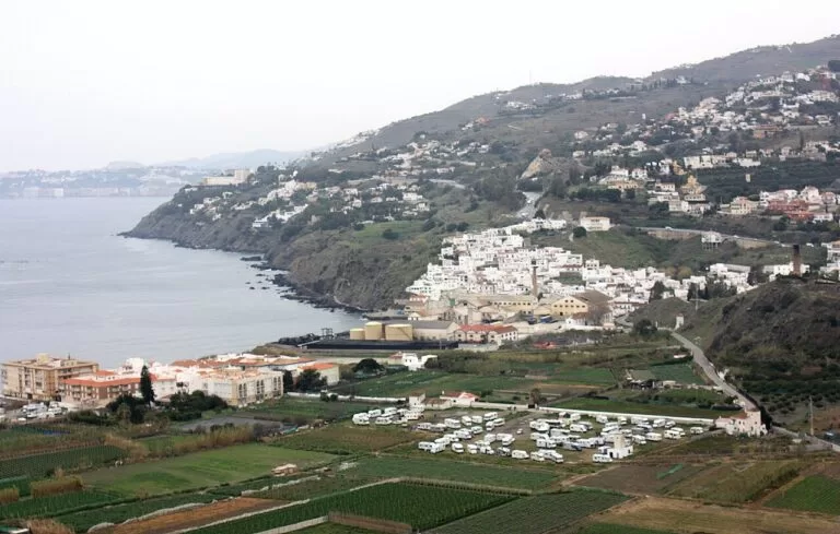
Costa Tropical
The whole coast of Granada province from La Herradura to La Rábita, with the map, the three areas and Granada inland.
Costa Tropical guide →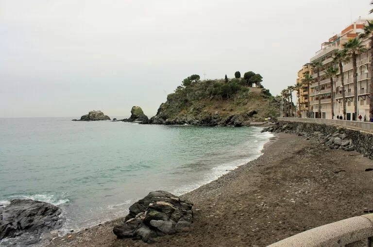
Almuñécar and La Herradura
The western stretch from the Cerro Gordo cliffs past the bay of La Herradura to Almuñécar, with the best-known coves.
Almuñécar and La Herradura guide →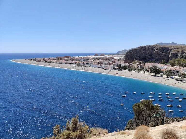
Salobreña, Motril and Calahonda
The long beaches of the middle coast: Salobreña under its castle, Motril, Torrenueva Costa, Carchuna and Calahonda.
Salobreña, Motril and Calahonda guide →Just west of Castell de Ferro, the middle area begins with Calahonda, about 6 km away, and Torrenueva Costa; the Charca de Suárez bird reserve and Salobreña Castle are about 16 and 21 km away. Inland, the nearest CostaMap campsite is Camping Trevélez in the Alpujarra.
Sources and freshness
Checked 9 November 2026. Andalucía.org (Junta de Andalucía tourism) on Castell de Ferro, Gualchos, Rubite, Polopos, Sorvilán, Albuñol, the castles of Castell de Ferro and La Rábita, the Gualchos heritage centre, the Museo Enológico de La Contraviesa and the beaches of El Sotillo, Cambriles, La Rijana, El Lance, Casarones, Castillo de Baños, La Mamola, Melicena, La Rábita, El Ruso, Cala Chilches and El Pozuelo. Spain.info on the Costa Tropical. Background: Spanish Wikipedia on Castell de Ferro, Gualchos, Rubite, La Mamola, Melicena, Sorvilán, La Rábita and Albuñol. Map data and straight-line distances: OpenStreetMap (ODbL). Not confirmed: bus routes and timetables, castle opening times, parking, beach lengths. Turismo de Granada (turgranada.es), Turismo Costa Tropical and the town hall sites of Gualchos, Polopos, Sorvilán and Albuñol could not be reached when we checked. Photos from Wikimedia Commons: La Mamola by Werner Wilmes (CC BY 2.0); Castell de Ferro castle by Rafax (public domain); Castell de Ferro beach by Feranza (CC BY-SA 4.0); Castell de Ferro and the Sierra de Lújar and La Rábita from the air by kallerna (CC BY-SA 4.0); La Rijana and Calahonda by Veinticuatro de Jahén (CC BY-SA 4.0); Salobreña and Almuñécar by Dguendel (CC BY 4.0).