
Costa Tropical · West
Almuñécar and La Herradura travel guide: coves, castles and diving
The western end of Granada’s coast: the cliffs and naturist beach of Cerro Gordo, the diving bay of La Herradura, and Almuñécar with its castle, Roman remains and a row of small coves.
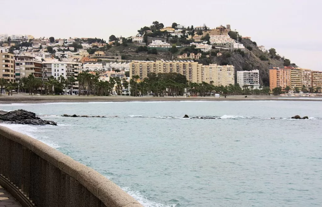
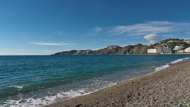
Almuñécar from the seafront · Photo: Dguendel, CC BY 4.0
Part of the Costa Tropical guide · West: Almuñécar and La Herradura
Almuñécar and La Herradura are the western end of the Costa Tropical, the coast of Granada province in Andalusia: one municipality with about 20 km of shoreline (spain.info) between the Maro–Cerro Gordo cliffs on the Málaga border and the coves east of Almuñécar towards Salobreña. Almuñécar is the town, with its castle, Phoenician and Roman sites and town beaches; La Herradura, 4 km west, is a beach village in a sheltered bay known for diving, with the villages of Jete and Otívar up the Río Verde valley behind.
At a glance
- Where the coast of Almuñécar municipality, Granada province, from Cantarriján beach on the Málaga border to the coves of Calabajío, Cabria and Curumbico east of Almuñécar town.
- Towns La Herradura, Marina del Este and Almuñécar on the coast; Jete and Otívar inland in the Río Verde valley.
- Best for diving and snorkelling, small gravel coves, a naturist beach, a walkable old town with a castle and Roman ruins, and tropical-fruit valleys.
- Getting there Granada airport (GRX) is about 50 km from Almuñécar and Málaga airport (AGP) about 72 km, both in a straight line; ALSA intercity buses stop in Almuñécar and La Herradura.
- On CostaMap the Almuñécar town guide, the Castle of San Miguel, the Peñón del Santo, La Herradura, Marina del Este, Cantarriján beach and the Maro–Cerro Gordo cliffs.
Map of Almuñécar and La Herradura
The map shows the places on this stretch that have a CostaMap page. Tick a place type to filter, and click a marker to see the place in the panel.
Place type
Area · next level
 Area map
Almuñécar and La Herradura
Click a marker to see the place here. From the Cantarriján cliffs and the bay of La Herradura to Almuñécar and its eastern coves.
Towns and villagesTowns and villages
From west to east, then inland. All of them belong to the municipality of Almuñécar except Jete and Otívar, which are their own municipalities.
La Herradura
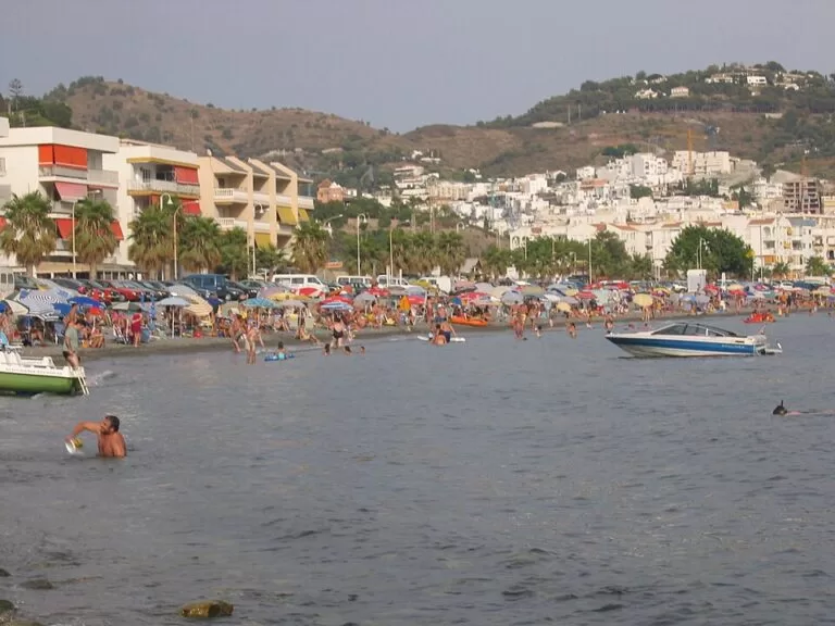
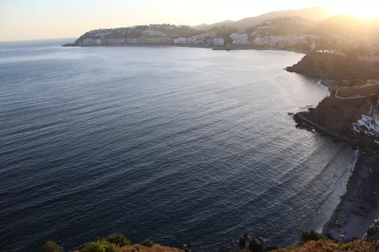
La Herradura is Almuñécar’s second population centre, a village behind a horseshoe-shaped bay closed by Cerro Gordo to the west and the Punta de la Mona to the east, which make it a natural harbour (Andalucía.org). Spain.info calls the bay a major centre for scuba diving, with a sub-aquatic reserve of artificial reefs (spain.info). On 19 October 1562 a Spanish fleet sheltering here was wrecked by a sudden southerly storm; Andalucía.org estimates about 5,000 dead. Charles III ordered the Castillo de La Herradura in 1764 against pirates, and it now houses an interpretation centre on the wreck (Andalucía.org). See our new La Herradura guide.
Marina del Este and the Punta de la Mona
On the east side of the Punta de la Mona headland, the small marina of Marina del Este fits its quays into the rocks, with restaurants serving fish and seafood (Andalucía.org). Beside it, Los Berengueles is a small, busy beach used mostly by people from the housing estates on the headland (Andalucía.org). It is the second base for diving and boat trips after La Herradura itself, about 1.4 km from the village in a straight line. See our Marina del Este guide.
Almuñécar
Almuñécar, with about 27,500 residents (INE 2025, via our Almuñécar town guide), is the main town of this stretch and one of the oldest on the coast. Spain.info says the Phoenicians founded it around 800 BC; its old name was Sexi, and it was taken by the Catholic Monarchs in 1489 (spain.info). The old quarter climbs to the Castle of San Miguel, built over a Roman fortress (Andalucía.org). Andalucía.org notes that the Umayyad prince Abd al-Rahman I landed here in 755 before founding the emirate of Córdoba. On the seafront, the Peñón del Santo splits the town beach in two, and the Roman fish-salting factory in El Majuelo park, the aqueduct and the archaeological museum in the Cueva de Siete Palacios are all within walking distance.
Jete
Jete lies on the road that follows the Río Verde inland from Almuñécar into the Sierra del Chaparral, between the Guájares and Almijara ranges, about 7 km north of Almuñécar in a straight line. Andalucía.org describes a small village without new building around it, with a 16th–17th-century parish church and the hermitage of the Virgen de Bohíjar; its land has turned to early fruit and tropical crops (Andalucía.org). There is no CostaMap page for Jete yet.
Otívar
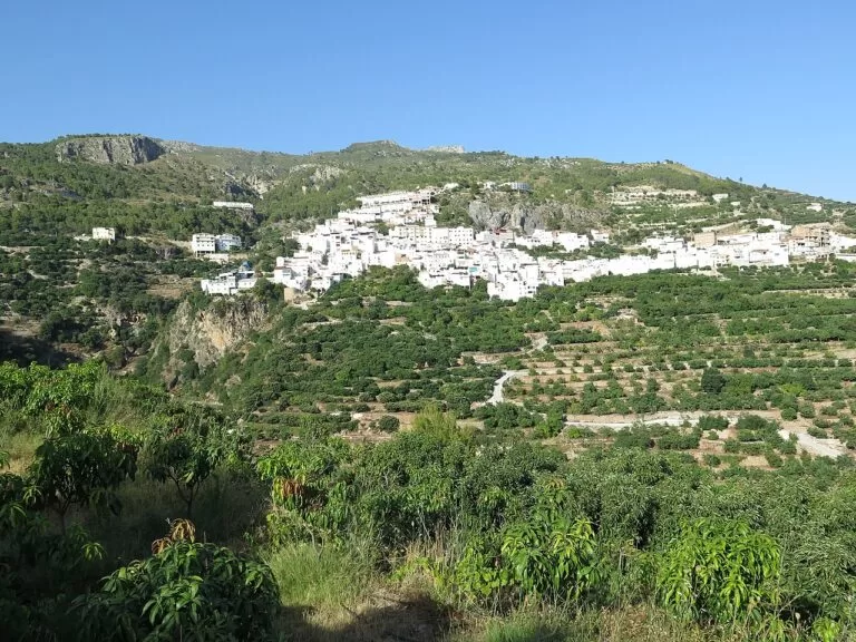
Further up the same valley, about 9 km from Almuñécar, Otívar has a parish church with a Mudéjar wooden ceiling and the Casa Principal de Cázulas (Andalucía.org). In the Peninsular War its mayor, Juan Fernández Cañas, known as “el tío Caridad”, organised guerrilla resistance to the French. Otívar is one of the Granada municipalities of the Sierras of Tejeda, Almijara and Alhama Natural Park (Junta de Andalucía, as cited in our Almuñécar guide), so it is the way in to the mountains from this coast. There is no CostaMap page for Otívar yet.
Beaches and coves
West to east. Descriptions and services are from the beach listings on Andalucía.org, Andalusia’s official tourism site. Most beaches here are dark gravel or pebbles, so bring water shoes.
Cantarriján
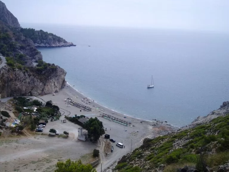
A small, fairly busy naturist beach with a complicated access, at the bottom of a ravine on the Málaga border inside the Maro–Cerro Gordo cliffs; lifeguards, toilets and shade are listed (Andalucía.org).
See the Cantarriján guide →La Herradura
An urban family beach of dark gravel in the sheltered bay, with a promenade, lifeguards, adapted toilets, amphibious chairs and a diving zone (Andalucía.org).
See the La Herradura guide →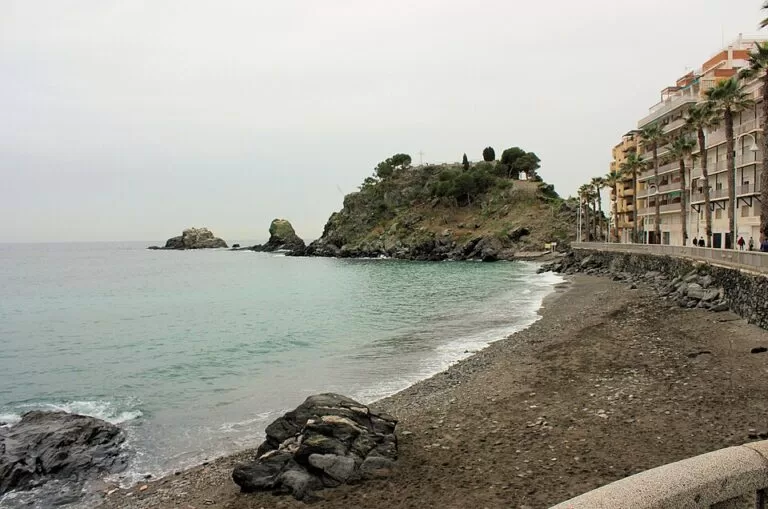
San Cristóbal and Puerta del Mar
The two town beaches either side of the Peñón del Santo: San Cristóbal is about 1 km long with a promenade, Puerta del Mar an extensive beach with a good level of services; both have lifeguards (Andalucía.org).
See the Peñón del Santo guide →- Los Berengueles – a small beach next to Marina del Este, busy with residents of the nearby estates (Andalucía.org).
- El Muerto and Cotobro – Cotobro is a narrow beach below a hillside of scattered houses; El Muerto, a main beach and a small cove joined by a footpath, is reached from Cotobro and is one of the coast’s naturist beaches (Andalucía.org, Andalucía.org).
- Velilla – a fairly long beach east of the centre, heavily built up behind and with every service (Andalucía.org).
- El Tesorillo – small and very busy, in a built-up area (Andalucía.org); spain.info points to the Moorish watchtower on its beach.
- Calabajío, Cabria and Curumbico – a row of small beaches in the least built-up part of Almuñécar, with moderate crowds; spain.info calls Calabajío’s shallow water ideal for children (Andalucía.org, spain.info).
Things to do
Nature: cliffs, reefs and seagrass
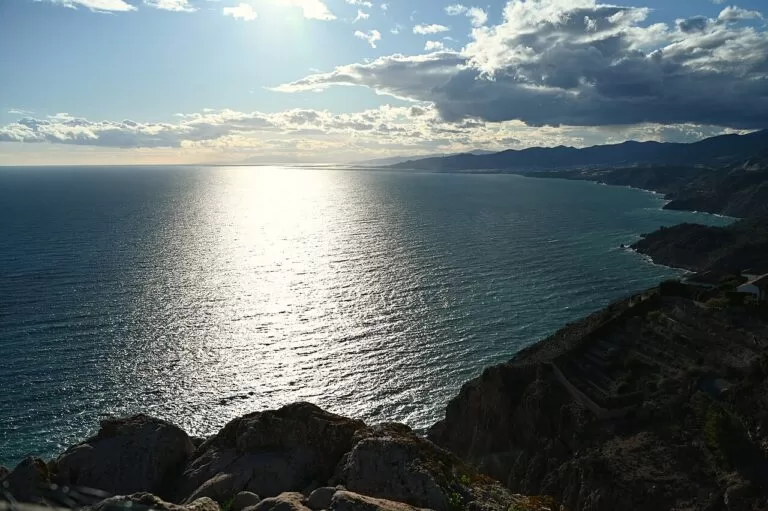
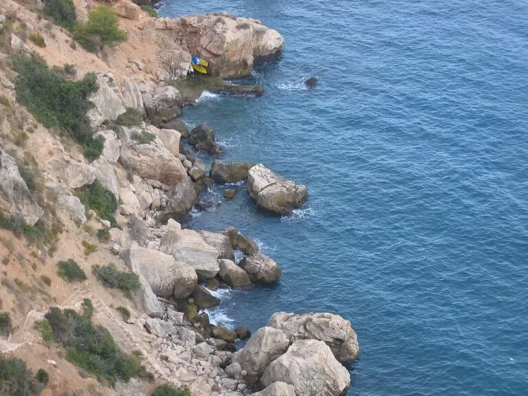
The Maro–Cerro Gordo cliffs are a protected strip 12 km long that reaches one nautical mile out to sea, with cliffs up to 75 m high, Posidonia and Zostera meadows and colonies of orange coral, a species listed as vulnerable (Andalucía.org). The three rocks of the Peñones de San Cristóbal in Almuñécar are a Natural Monument, with orange coral and anemones on their underwater walls (Andalucía.org). Divers base themselves in La Herradura and at Marina del Este; spain.info describes artificial reefs in the bay that imitate sunken galleons (spain.info).
History: Phoenicians, Romans and a castle
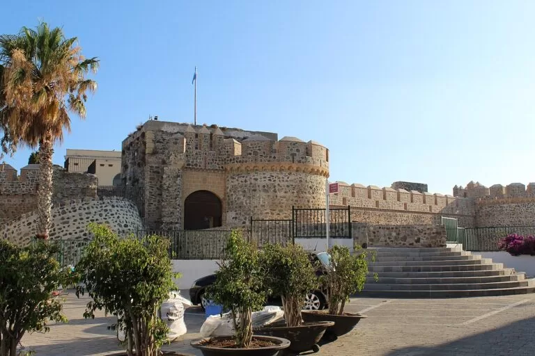
Almuñécar’s Roman fish-salting factory in El Majuelo worked from the late 5th century BC to the 4th century AD; salted fish went out in amphorae to Carthage, Rome and Corinth, and more than 700 coins were found in its south sector (Andalucía.org). The Roman aqueduct survives in several stretches; its fourth section, about 72 m long, is the most striking, and the stretches are open-air and lit at night (Andalucía.org). The archaeological museum sits in the Cueva de Siete Palacios, a 1st-century Roman vaulted building; its best-known piece is an Egyptian canopic jar with the name of the pharaoh Apophis I (Andalucía.org). Above it all, the Castle of San Miguel has a wide moat and towers of different shapes (Andalucía.org).
Food and family days
Spain.info recommends rice dishes such as arroz a banda, fried fish, sardine skewers, langoustines and kid with garlic, and the Moorish-origin sweet cazuela mohína, made with almonds, sugar, aniseed and pumpkin (spain.info). El Majuelo park has 182 species of tropical plants (Andalucía.org). The Almuñécar aquarium has 18 tanks and a one-million-litre oceanarium above a 17 m tunnel; the regional listing gives €12 for adults and €9 for children and over-65s, without a date (Andalucía.org).
Where to stay by town
The two coastal bases, west to east. Hotel names are not listed here.
La Herradura
A village on a sheltered bay with the beach at the door, closest to Cantarriján, the Cerro Gordo cliffs and the dive centres. Quieter than Almuñécar, with buses to town.
Divers and snorkellersAlmuñécar
The town base: castle, museums, El Majuelo and two town beaches on foot, the bus station for Granada and Málaga, and the most open out of season. Choose the San Cristóbal side for the old town, Velilla for longer beaches.
First visit, no carGetting there and around
By air
Granada airport (GRX) is about 50 km from Almuñécar and Málaga airport (AGP) about 72 km, in a straight line (OurAirports via our Costa Tropical guide); road distances are longer.
By bus
Almuñécar’s bus station is on Avenida del Rey Juan Carlos I, at the entrance to the town (Andalucía.org). OpenStreetMap maps ALSA routes between Málaga and Motril with stops in La Herradura, and urban lines 2A and 2B between Almuñécar and La Herradura. Check timetables before you travel.
By car
The old N-340 runs along the coast from Nerja through the Cerro Gordo tunnel to La Herradura and Almuñécar; the road to Jete and Otívar follows the Río Verde inland (Andalucía.org). In Almuñécar’s old town, park low down and walk up.
Tourist information: Almuñécar tourist office in the Palacete de La Najarra, a 19th-century neo-Arab villa on Avenida Europa, +34 958 631 125 (Andalucía.org); La Herradura information point, Paseo Andrés Segovia 5, +34 958 618 636 (Andalucía.org).
A two-day route
West to east, with a night in La Herradura or Almuñécar. A car helps for Cantarriján and the Río Verde valley.
Day 1
Cerro Gordo, Cantarriján and La Herradura
Start at the Mirador de Cerro Gordo above the cliffs, then go down to Cantarriján for a swim; check access rules first. In the afternoon, snorkel or take a dive in La Herradura bay, visit the Castillo de La Herradura and its 1562 shipwreck centre, and end with fish at Marina del Este.
Day 2
Almuñécar old town and the Río Verde
Climb the Peñón del Santo for the view, then walk to El Majuelo, the Castle of San Miguel and the Cueva de Siete Palacios museum. After lunch, drive up the Río Verde to Jete and Otívar, or stay on the coast and swim at Calabajío or Cabria.
FAQ
Is La Herradura part of Almuñécar?
Yes. La Herradura is a village of Almuñécar municipality and its second population centre, about 4 km west of the town on its own bay.
Almuñécar or La Herradura: where should I stay?
Almuñécar for sights, shops, buses and a town that stays open all year; La Herradura for a quieter beach village, diving and the cliffs of Cerro Gordo.
What are the best beaches in Almuñécar?
San Cristóbal and Puerta del Mar for a town beach with services, Velilla for length, Calabajío for shallow water and children, and Cabria and Curumbico for quieter coves. Most are gravel or pebbles.
Is there a nudist beach near Almuñécar?
Yes: Cantarriján, west of La Herradura on the Málaga border, and El Muerto, reached from Cotobro beach. Clothing is optional, not required.
Is La Herradura good for diving?
Yes. Spain.info calls the bay a major scuba-diving centre with a sub-aquatic reserve, and the marine strip of the Maro–Cerro Gordo cliffs has seagrass meadows and orange coral.
How far is Almuñécar from Granada and Málaga?
Granada city is 69.9 km by road (SIMA figure in our Almuñécar guide); Granada airport is about 50 km and Málaga airport about 72 km away in a straight line.
Other areas of the Costa Tropical
Costa Tropical
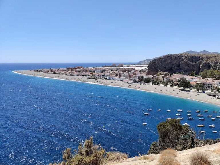
The whole coast of Granada province from La Herradura to La Rábita, with the map, the three areas and Granada inland.
Costa Tropical guide →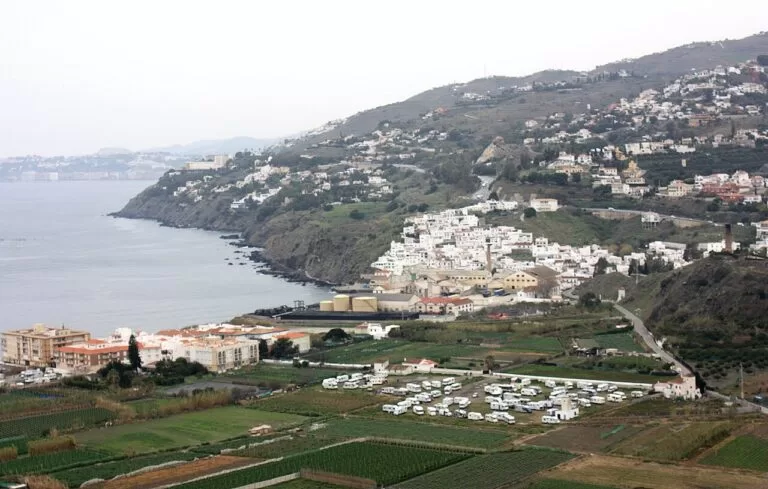
Salobreña, Motril and Calahonda
The long beaches: Salobreña under its castle, Motril’s Poniente and Playa Granada, Carchuna and Calahonda.
Salobreña, Motril and Calahonda guide →
Castell de Ferro to La Rábita
Villages and coves at the eastern end, with castles at Castell de Ferro and La Rábita.
Castell de Ferro to La Rábita guide →West of Cantarriján, in Málaga province, the coast continues as the Costa del Sol: Nerja is about 12 km from La Herradura in a straight line, and the Axarquía coast and Nerja guide covers it. Salobreña’s castle, the Castillo de Salobreña, is about 9.5 km east of the Peñón del Santo.
Sources and freshness
Checked 9 November 2026. Andalucía.org (Junta de Andalucía tourism) on Almuñécar, La Herradura, Jete, Otívar, the Castillo de La Herradura, the Castle of San Miguel, Marina del Este, the Peñones de San Cristóbal, the Maro–Cerro Gordo cliffs, El Majuelo factory, El Majuelo park, the aqueduct and baths, the Cueva de Siete Palacios museum, the aquarium, the bus station, the tourist office and the La Herradura information point, and the beach listings for Cantarriján, La Herradura, Los Berengueles, El Muerto, Cotobro, San Cristóbal, Puerta del Mar, Velilla, El Tesorillo, Calabajío and Cabria. Spain.info (Turespaña) on Almuñécar, La Herradura and the Costa Tropical. Population and road distance to Granada: INE and SIMA, as cited in our Almuñécar guide. Map data, bus routes and straight-line distances: OpenStreetMap (ODbL). Not confirmed: bus timetables, summer access rules at Cantarriján, castle and museum hours and prices. Turgranada, Almuñécar’s tourism website and ALSA could not be reached when we checked. Photos from Wikimedia Commons: Almuñécar seafront and the Peñón del Santo by Dguendel (CC BY 4.0); La Herradura and Cerro Gordo by jlpino (CC BY 3.0); Cantarriján by Por los caminos de Málaga (CC BY 2.0); Otívar, Playa de Cabria, the Castle of San Miguel and Calahonda by Veinticuatro de Jahén (CC BY-SA 4.0); Playa San Cristóbal by José Luis Filpo Cabana (CC BY 3.0); Maro–Cerro Gordo cliffs by Krzysztof Ziarnek, Kenraiz (CC BY-SA 4.0); Salobreña by Dguendel (CC BY 4.0); Castell de Ferro by Feranza (CC BY-SA 4.0).