
Marina del Este (La Herradura, Almuñécar)
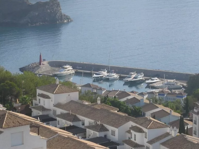
MarinaMarina del Este is the small marina of La Herradura, in the municipality of Almuñécar on the Costa Tropical (Granada), tucked into the east side of the Punta de la Mona headland. You reach it by car on the Avenida Marina del Este, which climbs over the headland from La Herradura, or by Almuñécar’s town bus, which stops above the port. Andalusia’s tourist board describes a marina of original design that fits its quays into the rocky coast. It suits divers, snorkellers, boat owners and anyone who wants a seafood lunch by the water. Skip it if you want a long beach or a big resort port with shops: it is compact and set below steep cliffs.
Quick facts
- Names: Marina del Este, Puerto Deportivo Marina del Este, or Puerto de Punta de la Mona after the headland it shelters behind.
- Where: Avenida Marina del Este, Torre de Control Puerto Deportivo s/n, La Herradura, Almuñécar (Granada), according to the Andalusia tourist board.
- Coordinates: 36.7267, -3.7263.
- Boats: the tourist board lists lengths of 8 to 30 m, a basin depth of 3 to 6.5 m, a harbour mouth 4 m deep and an entrance 45 m wide.
- Berths: we could not reach the operator’s website, so we do not give a berth number here.
- Contact: +34 958 640 801, marinaeste@marinasmediterraneo.com (tourist board listing).
- Services listed: harbour office, fuel station, electricity, showers, toilets, crane, dry storage, parking, bar, restaurant and car hire.
- Entry: the quays are open to walkers and we found no entry charge.
Access and parking
By car: from La Herradura village, follow the seafront Paseo Andrés Segovia west along the bay to the Avenida Marina del Este, which climbs over the Punta de la Mona and drops down to the port, about 1.3 km from the village church in a straight line. The road passes residential estates on the headland, so drive slowly.
Parking: OpenStreetMap shows a row of very small car parks on the quay itself, with 2 to 18 spaces each, and a surface car park with about 50 spaces 0.34 km south of the port, near the beach. In summer the quay spaces fill early; we could not confirm whether any of them are reserved for berth holders, so read the signs.
By bus: the urban bus network of Almuñécar (Autobuses Urbanos de Almuñécar) has a stop called “Puerto Deportivo Marina del Este” about 0.3 km south of the port and two “Marina del Este (Best Alcázar)” stops about 0.45 km to the west, according to OpenStreetMap. Check the town’s current timetable before you rely on it.
By sea: the tourist board gives the position of the breakwater head as 36° 43′ 41.04″ N, 3° 43′ 32.39″ W, with a red light, on nautical chart 456. OpenStreetMap shows a Repsol fuel berth with diesel and petrol near the entrance. Call the harbour office before arriving.
What to expect
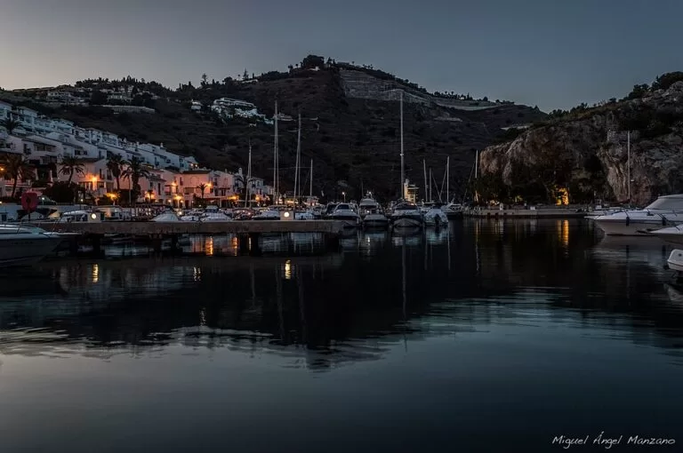
The marina is small and enclosed by rock. In the tourist board’s words it combines “the harmony of the quays with the whims” of the rocky coast, in a natural setting between sea and mountain, with restaurants serving Mediterranean food, fish and seafood (Andalusia tourist board). Spanish Wikipedia places it in the Ensenada de los Berengueles, on the east face of the Punta de la Mona.
Around the basin, OpenStreetMap shows:
- Dive centres: Buceo La Herradura on the quay and Nerja Dive Resort just south of the port.
- Boat hire: Alborán Náutica & Charters on the quay.
- Food: several restaurants and bars on the quay, including El Barco, Salazón and Pizzería Altamar, and a small supermarket (Mi Puerto Market).
- The beach: just south of the port. The national tourism portal spain.info lists it as Playa Marina del Este: 250 m long and 40 m wide, dark sand and gravel, calm water, with sunbed and sunshade hire, boat hire, toilets and showers. OpenStreetMap names it Playa de los Berengueles.
- Viewpoints: the Mirador del Peñón del Lobo 0.5 km to the north-east, and the Punta de la Mona lighthouse 0.6 km to the south-west, high on the headland.
Spain.info says the beach is one of the most popular on this stretch, with families and snorkellers, and that the Ensenada de los Berengueles is a reference point for divers, because its cliffs are full of small caves where you can watch marine life.
Prices and opening
The quays and the beach are free to visit. For berth rates, fuel hours and the harbour office’s hours, contact the marina on the number above; we could not check them with the operator, so we do not print them. Dive centres, boat hire firms and restaurants set their own prices and hours. Beach services such as sunbeds run in the season.
Accessibility and safety
The tourist board marks the marina as accessible for people with disabilities, but we could not confirm step-free routes onto the pontoons, which are for berth holders. The access road over the headland is steep and winding. The water off the cliffs is popular with divers and snorkellers, so watch for boats near the harbour mouth and swim only at the beach, never inside the port. Keep children away from the quay edges.
Best time to visit
Spring, summer and autumn suit sailing and diving; the tourist board lists those three seasons for the marina. In July and August the small car parks fill quickly, so arrive in the morning or come by bus. Out of season it is quieter; check that the restaurant you want is open before you drive over the headland.
Nearby alternatives
- Castle of San Miguel, 3 km away: the castle above the old town of Almuñécar.
- Maro–Cerro Gordo Cliffs Natural Park, 7.2 km away: the protected cliffs and coves to the west.
- Caves of Nerja, 11.3 km away.
- Castillo de Salobreña, 12.3 km away: the Moorish castle above Salobreña.
- Nerja, 13.3 km away: the town and its Balcón de Europa.
- Balcón de Europa, 13.4 km away: the viewpoint in the centre of Nerja.
Distances are in a straight line from the marina.
FAQ
Where is Marina del Este?
In La Herradura, part of Almuñécar (Granada), on the east side of the Punta de la Mona headland at the west end of the bay. Coordinates: 36.7267, -3.7263.
Is there parking at Marina del Este?
Yes, but little. OpenStreetMap shows several small car parks on the quay and a car park with about 50 spaces 0.34 km south, near the beach. In summer, arrive early or take the town bus.
Can you swim at Marina del Este?
Not in the harbour, but there is a small beach just south of it: 250 m of dark sand and gravel with calm water, according to spain.info. It is popular with snorkellers.
Can you dive at Marina del Este?
Yes. Spain.info calls the Ensenada de los Berengueles a reference for divers, and OpenStreetMap shows two dive centres at the port.
How big are the boats Marina del Este can take?
The Andalusia tourist board lists boat lengths of 8 to 30 m and a basin depth of 3 to 6.5 m. Confirm with the harbour office before arriving.
Sources and freshness
Checked 6 November 2026 · 5 sources Show
Checked 6 November 2026. Official: Andalusia tourist board, Puerto Deportivo Marina del Este (description, address, contact, dimensions, services, seasons, breakwater position); spain.info, Playa Marina del Este (beach size, services, snorkelling and diving). Background: Wikipedia, Marina del Este. Location, car parks, bus stops, fuel berth, businesses on the quay and distances: OpenStreetMap (OpenStreetMap contributors, ODbL). The marina operator’s website could not be reached for this update. Photos: Wikimedia Commons, licences as credited.
How this page is made. CostaMap is written with an AI editorial system run by Ebizapple. This page is based on the sources listed above. Last updated 6 November 2026. Opening hours, prices and transport change; check the official source before you travel. How we work · Partner links and ads