
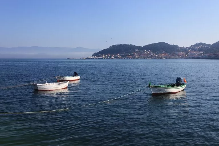
Muros is a fishing town on the north shore of the Ría de Muros e Noia in A Coruña province, Galicia, 71 km by road from Santiago de Compostela. Its old town of arcaded stone houses along the harbour has been a protected historic site since 1970, and the granite hump of Monte Louro and the beaches of Louro lie a few kilometres west. You reach it by car on the AC-550 coast road, which links Noia with Carnota and the Costa da Morte. It suits travellers who like walking old harbour streets, seafood and quiet beaches; skip it if you want a resort with nightlife and big hotels.
Quick facts
- Names: Muros in both Galician and Spanish. Not to be confused with Muros de Nalón in Asturias.
- Where: north shore of the Ría de Muros e Noia, at the foot of Monte Louro; one of five municipalities of the Ría de Muros e Noia tourist area with Outes, Noia, Lousame and Porto do Son (Turismo de Galicia).
- Coordinates: 42.7764, -9.0592 (old town, Turismo de Galicia).
- Protection: Historic-Artistic Site since 1970 and Property of Cultural Interest (Spain.info).
- Coastline: 25 km in the municipality, with broad beaches.
- Distances (straight line): Noia 14 km, Carnota beach 7 km, Castro de Baroña 9.4 km, Cape Finisterre 21 km.
Getting there and parking
By car: Spain.info gives 71 km from Santiago de Compostela. The usual way is through Noia and then west along the AC-550, the road that Turismo de Galicia uses as the boundary of the Monte Louro protected area. The same road continues north to Carnota and the Costa da Morte.
Parking: we could not find official parking information. The old town is a tight grid of narrow streets, so park on the edge and walk in.
By bus: we could not confirm routes or timetables.
What to see in Muros
Turismo de Galicia calls Muros “an unexpected mix of popular and elegant architecture”, where old fishermen’s houses stand beside Gothic mansions. According to Spain.info, the town was protected for its original street plan, which is still intact.
- The sea arcades: the typical Muros house is built of large stone blocks, with arcades on the ground floor and continuous balconies above. Fishing tackle was hung and fish salted under the arcades.
- Praza de Santa Rosa and the Pescadería Vella: two squares between Rúa Real, Rúa Axesta and the seafront Paseo da Mariña. Santa Rosa has a stone cross from 1789; the old fish market square has a stone fountain and many taverns.
- Civic buildings: the town hall, the Mercado de Abastos food market and the Don Diego arch. Turismo de Galicia also names the Casa Caldeirón, Casa Anido and Casa Romaní, and lists the 20th-century Teatro Mercedes.
- Church of San Pedro: the former collegiate church of Santa María, dated by Turismo de Galicia to the 12th and 14th centuries.
- Santuario da Virxe do Camiño: a 14th-century sanctuary on the north side of town, with a stone cross in front.
- Tide mill: the Muíño de Marea do Pozo do Chacón was driven by the ebb and flow of the tide. Turismo de Galicia calls it one of the few in Galicia and one of the largest in Spain.
Monte Louro and the beaches
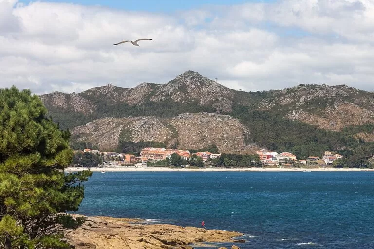
West of town, Monte Louro rises to 241 m at the northern point of the ría mouth, with two humps of granite that seem to come straight out of the sea (Turismo de Galicia). The protected area of Monte and Lagoa de Louro covers 1,160.88 hectares in Muros and Carnota, 491 of them sea.
- Area Maior (Louro beach): about 1,400 m of fine sand, open to the sea (Turismo de Galicia). Its dunes close off the As Xarfas lagoon, a wetland where herons feed.
- Ancoradoiro (Lariño): a small beach of about 100 m with a pine grove and a lighthouse next to it; the water is cold and the sea lively.
- Inside the ría: Turismo de Galicia also names San Francisco, O Testal, Boa and A Aguieira among the beaches of the Ría de Muros e Noia.
- Cabo Uía: a headland with views of the islands of A Creba and Illa Vella.
The Monte Louro lighthouse stands on the point below the mountain (OpenStreetMap).
Festivals
The Gran Premio de Carrilanas, held in Esteiro east of the town, is declared a Galician Tourist Event (Turismo de Galicia). We could not confirm the 2027 date.
Accessibility and safety
The old town has stone paving and narrow lanes; we could not confirm step-free routes. The open beaches at Louro face the Atlantic: we found no official lifeguard information, so swim only in calm sea. Monte Louro is rocky; keep to paths.
Best time to visit
Late spring to early autumn for the beaches; the old town works year round. Avoid stormy days for Monte Louro and the open beaches.
Nearby alternatives
- Carnota Beach, 7 km away: a 7 km Atlantic beach with dunes and marsh below Monte Pindo.
- Castro de Baroña, 9.4 km away across the ría: an Iron Age hill fort on a rocky point.
- Ézaro Waterfall, 15.9 km away: the River Xallas falls into the sea below Monte Pindo.
- Cape Finisterre, 21 km away: the lighthouse headland at the end of the Camino.
- Corrubedo Dunes Natural Park, 22 km away: the largest shifting dune in Galicia.
FAQ
Is Muros worth visiting?
Yes, if you like historic fishing towns. Its old town has been a protected historic site since 1970 for its intact street plan and arcaded stone houses, and Monte Louro and its beaches are a few kilometres away.
How far is Muros from Santiago de Compostela?
71 km, according to Spain.info. The usual road goes via Noia and the AC-550.
What are the best beaches near Muros?
Area Maior at Louro, about 1.4 km long below Monte Louro, and the small Ancoradoiro beach with its pine grove. Carnota beach is 7 km north in a straight line.
What is the Muros tide mill?
The Muíño de Marea do Pozo do Chacón, a mill powered by the tides, which Turismo de Galicia calls one of the largest in Spain.
Is there parking in Muros?
We found no official information. The old town has narrow streets, so leave the car on the edge and walk in.
Sources and freshness
Checked 9 November 2026 · 9 sources Show
Checked 9 November 2026. Spain.info: Muros; Turismo de Galicia on the Ría de Muros e Noia tourist area, the Ría de Muros e Noia, Monte e Lagoa de Louro, the Vila de Muros historic ensemble, the Santuario da Virxe do Camiño and the beaches of Area Maior and Ancoradoiro. Map data and distances: OpenStreetMap. Not confirmed: parking, buses, lifeguards, tide mill opening times and festival dates.
How this page is made. CostaMap is written with an AI editorial system run by Ebizapple. This page is based on the sources listed above. Last updated 9 November 2026. Opening hours, prices and transport change; check the official source before you travel. How we work · Partner links and ads