
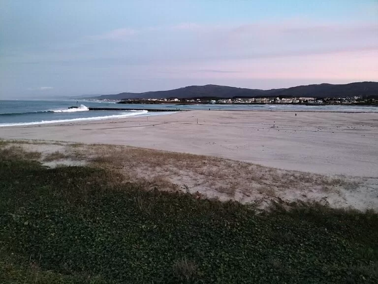
Foz is a beach town at the mouth of the River Masma on the Lugo coast of Galicia, in the Mariña, with almost 15 km of fine sandy beaches along its ría and coast and the basilica of San Martiño de Mondoñedo, which Turismo de Galicia calls Spain’s oldest cathedral, about 4 km inland. It lies on the N-642 coast road, about 8 km west of Cathedrals Beach and 18 km west of Ribadeo in a straight line, with a bus station 400 m from the town hall. It suits families and surfers who want long beaches; skip it if you are after a historic walled town.
Quick facts
- Names: Foz in both Galician and Castilian; Spanish Wikipedia says the name comes from the Latin fauces, the mouth of the river.
- Where: municipality of Foz, A Mariña Central, province of Lugo, Galicia, on the Ría de Foz at the mouth of the Masma.
- Coordinates (town hall): 43.5685, -7.2598.
- Population: 10,329 in 2025 (INE, via Spanish Wikipedia); the municipality covers 100.6 km².
- History: in the 16th and 17th centuries Foz had an important port, one of the three main shipyards of Galicia and a fleet that hunted whales (Spanish Wikipedia). Turismo de Galicia puts it this way: yesterday’s whale hunters are today’s wave hunters.
- Landmarks: the basilica of San Martiño de Mondoñedo and the Iron Age coastal hill fort of Fazouro, both listed as Assets of Cultural Interest (Turismo de Galicia).
- Main events: O Carme on 16 July and the patron saint festival of San Lourenzo on 10 August, a Galician Festival of Tourist Interest.
Getting there and parking
By car: Turismo de Galicia gives the access as the N-642 (Ribadeo–San Cibrao) along the coast and the N-634 from Mondoñedo.
By bus: OpenStreetMap places the Foz bus station about 400 m north of the town hall. We could not confirm current routes and times.
By train: OpenStreetMap shows two stops on the coast railway: Marzán, about 1 km north-west of the town hall, and Foz, about 1.3 km south-west.
Parking: OpenStreetMap marks several free surface car parks in the centre, the nearest about 250 m from the town hall, more near the harbour and A Rapadoira, and street-side parking behind Llas beach.
Beaches
Turismo de Galicia counts almost 15 km of beaches with fine white sand along the ría. The Ruta da Mariña says A Rapadoira, Llas and Peizás and the rock formations along the coast, including the “Eye of Foz”, can all be reached from the centre on foot or by bike along the seafront path, which is part of the Natural Path of the Cantabrian.
- A Rapadoira, about 900 m east of the town hall at the mouth of the ría: 270 m of fine sand, sheltered, Blue Flag (Turismo de Galicia).
- Llas, about 1.2 km north: 760 m of fine sand on the open sea, Blue Flag (Turismo de Galicia).
- Arealonga, further west towards Fazouro: 850 m of fine sand on the open sea (Turismo de Galicia).
- O Altar, on the right bank across the mouth of the ría in Barreiros, closes the ría opposite A Rapadoira.
Turismo de Galicia calls the ría a natural paradise for surfing, windsurfing, kitesurfing, canoeing and sailing. We could not confirm lifeguard seasons; swim only where flags show it is safe.
What to see
San Martiño de Mondoñedo. In the parish of San Martiño, about 4 km south-west of the town hall in a straight line, the basilica is described by Turismo de Galicia as Spain’s oldest cathedral and the first built in southern Europe, dating from the 6th century and transformed between the 10th and 13th centuries. The Ruta da Mariña calls it a Romanesque gem and the original seat of the diocese of Mondoñedo. Spanish Wikipedia says it was a bishop’s see from 870 to 1112, and that it has carved capitals and corbels and wall paintings from the 14th to 16th centuries. We could not confirm opening hours.
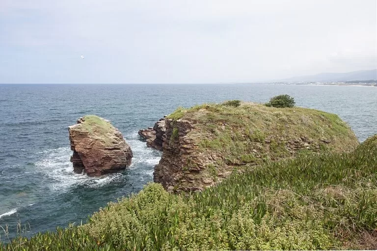
Castro de Fazouro. About 5 km north-west, this hill fort stands at the foot of the cliffs on a coastal promontory east of Arealonga beach. Spanish Wikipedia dates it to the 2nd century BC, with an area of about 700 m², one of the sea-front hill forts of north-west Iberia.
The port and the old fishing quarter. The harbour and marina sit at the mouth of the ría. In July, for the Carme festival, the streets of the fishing quarter are carpeted with flowers for the procession, followed by a large sardine feast (Spanish Wikipedia).
Nature and birds
The Ría de Foz-Masma is a Natura 2000 area of 575.17 hectares. Turismo de Galicia describes the estuary as an internationally famous migration and resting point for birds; its marshes hold one of the largest marine bird colonies of north-west Spain, with gulls, shearwaters and gannets nesting on the nearby cliffs. The Masma, 46.2 km long, is one of the best salmon rivers in Galicia. For a view, the Pico da Frouxeira, a 427-metre rock in the municipality, carries the remains of a late medieval fortress linked to Marshal Pardo de Cela and looks over the ría (Turismo de Galicia).
Accessibility and safety
We could not confirm step-free access to the beaches or the seafront path. Llas and Arealonga face the open sea and can have strong waves; A Rapadoira is more sheltered. The Fazouro hill fort sits on a cliff-foot promontory: watch your footing on the rocks.
Best time to visit
July and August for the beach season, the Carme festival on 16 July and San Lourenzo on 10 August; Spanish Wikipedia also describes a Viking-themed Festa Normanda, held since 2011, in late August. Spring and autumn suit birdwatching on the ría and visits to San Martiño.
Nearby alternatives
- Cathedrals Beach, about 8 km east: rock arches walkable at low tide; free booking in summer and Holy Week.
- Rinlo Costa Camping, about 12 km east: campsite near the fishing village of Rinlo.
- Ribadeo, about 18 km east: estuary town on the Asturian border.
- Camping A Camposa, about 21 km north-west: campsite on the coast.
- Viveiro, about 29 km west: walled old town and the Porta de Carlos V.
Distances are in a straight line from the town hall. For the whole stretch see our Rías Altas and A Mariña guide.
FAQ
What are the best beaches in Foz?
A Rapadoira, a sheltered Blue Flag beach by the town, and Llas, 760 m of open sand with a Blue Flag. Both are on the seafront path from the centre.
Where is the oldest cathedral in Spain?
Turismo de Galicia gives that title to San Martiño de Mondoñedo, in the municipality of Foz, about 4 km from the town, dating from the 6th century.
Is there parking in Foz?
Yes. OpenStreetMap shows several free car parks in the centre and near A Rapadoira, and street parking behind Llas beach.
Can you surf in Foz?
Yes. Turismo de Galicia lists surfing, windsurfing and kitesurfing on the ría, and the open beaches west of the town face the swell.
How far is Foz from Cathedrals Beach?
About 8 km east in a straight line, along the N-642 coast road.
Sources and freshness
Checked 9 November 2026 · 12 sources Show
Checked 9 November 2026. Official: Turismo de Galicia, Ría de Foz (beaches, birds, water sports, San Martiño), Ría de Foz-Masma protected area, A Rapadoira, Llas and Arealonga beaches, Basílica de San Martiño, Castro de Fazouro, the Ruta da Mariña, the Ribadeo to Pico da Frouxeira route and Mariña Lucense (San Lourenzo). Background: Spanish Wikipedia (name, population, history, San Martiño, Fazouro, festivals). The town hall website could not be reached. Town hall, bus station, train stops, car parks and distances: OpenStreetMap contributors (ODbL). Photos: Wikimedia Commons, licences as credited.
How this page is made. CostaMap is written with an AI editorial system run by Ebizapple. This page is based on the sources listed above. Last updated 9 November 2026. Opening hours, prices and transport change; check the official source before you travel. How we work · Partner links and ads