
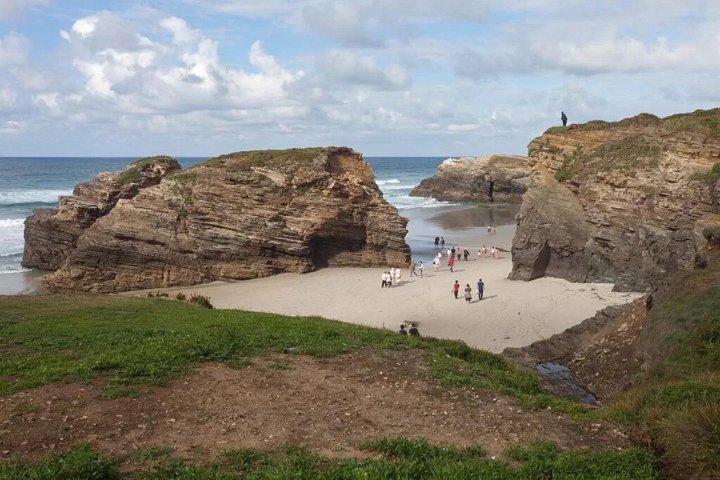
Galician coast · Rías Altas and A Mariña
Rías Altas and A Mariña travel guide: Cedeira to Ribadeo
The highest cliffs of the Capelada, the northernmost point of Spain, small estuaries and fishing ports, and the rock arches of Cathedrals Beach on the Bay of Biscay.
Cathedrals Beach · Photo: Luis Miguel Bugallo Sánchez (Lmbuga), CC BY-SA 3.0
Part of the Galician coast guide · Rías Altas and A Mariña
The Rías Altas and A Mariña are the north coast of Galicia from Cedeira, in the province of A Coruña, round Estaca de Bares to Ribadeo on the Eo estuary, the border with Asturias, about 83 km away in a straight line. Turismo de Galicia describes it as cliffs, small estuaries (rías) and fishing ports, with the Mariña of Lugo alone covering about 100 km of coast on the Bay of Biscay (Turismo de Galicia). This guide covers each town from west to east, the beaches, what to do, where to base yourself, how to get there and a two-day route.
At a glance
- Where the north coast of Galicia, from the Ría de Cedeira past Cabo Ortegal and Estaca de Bares to the Eo estuary at Ribadeo.
- Towns Cedeira, Cariño, Ortigueira, O Barqueiro, O Vicedo, Viveiro, San Cibrao, Burela, Foz and Ribadeo, with Mondoñedo inland.
- Best for cliff drives and lighthouses, quiet estuary beaches, Cathedrals Beach at low tide, birdwatching and seafood.
- Getting there A Coruña Airport is about 48 km from Cedeira and Asturias Airport about 81 km from Ribadeo in a straight line; a car is the practical way round.
- On CostaMap guides to Cedeira, San Andrés de Teixido, the Garita de Herbeira, Estaca de Bares, Viveiro, Foz, Cathedrals Beach and Ribadeo, and two campsites.
Map of the Rías Altas and A Mariña
The map shows the places on this stretch that have a CostaMap page. Tick a place type to filter, and click a marker to see the place in the panel.
Place type
Area · next level
 Area map
Rías Altas and A Mariña
Click a marker to see the place here. From Cedeira and the Capelada cliffs round Estaca de Bares to Viveiro, Foz and Ribadeo.
Towns and villagesTowns and villages
From west to east, as Turismo de Galicia, the regional tourist board, describes them.
Cedeira
Cedeira sits on a small ría surrounded by cliffs 600 metres high; Turismo de Galicia says local legend has its people descended from whales and fish, and calls it a sea of barnacles. The most spectacular beach is the crescent of Vilarrube (Turismo de Galicia). The narrow streets of the old town start at the Praza do Peixe, where Turismo de Galicia’s cliff route to Cabo Ortegal begins (Turismo de Galicia). See our Cedeira guide.
San Andrés de Teixido and the Serra da Capelada
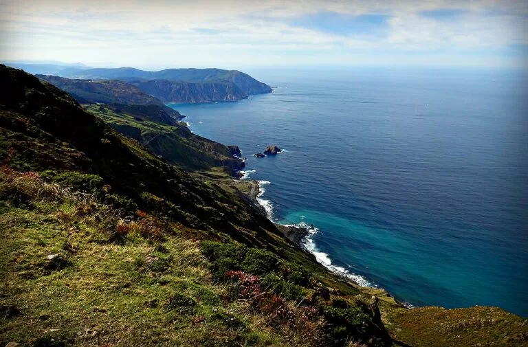
North of Cedeira the road climbs into the Capelada range. The sanctuary of Santo André de Teixido, with pilgrimages documented since the 14th century, is known by the saying that whoever does not go there alive will go when dead. Mount Herbeira, at 615 metres the highest point of the range, drops to the sea with gradients of over 80 per cent, among the highest and steepest cliffs in Europe; the Garita de Herbeira lookout post dates from 1805.. (Turismo de Galicia). See San Andrés de Teixido and Garita de Herbeira and Cabo Ortegal.
Cariño and Cabo Ortegal
Descending the range, lookout points alternate views of the open sea and the Ría de Ortigueira and Cariño. At Cabo Ortegal the lighthouse stands 125 metres above the sea, with the O Limo cliffs to the west and the islets of Os Aguillóns to the east, which symbolically separate the Atlantic from the Cantabrian Sea (Turismo de Galicia).
Ortigueira
The winding Ría de Ortigueira opens between Cabo Ortegal and Estaca de Bares. Facing the island of San Vicente, which you can walk to at low tide, Morouzos beach runs for more than two kilometres backed by pine forest. On the second weekend of July more than 20,000 people camp there for the Celtic World International Festival of Ortigueira, held since 1978 (Turismo de Galicia). Spain.info calls it the widest estuary in the north of Galicia (Spain.info).
O Barqueiro, Bares and Estaca de Bares
The Ría do Barqueiro is one of the smallest in Galicia. At the mouth of the River Sor, a salmon river, the port of O Barqueiro has white houses spilling down the slopes like an amphitheatre. Bares is a seaside village with a massive dyke believed to have been built by the Phoenicians (Turismo de Galicia). Above it, Estaca de Bares is the northernmost point of the Iberian Peninsula and lies on a migration route for hundreds of thousands of birds (Turismo de Galicia). See our Estaca de Bares guide.
O Vicedo
East of the ría, the sheltered port of O Vicedo opens onto the beach of Area Longa, and the island of Coelleira, with the remains of a Templar monastery, lies offshore (Turismo de Galicia). In the parish of Suegos are the Maiden’s Cave, reached by a path through a hole in the rock, and the Fuciño do Porco headland, which needs a booking in high season at puntafucinodoporco.gal (Turismo de Galicia).
Viveiro
Viveiro stands at the mouth of the River Landro on its ría, with beaches such as Area and Covas, the latter 1.5 km long. Its medieval old quarter is one of the most important in Galicia, entered by the Porta de Carlos V, a national monument; nearby, the port of Celeiro holds fish auctions (Turismo de Galicia). Its Holy Week is of International Tourist Interest (Turismo de Galicia). See our Viveiro guide.
Xove, San Cibrao and Sargadelos
From Xove, local roads lead to the Punta Roncadoira lighthouse. In Cervo, the Royal Factory of Sargadelos was the first industrial complex in Galicia. The factory and its historical museum can be visited. San Cibrao, the largest town in the municipality, has the Provincial Maritime Museum and a lighthouse on the Atalaia with a metal walkway viewpoint over the rocks; the Maruxaina festival falls on the second weekend of August (Turismo de Galicia). Camping A Camposa is on this stretch of coast.
Burela
Burela is nicknamed the capital of bonito and has the most important port in Galicia for northern bonito (albacore tuna), and its Feira do Bonito, of National Tourist Interest, is held on the first weekend of August (Turismo de Galicia). The tuna boat museum “Reina del Carmen” tells its maritime story, and the Monte Castelo viewpoint looks along the coast (Turismo de Galicia).
Foz
Foz has almost 15 km of fine sandy beaches along its ría, whose marshes hold one of the largest marine bird colonies in north-west Spain; the former whaling port now draws surfers. About 5 km away is San Martiño de Mondoñedo, which Turismo de Galicia calls Spain’s oldest cathedral, dating from the 6th century (Turismo de Galicia). See our Foz guide.
Barreiros
Barreiros begins with San Miguel de Reinante beach, also called Arealonga, which you can reach on foot from Cathedrals Beach along a wooden walkway. From Punta do Castro a string of beaches separated by low rocks, well known to surfers, runs past A Pasada, Lóngara, Remior and San Bartolo to O Altar in the Foz estuary. (Turismo de Galicia).
Rinlo and Cathedrals Beach
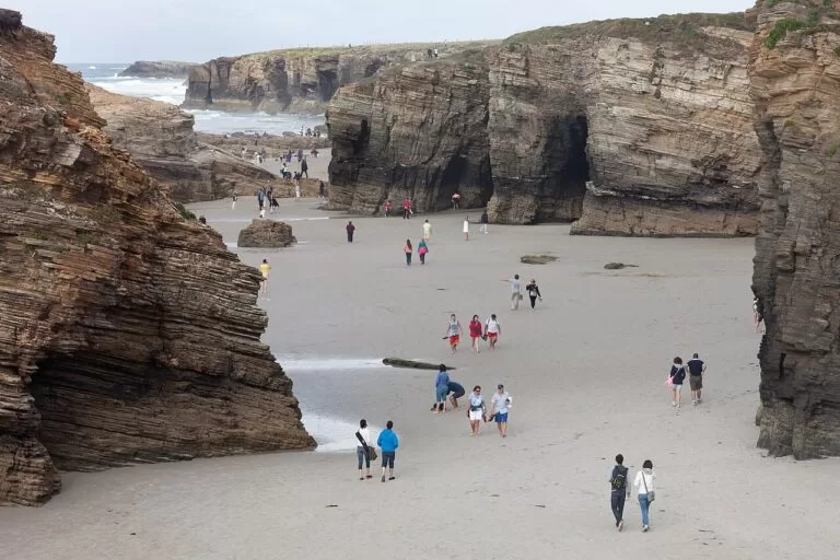
Rinlo is a fishing village tucked into the Areosa cove, with houses built on the cliffs and slate gable roofs; its shellfish nurseries are the basis of its arroz caldoso with lobster (Turismo de Galicia), and it celebrates the barnacle every summer (Turismo de Galicia). Rinlo Costa Camping is next to it. West of Rinlo, Cathedrals Beach (As Catedrais) has rock arches you can walk among at low tide; from 1 July to 30 September and in Holy Week you need a free authorisation, booked online with the Xunta (Turismo de Galicia).
Ribadeo
Ribadeo stands on the Eo estuary, a Biosphere Reserve shared with Asturias, and Turismo de Galicia says it was once the main port of the Cantabrian Sea, which shows in its stately buildings and the houses of indianos, emigrants who came back rich from the Americas (Turismo de Galicia). The Torre dos Moreno dates from 1915; a road leads past the 18th-century San Damián fort and the Cargadoiro, an old iron-ore wharf, to the Illa Pancha lighthouse of 1857 (Turismo de Galicia). See our Ribadeo guide.
Inland: Mondoñedo and Lourenzá
Mondoñedo, on the Northern Way of St James, was an episcopal see; its cathedral is known as the “kneeling cathedral” for its low height, and the Os Muíños mill quarter and the Pasatempo bridge are linked to Marshal Pardo de Cela, beheaded here in 1483 (Turismo de Galicia). Spain.info notes its diocesan museum of sacred art (Spain.info). In Vilanova de Lourenzá the Faba Interpretation Centre covers the Lourenzá bean, which has a Protected Geographical Indication (Turismo de Galicia).
Beaches and coves
From west to east. Lengths and Blue Flags as Turismo de Galicia lists them, checked November 2026.
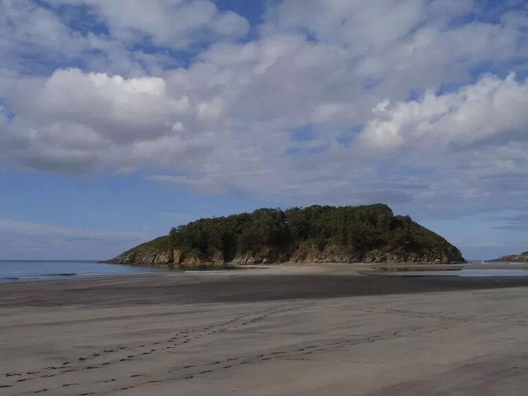
Morouzos
More than two kilometres of sand backed by pine forest, facing the island of San Vicente, which you can walk to at low tide; the Ortigueira festival camps here in July (Turismo de Galicia).
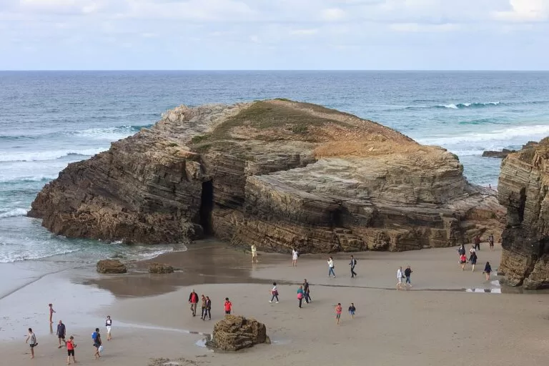
As Catedrais (Augas Santas)
Cliffs and arches of slate and quartzite, a Natural Monument since 2005, walkable at low tide. Free authorisation needed from 1 July to 30 September and in Holy Week (Turismo de Galicia).
See the beach guide →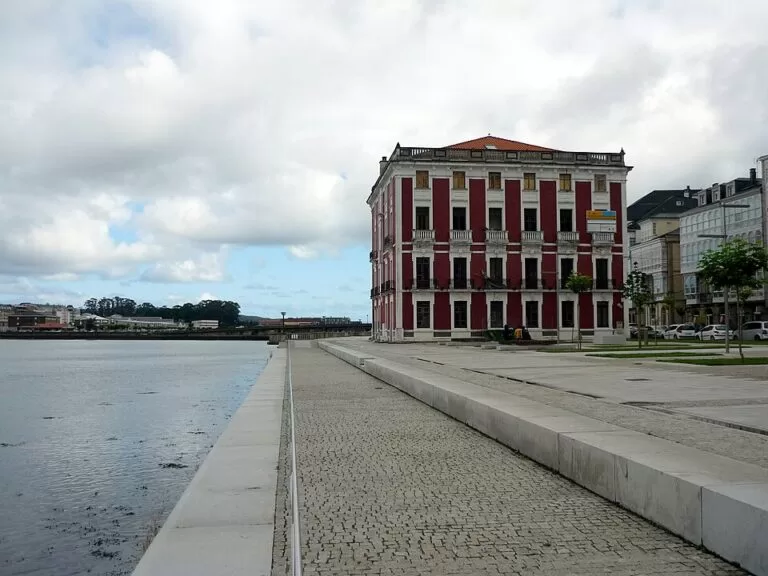
Covas and Area
Covas is 1.5 km of sand close to the town; many of the ría’s beaches have the Blue Flag, and more than 30 wrecks lie in the ría for divers (Turismo de Galicia).
See the Viveiro guide →- Vilarrube (Cedeira ría, municipality of Valdoviño) – a 1,420 m crescent of fine sand, sheltered (Turismo de Galicia).
- Bares (Mañón) – about 1,500 m of fine sand, sheltered, below the village of Bares (Turismo de Galicia).
- A Rapadoira (Foz) – 270 m of fine sand by the town, sheltered, Blue Flag (Turismo de Galicia).
- Llas (Foz) – 760 m of open sand, Blue Flag (Turismo de Galicia).
- San Miguel de Reinante or Arealonga (Barreiros) – a long beach linked to Cathedrals Beach by a wooden walkway (Turismo de Galicia).
Things to do
Nature: cliffs, capes and birds
Turismo de Galicia’s 20 km drive from Cedeira to Cabo Ortegal crosses the Serra da Capelada, with some of the highest cliffs in western Europe (Turismo de Galicia). Estaca de Bares is a classic place to watch gannets and migrating seabirds, and the Foz-Masma estuary is an internationally known resting point for birds (Turismo de Galicia).
History: cathedrals, castles and indianos
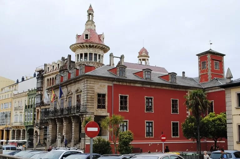
San Martiño de Mondoñedo near Foz is described by Turismo de Galicia as the oldest cathedral in Spain, and Mondoñedo’s cathedral dates from the 13th century. Marshal Pardo de Cela held out against the Catholic Monarchs in A Frouxeira castle before he was beheaded in 1483. Sargadelos in Cervo was the first industrial complex in Galicia (Turismo de Galicia).
Food: barnacles, bonito and fabas
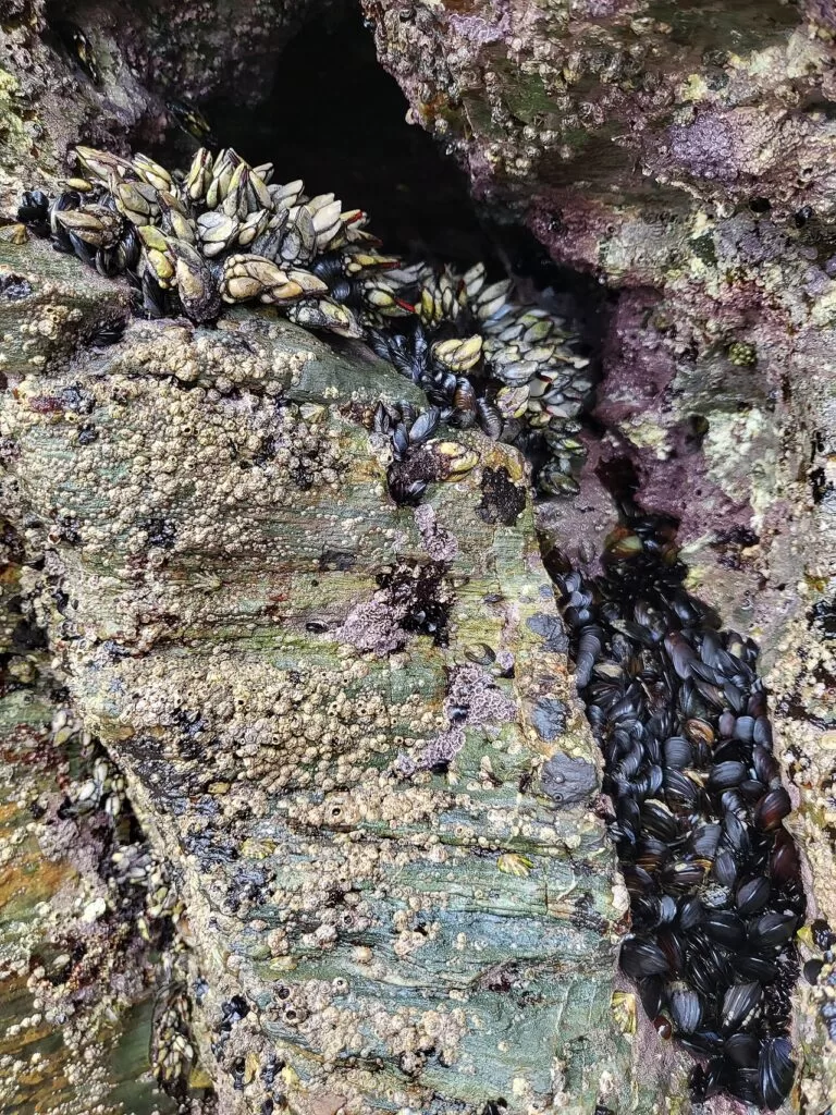
Cedeira’s waters are, in Turismo de Galicia’s words, a sea of barnacles. Burela holds its bonito fair on the first weekend of August, Rinlo is known for arroz caldoso with lobster, and the Lourenzá bean has a Protected Geographical Indication. San Lucas in Mondoñedo and San Lourenzo in Foz are Galician Tourist Festivals (Turismo de Galicia).
Where to stay by town
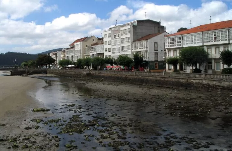
Cedeira
A fishing town with sheltered beaches, 8 km from Teixido and close to the Capelada cliffs and Cabo Ortegal.
Cliffs and shrinesViveiro
The middle of the stretch, with a walled old town, two long beaches and Estaca de Bares about 16 km away.
Central baseRibadeo or Foz
Ribadeo is the usual base for Cathedrals Beach, about 10 km away; Foz has the longest town beaches. Both are busy in July and August.
Beaches and CatedraisCampsites with a CostaMap page: Camping A Camposa near San Cibrao and Rinlo Costa Camping near Cathedrals Beach.
Getting there and around
By air
A Coruña Airport is about 48 km from Cedeira in a straight line (OpenStreetMap). At the east end, Asturias Airport is 14 km from Avilés and has direct buses to Oviedo, Gijón and Avilés (Turismo Asturias); it is about 81 km from Ribadeo in a straight line.
By car
The AC-862 runs from Ferrol to Viveiro along the A Coruña side (Turismo de Galicia), the N-642 follows the Lugo coast from San Cibrao to Ribadeo, and the N-634 and the A-8 motorway link Mondoñedo, Foz and Ribadeo (Turismo de Galicia).
By train and bus
OpenStreetMap shows stations on the coast railway at Ortigueira, Xove, San Cibrao, Burela, Foz and Rinlo, and bus stations in Cedeira and Foz. We could not confirm timetables.
A two-day route
By car, west to east. Day 1 covers about 33 km in a straight line from Cedeira to Estaca de Bares, day 2 about 47 km from Viveiro to Ribadeo.
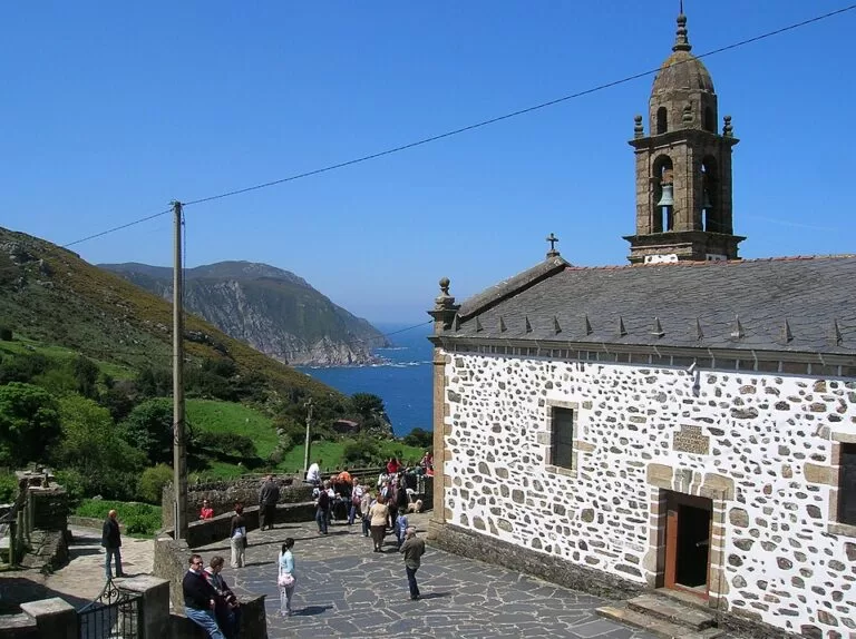
Day 1
Cedeira, the Capelada and Estaca de Bares
Start at the Praza do Peixe in Cedeira and drive up to San Andrés de Teixido. Continue over the range to the Garita de Herbeira and down to Cabo Ortegal. Drive round the Ría de Ortigueira via Morouzos beach to O Barqueiro and Estaca de Bares for the evening light, and sleep in Viveiro.
Day 2
Viveiro, Sargadelos, Foz and Cathedrals Beach
Walk through the Porta de Carlos V in Viveiro, then follow the coast to Sargadelos and San Cibrao. Stop in Foz for San Martiño de Mondoñedo. Time Cathedrals Beach for low tide, with your free booking if you are there in summer or Holy Week, and finish in Ribadeo with a walk to the Illa Pancha lighthouse.
FAQ
What are the Rías Altas?
The “high estuaries” of Galicia’s north coast, as against the Rías Baixas in the south. This guide covers the stretch from Cedeira to the Eo, including the Mariña of Lugo.
Do you need to book Cathedrals Beach?
From 1 July to 30 September and in Holy Week, yes: you need a free authorisation booked online with the Xunta de Galicia. Go at low tide to walk among the arches.
Where is the northernmost point of Spain?
Estaca de Bares, in Mañón (A Coruña), between the Ortigueira and O Barqueiro estuaries. A lighthouse and a free car park are at the end of the road.
When is the Ortigueira festival?
The Celtic World International Festival of Ortigueira is held on the second weekend of July on Morouzos beach, and has been held since 1978.
What are the best beaches between Cedeira and Ribadeo?
Cathedrals Beach for the rock arches, Morouzos and Vilarrube for long sand, Covas in Viveiro and A Rapadoira and Llas in Foz for town beaches with the Blue Flag.
Other areas of the Galician coast
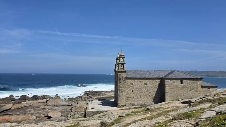
Galician coast
From Carnota and Fisterra to A Coruña, Ferrol and Ribadeo, with the map, weather and routes.
Galician coast guide →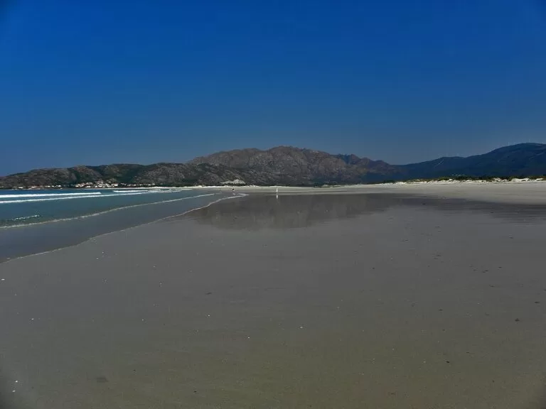
Costa da Morte: Carnota to Malpica
Carnota beach, Cape Finisterre, Muxía and the lighthouses of the shipwreck coast.
Costa da Morte guide →
A Coruña and the Golfo Ártabro
A Coruña and the Tower of Hercules, Betanzos, the Fragas do Eume, Ferrol and Pantín beach.
A Coruña and Golfo Ártabro guide →Across the Eo estuary in Asturias, see our western Asturias guide.
Sources and freshness
Checked 9 November 2026. Turismo de Galicia: the estuaries of Cedeira, Ortigueira, O Barqueiro, Viveiro, Foz and Ribadeo; the geodestinations Mariña Lucense and Ferrolterra; the Ruta da Mariña; the drives Cedeira to Cabo Ortegal and Ribadeo to Pico da Frouxeira; Praia das Catedrais; Estaca de Bares; the Feira do Bonito; and the beaches linked above. Spain.info on Ortigueira and Mondoñedo. Turismo Asturias on Asturias Airport. Map data, stations and straight-line distances: OpenStreetMap. Not confirmed: train and bus timetables, lifeguard seasons, museum hours.