
Galician coast · Costa da Morte
Costa da Morte travel guide: Carnota to Malpica
Lighthouses on shipwreck capes, the end of the Way of St James, wild Atlantic beaches and fishing towns, from Carnota and Cape Finisterre north to Malpica.
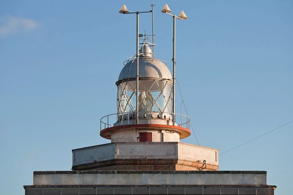
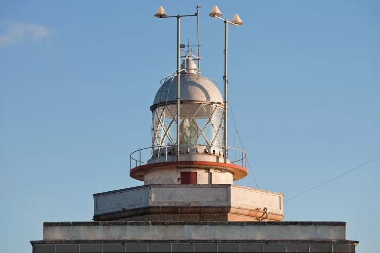
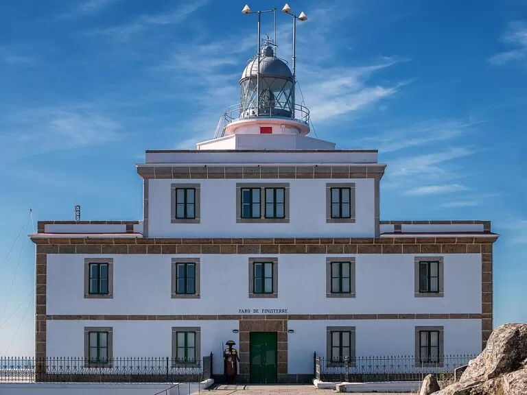
Fisterra lighthouse · Photo: Luis Miguel Bugallo Sánchez, CC BY-SA 3.0
Part of the Galician coast guide · Costa da Morte
The Costa da Morte, the Coast of Death, is the Atlantic coast of the province of A Coruña in Galicia between Carnota, south of Cape Finisterre, and Malpica, about 60 km further north in a straight line. Turismo de Galicia says it takes its name from the many shipwrecks on a coast of cliffs, strong currents and sudden storms, and counts seventeen municipalities in it, among them Carnota, Fisterra, Muxía, Camariñas, Laxe and Malpica (Turismo de Galicia). This guide covers each town from south to north, the beaches, what to do, where to base yourself, how to get there and a two-day route.
At a glance
- %%Where the west coast of the province of A Coruña, from Carnota and the Corcubión ría round Cape Finisterre and north past the rías of Camariñas and Corme e Laxe to Malpica.
- %%Towns Carnota, O Ézaro, Cee, Corcubión, Fisterra, Muxía, Camariñas, Laxe, Corme, Ponteceso and Malpica.
- %%Best for lighthouses and sunsets, the end of the Camino, wild beaches, coastal walks and seafood.
- %%Getting there Santiago de Compostela Airport (SCQ) is about 57 km from Carnota and Malpica in a straight line; A Coruña Airport (LCG) is about 35 km from Malpica. You need a car for most of the coast.
- %%On CostaMap guides to Carnota beach, the Ézaro waterfall, Cape Finisterre, Muxía, Cabo Vilán, Camariñas, Laxe and Malpica.
Map of the Costa da Morte
The map shows the places on the Costa da Morte that have a CostaMap page. Tick a place type to filter, and click a marker to see the place in the panel.
Place type
Area · next level
 Area map
Costa da Morte
Click a marker to see the place here. From Carnota and Cape Finisterre past Muxía, Camariñas and Laxe to Malpica.
Towns and villagesTowns and villages
From south to north, following the coast as Turismo de Galicia describes it.
Carnota
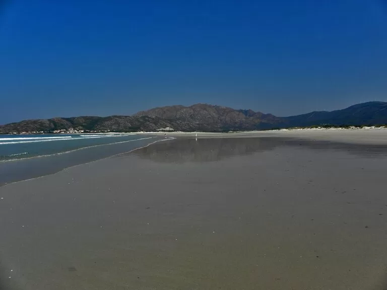
Carnota has the most extensive beach in Galicia: seven kilometres of sand in a crescent, up to a kilometre wide at low tide, backed by dunes and fed by a channel in the north that floods a rich intertidal plain. Behind it rises Monte Pindo, 627 m high only two kilometres from the sea, whose summit, A Moa, takes about two hours to climb. The marshes of Caldebarcos hold waterbirds and even otters (Turismo de Galicia). In the village stands the largest hórreo, or granary, in Galicia, 35 m long, and Lira has another famous one (Turismo de Galicia). See our Carnota beach guide.
O Pindo and O Ézaro
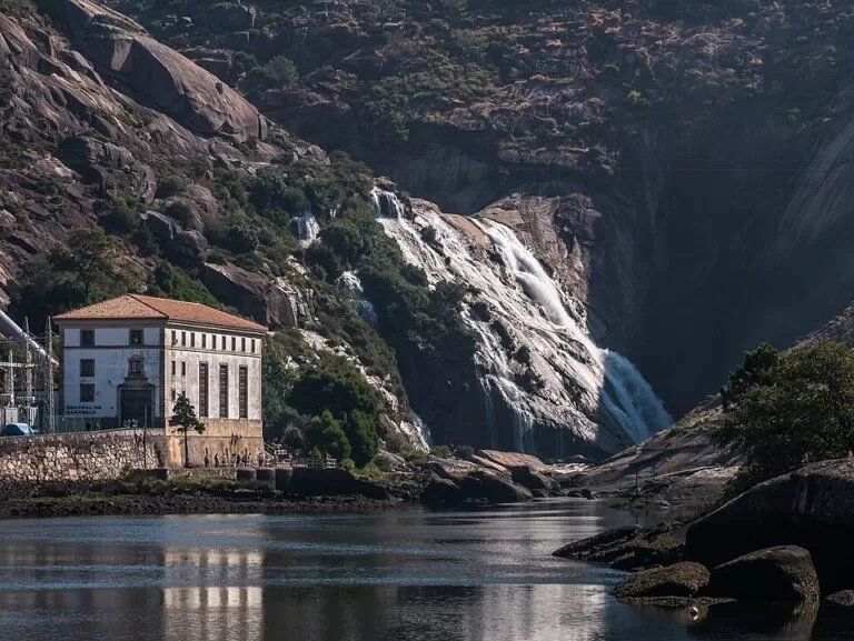
At the northern foot of Monte Pindo, the River Xallas falls about 40 m straight into the sea at O Ézaro, in the municipality of Dumbría; the flow depends on how much water the dams upstream release (Turismo de Galicia). A steep road climbs to the Miradoiro do Ézaro, with views to the Lobeiras islands and Cape Fisterra (Turismo de Galicia). See our Ézaro waterfall guide.
Cee and Corcubión
Corcubión sits at the end of the ría that bears its name, a fishing village whose old town is protected as a Property of Cultural Interest. Spain.info points to the seafront houses, the old harbour, the 12th-century Romanesque church of San Marcos and the late-15th-century Pazo of the Counts of Altamira (Spain.info). Cee, its larger neighbour at the head of the ría, has the small sheltered beach of Area Grande, 190 m long (Turismo de Galicia).
Fisterra and Cape Finisterre
Fisterra is both a fishing and a tourist town. Life turns around the fishing port, the fish market and the tapas bars and restaurants of its narrow streets. The Ara Solis square recalls the altar to the sun said to have stood on the cape (Turismo de Galicia). The road to the lighthouse starts by the church of Santa María das Areas, begun in the 12th century, which keeps the Gothic Christ of the Golden Beard (Turismo de Galicia). On the cape, the lighthouse of 1853 stands 138 m above the sea; Monte Facho rises to 242 m above it, and the Camino ends here (Turismo de Galicia). See our Cape Finisterre guide.
Muxía and Cabo Touriñán
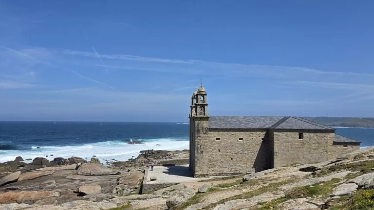
Muxía stands on the southern bank of the Camariñas ría (Spain.info) and is the end of the Fisterra–Muxía Camino. On the rocks at its tip is the sanctuary of the Virxe da Barca, and its September pilgrimage, the Romaría de Nosa Señora da Barca, is a Festival of National Tourist Interest (Turismo de Galicia). South-west of the town, Cabo Touriñán is the westernmost point of Galicia after Cabo da Nave; in summer, at low tide, you can watch the barnacle gatherers below its cliffs (Turismo de Galicia). See our Muxía guide.
Camariñas, Cabo Vilán and Camelle
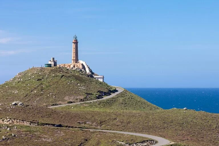
Camariñas sits at the mouth of its ría, protected by Punta da Barca and Cabo Vilán, and is famous for its bobbin lace, with a Lace Museum and a lace fair in Holy Week (Turismo de Galicia). About 4 km north-west, the lighthouse of Cabo Vilán, of 1896, was the first in Spain with electric light, and a coast path leads past the English Cemetery of HMS Serpent to the wild beach of Trece. East along the coast are the fishing village of Camelle and the Blue Flag beach of Arou. See our Camariñas guide and Cabo Vilán guide.
Laxe
Laxe, on the south side of the Corme and Laxe ría, shows that the Costa da Morte is not only cliffs: its sheltered Blue Flag beach runs right through the centre of the town (Turismo de Galicia). By the port stands the 15th-century church of Santa María da Atalaia with its fortified atrium (Turismo de Galicia). The wild beaches of Soesto and Traba, with the granite Penedos de Pasarela e Traba behind them, are a few kilometres west. See our Laxe guide.
Corme and Ponteceso
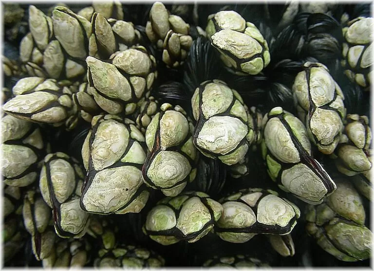
Across the ría, Corme has fishermen’s houses painted in bright colours and, nearby, the Pedra da Serpe, the Serpent Rock. At Punta do Roncudo, on cliffs battered by the waves, grow what Turismo de Galicia calls the best barnacles in the world; the white crosses around the lighthouse remember the percebeiros who died gathering them. The sheltered Blue Flag beach of Balarés is on the ría, and at its head the River Anllóns forms an estuary more than two kilometres long, with geese, herons and shelducks (Turismo de Galicia).
Malpica and Buño
Malpica, at the northern end of the Costa da Morte, is a fishing town on a small peninsula, with the harbour on one side and Area Maior, an 800 m Blue Flag beach popular with surfers, on the other (Turismo de Galicia). Offshore lie the Sisargas Islands. About 8 km west, near Barizo, the Punta Nariga lighthouse by the architect César Portela was the last lighthouse built in Spain (Turismo de Galicia). Inland, Buño is the largest pottery centre in Galicia, with around twenty potters and a pottery fair of Galician Tourist Interest (Turismo de Galicia). See our Malpica guide.
Inland: Vimianzo, Zas and Cabana de Bergantiños
A short drive inland are the castle of Vimianzo, with a history exhibition and live crafts (Turismo de Galicia), the Torres do Allo manor in Zas (Turismo de Galicia), and in Cabana de Bergantiños the Dolmen de Dombate, with its archaeological interpretation centre, and the hill fort (castro) of Borneiro, both Goods of Cultural Interest (Turismo de Galicia).
Beaches and coves
From south to north; lengths as Turismo de Galicia gives them, checked November 2026. Turismo de Galicia says O Rostro and Mar de Fóra are dangerous for swimming: swim in the sheltered beaches inside the rías.
Carnota
Seven kilometres of fine sand, the longest beach in Galicia, open to the ocean, with dunes, a channel and marshes at the northern end, below Monte Pindo (Turismo de Galicia).
See the beach guide →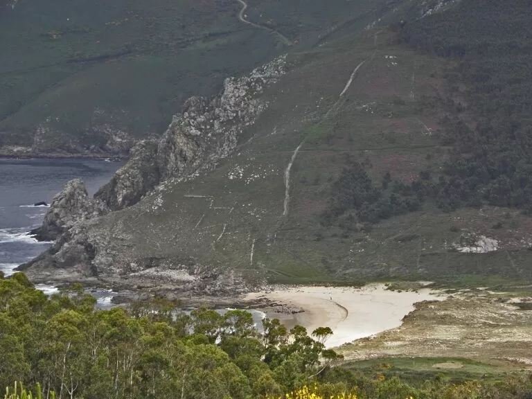
Mar de Fóra and O Rostro
Mar de Fóra, 700 m, lies on the open side of the Fisterra peninsula between Cape Fisterra and Cabo da Nave; O Rostro, 2,200 m, is further north. Both are wild and dangerous for swimming (Turismo de Galicia).
See the Cape Finisterre guide →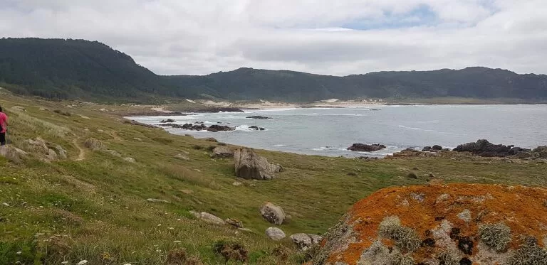
Area de Trece
A 500 m open beach below a climbing dune, reached on foot or by bike along the path from the Cabo Vilán road, past the English Cemetery (Turismo de Galicia).
See the Camariñas guide →- Arou, Camariñas – 400 m, open, with a Blue Flag, where the coastal track to Trece and Vilán begins (Turismo de Galicia).
- Traba, Laxe – 2,630 m of open beach with dunes and a coastal lagoon (Turismo de Galicia); Soesto, 860 m, is closer to the town and often windy.
- Laxe – the sheltered Blue Flag town beach, 1,320 m on Turismo de Galicia’s beach record (Turismo de Galicia).
- Balarés, Ponteceso – 350 m, sheltered, with a Blue Flag, inside the Corme and Laxe ría (Turismo de Galicia).
- Area Maior, Malpica – 800 m, open, with a Blue Flag, in the town (Turismo de Galicia).
Things to do
Nature: Monte Pindo, wild beaches and granite
Turismo de Galicia calls the Carnota – Monte Pindo area one of the most varied coastal spaces in Galicia, with dunes, mudflats, cliffs, the Ézaro waterfall and the granite figures of the Pindo, a national Point of Geological Interest (Turismo de Galicia). Further north, the path from Cabo Vilán to Trece crosses a landscape where the camariña heather, which gives Camariñas its name, grows in Galicia only here and on the Cíes Islands, and the Penedos de Pasarela e Traba, a Protected Landscape, rise to 274 m behind Traba beach (Turismo de Galicia).
History: lighthouses, shipwrecks and dolmens
Turismo de Galicia’s lighthouse route links Punta Nariga, Cabo Vilán, Touriñán and Fisterra. More than 150 wrecks have been recorded on the stretch around Vilán; the best known is HMS Serpent, lost on 10 November 1890, whose 172 dead lie in the English Cemetery, with only three survivors (Turismo de Galicia). At Fisterra, the light of the 1853 lighthouse reaches 65 km (Turismo de Galicia). Older still are the Dolmen de Dombate, the hill fort of Borneiro and the Roman bridge of Lubiáns, all named by Turismo de Galicia among the landmarks of this coast.
Food and crafts: barnacles, lace and pottery
The barnacles of Punta do Roncudo near Corme are, for Turismo de Galicia, the best in the world, and their harvest is strictly regulated (Turismo de Galicia). Fisterra’s restaurants serve razor clams, barnacles, sea bass and octopus (Turismo de Galicia). Two crafts have their own museums and fairs: the bobbin lace of Camariñas, with the Museo do Encaixe and the Holy Week Mostra, and the pottery of Buño in Malpica, with its Museo da Olaría (Turismo de Galicia).
Where to stay by town
The towns we would base a trip in, south to north. Book ahead for July and August.
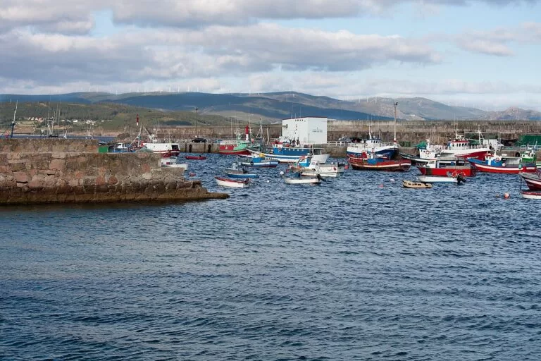
Fisterra
A fishing port with tapas bars, restaurants and the pilgrims’ hostel, 3 km from the cape for the sunset, and close to Carnota and Ézaro.
Sunsets and the Camino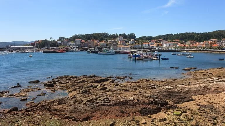
Camariñas or Muxía
The middle of the coast, 4 km apart across the ría: Cabo Vilán, Trece and the English Cemetery on one side, the Virxe da Barca and Touriñán on the other.
Central base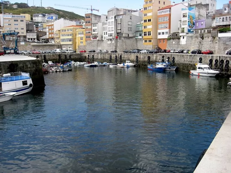
Laxe or Malpica
Town beaches with Blue Flags and working harbours in the north, the closest part of the coast to A Coruña and its airport.
Beach and harbourGetting there and around
By air
Santiago de Compostela Airport (SCQ) is the nearest for the south: about 57 km from Carnota and 69 km from Fisterra in a straight line. A Coruña Airport (LCG) suits the north: about 35 km from Malpica (OpenStreetMap).
By car
A car is the practical way to see this coast. For Camariñas, Turismo de Galicia says to leave the C-552 at Vimianzo and follow the AC-432 (Turismo de Galicia); a small signed road climbs from Fisterra to the lighthouse (Turismo de Galicia).
On foot
The Way of St James continues to the sea at Fisterra, and the Fisterra–Muxía Camino links the two ends (Turismo de Galicia). The Camiño dos Faros, a coastal walking route, passes through Camariñas between its fifth and sixth stages (Galician Wikipedia). We could not confirm bus routes or timetables.
A two-day route
By car, south to north. Day 1 covers about 32 km in a straight line from Carnota to Muxía, day 2 about 41 km from Muxía to Malpica.
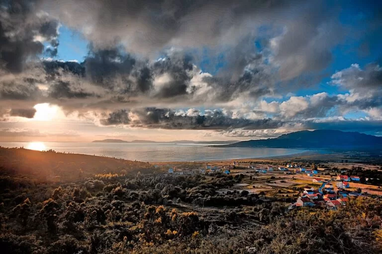
Day 1
Carnota, Ézaro and Cape Finisterre
Walk on Carnota beach and see the great hórreo. Drive round Monte Pindo to O Ézaro for the waterfall, then through Cee and Corcubión to Fisterra for lunch by the port. In the afternoon look at Mar de Fóra, then drive up to Cape Finisterre for the sunset, and sleep in Fisterra or Muxía.
Day 2
Muxía, Cabo Vilán, Laxe and Malpica
Begin at the Virxe da Barca in Muxía, drive round the ría to Camariñas for the Lace Museum and on to Cabo Vilán, and walk part of the path towards the English Cemetery. Continue to Laxe for lunch by the beach, stop at Punta do Roncudo near Corme, and end in Malpica, looking out to the Sisargas Islands.
FAQ
Where is the Costa da Morte?
On the Atlantic coast of A Coruña province in Galicia, from Carnota and Fisterra north to Malpica: seventeen municipalities, says Turismo de Galicia.
Why is it called the Coast of Death?
Turismo de Galicia says the name comes from its many shipwrecks; more than 150 have been recorded around Cabo Vilán alone.
Is Cape Finisterre the westernmost point of Europe?
Traditionally it is regarded as the end of the continent, but Turismo de Galicia says that strictly speaking it is not: Cabo da Nave in Fisterra and Cabo Touriñán in Muxía reach further west.
What are the best beaches on the Costa da Morte?
Carnota for size, Mar de Fóra and Trece for wild scenery, and the Blue Flag beaches of Laxe, Balarés, Arou and Malpica for swimming.
How many days do you need for the Costa da Morte?
Two full days by car cover the main sights from Carnota to Malpica, as in the route above; add more if you want to walk the coast paths.
Where should I stay on the Costa da Morte?
Fisterra for the cape and the south, Camariñas or Muxía for the middle of the coast, Laxe or Malpica for town beaches and quicker access from A Coruña.
Other areas of the Galician coast
Galician coast
The north and west coast of Galicia, from Carnota to the Eo estuary, with the map, weather and routes.
Galician coast guide →
A Coruña and the Golfo Ártabro
The city of A Coruña and the Tower of Hercules, Betanzos, Ferrol and the estuaries of the gulf.
A Coruña area guide →
Rías Altas and A Mariña
Cedeira, San Andrés de Teixido, the Capelada cliffs, Estaca de Bares and the Mariña of Lugo to Ribadeo.
Rías Altas guide →South of Carnota, the Rías Baixas begin with the ría of Muros e Noia.
Sources and freshness
Checked 9 November 2026. Turismo de Galicia on the Costa da Morte; the rías of Corcubión, Camariñas and Corme e Laxe; Carnota – Monte Pindo; Cabo Fisterra; the route Lighthouses and beaches at the end of the world; the towns of Fisterra, Camariñas and Laxe; and the places and beaches linked above. Spain.info on Corcubión and Muxía. The Camiño dos Faros and Malpica’s surf: Galician Wikipedia on Camariñas and Malpica. Map data and straight-line distances: OpenStreetMap. Not confirmed: bus routes, museum hours and the exact route of the Camiño dos Faros.