
Costa Verde · Western Asturias
Western Asturias travel guide: Castropol to Cudillero
Fishing ports, island lighthouses, dark-sand beaches and pebble coves under cliffs, from the Eo estuary on the Galician border to Cudillero.
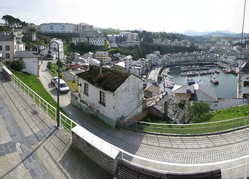
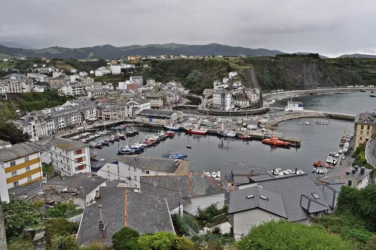
Luarca · Photo: charles lecompte, CC BY-SA 3.0
Part of the Costa Verde guide · Western Asturias
Western Asturias is the stretch of the Costa Verde between Castropol, on the Eo estuary that forms the border with Galicia, and Cudillero, about 70 km further east in a straight line. It is a coast of small fishing ports such as Tapia, Viavélez, Puerto de Vega and Luarca, with long beaches of sand or dark sand at Penarronda, Otur and Barayo and pebble coves below the cliffs, such as El Silencio (Turismo Asturias). This guide covers each town from west to east, the beaches, what to do, where to base yourself, how to get there and a two-day route.
At a glance
- Where the west coast of Asturias, from the Eo estuary at Castropol and As Figueiras to Cudillero.
- Towns Castropol, Tapia, Viavélez, Ortigueira, Navia, Puerto de Vega, Luarca and Cudillero.
- Best for quiet fishing ports, surfing at Tapia and Penarronda, cliff coves, lighthouses and seafood.
- Getting there Asturias Airport (OVD) is about 9 km from Cudillero and 74 km from Tapia in a straight line; the A-8 motorway runs the length of the stretch.
- On CostaMap guides to Tapia de Casariego, Luarca, Playa del Silencio and Cudillero, the Wecamp Cudillero campsite and, inland, La Pomarada in Somiedo.
Map of western Asturias
The map shows the places in western Asturias that have a CostaMap page. Tick a place type to filter, and click a marker to see the place in the panel.
Place type
Area · next level
 Area map
Western Asturias
Click a marker to see the place here. From Tapia and the Eo estuary to Luarca, El Silencio and Cudillero.
Towns and villagesTowns and villages
From west to east, as described by Turismo Asturias, the regional tourist board.
Castropol and As Figueiras
Castropol stands on a stepped promontory above the Eo estuary, the natural border between Asturias and Galicia. Its historic quarter has palaces, emblazoned houses, chapels and squares, and every year the streets are decorated with floral carpets for Corpus Christi. Oysters are farmed off its coast, and you can join a guided visit to the aquaculture. See the chapel of Santa María del Campo, the only building saved from the fire of 1587 (Turismo Asturias). Across the estuary mouth, As Figueiras sits at the foot of the Los Santos bridge, with a small fishing port, a shipyard whose first records go back to the 17th century and the Peñalba Palace by Ángel Arbex, a disciple of Gaudí (Turismo Asturias).
Tapia de Casariego
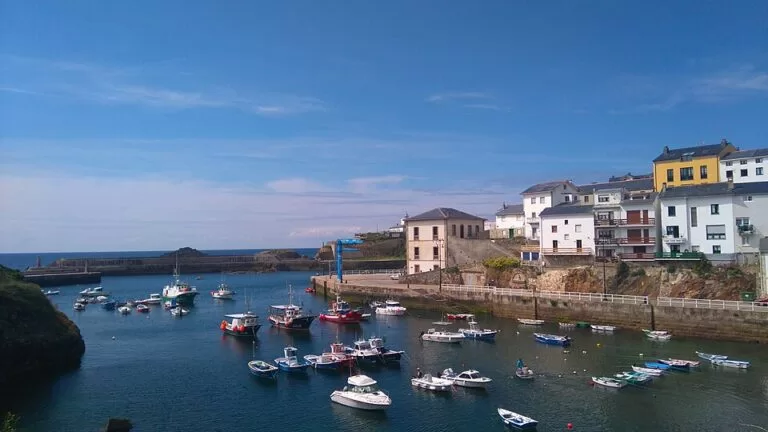
Tapia is a fishing village with whaling origins, known for fishing and canning. Its harbour has four granite quays, terraces on the quayside and a lighthouse of 1859 on an island that you reach on foot across a jetty of about 100 metres (Turismo Asturias). Turismo Asturias calls Tapia a pioneer of surfing in the Bay of Biscay; Anguileiro, the town beach, has hosted a famous world championship event, and the Festival Intercéltico d’Occidente began here (Turismo Asturias). Penarronda, the best-known beach of the far west, is about 5 km away. See our Tapia de Casariego guide.
El Porto/Viavélez
Viavélez, in El Franco, is a small and quiet fishing port. Its shipyard, famed for fast brigantines, closed in the 19th century. The novelist Corín Tellado was born here; Turismo Asturias calls her the most widely read novelist in Spanish after Cervantes, and a street and her birthplace recall her. Walk up to the El Porto viewpoint, where Ernesto Knorr’s sculpture “Litoral” stands, for a view along the coast (Turismo Asturias).
Ortigueira
Ortigueira, in Coaña, sits only twenty metres above sea level, with sailors’ houses on the slopes of a small valley that runs down to the sea. It grew from whaling and lobster fishing, and its little port of El Ribeiro was built after years of mooring boats on a flat rock. Above it, the Quinta Jardón has one of the best-preserved French-style gardens in Asturias. A walk leads to its two lighthouses: the old one, which still has its bell, and the modern San Agustín lighthouse on the west bank of the Navia estuary (Turismo Asturias). The Castro de Coaña is inland from here.
Navia
Navia is the capital of its municipality, at the mouth of a broad estuary. Its port has a naval shipyard, a promenade follows the estuary to the beach, and the old quarter keeps remains of the town walls. For more than 60 years Navia has held one of the best-known swimming races in Spain, the Swimming Descent of the Ría de Navia, with a programme of events around it. The local sweet is the venera, made with almonds, sugar and egg (Turismo Asturias). Navia beach, about one kilometre from the centre, is 330 m long beside the river mouth, with lifeguards in summer and strong waves (Turismo Asturias).
Puerto de Vega
Puerto de Vega, in Navia, has been an Exemplary Town of Asturias since 1995. Its small fleet of wooden boats still goes out every day, and the harbour is lined with fishermen’s houses, indiano houses and mansions. The enlightened statesman Gaspar Melchor de Jovellanos died here in the Casona Trelles in 1811, after taking refuge in the town during a storm. Visit the rula (fish market), the “Stories of the Sea” interpretation centre and the Juan Pérez Villamil Ethnographic Museum (Turismo Asturias). Barayo beach, in its nature reserve, is just east of here.
Luarca
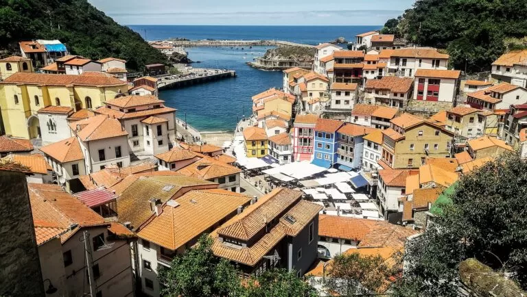
Luarca, capital of Valdés, is called the white village of the green coast in a popular saying. It is built around a narrow harbour crossed by the River Negro and its bridges, with the old fishing quarters of El Cambaral and La Pescadería by the port. On the headland are the watchtower, the chapel of La Atalaya, the lighthouse of 1862 and the cemetery on the cliff, considered one of the most beautiful in Spain, where the Nobel laureate Severo Ochoa is buried (Turismo Asturias). Two August fiestas, Nuestra Señora del Rosario and San Timoteo, are declared of Tourist Interest. Otur and Barayo beaches are a short drive west. See our Luarca guide.
Cudillero
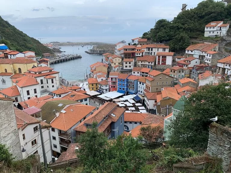
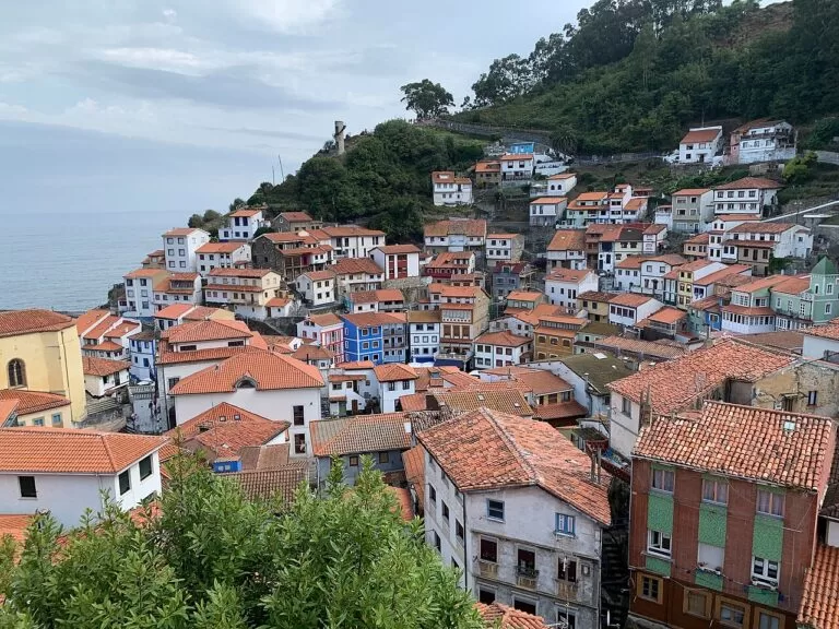
Cudillero closes the stretch to the east. Its houses of a thousand colours climb the slopes round the port in the much-photographed amphitheatre, and the village has its own way of speaking, the pixueto, heard every 29 June in L’Amuravela, a humorous sermon on the events of the year. Fishermen once dried small sharks outside their doors to make curadillo, still a local speciality. On the way in, El Pito has the 19th-century Selgas Palace, the “Asturian Versailles” (Turismo Asturias). The municipality also has Playa del Silencio, Gueirúa, the Concha de Artedo and the clifftops of Cabo Vidío (Turismo Asturias). See our Cudillero guide.
Beaches and coves
From west to east. Lengths, services and lifeguard dates are as Turismo Asturias gives them, checked in November 2026; lifeguard dates apply to the summer season and change from year to year.
Penarronda
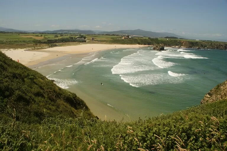
600 m of fine golden sand split by a stream, a Natural Monument and the only place in Asturias where the sea wallflower grows. Windy, with strong waves and good surf; lifeguards from 20 June to 10 September, ramp and accessible facilities (Turismo Asturias).
Anguileiro
Tapia’s town beach: 410 m of fine golden sand at the mouth of the River Anguileiro, with a promenade to the harbour, a car park and motorhome parking; lifeguards from 27 June to 8 September (Turismo Asturias).
See the Tapia guide →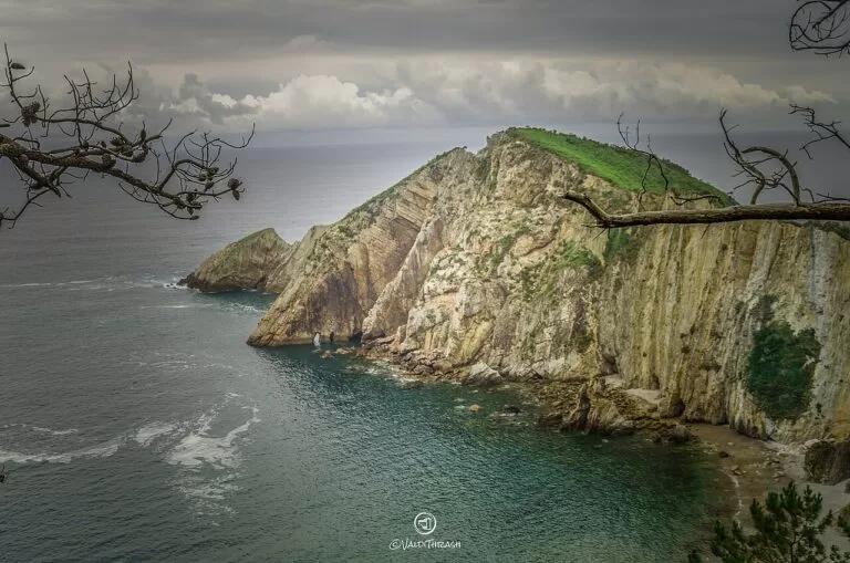
El Silencio (Gavieiro)
A 500 m cove of clear pebbles sheltered by cliffs and islets, reached on foot down about 500 m of path and stairs. No services; no dogs from 1 June to 30 September (Turismo Asturias).
See the beach guide →- Navia – 330 m of dark sand at the river mouth, one kilometre from the town, with lifeguards from 20 June to 11 September and a picnic area (Turismo Asturias).
- Barayo – a wild beach of dark sand with dunes and marshes in the Barayo Partial Nature Reserve. From Vigo you park above the beach and walk about 800 m down a forest path; no dogs from 1 May to 30 September (Turismo Asturias).
- Otur – almost 600 m of sand between two streams, one of the busiest beaches of the west in summer, with a ramp and lifeguards from 1 July to 31 August (Turismo Asturias).
- Portizuelo – a narrow 100 m pebble beach near Luarca with pointed rocks, Severo Ochoa’s favourite walk; no parking at the bottom (Turismo Asturias).
- Concha de Artedo – 760 m with pebbles at the top and golden sand at low tide, very sheltered, with a Blue Flag and lifeguards from 26 June to 8 September (Turismo Asturias).
Things to do
Nature: capes, coves and a biosphere reserve
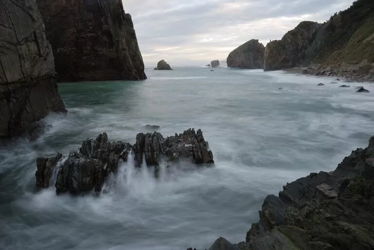
Turismo Asturias’s lighthouse route follows this coast in two stages. The first runs from the Eo estuary, a biosphere reserve, past Tapia and the striped San Agustín lighthouse at Ortigueira to Luarca and Cabo Busto, with its vertical cliffs and its lighthouse of 1858; between Valdés and Cudillero it crosses the Protected Landscape of the Western Coast (Turismo Asturias). The second continues past the beaches of Cadavéu and El Silencio to Cabo Vidío, one of the most beautiful clifftops of Asturias. Below it is La Iglesiona, a sea cave sixty metres high that you can only visit at low tide, so check the tide times (Turismo Asturias).
History: hill forts, whalers and indianos
The Castro de Coaña is the best known of the Iron Age hill forts of Asturias. It was already fortified in the 5th century BC, about 80 huts survive in its northern quarter, and two buildings once thought to be cremation ovens are now read as indigenous saunas. Turismo Asturias lists it as open Wednesday to Sunday, 10:30–16:30, cash only; phone first (Turismo Asturias, checked November 2026). Tapia, Viavélez and Ortigueira were whaling ports, and most towns have houses of indianos, emigrants who came back rich from the Americas. Tapia says it was the first port where corn from America landed, in 1604 (Turismo Asturias).
Food: oysters, curadillo and the venera
Castropol is known for oysters farmed in the Eo estuary, with their own festival (Turismo Asturias). Tapia’s hoteliers hold a mussel and shellfish festival over the long weekend in early December. In Navia, try the venera, an almond, sugar and egg dessert (Turismo Asturias). In Cudillero, the harbour restaurants serve curadillo, shark dried in the open air, and hake skewers (Turismo Asturias). In Luarca, Spain.info points to the chigres, the old cider taverns, where you can learn how cider is poured (Spain.info).
Where to stay by town
The towns we would base a trip in, west to east.
Tapia de Casariego
A harbour village with a town beach, near Penarronda and the Eo estuary. Busy from Easter to the end of summer: book well ahead.
Surf and harbour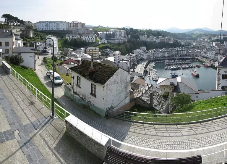
Luarca
The middle of the stretch, with a train station, a tourist office open all year, and Otur and Barayo close by.
Central base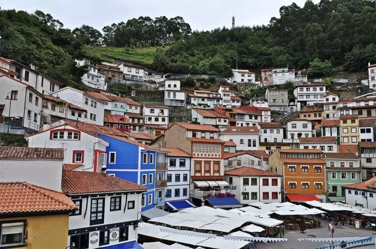
Cudillero
One of the most photographed fishing villages in northern Spain, per Turismo Asturias, and 9 km from the airport, with El Silencio and the Concha de Artedo nearby.
Photogenic villageCampsites with a CostaMap page: Wecamp Cudillero, at Aroncés on the road to Aguilar beach, has bungalows, tents and pitches and is closed from 30 September to 10 April (Turismo Asturias). Inland, Camping La Pomarada de Somiedo is in La Pola Somiedo, inside the Somiedo Natural Park and Biosphere Reserve (Turismo Asturias), the first natural park declared in Asturias, with 283 km² over five valleys (Turismo Asturias).
Getting there and around
By air
Asturias Airport (OVD) is 14 km from Avilés, 40 km from Gijón and 47 km from Oviedo, with direct buses to those cities (Turismo Asturias). In a straight line it is about 9 km from Cudillero, 41 km from Luarca and 74 km from Tapia.
By car
The A-8, the Autovía del Cantábrico, links Asturias from east to west (Turismo Asturias) and runs close to the whole stretch; the towns are reached by short local roads, such as the AS-23 and N-634 for Tapia. A car is the practical way to reach the coves.
By train
Renfe runs the rail lines within Asturias (Turismo Asturias). The Ferrol–Gijón coast line stops at Luarca, about 700 m from the centre, and at Cudillero, about 1.5 km from the harbour (OpenStreetMap). Check times before you plan around them.
A two-day route
By car, west to east. Day 1 covers about 40 km in a straight line from the Eo estuary to Luarca, day 2 about 32 km from Luarca to Cudillero.
Day 1
Castropol, Tapia and the fishing ports
Start in Castropol with the view over the Eo estuary from the upper town. Drive to Penarronda for a walk on the beach, then on to Tapia: walk the quays, cross the jetty to the lighthouse island and climb to the Os Cañóis viewpoint. In the afternoon follow the coast through Viavélez and Ortigueira, stop in Puerto de Vega for the harbour, and end the day in Luarca.
Day 2
Luarca, El Silencio and Cudillero
In the morning walk from Luarca harbour up to the chapel, the lighthouse and the cemetery,. Drive east to Playa del Silencio: park above the cove and walk down the path and stairs. Continue to Cabo Vidío for the clifftop and, if the tide is low and you have checked the times, La Iglesiona. Finish in Cudillero for an evening in the harbour square and a walk up to the viewpoints.
FAQ
What is the most beautiful village in western Asturias?
Cudillero, which Turismo Asturias calls one of the most photographed fishing villages in northern Spain, with its houses stacked round the port. Luarca, Tapia and Puerto de Vega, an Exemplary Town of Asturias since 1995, are quieter alternatives.
What are the best beaches in western Asturias?
Penarronda for sand and surf, Otur and Barayo for dark sand near Luarca, the Concha de Artedo for a sheltered beach with lifeguards, and El Silencio for a pebble cove under cliffs.
Is western Asturias good for surfing?
Yes. Turismo Asturias calls Tapia a pioneer of surfing in the Bay of Biscay; Anguileiro hosts championships and Penarronda is windy with strong waves.
How do you get to Playa del Silencio?
By car to the car parks above the cove near Castañeras, then on foot down about 500 m of path and stairs. There are no services on the beach.
Where should I stay on the west coast of Asturias?
Luarca is the most central base and has a train station; Cudillero is closest to the airport; Tapia suits surfers and is near the Galician border.
Other areas of the Costa Verde
Costa Verde
The whole coast of Asturias, from the Eo to the Tina Mayor estuary, with the map, weather and itineraries.
Costa Verde guide →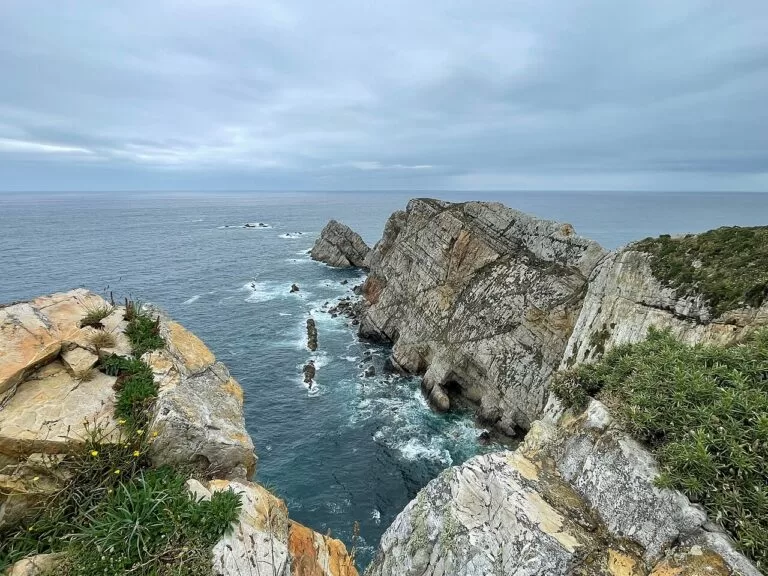
Centre: Salinas to Villaviciosa
Gijón, the dunes of Salinas, Luanco and Cabo Peñas, and the estuary of Villaviciosa.
Central Asturias guide →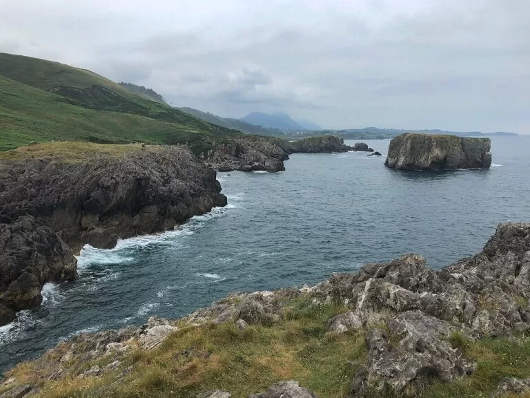
East: Lastres to La Franca
Lastres, Ribadesella, the coves of Llanes and the Picos de Europa close behind the coast.
Eastern Asturias guide →Across the Eo estuary in Galicia, Ribadeo is about 9 km from Tapia.
Sources and freshness
Checked 7 November 2026. Turismo Asturias on the fishing villages of Castropol, As Figueiras, Tapia, Viavélez, Ortigueira, Navia, Puerto de Vega, Luarca and Cudillero; the lighthouse route (stage 1, stage 2); the beaches of Penarronda, Anguileiro, Navia, Barayo, Otur, Portizuelo, El Silencio and the Concha de Artedo (linked above); the Castro de Coaña; the blog What to see in Tapia; the municipalities of Valdés and Cudillero; and getting there by air, car and train. Spain.info on Luarca. Map data and straight-line distances: OpenStreetMap. Not confirmed: bus routes, train times and museum hours.
Every place we have mapped on the Western Asturias
6 towns, beaches, coves and landmarks, kept up to date automatically.