
Costa Verde · Eastern Asturias
Eastern Asturias travel guide: Lastres, Ribadesella and Llanes
Dinosaur footprints, Palaeolithic cave art, blowholes and small coves under the Picos de Europa, from Lastres to La Franca.
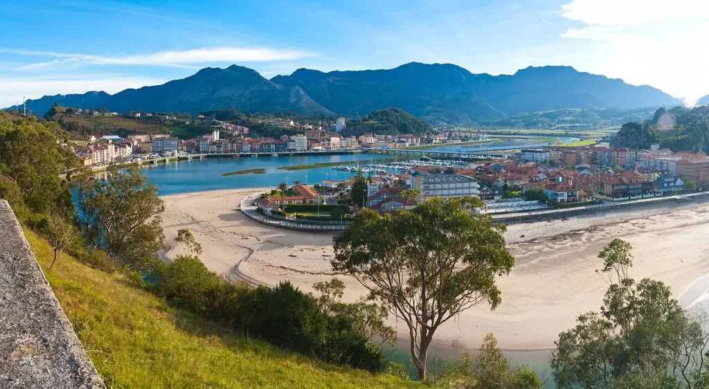
Ribadesella · Photo: D.Rovchak, CC BY-SA 4.0
Part of the Costa Verde guide · Other areas: Western Asturias · Central Asturias
Eastern Asturias is the last stretch of the Costa Verde before Cantabria: about 58 km in a straight line from the fishing village of Lastres in Colunga to the beach of La Franca in Ribadedeva, with the Tina Mayor estuary on the border just beyond. It takes in Ribadesella, with the Tito Bustillo Cave, and the walled town of Llanes, whose municipality alone has more than thirty beaches; the Picos de Europa start about 20 km inland. This guide covers each town and village, the beaches, what to do, where to base yourself and how to get around.
At a glance
- Where the eastern coast of Asturias, from Lastres (Colunga) through Caravia, Ribadesella and Llanes to La Franca and Pimiango in Ribadedeva.
- Mountains the Sierra del Sueve behind Colunga and Caravia, the Sierra del Cuera behind Llanes, and the Picos de Europa further south.
- Getting there the A-8 motorway follows the whole coast; Asturias Airport (OVD) is in Castrillón, west of Gijón.
- Best for cave art, dinosaur footprints, coastal walks, coves and the Picos.
- Main towns Lastres, Colunga, Ribadesella, Llanes and Colombres.
- On CostaMap 11 places, from Lastres and Ribadesella to Torimbia, the Llanes coastal path, the Ruta del Cares and two campsites.
Map of Eastern Asturias
The places in this area with a CostaMap page. Tick a place type to filter, and click a marker to see the place in the panel.
Place type
Area · next level
 Area map
Eastern Asturias
Click a marker to see the place here. Lastres, Ribadesella, Llanes and the coves to La Franca, with the Picos de Europa inland.
Towns and villagesTowns and villages
From west to east; populations are for the whole municipality (Turismo Asturias).
Lastres (Colunga)
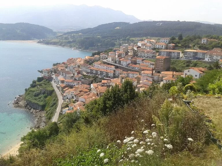
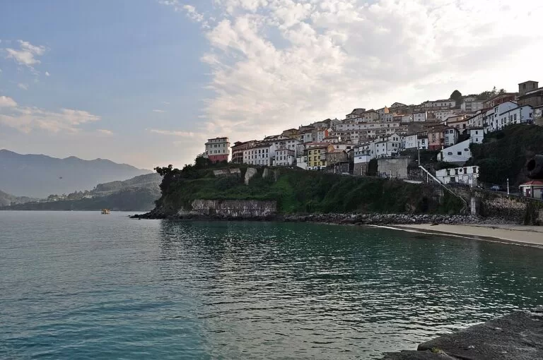
Lastres (Llastres) is a former whaling village built in steps above its harbour, officially counted among the most beautiful villages in Spain and named Exemplary Village of Asturias in 2010. You can watch the fish auctions in the port and eat the catch in its restaurants and cider bars. The San Roque viewpoint looks over the village, the Sierra del Sueve and the Picos de Europa. The cobbled old town has the Whalers’ quarter, the Clock Tower and the church of Santa María de Sábada, and the TV series Doctor Mateo was filmed here (Turismo Asturias). The village beach is a 300 m cove of sand and pebbles (Turismo Asturias).
Colunga
The municipal capital (3,614 inhabitants in the municipality) lies inland between the sea and the Sierra del Sueve. Dinosaur footprints on its coast led to the Jurassic Museum on the San Telmo rasa. The town has indiano houses, built by emigrants who returned rich from the Americas, and Gobiendes has the pre-Romanesque church of Santiago (Turismo Asturias). The road over the Sueve passes the Mirador del Fitu. The main beaches, La Griega and La Isla, have lifeguards from 20 June to 8 September.
Caravia
Caravia, with 520 inhabitants, has two surf beaches: the Arenal de Morís, which holds championships, and La Espasa, with surf schools and a beach bonfire on the night of San Juan. The ground below holds one of the world’s most important fluorite reserves, and the villages keep indiano houses and palaces (Turismo Asturias).
Ribadesella
Ribadesella (Ribeseya, 6,209 inhabitants) sits on the estuary of the Sella. The old town and port are on the east bank; across the bridge are Santa Marina beach, lined with indiano villas from around 1900, and the Tito Bustillo Cave, a UNESCO World Heritage Site for its Palaeolithic paintings (Spain.info). The cave opens from March to October; its Cave Art Centre, 250 m away, opens all year except January. On the first Saturday in August the town fills for the finish of the International Descent of the Sella canoe race (Turismo Asturias).
Pría, Nueva and Naves
At Llames de Pría are the Bufones de Pría, the westernmost blowholes on the Asturian coast: with a high tide and a big swell, spray shoots up through holes in the cliff top, sometimes more than ten metres (Wikipedia). The Guadamía estuary next to them is where the Llanes coastal path starts. Near Nueva, Cuevas del Mar beach lies among rocks pierced into caves and tunnels (Turismo Asturias). Near Naves is Playa de Gulpiyuri, a 40 m inland beach fed by the sea under the cliffs, reached only on foot (Turismo Asturias).
Niembru, Barro and Celorio
West of Llanes, a lane from Niembru climbs to the headland above Playa de Torimbia, 500 m of sand under vertical cliffs, reached on foot (Turismo Asturias). Barro is a sheltered horseshoe bay between two islets, with calm water and an access ramp (Turismo Asturias). San Antolín, at the mouth of the Bedón, is the longest beach in the municipality at 1,200 m, popular with surfers but considered dangerous for swimming (Turismo Asturias).
Llanes
Llanes is the main town of the east, capital of a municipality of 13,893 people (Turismo Asturias). Its old town is a historic-artistic site with 300 m of 13th-century walls, a castle tower and the Basilica of Santa María del Conceyu, begun in the mid-12th century; the Paseo de San Pedro, a clifftop walk of more than a kilometre, looks over the town and El Sablón beach (Spain.info). On the breakwater are Agustín Ibarrola’s Cubos de la Memoria, and the octagonal lighthouse dates from 1860 (Turismo Asturias). Nearby are Toró, with rock pinnacles in the sand (Turismo Asturias), and Poo, where the high tide fills a calm natural pool (Turismo Asturias).
Andrín, Buelna and Vidiago
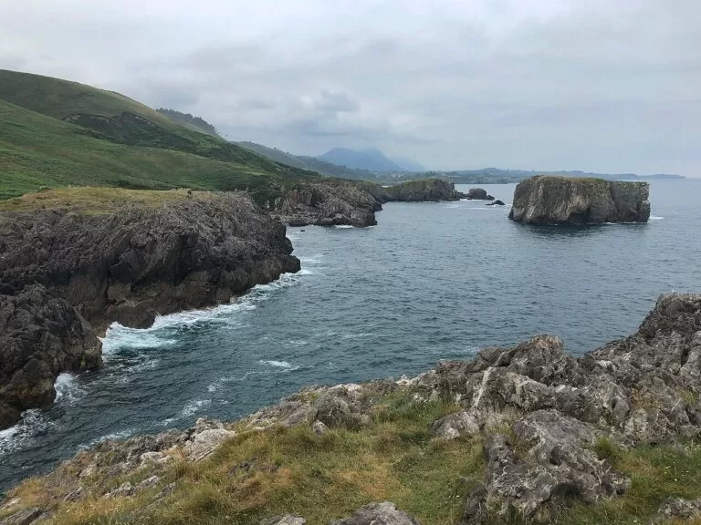
Andrín is a 240 m beach of sand and rocks below the Boriza viewpoint, with unpredictable currents (Turismo Asturias). Near Buelna, the Cobijeru Natural Monument joins an inland beach, a 230 m cave running down to the sea and the stone arch of Puente Caballo (Turismo Asturias); Buelna beach grows from 50 m to 1,000 m with the tide (Turismo Asturias). Near Puertas de Vidiago are the Bufones de Arenillas; leave the car near the mouth of the river Purón and walk on (Turismo Asturias).
La Franca and Colombres (Ribadedeva)
La Franca is a 260 m triangular beach at the mouth of the River Cabra, on the boundary between Llanes and Ribadedeva. It was a seaside spa in the 19th century, and at low tide you can walk to the coves of El Oso, El Viveru and Regorgueru (Turismo Asturias). Inland, Colombres, capital of Ribadedeva (1,875 inhabitants), has the largest collection of indiano architecture in Asturias, with the Emigration Museum in the Quinta Guadalupe (Turismo Asturias), and an Indianos Fair every July (Turismo Asturias).
Pimiango and Tina Mayor
The last stretch belongs to the Protected Landscape of the Eastern Coast. At Pimiango the San Emeterio lighthouse, built in 1852, is the easternmost in Asturias, near the Pindal cave with Magdalenian paintings and the ruins of the monastery of Santa María de Tina. The Tina Mayor estuary, the border with Cantabria, has a birdwatching centre (Turismo Asturias).
Beaches and coves
Lengths, facilities and lifeguard dates are as Turismo Asturias gives them, checked in November 2026. On most beaches in this area pets are banned from 1 June to 30 September.
Santa Marina
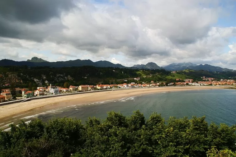
The town beach, about a kilometre of golden sand at the mouth of the Sella, with strong waves, surf schools and lifeguards from 15 June to 15 September (Turismo Asturias).
See Ribadesella →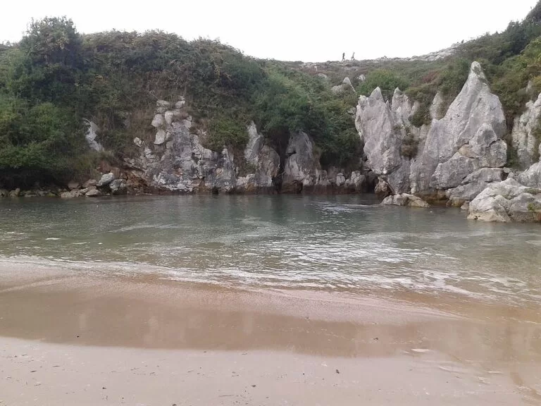
Gulpiyuri
A 40 m inland beach of coarse sand with no visible link to the sea; no services, and access on foot only (Turismo Asturias).
See Gulpiyuri →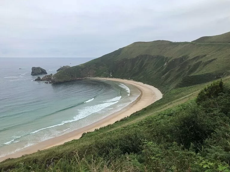
Torimbia
500 m of sand below vertical cliffs, reached on foot from the headland, with lifeguards daily from mid-June to 8 September (Turismo Asturias).
See Torimbia →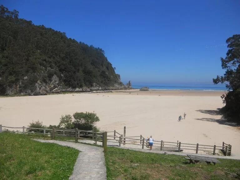
La Franca
A 260 m triangular beach with three access ramps, full facilities and lifeguards from 1 July to 8 September (Turismo Asturias).
Also on this stretch, from west to east:
- La Griega (Colunga): 820 m of golden sand at the mouth of the Libardón, with natural pools at low tide and a path of just over half a kilometre to some of the largest dinosaur footprints found anywhere (Turismo Asturias).
- La Isla (Colunga): a windy beach with strong waves, named after an islet joined to it at low tide; its listed length is 1,600 m, though the description says 800 m (Turismo Asturias).
- Vega (Ribadesella): a quiet beach with a small dune system and a wooden walkway, in a Natural Monument (Turismo Asturias).
- Cuevas del Mar (Llanes): 125 m of white sand among caves and tunnels, with a large car park and lifeguards from 14 June to 8 September.
Things to do
Dinosaurs and cave art
The Dinosaur Coast runs through Villaviciosa, Colunga and Ribadesella. Jurassic footprints (ichnites) are found at Lastres, at La Griega, whose prints are the largest known in Spain, and at Vega, Tereñes and Ribadesella; together they form a Natural Monument (Turismo Asturias). The Jurassic Museum stands on the San Telmo rasa in Colunga (Turismo Asturias).
The Tito Bustillo Cave in Ribadesella has more than a hundred painted and engraved figures from between 22,000 and 10,000 BC; guided visits for 15 people run from March to October, so book ahead (Turismo Asturias).
Blowholes and the coastal path
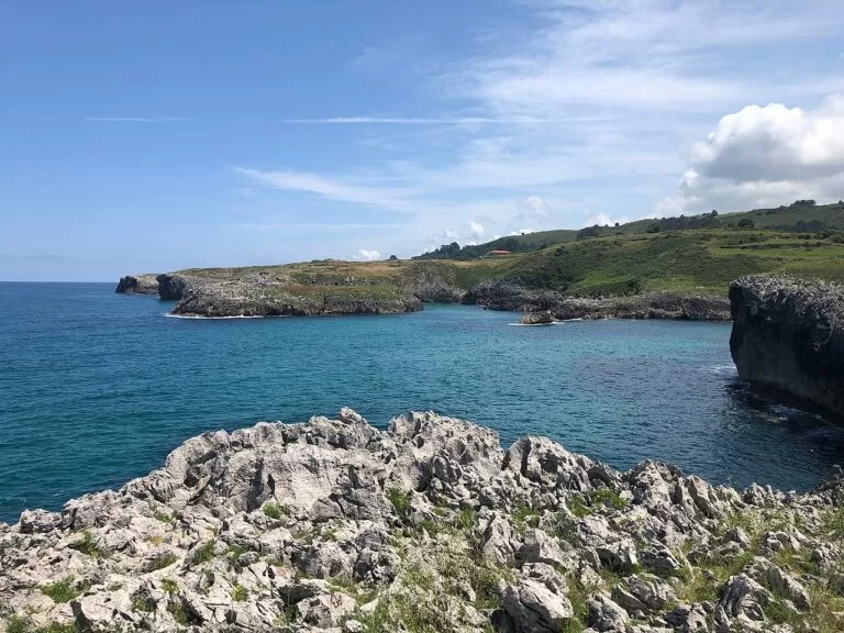
The blowholes (bufones) of Pría, Arenillas and Santiuste spout sea spray through chimneys in the cliffs (Turismo Asturias). Santiuste, on the border of Llanes and Ribadedeva, is considered the largest on the eastern coast and can throw its jet up to 40 m (Turismo Asturias). They work best in autumn and winter; keep well back, as the sea can throw up rocks too (Turismo Asturias). To link them on foot, follow the Llanes coastal path, about 48 km in four stages between Guadamía and Pendueles.
Into the mountains
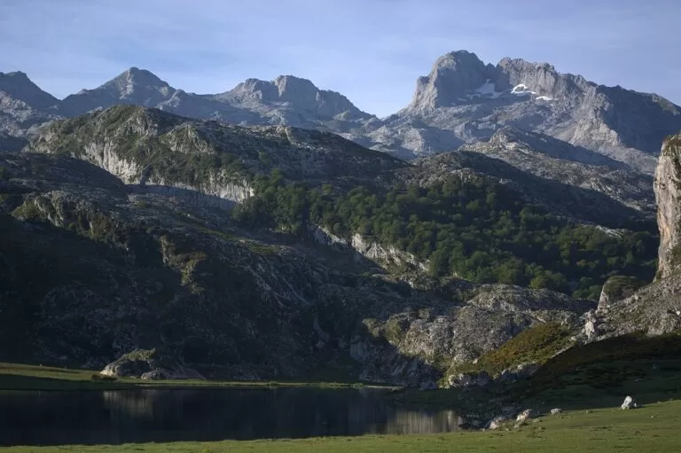
The Mirador del Fitu on the Sierra del Sueve, at 597 m, gives the classic view from the coast to the Picos in one stop. The Picos de Europa National Park starts about 20 km inland: most visitors go up to the Covadonga Lakes, where in 2026 private cars were barred from the road on busy dates and a bus ran instead, or walk the Ruta del Cares from Poncebos, 22.1 km there and back.
Seafood, cider and the indianos
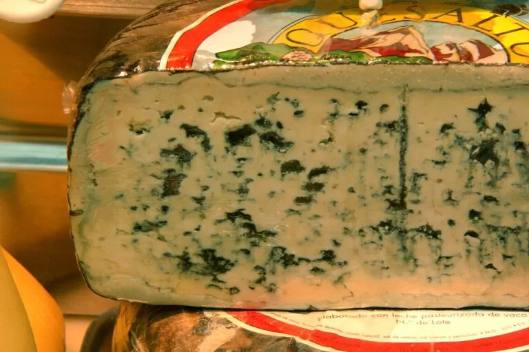
Seafood comes straight from the auction in Lastres, and Llanes is full of cider bars. The indianos, emigrants who came back rich from the Americas in the 19th and 20th centuries, left villas all along this coast; to understand them, visit Colombres, with the Emigration Museum and the Indianos Fair in July (Turismo Asturias).
Where to stay by town
We do not recommend individual hotels. These are the bases that make the most sense, from west to east.
Lastres or Colunga
A harbour village with steep lanes, close to La Griega, the dinosaur sites and the Fitu viewpoint. La Griega has a campsite about 200 m from the sand.
Village and fossils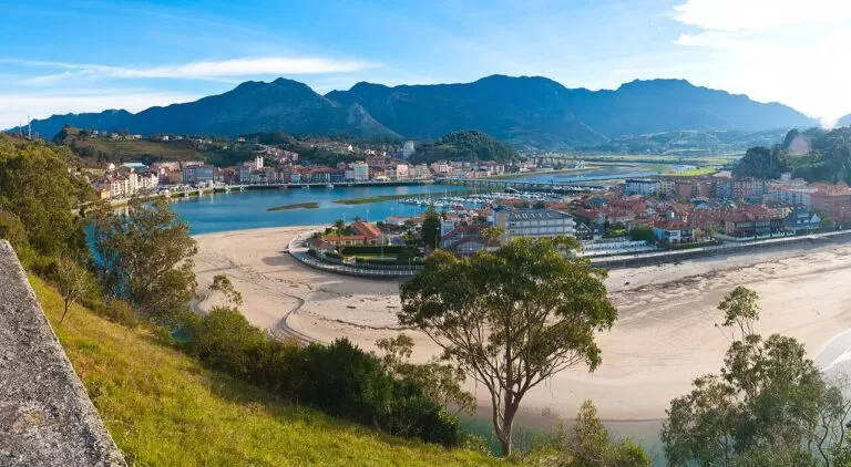
Ribadesella
A station, a long beach and the cave; the most central base. Book early for early August.
Central base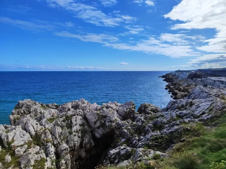
Llanes
The widest choice of rooms and restaurants, a station, and the coves a short drive away.
Base for the coves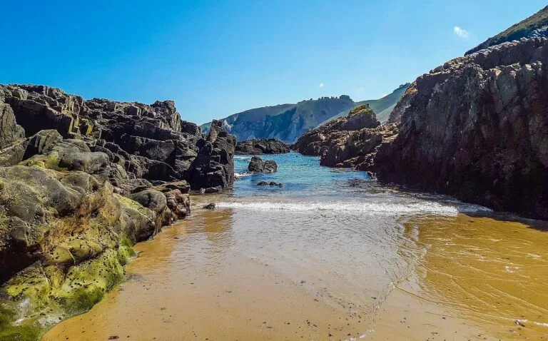
La Franca
A beach village with two campsites: HolaCamp La Franca, 80 m from the beach by its own account, and Las Hortensias, which Turismo Asturias lists on the beach itself.
Camping by the seaOne more campsite on CostaMap belongs to this area’s map: Camping San Pelayo, at km 5 of the Potes–Fuente Dé road in Cantabria, a base for the eastern side of the Picos rather than the coast.
Getting there and around
By air
Asturias Airport (OVD) is 40 km from Gijón, with direct buses to Gijón and Oviedo (Turismo Asturias); from there the east is a drive along the A-8.
By car
The A-8, the Autovía del Cantábrico, crosses Asturias from east to west (Turismo Asturias) and runs parallel to this coast. Many beaches are at the end of narrow lanes with small car parks, so arrive early in summer.
By train and bus
Ribadesella and Llanes both have a railway station and a bus station (OpenStreetMap). Renfe runs rail services in Asturias (Turismo Asturias); we could not open its timetables. Outlying beaches need a car.
A 1–2 day route
Day 1: Lastres to Ribadesella
Start in Lastres, from the San Roque viewpoint down to the harbour. Drive to La Griega and take the half-kilometre path east of the beach to the dinosaur footprints. Climb to the Mirador del Fitu for the view of the coast and the Picos, then drop down to Ribadesella. Between March and October, take a booked visit to the Tito Bustillo Cave (Wednesday to Sunday); otherwise visit the Cave Art Centre.
Day 2: the coves to La Franca
Stop at the Bufones de Pría if the sea is rough, then walk in to Gulpiyuri from Naves. Spend late morning at Torimbia or the easier Barro. In the afternoon walk the old town of Llanes, the Paseo de San Pedro and the Cubos de la Memoria. Continue east past Buelna and the Bufones de Arenillas to La Franca, and end at the San Emeterio lighthouse at Pimiango.
FAQ
Where is the eastern Asturias coast?
It is the eastern part of the Costa Verde in northern Spain, from Lastres in Colunga to La Franca and the Tina Mayor estuary on the border with Cantabria.
Is Llanes or Ribadesella the better base?
Ribadesella is more central for Lastres, the Fitu and the cave; Llanes is closer to the best-known coves, Torimbia, Gulpiyuri and Barro, and to the blowholes.
Do you need to book the Tito Bustillo Cave?
In practice yes. Visits are guided, for at most 15 people and 150 a day, and the cave is closed from November to March.
Where can I see the blowholes of Llanes?
At Pría west of Llanes, at Arenillas near Puertas de Vidiago and at Santiuste on the border with Ribadedeva. They need a big swell, mostly in autumn and winter.
Where are the dinosaur footprints in Asturias?
On the coast of Villaviciosa, Colunga and Ribadesella: at Lastres, at La Griega beach, which has a footpath to the prints, and at Vega, Tereñes and Ribadesella’s town beach.
How far is the coast from the Picos de Europa?
The national park starts about 20 km inland in a straight line. The Covadonga Lakes and the Ruta del Cares are easy day trips.
Other areas of the Costa Verde
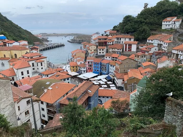
Western Asturias
From the Eo estuary on the Galician border to Cudillero: Castropol, Tapia, Luarca and dark-sand beaches.
Western Asturias guide →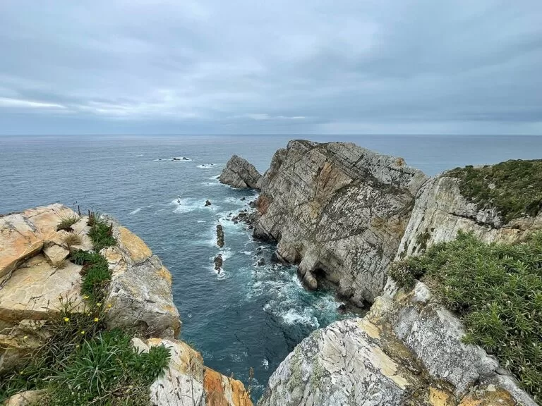
Central Asturias
Salinas, Cabo Peñas, Gijón and the Villaviciosa estuary, from Rodiles to Tazones.
Central Asturias guide →Costa Verde
The full guide to the coast of Asturias, with the weather, itineraries and practical information.
Costa Verde guide →Sources and freshness
Checked 6 November 2026. Facts come from the Turismo Asturias pages linked in each section (fishing villages, municipalities, beaches, natural monuments, the lighthouse route, Tito Bustillo Cave and getting there), from Spain.info on Ribadesella and Llanes, and from Wikipedia on the Bufones de Pría (background; we found no official page). Stations and straight-line distances are from OpenStreetMap; campsite details and the Picos access rules are as in the Costa Verde guide and our place pages. The town hall websites of Llanes, Ribadesella and Ribadedeva could not be opened from here.
Photo credits · 15 photos from Wikimedia Commons Show
Photos from Wikimedia Commons, not altered except for cropping: Ribadesella by D.Rovchak (CC BY-SA 4.0); Torimbia, Llanes by Einaz80 (CC BY-SA 4.0); Ribadesella by Herbythyme (CC BY-SA 4.0); Gulpiyuri by Fernando Vázquez (CC BY 3.0); Torimbia by Einaz80 (CC BY-SA 4.0); La Franca by McBodes (CC BY 3.0); Lastres by Fernando Vázquez (CC BY 3.0); Llanes by Einaz80 (CC BY-SA 4.0); Lagos de Covadonga by Luis Parra Rubio (CC BY-SA 4.0); Asturias by Tamorlan (CC BY 3.0); Lastres by Wamba Wambez (CC BY-SA 3.0); Llanes by Mentxuwiki (CC BY-SA 4.0); La Franca by David Ceballos from Quito, España (CC BY 2.0); Cudillero by Robot8A (CC BY-SA 4.0); Cabo Peñas by Einaz80 (CC BY-SA 4.0).
Every place we have mapped on the Eastern Asturias
11 towns, beaches, coves and landmarks, kept up to date automatically.