
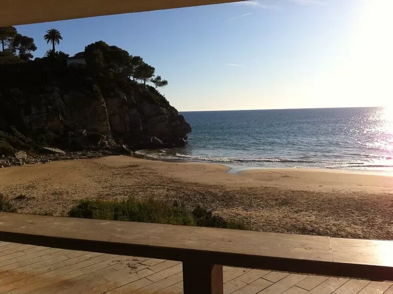
Cala Crancs is a small sandy cove on Cap de Salou, the headland between Salou and La Pineda on the Costa Daurada, a few metres west of the Salou lighthouse. You reach it by car through the Cap Salou residential area, where a small car park sits about 150 m from the beach, or on foot along Salou’s Camí de Ronda coast path. The cove is U-shaped, closed by rocks on both sides, with fine golden sand, a gentle slope into calm water and a full set of summer services. It suits families and swimmers who want something quieter than Salou’s big town beaches. Skip it at midday in August if you want space: at roughly 80 m long it fills up fast.
Quick facts
- Name: Cala Crancs is Catalan for “crabs’ cove”; Catalan Wikipedia says the name comes from the many crabs that lived there, and still do.
- Where: Cap de Salou, municipality of Salou (Tarragonès, Tarragona).
- Coordinates: 41.0565, 1.1678 (OpenStreetMap).
- Size: sources differ: Spain.info gives 80 m by 40 m, a University of Girona survey cited by Catalan Wikipedia gives 77 m long and 40 m wide on average, and the Salou tourist board gives 89 m.
- Sand and water: fine golden sand, calm water, gentle slope (Spain.info, Catalan Wikipedia).
- Faces: south-west to west, so it gets the afternoon sun.
- Services: sunshade and lounger hire, water-craft and pedal-boat hire, toilets, showers, a first-aid post and a kiosk in season.
- Water quality: the Catalan Water Agency checks it every two weeks in the bathing season, and Catalan Wikipedia reports an “excellent” result.
Access and parking
By car: drive up into Cap Salou on the Carretera del Far, the lighthouse road, and turn down the Carrer de la Cala Crancs. OpenStreetMap shows a small car park with about 30 spaces at the bottom of the street, roughly 150 m from the sand, and a second small car park near the lighthouse. The streets around are residential and partly one-way.
On foot: the cove lies on the Camí de Ronda, the coast path that the Salou tourist board describes as 9.49 km from Punta de Sant Pere, at the end of Ponent beach, to the Racó de Salou next to La Pineda (as quoted in our Salou guide). From the centre of Salou it is about 3 km in a straight line, and the path climbs and drops with stairs and rocky stretches. The last part down to the beach is a set of steps.
From the marina: Spain.info gives the Salou marina as 3 km from the cove.
Public transport: we could not confirm a bus stop or line that serves the cove directly. Taxis and the coast path are the practical options without a car.
What to expect
Spain.info calls Cala Crancs a picturesque cove with a more relaxed atmosphere than the bigger beaches, set among large rocks that keep the water calm (Spain.info). The Salou tourist board describes it as surrounded by vegetation, away from the hotels, and good for snorkelling around the rocks on each side. Catalan Wikipedia adds that it lies in the residential area of Cap Salou, framed by rocks and greenery.
On the path down to the beach stands a small piece of modern architecture: three concrete triangles designed by Antoni Bonet i Castellana and Josep Puig i Torné that shelter the snack bar and changing rooms, the Cap Salou civic centre, a porch and a viewpoint (Catalan Wikipedia). OpenStreetMap maps several viewpoints on the rocks either side of the cove.
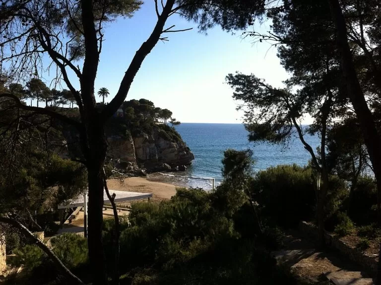
The cove has a darker history too. Catalan Wikipedia, citing the Diari de Tarragona, says that in the 16th century corsairs used it as a hideout and to hold people they had kidnapped until a ransom was paid. A short walk east brings you to the Cap de Salou lighthouse and, north of the lighthouse near the coast path, the ruins of a gun emplacement mapped on OpenStreetMap.
With only about 80 m of sand, the cove has little room on busy summer days. Outside the bathing season the services are not running.
Practical details
- Entry: free; it is a public beach.
- Services: OpenStreetMap shows public toilets and a free cold-water shower near the steps; Spain.info and Catalan Wikipedia list lounger, sunshade and water-craft hire, a kiosk and a first-aid point. Expect these only in the bathing season.
- Prices: we could not confirm lounger or parking prices for 2026.
- Food: the kiosk at the beach; for restaurants, go back up into Cap Salou or to Salou town.
- What to bring: water shoes and a mask if you want to explore the rocks, shade in the afternoon.
Accessibility and safety
Access to the sand is by steps, so the cove is not suitable for wheelchairs and is awkward with a pushchair. The rocks on both sides are uneven and slippery when wet; take care when snorkelling near them. The water is usually calm, but check the flag at the first-aid post, as lifeguard cover is seasonal. We could not confirm lifeguard hours.
Best time to visit
June and September give warm water with fewer people. In July and August, come early in the morning or late in the afternoon, when the west-facing cove keeps the sun. In winter the beach is empty and is best as a stop on a walk along the Camí de Ronda.
Nearby alternatives
- Aquopolis Costa Daurada, 2.0 km away: the water park on the seafront of La Pineda.
- Salou, 3.1 km away: Llevant beach, the seafront promenade and the start of the coast path.
- Ferrari Land, 3.4 km away: the Ferrari theme park inside PortAventura World.
- PortAventura World, 3.6 km away: the theme-park resort between Salou and Vila-seca.
- Caribe Aquatic Park, 3.7 km away: PortAventura’s summer water park.
- Port de Cambrils, 9.0 km away: the fishing harbour of Cambrils.
Distances are in a straight line from the cove.
FAQ
Is there parking at Cala Crancs?
Yes, but little. OpenStreetMap shows a car park of about 30 spaces at the end of the Carrer de la Cala Crancs, about 150 m from the beach, and another small one near the lighthouse. In summer, arrive early.
How do I get to Cala Crancs from Salou?
Walk the Camí de Ronda coast path east from the town beaches, about 3 km in a straight line with stairs on the way, or drive up into Cap Salou on the lighthouse road.
Is Cala Crancs good for snorkelling?
Yes. The Salou tourist board recommends it for snorkelling, and the rocks on both sides keep the water calm.
Is Cala Crancs good for children?
Yes, for swimming: the sand slopes gently and the water is usually calm. The steps down and the small size are the drawbacks.
Are there toilets at Cala Crancs?
Yes. OpenStreetMap shows public toilets and a shower near the beach, and the snack bar has changing rooms.
Sources and freshness
Checked 7 November 2026 · 6 sources Show
Checked 7 November 2026. Official tourism: Spain.info on Cala Crancs (size, sand, services, marina distance) and on Salou (coast path). The Salou tourist board’s figures (89 m, snorkelling, coast path length) as quoted in our Salou guide; the tourist board’s own site could not be reached for this update. Background: Viquipèdia, Cala Crancs (orientation, water quality, history, architects). Location, car parks, toilets, shower, steps, viewpoints and distances: OpenStreetMap (OpenStreetMap contributors, ODbL). Photos: Wikimedia Commons, licences as credited.
This place is part of our Costa Dorada map and travel guide: Roman Tarragona, Salou and the Ebro Delta — see every town, beach and cove we have mapped on that coast.
How this page is made. CostaMap is written with an AI editorial system run by Ebizapple. This page is based on the sources listed above. Last updated 6 November 2026. Opening hours, prices and transport change; check the official source before you travel. How we work · Partner links and ads