
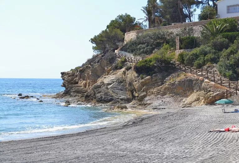
Cala de la Fustera is the main beach of Benissa: a sandy cove about 110 m long and 30 m wide, framed by rock, on the coast road between Calp and Moraira. The regional tourist board lists a beach bar, toilets, a playground, a picnic area, lifeguards and an assisted bathing service in summer. Parking, a bus stop and the Benissa beach tourist office are all within about 150 m. It suits families, snorkellers and walkers on the coastal trail; skip it if you want a long beach with room to spread out.
Quick facts
- Names: Cala de la Fustera, Cala Fustera, Platja de la Fustera (Valencian) or Playa de la Fustera (Spanish). The regional tourist board calls it the main beach of Benissa.
- Where: Benissa Costa, on the Avinguda de la Marina (CV-746), the coast road between Calp and Moraira, Marina Alta, Alicante.
- Coordinates: 38.6646, 0.0880.
- Size: 110 m long and about 30 m wide (Comunitat Valenciana tourist board).
- Surface: sand, with rocks at both ends.
- Facilities listed: beach bar, toilets, footwash, children’s playground, picnic area, lifeguards, walkways, and access for people with reduced mobility.
- Certificates listed: ISO 14001 and ISO 9001, and an Ecoplayas award.
- Entry: free; the beach is tagged as public access on OpenStreetMap.
Access and parking
By car: the cove lies right below the Avinguda de la Marina (CV-746), the road that runs along the Benissa coast. Benissa town is 6.5 km away in a straight line, inland. The regional tourist board says you can walk or drive along the coast road and that there is a car park nearby.
Parking: OpenStreetMap shows three small car parks between 115 m and 145 m from the sand, just off the coast road, and a larger asphalt car park about 350 m to the west. Another car park, marked free, sits by the Cala dels Pinets about 360 m to the north-east. We could not confirm the number of spaces.
By bus: OpenStreetMap shows a bus stop called “la Fustera” on the Avinguda de la Marina, about 150 m from the beach, with a second stop of the same name on the other side of the road. We could not confirm which lines stop there or how often, so check locally before you rely on it.
On foot: the cove is a starting point of the Paseo Ecológico Litoral de Benissa, the coastal trail along the town’s 4 km of shore (see below).
What to expect
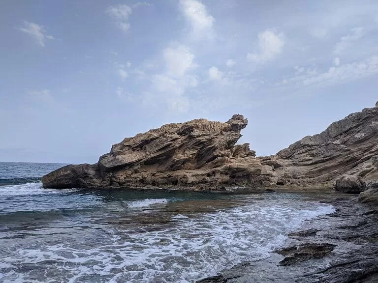
A small, semi-urban cove. Rough rocks close it in at both ends, and pine and garden plants run almost down to the sand. Holiday homes line the slopes above. The water is clear, and the tourist board recommends it for snorkelling: there are seagrass meadows of Posidonia (Mediterranean tapeweed) on the seabed. From the shore you look south to the Peñón de Ifach at Calp.
It is the best-served beach on the Benissa coast. The neighbouring coves are wilder. The Cala dels Pinets, 300 m north-east, is a pebble cove of 60 m by 10 m with no listed bar or toilets, according to the same tourist board. If you want sand, a bar and a lifeguard, La Fustera is the one.
Practical details
- Food and drink: OpenStreetMap shows a beach bar about 50 m from the sand and several restaurants and a small supermarket within 300 m on the coast road.
- Tourist office: Tourist Info Benissa Playa is at Avinguda de la Marina 307, about 140 m from the beach. The regional site lists phone 96 649 83 61. Check its opening hours before you go.
- Health: a summer clinic, the Consultori d’Estiu Platja de la Fustera, run by the regional health service, sits about 125 m away (OpenStreetMap).
- Picnics: OpenStreetMap maps a picnic site about 70 m from the beach and another at the viewpoint on Punta Prado.
- Bring: a snorkel mask and water shoes for the rocky ends.
Accessibility and safety
The regional tourist board lists access for people with reduced mobility, walkways, and an assisted bathing service in the summer months with amphibious chairs and crutches. We could not confirm the 2026 dates or hours for this service or for lifeguards; outside the summer season the beach is unsupervised. Paths at both ends of the cove climb in steps up the cliff, so they are not step-free. The rocks at the edges are uneven and slippery.
Best time to visit
Come in June or September, when the summer services run and there is more space on a beach this size. Parking is in small car parks, so in July and August arrive early. Out of season the cove is quiet, and the coastal trail is pleasant for walking in spring and autumn.
The coastal trail
The Paseo Ecológico Litoral de Benissa follows the town’s coastline past cliffs and coves on a marked path. The regional tourist board describes it as an easy linear route with a total elevation change of 93 m and information panels on local history and nature. You can walk sections of it, for example from the Benissa Playa tourist office to the Les Bassetes marina, or on to Cala Advocat. On the way you pass seagrass meadows, old aeolianite rock and protected plant micro-reserves.
Nearby alternatives
- The Cala dels Pinets, 0.3 km north-east along the trail: a small pebble cove for snorkelling, with no listed services.
- Peñón de Ifach (Calpe), 3.3 km away: the rock you see from the beach, a natural park.
- Moraira (Teulada), 4.7 km away: the next town north-east along the coast.
- Benissa, 6.5 km away: the town centre, inland.
- Sierra de Bernia, 11.7 km away: a mountain ridge with hiking routes.
Distances are in a straight line from the cove.
FAQ
Where is Cala de la Fustera?
On the Benissa coast, below the Avinguda de la Marina (CV-746) between Calp and Moraira, in the Marina Alta of Alicante. Coordinates: 38.6646, 0.0880.
Is Cala Fustera sand or pebbles?
Sand, with rocks at both ends. The neighbouring Cala dels Pinets is the pebble one.
Is there parking at Cala de la Fustera?
Yes. OpenStreetMap shows three small car parks 115–145 m from the sand and a bigger one about 350 m west.
Is Cala de la Fustera good for snorkelling?
Yes. The water is clear, and the tourist board points to Posidonia seagrass and sea life on the seabed.
Is the beach accessible for wheelchair users?
The tourist board lists access for people with reduced mobility and an assisted bathing service with amphibious chairs in the summer months. Check the current dates with Tourist Info Benissa Playa before you go.
Sources and freshness
Checked 6 November 2026 · 6 sources Show
Checked 6 November 2026. Official: Turisme Comunitat Valenciana on Cala Fustera (size, services, certificates, access), Cala dels Pinets, the Paseo Ecológico Litoral and Tourist Info Benissa Playa. Background: Wikipedia, Benissa (4 km of coastline). Location, parking, bus stops, services and distances: OpenStreetMap contributors (ODbL). Photos: Wikimedia Commons, licences as credited.
This place is part of our Costa Blanca, Spain: towns, beaches and where to stay — see every town, beach and cove we have mapped on that coast.
How this page is made. CostaMap is written with an AI editorial system run by Ebizapple. This page is based on the sources listed above. Last updated 6 November 2026. Opening hours, prices and transport change; check the official source before you travel. How we work · Partner links and ads