
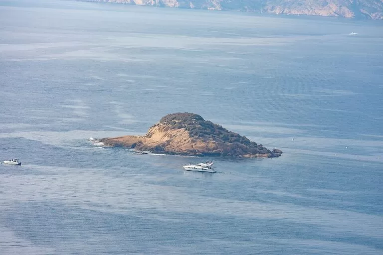
The Illa de l’Olla (Illeta de l’Olla, or Isla de la Olla in Spanish) is the small, flat islet about 500 m off the l’Olla district of Altea, on the Costa Blanca. You see it from Olla beach and the seafront path; the regional tourism board says confident swimmers can reach it from the shore. It is part of the Serra Gelada Natural Park, and every August Altea’s Castell de l’Olla fireworks are fired over the sea in front of it. It suits swimmers, paddlers and anyone staying in Altea; skip it if you want an island with paths, shade or services.
Quick facts
- Names: Illa de l’Olla or Illeta de l’Olla in Valencian, also Illot de l’Olla on OpenStreetMap; Isla de la Olla or islote de la Olla in Spanish. The regional tourism board calls it simply L’Illeta.
- Where: Altea bay, opposite the l’Olla district and Olla beach, Altea (Alicante), Marina Baixa.
- Coordinates: 38.6170, -0.0197.
- Size: roughly 100 m across, about 0.7 hectares, measured on OpenStreetMap.
- Distance from shore: about 470 m at the nearest point and about 950 m from the mapped centre of Olla beach.
- Geology: a flat islet of Paleogene age, formed mainly by an old raised marine terrace (Spanish Wikipedia).
- Protection: one of the islets in the marine area of the Serra Gelada Natural Park, declared in 2005.
- Entry: free; no ferry, ticket or visitor service.
Access and parking
To the shore: the l’Olla district lies south of Altea town. The closest stretch of shore is near the Merendero Arrecife and L’Olleta beach bars, which OpenStreetMap places about 550–750 m from the islet.
Parking: OpenStreetMap shows a free public car park about 590 m from the islet, close to that stretch of shore, and several smaller parking spots in the streets behind. We could not confirm how many spaces there are or how full they get in August.
By tram: the Olla Altea stop on the Alicante TRAM line, run by FGV, is about 1.2 km from the islet in a straight line (OpenStreetMap). Walk down to the seafront from there.
Onto the water: the Portet de l’Olla, a small dock with nearly forty moorings, is about 1.1 km away. In summer, catamarans and windsurf boards are for hire there (Comunitat Valenciana). We could not confirm kayak or paddleboard hire.
What to expect
A low, rocky islet, flat on top and covered in scrub, with no paths, buildings or services that we could confirm. Olla beach, which faces it, stretches for about 1.5 km and mixes pebbles, rock and patches of sand. The regional tourism board names two islets off this beach, L’Illeta and L’Illot, and says confident swimmers can reach L’Illeta from the shore (Comunitat Valenciana). OpenStreetMap maps the Illeta de l’Olla and a much smaller, unnamed rock about 850 m to the north-east, off Platja de la Solsida.
The islet belongs to the Serra Gelada Natural Park. The park covers 5,653.92 hectares, and 4,908.95 hectares of that are sea and islets: Mitjana, Benidorm Island, l’Olla and la Galera (Comunitat Valenciana). Spanish Wikipedia notes Posidonia and Cymodocea seagrass meadows in the park’s waters and seabirds such as the European storm petrel, the shag and Audouin’s gull.
Local legend ties the islet to the Cova del Frare, a sea cave on Olla beach that has now almost disappeared. In the version told by the folklorist Francesc Martínez, two fishermen brothers fought over a girl during a night’s fishing at the Illeta; one drowned and his body appeared in the cave (Catalan Wikipedia). The cave is included in the heritage area of the Cala del Soio–Illeta de l’Olla.
The Castell de l’Olla fireworks
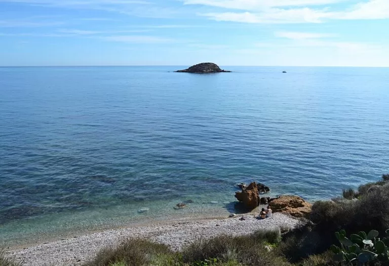
The islet’s best-known night is the Castell de l’Olla, Altea’s fireworks display over the sea. It is held on the Saturday closest to San Lorenzo, 10 August. The fireworks are set off from a platform floating in the bay, with music choreographed to the show. It is a Festival of Regional Tourist Interest and draws more than 50,000 people a year to Olla beach, while boats gather in the bay to watch from the water. It began over 30 years ago as a tribute to Blas Aznar, a local pyrotechnician (Comunitat Valenciana). We could not confirm the 2027 date or times; check Altea’s official programme before you go.
Accessibility and safety
The islet is about 470 m from the nearest shore: only strong swimmers should try it, ideally with a tow float and a companion, and never across boat traffic in the bay. We found no landing point or path on the islet. Olla beach is mostly pebbles and rock; we could not confirm step-free access to the water or lifeguard cover. On the night of the Castell, expect very large crowds and full parking.
Best time to visit
For swimming or paddling, choose a calm morning in summer or early autumn. For the fireworks, come on the Saturday closest to 10 August and arrive early. The rest of the year the islet is simply part of the view along the seafront.
Nearby alternatives
- Marina Greenwich (Altea), 2.1 km away: a marina within Altea’s municipality.
- Altea, 2.7 km away: the town guide, with the old town and seafront.
- Serra Gelada Natural Park, 6.6 km away: the cliffs and walks of the park the islet belongs to.
- Faro del Albir, 6.5 km away: the lighthouse viewpoint in the Serra Gelada.
- Benidorm Island, 15.9 km away: another island of the same natural park.
Distances are in a straight line from the islet.
FAQ
Can you swim to the Illa de l’Olla?
The regional tourism board says confident swimmers can reach it from the shore. The nearest point of the coast is about 470 m away, so it is only for strong swimmers on a calm day.
Where is the island in Altea?
Off the l’Olla district, south of Altea town, opposite Olla beach. Coordinates: 38.6170, -0.0197.
Is there parking near Olla beach?
Yes. OpenStreetMap shows a free car park about 590 m from the islet and small parking areas in the streets behind the beach. Expect it to fill on summer weekends and on the night of the Castell.
When is the Castell de l’Olla?
On the Saturday closest to San Lorenzo, 10 August. The fireworks are fired from a floating platform in the bay and watched from Olla beach and from boats.
Can you go onto the island?
We found no rule that allows or bans landing. It is part of a natural park, has no paths or landing point, and is best enjoyed from the water.
Sources and freshness
Checked 6 November 2026 · 8 sources Show
Checked 6 November 2026. Altea town hall’s website could not be reached, so we relied on the regional board. Official: Turisme Comunitat Valenciana on Olla beach (length, islets, swimming, dog area), the Castell de l’Olla festival and event, El Portet de l’Olla and Serra Gelada Natural Park. Background: Spanish Wikipedia on the Serra Gelada park (geology, 2005, seagrass, birds); Catalan Wikipedia on the Cova del Frare (legend, heritage area). Location, size, parking, tram stop and distances: OpenStreetMap contributors (ODbL). Photos: Wikimedia Commons, licences as credited.
This place is part of our Costa Blanca, Spain: towns, beaches and where to stay — see every town, beach and cove we have mapped on that coast.
How this page is made. CostaMap is written with an AI editorial system run by Ebizapple. This page is based on the sources listed above. Last updated 6 November 2026. Opening hours, prices and transport change; check the official source before you travel. How we work · Partner links and ads