
Camí de Ronda S’Agaró to Platja d’Aro (Castell-Platja d’Aro)
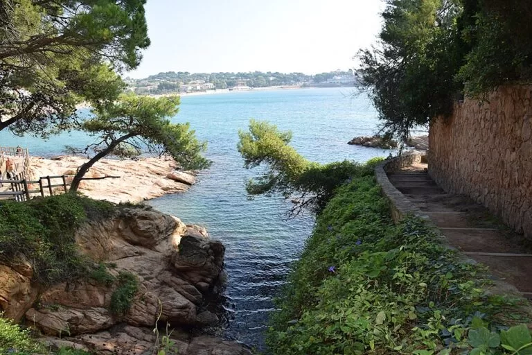
Hiking trailThe Camí de Ronda of S’Agaró is the coastal path that runs from the east end of Sant Pol beach, round the headland of S’Agaró, to Sa Conca beach, in the municipality of Castell-Platja d’Aro on the Costa Brava. The official Costa Brava tourism board puts it at 2 km, and it is part of the GR 92 long-distance path; measured on OpenStreetMap, you can carry on north past Platja Llarga and Port d’Aro to the main beach of Platja d’Aro, about 5.4 km from the start. The S’Agaró section is an easy, built path past the villas of a garden-city resort planned from 1916. It suits families and anyone who wants an easy, short coastal walk. Skip it if you are after wild cliffs and solitude: this is a manicured promenade between private houses and the sea.
Quick facts
- Names: Camí de Ronda de S’Agaró in Catalan; named after Josep Ensesa i Gubert, the visionary behind S’Agaró. Spanish: Camino de Ronda de S’Agaró.
- Where: S’Agaró, Castell-Platja d’Aro (Baix Empordà, Girona), between Sant Feliu de Guíxols and Platja d’Aro.
- Start coordinates: 41.7906, 3.0539, at the east end of Sant Pol beach.
- Distance: 2 km for the Camí de Ronda itself (Costa Brava tourism). Measured on OpenStreetMap: 1.9 km from Sant Pol to Sa Conca beach, 2.3 km to the far end of Sa Conca, and about 5.4 km to the south end of the main Platja d’Aro beach, one way.
- Time and height gain: we could not open the official Platja d’Aro tourism pages, so we give no official time.
- Waymarking: part of the GR 92 Mediterranean long-distance path (OpenStreetMap).
- Heritage: the S’Agaró architectural ensemble has been listed as a Cultural Asset of National Interest since 1996 (Costa Brava tourism).
- Entry: free.
Access and parking
Start: walk to the east end of Sant Pol beach, where the Camí de Ronda leaves the sand (41.7906, 3.0539). The beach lies between Sant Feliu de Guíxols and S’Agaró, off the coast road.
Parking: OpenStreetMap marks several free surface car parks just inland of Sant Pol beach, about 400–650 m from the start, and more free car parks inland of Sa Conca at the other end. Capacity and any summer rules are not listed.
Bus: OpenStreetMap shows several stops in S’Agaró and along Sant Pol, served by local line L5 (Sant Feliu de Guíxols – Sant Pol – Castell d’Aro) and by intercity buses towards Palamós and Girona. Check current timetables locally; we could not confirm them.
Getting back: the S’Agaró section is short enough to walk back the same way.
What to expect
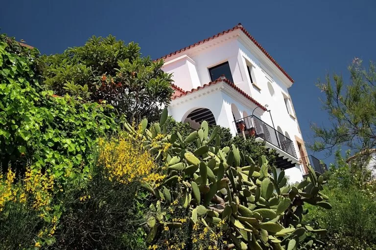
S’Agaró was planned from 1916 by the industrialist Josep Ensesa, with the architect Rafael Masó, as a noucentista garden city where architecture and landscape were designed together (Costa Brava tourism). The Camí de Ronda is part of that design. Rather than a cliff trail, it is a built promenade with a compacted surface and some stairs, hugging the rocks below the villas of the listed ensemble, which includes Senya Blanca and the Hostal de La Gavina. Information panels along the way tell the resort’s history (Catalan Wikipedia).
The path ends at Sa Conca, a sandy beach in a bay. Beyond it, the GR 92 continues along a dirt path, then mostly along streets and promenades past Platja Llarga and the marina at Port d’Aro to the long town beach of Platja d’Aro. This northern part is less special: on OpenStreetMap most of it is on asphalt, concrete or paving.
Practical details
- Sa Conca has a free public toilet near the beach (OpenStreetMap; not wheelchair accessible).
- Trainers are fine on the S’Agaró section: OpenStreetMap maps it as a compacted footway.
- Combine it with a swim: Sant Pol at the start and Sa Conca at the end are both sandy beaches.
- For a longer day, the GR 92 continues south to Sant Feliu de Guíxols. Costa Brava tourism describes the whole Sant Feliu–Palamós stretch as 17 km.
Accessibility and safety
The S’Agaró section is easy, but there are stairs, including the steps down to Sa Conca beach, so we cannot confirm full step-free access. Sant Pol beach has a lit wooden boardwalk that OpenStreetMap tags as wheelchair accessible. The path runs above the rocks in places; keep small children close.
Best time to visit
Any time of year: the path is short, low and made. In July and August, go early in the morning or in the evening, and add a swim at Sa Conca. In 2024 S’Agaró celebrated the centenary of the resort (Catalan Wikipedia).
Nearby alternatives
- La Fosca, 10 km away: a beach further north on the same GR 92 coastal path, near Palamós.
- Tossa de Mar, 13 km away: a town on the coast to the south.
- Calella de Palafrugell, 15 km away: a fishing village with its own Camí de Ronda.
- Llafranc, 16 km away: the next beach north of Calella on the coastal path.
- Begur, 22 km away: a hill town further up the coast.
Distances are in a straight line from the start at Sant Pol beach.
FAQ
How long is the Camí de Ronda in S’Agaró?
About 2 km from Sant Pol beach to Sa Conca beach (Costa Brava tourism); 1.9 km measured on OpenStreetMap. Continuing to Platja d’Aro beach makes about 5.4 km one way.
Where does the S’Agaró coastal path start?
At the east end of Sant Pol beach, between Sant Feliu de Guíxols and S’Agaró (41.7906, 3.0539). It ends at Sa Conca beach.
Is there parking?
Yes. OpenStreetMap marks free car parks 400–650 m inland of Sant Pol beach and more near Sa Conca.
Is the walk suitable for children or pushchairs?
It is easy and suits children. With a pushchair, expect some stairs, including at Sa Conca.
Can I swim along the way?
Yes, at Sant Pol beach at the start and Sa Conca beach at the end.
Sources and freshness
Checked 6 November 2026 · 6 sources Show
Checked 6 November 2026. The Platja d’Aro tourism website (visitplatjadaro.com) could not be opened when we checked, so no official walking time or accessibility statement is given. Length, history and heritage listing: Costa Brava tourism, S’Agaró and Camins de Ronda one-day hikes. Background: Catalan Wikipedia, S’Agaró. Route line, distances, surfaces, parking, toilets and bus stops: OpenStreetMap, Camí de Ronda de Josep Ensesa and GR 92 Palamós–Sant Feliu; map data © OpenStreetMap contributors (ODbL). Photos: Wikimedia Commons, licences as credited.
How this page is made. CostaMap is written with an AI editorial system run by Ebizapple. This page is based on the sources listed above. Last updated 6 November 2026. Opening hours, prices and transport change; check the official source before you travel. How we work · Partner links and ads