
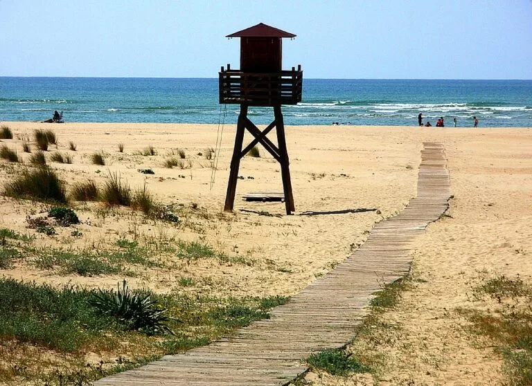
Playa de la Bota is a 3.8 km natural beach of golden sand in Punta Umbría (Huelva), on the open Atlantic between the town and El Portil, backed by pine woods and dunes instead of buildings. You reach it by car on the A-497 coast road from Huelva towards El Portil, and in summer it has lifeguards, toilets, showers and beach bars. It suits families, walkers and anglers who want space; skip it if you want a promenade, shops and a town on the sand.
Quick facts
- Names: Playa de la Bota or Playa de La Bota; OpenStreetMap also lists the name Playa del Cruce.
- Where: west of Punta Umbría town, on the Huelva coast of the Costa de la Luz. The beach of El Portil starts about 1.3 km further west.
- Coordinates: 37.2027, -7.0270 (middle of the beach, OpenStreetMap).
- Size: 3,800 m long and about 35 m wide (Andalusian tourist board and spain.info).
- Sand and sea: golden sand; moderate waves.
- Setting: classed as “isolated”, meaning no town behind it, with pine woods and dunes.
- Facilities listed: parking, lifeguard service, toilets, showers, footwash, sunbed and parasol hire, cleaning, bins, public phone.
- Entry: free.
Access and parking
By car: the official access is by car. Spain’s tourism site gives the A-497 Huelva–Punta Umbría road as the nearest main road (spain.info).
Parking: OpenStreetMap marks two car parks about 250 m from the middle of the beach, beside the Cruz Roja lifeguard post. A larger free surface car park lies at the eastern end, about 1.5 km away, and another car park sits at the western end near El Portil. We could not confirm 2026 parking fees, if any, or the number of spaces.
Without a car: OpenStreetMap shows no bus stop on the beach itself. The nearest stops it maps are about 2 km west, at El Portil. We could not confirm a 2026 bus timetable for this stretch, so check locally before relying on the bus.
What to expect
The Andalusian tourist board calls La Bota the busiest beach of the area, with both swimmers and anglers, set between pine woods and dunes and good for long walks (andalucia.org). There is no promenade and no row of apartments. OpenStreetMap shows the beach as one long, straight strip of sand.
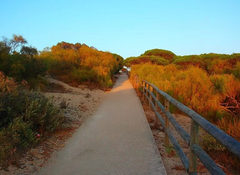
The beach is part of a chain of protected coast. The Paraje Natural Enebrales de Punta Umbría, a natural area declared on 27 July 1989 and covering 162 hectares, runs along the shore from Punta Umbría town to La Bota. It is one of the few mixed woods of Phoenician juniper (sabina) and prickly juniper (enebro) left on the Andalusian coast, and boardwalk paths cross it to the beach (andalucia.org, Enebrales). The core of the juniper wood lies about 3 km east of the middle of La Bota.
Inland, the Marismas del Odiel, a tidal marsh that UNESCO lists as a biosphere reserve and a special protection area for birds, begins a few kilometres north (andalucia.org, Marismas del Odiel). To the west, El Portil beach is surrounded by the Laguna del Portil nature reserve, the Enebrales and the Odiel marshes (andalucia.org, El Portil).
Practical details
- Food and drink: OpenStreetMap maps several beach bars and restaurants along the beach, among them Chiringuito Der Matías and Chiringuito Playa del Este, and the restaurant at Camping Playa la Bota. Opening months were not confirmed.
- Toilets and showers: listed by the tourist board; OpenStreetMap shows toilet blocks near the campsite and a free shower and drinking water tap at the western end.
- Camping: Camping Playa la Bota sits just behind the beach, about 0.5 km from the middle.
- Shade: there is little natural shade on the sand. Parasols can be hired in season.
- Fishing: anglers use the beach; keep clear of lines at dawn and dusk.
Accessibility and safety
The tourist board lists a lifeguard service and rescue equipment, and OpenStreetMap marks a Cruz Roja lifeguard post near the central car parks. Lifeguard dates and hours for 2026 could not be confirmed, so outside summer treat the beach as unsupervised. This is the open Atlantic with moderate waves: watch the flags and the tide. We found no official statement of step-free access or an adapted bathing point at La Bota, so wheelchair users should check on arrival.
Best time to visit
Summer brings the lifeguards, beach bars and parasol hire, and also the crowds: spain.info rates occupancy as high. For walking along the sand and through the junipers, spring and autumn are calmer; the tourist board recommends spring and autumn for the Enebrales natural area. Weekdays outside July and August are the quietest.
Nearby alternatives
- Punta Umbría, 6.1 km away: the town, its urban beach and the river mouth.
- Marismas del Odiel, 5.4 km away: tidal marshes and salt pans, known for spoonbills.
- Aljaraque, 8.6 km away: the neighbouring municipality to the west.
- Flecha del Rompido, 8.5 km away: a sand-spit beach further west.
- Huelva, 9.8 km away: the provincial capital across the Odiel.
Distances are in a straight line from the middle of the beach.
FAQ
Where is Playa de la Bota?
In Punta Umbría, Huelva, west of the town and just east of El Portil, along the A-497 coast road. Coordinates: 37.2027, -7.0270.
Is there parking at Playa de la Bota?
Yes. OpenStreetMap shows two car parks about 250 m from the middle of the beach and a larger free car park at the eastern end. Fees for 2026 were not confirmed.
Are there lifeguards at La Bota?
The Andalusian tourist board lists a lifeguard service, and a Cruz Roja post is mapped on the beach. Dates and hours for 2026 were not confirmed; outside summer assume there are none.
Can you swim at Playa de la Bota?
Yes. It is an open Atlantic beach with moderate waves and golden sand. Swim near the lifeguard post in season and respect the flags.
Can I get to La Bota by bus?
OpenStreetMap shows no bus stop on the beach; the nearest mapped stops are about 2 km west at El Portil. A car is the practical option.
Sources and freshness
Checked 6 November 2026 · 6 sources Show
Checked 6 November 2026. Official: Andalusian tourist board on Playa de la Bota (size, sand, facilities, setting), Enebrales de Punta Umbría (area, date, juniper wood, boardwalks), El Portil and Marismas del Odiel; Turespaña on La Bota (size, access road, occupancy). The Punta Umbría town hall website could not be reached. Location, parking, lifeguard post, bars, bus stops and distances: OpenStreetMap contributors (ODbL). Photos: Wikimedia Commons, licences as credited.
This place is part of our Costa de la Luz, Spain: beaches, towns, sherry and map — see every town, beach and cove we have mapped on that coast.
How this page is made. CostaMap is written with an AI editorial system run by Ebizapple. This page is based on the sources listed above. Last updated 6 November 2026. Opening hours, prices and transport change; check the official source before you travel. How we work · Partner links and ads