
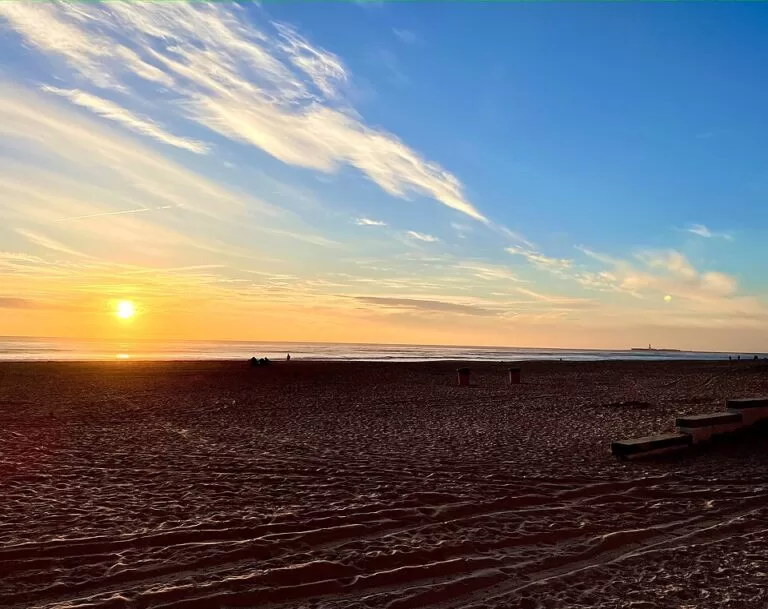
Playa de la Victoria is the main city beach of Cádiz: a straight strip of fine golden sand about 2.9 km long on the Atlantic side of the isthmus, backed along its whole length by the Paseo Marítimo. You get there on foot or by city bus line 7 from the old town, and there are underground car parks right behind the promenade. It suits families, joggers and anyone staying in Cádiz; skip it if you want dunes and empty sand.
Quick facts
- Names: Playa de la Victoria or Playa Victoria; locals often just say “la Victoria”.
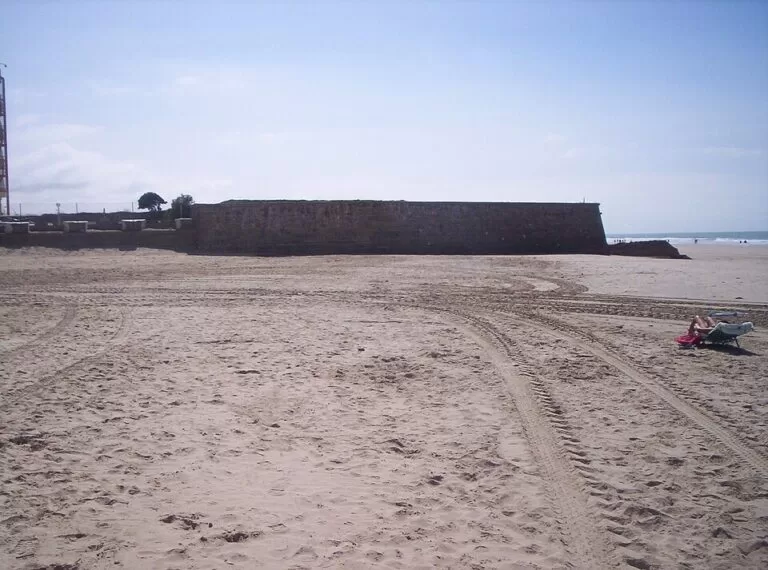
- Where: the modern, southern part of Cádiz city, on the western (ocean) side of the isthmus. North of it is Santa María del Mar; at its southern end the Cortadura fort marks the start of Cortadura beach.
- Coordinates: 36.5062, -6.2793 (middle of the beach, OpenStreetMap).
- Size: about 2,900 m long and on average 185 m wide at low tide after beach regeneration works (Andalusian tourist board).
- Sand and sea: fine golden sand of silica; gentle slope of about 6 % (Wikipedia); moderate waves.
- Setting: urban, open and straight, with a promenade wall behind it.
- Facilities listed: lifeguards, toilets, showers, footwash, sunbed and parasol hire, children’s play area, sports areas, summer tourist information point.
- Entry: free.
Access and parking
On foot: the promenade runs the length of the beach along the Paseo Marítimo and its continuation, Avenida Amílcar Barca (Wikipedia). From the old town it is a long walk of about 3 km to the middle of the beach, so most visitors take the bus.
By bus: OpenStreetMap shows city bus line 7 (Transporte Colectivo Urbano de Cádiz) stopping at Balneario – Glorieta Ana Orantes and Ingeniero La Cierva, one street back from the sand, and metropolitan buses of the Bahía de Cádiz consortium stopping by the Hospital Puerta del Mar. Timetables for 2026 were not confirmed.
Parking: street parking behind the promenade is scarce in summer. OpenStreetMap maps several underground car parks within 300 m of the middle of the beach, including Parking Niños, Parking Rebollo and the public Puerta del Mar car park. Prices for 2026 were not confirmed.
What to expect
This is a big, busy city beach. The Andalusian tourist board says it stands out among Cádiz’s beaches both for its physical features and for how intensely it is used (andalucia.org). At low tide the sand is very wide, so even on summer weekends there is room near the water. Behind you are apartment blocks, bars and the promenade; in front is the open Atlantic.
The name comes from the early 20th century. Spanish Wikipedia explains that the city built a seawater bathing establishment here, the Balneario Reina Victoria, open between 1907 and 1931, whose site is now taken by a hotel; it is unclear whether the beach was named after the balneario or after the new Reina Victoria districts of the city (Wikipedia). The beach was widened by a regeneration project for the city’s urban beaches in 2003.
Wikipedia also records that La Victoria held a Blue Flag without a break from 1987 to 2011 and was the first beach in Spain with environmental management certification and the Q for tourist quality. We could not confirm its Blue Flag status for 2026.
Practical details
- Toilets and showers: OpenStreetMap maps free toilets tagged wheelchair accessible, free showers and drinking water taps at regular intervals along the promenade.
- Information: in the beach season a tourist information point works in the central module of the beach (andalucia.org).
- Food and drink: beach bars on the sand and many bars and restaurants on the promenade side; opening months were not confirmed.
- Shade: parasols can be hired in season; there is no natural shade.
- Hospital: the Hospital Universitario Puerta del Mar stands directly behind the promenade.
Accessibility and safety
The tourist board lists the beach as accessible, with services for disabled visitors, lifeguards and rescue equipment, and OpenStreetMap marks a lifeguard post on the sand and wheelchair-accessible toilets. Lifeguard dates and hours for 2026, and amphibious chairs, could not be confirmed. The water is the open Atlantic with moderate waves, and the Cortadura fort’s spur runs into the sand at the southern end: swim between the flags.
Best time to visit
From June to September the full set of services runs, and July and August weekends are the busiest. In spring and autumn the beach is good for long walks and runs along the promenade. Low tide gives you the widest sand.
Nearby alternatives
- Cádiz, 2.9 km away: the old town on the tip of the peninsula.
- La Caleta, 3.7 km away: the small beach of the old town.
- Cádiz Cathedral, 2.9 km away: the cathedral in the old town.
- Puerto Sherry, 8.6 km away: the marina across the bay in El Puerto de Santa María.
- El Puerto de Santa María, 10.6 km away: the sherry town across the bay.
Distances are in a straight line from the middle of the beach.
FAQ
How do I get to Playa de la Victoria from Cádiz old town?
Take city bus line 7, which stops one street behind the beach, or walk about 3 km along the seafront. Check the 2026 bus timetable locally.
Is there parking at Playa de la Victoria?
Street parking is limited, but OpenStreetMap shows several underground car parks within 300 m of the middle of the beach, including the public Puerta del Mar car park.
How long is Playa de la Victoria?
About 2,900 m, with an average width of 185 m at low tide, according to the Andalusian tourist board.
Are there lifeguards and toilets?
Yes. The tourist board lists lifeguards, toilets and showers, and OpenStreetMap maps free accessible toilets and showers along the promenade. 2026 dates were not confirmed.
Is Playa de la Victoria accessible?
The tourist board lists it as accessible with services for disabled visitors, and the toilets are tagged wheelchair accessible. Check adapted bathing services on arrival.
Sources and freshness
Checked 6 November 2026 · 6 sources Show
Checked 6 November 2026. Official: Andalusian tourist board on Playa Victoria (size, limits, facilities, accessibility), the Playa Victoria information point and Cortadura; Turespaña on La Victoria (sand, occupancy, services). Background, name and history: Spanish Wikipedia. The Cádiz city council website could not be reached. Location, bus stops, car parks, toilets and distances: OpenStreetMap contributors (ODbL). Photos: Wikimedia Commons, licences as credited.
This place is part of our Costa de la Luz, Spain: beaches, towns, sherry and map — see every town, beach and cove we have mapped on that coast.
How this page is made. CostaMap is written with an AI editorial system run by Ebizapple. This page is based on the sources listed above. Last updated 6 November 2026. Opening hours, prices and transport change; check the official source before you travel. How we work · Partner links and ads