
Rías Baixas · Northern rías
Muros e Noia and the Ría de Arousa travel guide: medieval towns, dunes and Albariño
Two Gothic stone towns on a quiet ría, the great dune of Corrubedo on the Barbanza peninsula, and the largest ría in Galicia, with Cambados, O Grove and its islands.
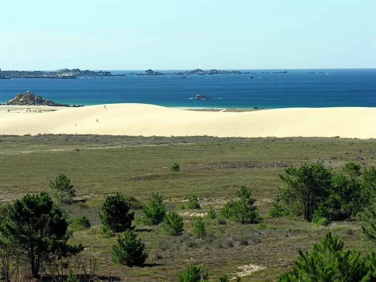
The Corrubedo dune · Photo: Luis Miguel Bugallo Sánchez, CC BY-SA 3.0
Part of the Rías Baixas guide · Muros e Noia and the Ría de Arousa
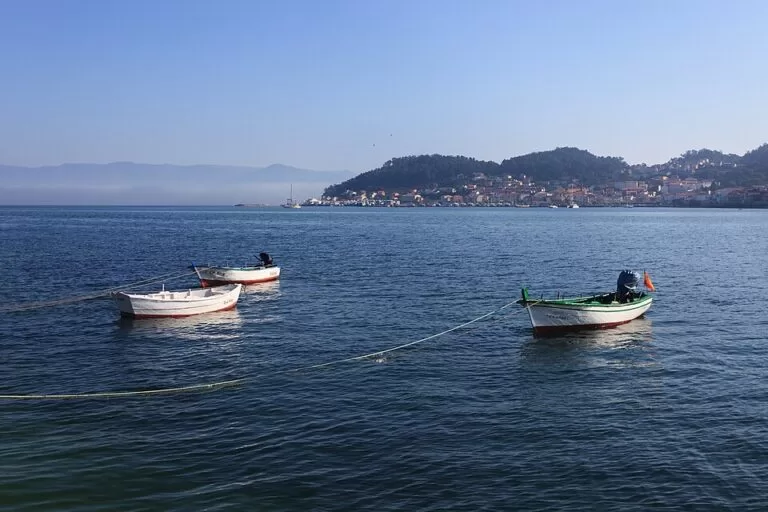
This is the northern part of the Rías Baixas, in south-west Galicia: the Ría de Muros e Noia, the Barbanza peninsula that separates it from the Ría de Arousa, and the Ría de Arousa itself, which Turismo de Galicia calls the largest of the Galician rías (Turismo de Galicia). It runs from Muros and Monte Louro in the north, round the Barbanza coast past Corrubedo, up the Ulla to Catoira and down the south shore to Cambados and O Grove. Below: towns, beaches, things to do, bases, transport and a two-day route.
At a glance
- Where the north of the Rías Baixas, from Muros and Monte Louro on the Ría de Muros e Noia round the Barbanza peninsula to O Grove at the mouth of the Ría de Arousa.
- Towns Muros, Noia, Porto do Son, Ribeira, A Pobra do Caramiñal, Boiro, Rianxo, Catoira, Vilagarcía de Arousa, Vilanova de Arousa, A Illa de Arousa, Cambados and O Grove.
- Best for Gothic old towns, the Corrubedo dunes, Iron Age forts, seafood and Albariño wine, and quiet beaches on the rías.
- Getting there Santiago de Compostela airport is the nearest; Noia is 36 km from Santiago by road. Trains stop at Vilagarcía de Arousa and Catoira.
- On CostaMap guides to Muros, Noia, Castro de Baroña, the Corrubedo dunes, Cambados and O Grove and A Toxa, plus five campsites.
Map of Muros e Noia and the Ría de Arousa
The map shows the places in this area that have a CostaMap page. Tick a place type to filter, and click a marker to see the place in the panel.
Place type
Area · next level
 Area map
Muros e Noia and the Ría de Arousa
Click a marker to see the place here. From Muros and Noia round the Barbanza peninsula and Corrubedo to Cambados and O Grove.
Towns and villagesTowns and villages
North to south: round the Ría de Muros e Noia, along the Barbanza peninsula, up the Ría de Arousa to the Ulla and back down its south shore.
Muros and Monte Louro
Muros sits on the north shore of the ría at the foot of Monte Louro, 71 km from Santiago. Its old town has been a Historic-Artistic Site since 1970: stone houses with sea arcades, where fish was once salted, and continuous balconies. Look for Praza de Santa Rosa, the old fish-market square and the Virxe do Camiño sanctuary (Spain.info). The Pozo do Chacón tide mill is, says Turismo de Galicia, one of the largest in Spain. West of town, Monte Louro rises 241 m above Area Maior beach and the As Xarfas lagoon. See our Muros guide.
Noia
Noia lies at the inner end of the ría, by the mouth of the Tambre, 36 km from Santiago. The writer Otero Pedrayo called it “the little Compostela” for its Gothic buildings (Turismo de Galicia). Santa María a Nova, a National Historic Monument since 1973, keeps more than two hundred medieval tombstones carved with the trades of the guilds; San Martiño, a Marine Gothic church with a rose window, closes Praza do Tapal; and the remains of the Tapal fortress and walls crown the old town (Spain.info). See our Noia guide.
Porto do Son, Portosín and Baroña
On the south shore, Porto do Son is a fishing town that Turismo de Galicia counts among Galicia’s main summer destinations; Portosín, next to it, has a modern marina (Turismo de Galicia). South-west of the town, the Castro de Baroña is an Iron Age hill fort on a rocky point, with round house foundations inside two walls and beaches on either side. Further south on the AC-550 is As Furnas beach, which Turismo de Galicia says Amenábar immortalised in his film Mar adentro. For a pitch, Portosín Camper Park has motorhome stopovers and Camping Cabeiro is also in Porto do Son.
Corrubedo and Ribeira
At the tip of the Barbanza peninsula, Ribeira has a large fishing fleet and fish market, which Turismo de Galicia says shapes its cuisine (Turismo de Galicia). Its best-known sight is the Corrubedo Dunes Natural Park: the largest shifting dune in Galicia, more than a kilometre long, between a salt-water lagoon and a fresh-water one, seen from boardwalks. Close by are the Neolithic Dolmen de Axeitos and the fishing village of Corrubedo with its lighthouse. Off the coast, the island of Sálvora belongs to the parish of Aguiño and to the Atlantic Islands National Park. Camping Rural Ría de Arosa 2 is in Oleiros, near the dolmen.
A Pobra do Caramiñal
A Pobra is the first town on the north shore of the Ría de Arousa. Above it, the A Curota viewpoint is, in the words of Turismo de Galicia, “spectacular”, and looks over the whole ría (Turismo de Galicia). The town has a museum devoted to the writer Valle-Inclán, Cabío beach, and the Xesús Nazareno procession with the Mortallas, a festival of Galician tourist interest (Turismo de Galicia). Camping Playa Ría de Arosa is in the municipality and open all year.
Boiro and Rianxo
Boiro has the late Bronze Age castros of Neixón, the early Romanesque church of Cespón and the Castelo de Vitres viewpoint, reached on a stretch of the Roman road Vía XX. Barraña is Boiro’s main beach and the Romaría de San Ramón de Bealo its festival. Rianxo, further up the ría, has the Museo do Mar, the Casa Museo Manuel Antonio and Tanxil beach. Turismo de Galicia notes that the writers Castelao and Rafael Dieste were also born in this district (Turismo de Galicia).
Catoira and the Ulla
At Catoira, where the ría meets the River Ulla, the Torres de Oeste are the remains of a medieval fortress that controlled river traffic to Santiago; two towers and a chapel survive, restored in 1970 (Turismo Rías Baixas). On the first Sunday of August, the Viking Pilgrimage, held since 1961 and a Festival of International Tourist Interest since 2002, re-enacts a Norse landing below the towers (Turismo Rías Baixas). Catoira has a train halt about 1.4 km from the towers.
Vilagarcía de Arousa, Carril and Vilanova
Turismo de Galicia calls Vilagarcía the capital of the Ría de Arousa, with a mild climate for most of the year. Its neighbouring port of Carril is known for its clams, celebrated in the Festa da Ameixa, and the San Roque festival is of national tourist interest (Turismo de Galicia). Opposite Carril lies the island of Cortegada, part of the national park, with a laurel wood that Turismo Rías Baixas calls the largest in Europe (Turismo Rías Baixas). Next door, vilanova has the Pazo do Cuadrante, now the Casa Museo Valle-Inclán, and the Pazo de Baión among vineyards. The Cruz de Lobeira viewpoint looks over the ría to the Barbanza peninsula, and the Festa do Mexillón e do Berberecho celebrates mussels and cockles (Turismo de Galicia).
A Illa de Arousa
This island in the middle of the ría is joined to the mainland by a 2 km bridge, opened in 1985. Its coastline runs for about 36 km, eleven of them beaches of fine white sand such as Area da Secada, O Bao, Camaxe, Xastelas and Sualaxe; Xufre is the main of its five harbours (Turismo Rías Baixas). At the southern tip, the Carreirón natural area is a 1.3 km² peninsula of dunes, marsh and pine wood, a bird protection area with two hides (Turismo Rías Baixas).
Cambados
Cambados is the capital of Albariño, the white wine of the Rías Baixas designation of origin. Its centre, declared a historical site, is built around the granite square and manor of the Pazo de Fefiñáns; the church of Santa Mariña Dozo and the Museo Etnográfico do Viño are nearby, and the Festa do Viño Albariño is a Festival of International Tourist Interest, the Festa da Vieira celebrates the scallop (Turismo de Galicia). See our Cambados guide.
O Grove and A Toxa
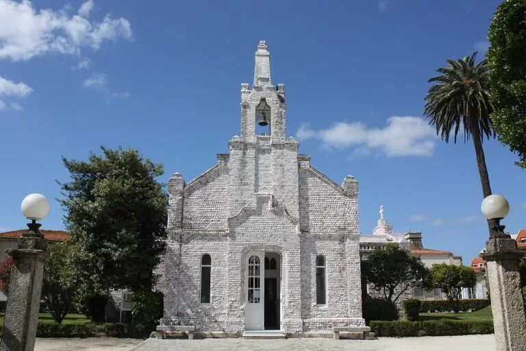
O Grove is a fishing port on its own peninsula at the mouth of the ría, joined by a bridge to A Toxa, an island of spa hotels with the chapel of San Caralampio, covered in scallop shells. Its seafood festival, the Festa de Exaltación do Marisco, is of national tourist interest. From the Siradella viewpoint you look down on A Lanzada beach (Turismo de Galicia). See our O Grove and A Toxa guide; Camping Moreiras has motorhome stopovers on the peninsula.
Beaches and coves
North to south, with lengths from Turismo de Galicia. We found no official lifeguard dates, so check on the spot; the open Atlantic beaches can have strong waves.
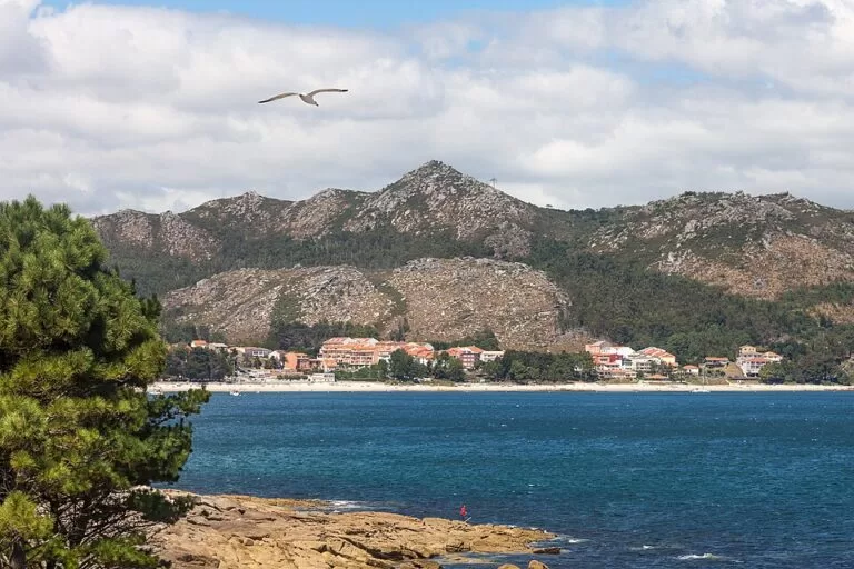
Area Maior (Louro)
About 1,400 m of fine sand below Monte Louro, open to the sea; its dunes close off the As Xarfas lagoon. Nearby Ancoradoiro is a 100 m beach with pines and a lighthouse (Turismo de Galicia).
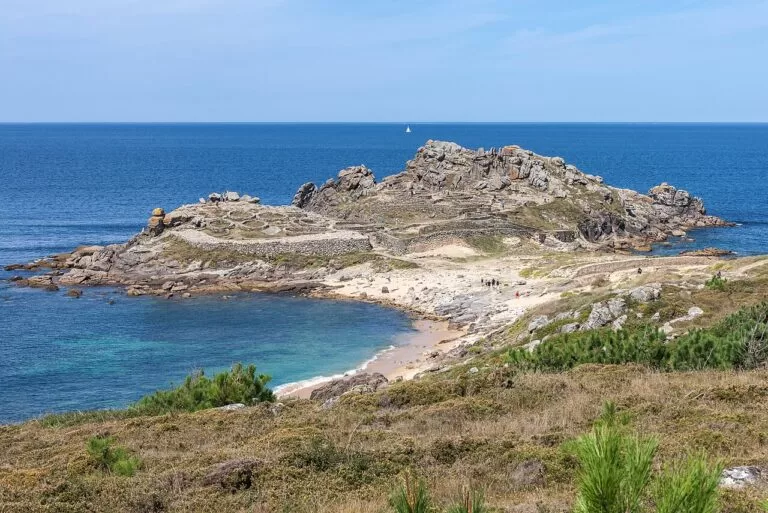
As Furnas and the Baroña beaches
As Furnas is 790 m of fine sand on the open coast (Turismo de Galicia). Small beaches lie on either side of the Castro de Baroña, and Aguieira and Basoñas are among the ría beaches Turismo de Galicia names.
Corrubedo, O Vilar and A Ladeira
The long beach of the natural park, split by the channel of the Carregal lagoon. Car parks at Olveira, O Vilar, A Ladeira and Vixán; keep off the protected dune.
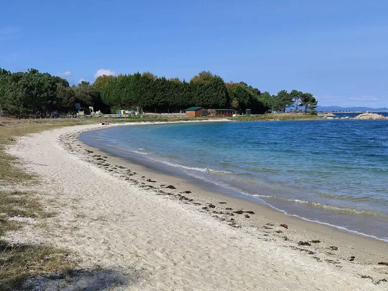
Inside the ría
Sheltered beaches: Coroso in Ribeira, Cabío in A Pobra, Barraña in Boiro and Tanxil in Rianxo (Turismo de Galicia), and Xastelas and Area da Secada on A Illa de Arousa.
Just south of O Grove, A Lanzada, the long Atlantic beach shared by O Grove and Sanxenxo, is covered in our Ría de Pontevedra guide.
Things to do
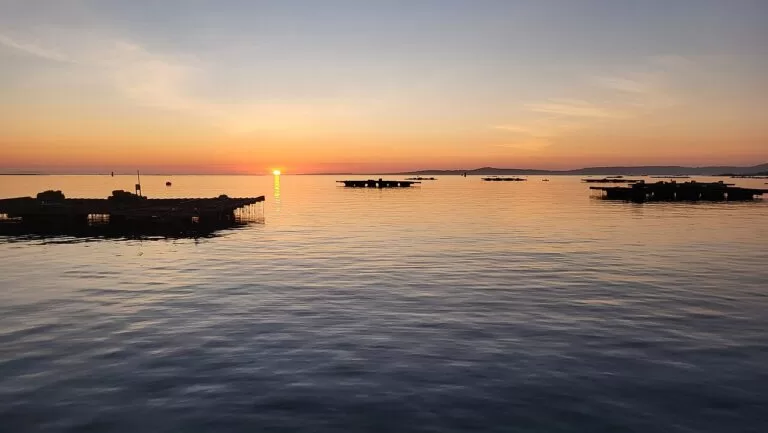
Nature: dunes, lagoons and islands
The Corrubedo natural park has self-guided water, sea and wind routes, bird hides and the Casa da Costa visitor centre (Turismo de Galicia). Sálvora and Cortegada, both in the Atlantic Islands National Park, are visited on guided routes run by authorised companies, with a limit of 250 people a day on each (Xunta de Galicia).
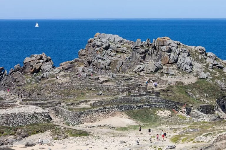
History: castros, towers and Gothic towns
See the Dolmen de Axeitos, the castros of Neixón and Baroña, the Gothic towns of Muros and Noia and the Torres de Oeste. The Route of the Sea of Arousa and River Ulla follows by boat the legendary arrival of the remains of St James up the ría to Padrón; Turismo Rías Baixas calls it the only maritime Way of the Cross in the world (Turismo Rías Baixas).
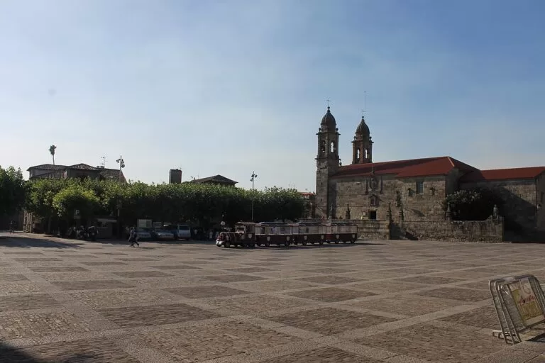
Food and wine: seafood and Albariño
Turismo de Galicia says the Ría de Arousa produces some of the best seafood in Europe, including the clams of Carril, and that the land around the mouths of the Ulla and Umia produces some of Spain’s best white wines, within the Rías Baixas designation (Turismo de Galicia). Time a visit for the Albariño festival in Cambados, the seafood festival in O Grove or the goose barnacle festival in Aguiño (Ribeira).
Where to stay by town
The towns we would base a trip in, north to south. We name no hotels.
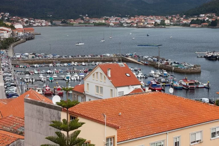
Muros or Noia
Old stone towns on the Ría de Muros e Noia. Noia is the closest to Santiago; Muros is nearest to Louro, Carnota and the Costa da Morte.
History and quiet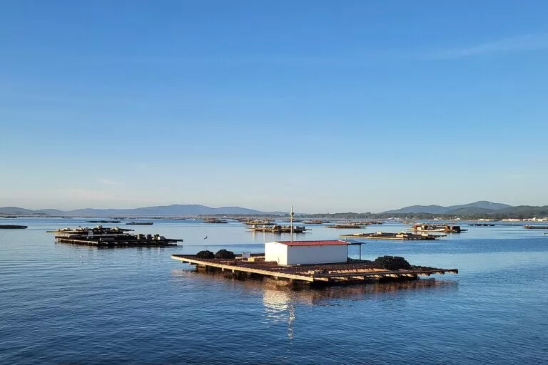
Ribeira or A Pobra do Caramiñal
The tip of the Barbanza peninsula, close to the Corrubedo dunes, A Curota and beaches on both rías, with campsites at A Pobra and Oleiros.
Beaches and nature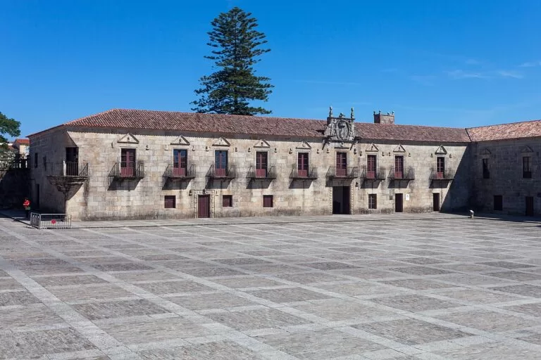
Cambados or Vilagarcía de Arousa
The south shore of the Ría de Arousa. Cambados for wine and the old centre; Vilagarcía for the train to Santiago and Pontevedra.
Food, wine and transport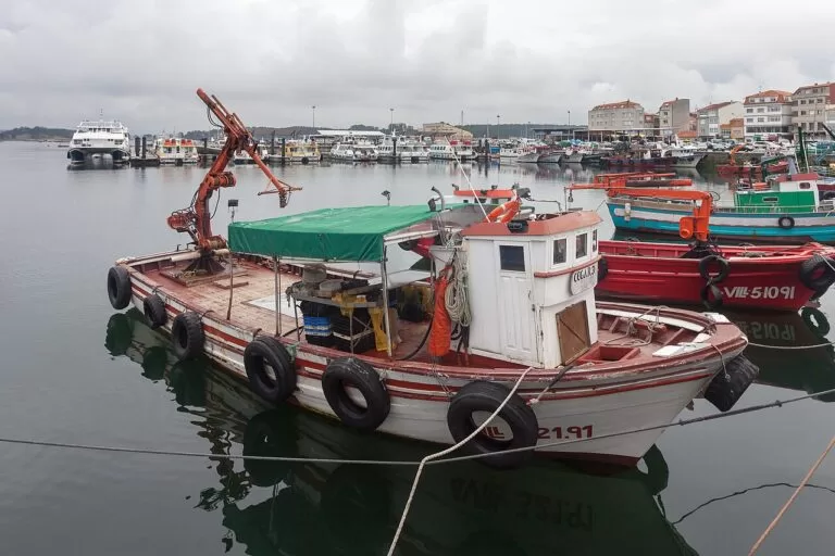
O Grove
The seafood port at the mouth of the ría, with spa hotels on A Toxa and A Lanzada beach a short drive away.
Seafood and spaGetting there and around
By air
Santiago de Compostela airport (SCQ), 12 km east of the city, is the busiest in Galicia (Wikipedia). From Santiago, Noia is 36 km and Muros 71 km by road (Spain.info).
By car
The AP-9 motorway runs from A Coruña through Santiago and Pontevedra (Turismo Rías Baixas). From Padrón the Barbanza dual carriageway runs to Ribeira, and the AC-550 follows the coast from Muros through Noia to Ribeira (Turismo de Galicia). Bridges at Catoira and Pontecesures link the two shores of the Ulla.
By train and bus
Trains link Vilagarcía de Arousa with Santiago, A Coruña and Pontevedra, and buses from Alsa, Monbus and other operators connect the coastal towns (Turismo Rías Baixas). Catoira has a train halt near the Torres de Oeste. We could not confirm bus routes on the Barbanza and Muros side.
A two-day route
By car: day 1 the Ría de Muros e Noia and the Barbanza coast, day 2 the Ría de Arousa.
Day 1
Noia, Muros, Baroña and Corrubedo
Start in Noia with Santa María a Nova and Praza do Tapal. Drive west to Muros and on to Louro beach. Come back round the ría and south on the AC-550 to the Castro de Baroña and As Furnas, and end on the Corrubedo boardwalks.
Day 2
A Curota, Catoira, Cambados and O Grove
Begin at the A Curota viewpoint above A Pobra. Follow the north shore through Boiro and Rianxo to the Torres de Oeste at Catoira, cross the Ulla to Vilagarcía and detour over the bridge to A Illa de Arousa. Walk the Fefiñáns square in Cambados and finish with seafood in O Grove and the shell chapel on A Toxa.
FAQ
Is Noia or Muros better to visit?
Both have protected old towns: Noia for Gothic churches, Muros for arcaded harbour houses and the Louro beaches. They are 14 km apart, so see both in a day.
What is the Ría de Arousa known for?
Seafood and wine: Turismo de Galicia says its waters produce some of the best seafood in Europe, and Cambados is the capital of Albariño. It is the largest of the Galician rías.
When is the Catoira Viking festival?
On the first Sunday of August, at the Torres de Oeste. It has been held since 1961 and is a Festival of International Tourist Interest.
Can you visit Sálvora and Cortegada islands?
Yes, on guided routes run by authorised companies. The Xunta limits each island to 250 visitors a day all year.
How do you get to A Illa de Arousa?
By car over the 2 km bridge from Vilanova de Arousa, the island’s only road access. Turismo Rías Baixas lists free parking on the island.
Other areas of the Rías Baixas
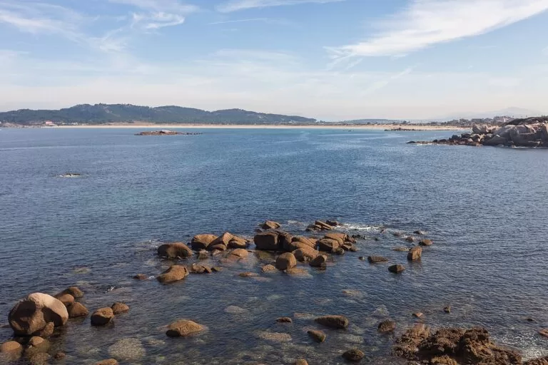
Rías Baixas
The whole southern coast of Galicia from Muros to the Miño, with the map, the island permits, the weather and routes.
Rías Baixas guide →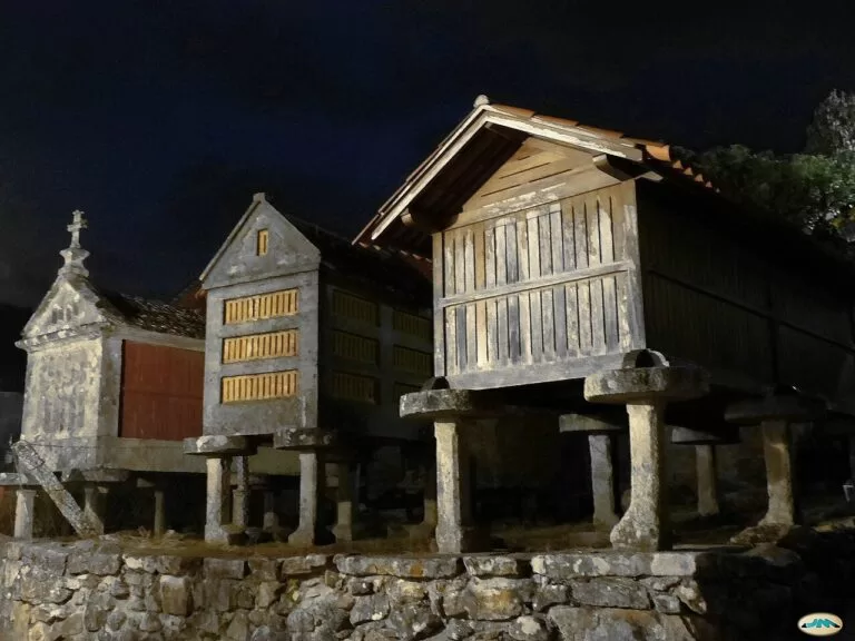
Ría de Pontevedra
Pontevedra old town, Sanxenxo and A Lanzada, the granaries of Combarro and the island of Ons.
Ría de Pontevedra guide →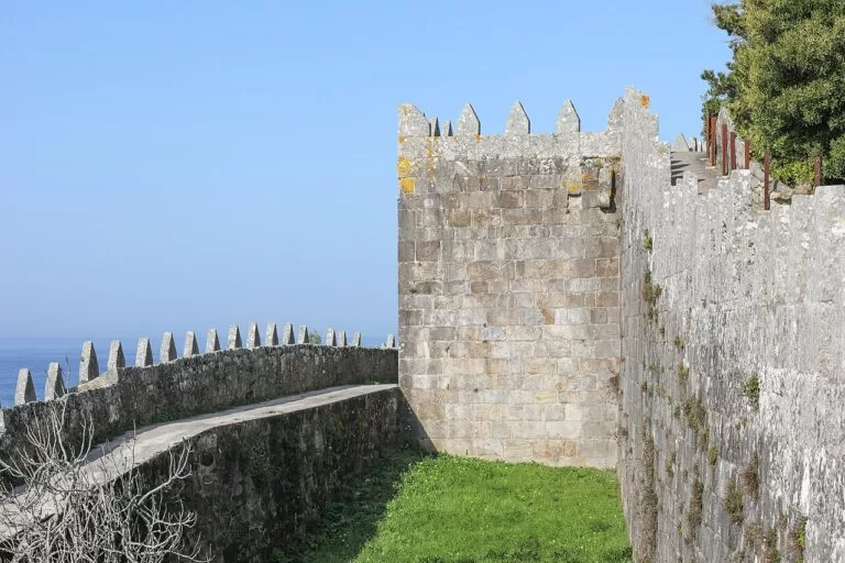
Ría de Vigo and the Baixo Miño
Vigo, the Cíes Islands, the walled town of Baiona and A Guarda above the mouth of the Miño.
Ría de Vigo guide →North of Muros, the Costa da Morte begins with Carnota Beach, about 7 km from Muros in a straight line.
Sources and freshness
Checked 7 November 2026. Turismo de Galicia on the Ría de Muros e Noia, the Ría de Arousa and the tourist areas Ría de Muros e Noia, Barbanza-Arousa, Mar de Santiago and O Salnés; the Corrubedo natural park, Monte e Lagoa de Louro and the beaches of Area Maior and As Furnas. Turismo Rías Baixas on the Torres de Oeste, the Viking Pilgrimage, A Illa de Arousa, its bridge, Carreirón, Cortegada, the Ría de Arousa, the sea route of Arousa and the Ulla and getting there. Spain.info on Muros and Noia. Xunta de Galicia on island visits. Map data and straight-line distances: OpenStreetMap. Not confirmed: lifeguard dates, bus routes on the Barbanza side, museum and visitor-centre hours, and 2027 festival dates.