
Rías Baixas · Ría de Vigo and the Baixo Miño
Ría de Vigo and the Baixo Miño travel guide: Cangas, Vigo, Baiona and Tui
Galicia’s largest city on its sheltered ría, the Cíes Islands at the mouth, the walled port of Baiona and, down the open coast, A Guarda and Tui on the River Miño and the Portuguese border.
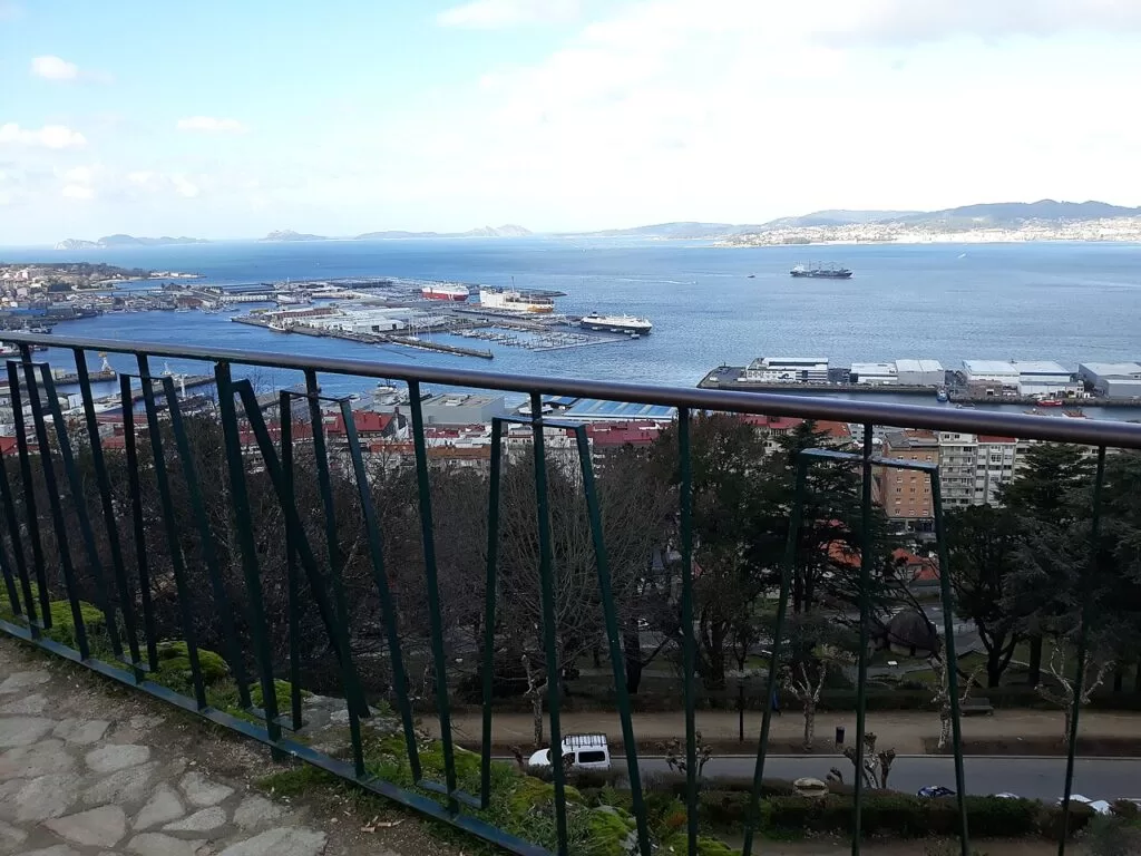
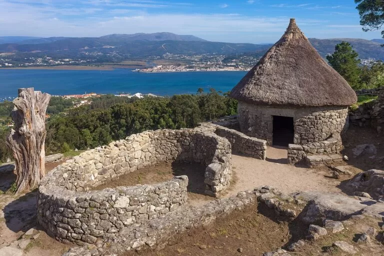
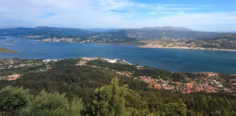
The Ría de Vigo from O Castro · Photo: Teresafs, CC BY-SA 4.0
Part of the Rías Baixas guide · Ría de Vigo and the Baixo Miño
The Ría de Vigo is the southernmost of the Rías Baixas: a sea inlet 33 km long and 176 km² in area, sheltered at its mouth by the Cíes Islands, with Cangas and Moaña on its north shore and Vigo, Galicia’s largest city, on the south (Turismo Rías Baixas). South of Baiona the coast turns to open Atlantic past Oia to A Guarda, where the Miño reaches the sea on the Portuguese border; the Baixo Miño district runs up the river to Tui. This guide covers each town and Vigo’s districts, the beaches, what to do, where to stay, how to get there and a two-day route.
At a glance
- Where the south-west corner of Galicia, from Cabo Home on the Morrazo peninsula round the Ría de Vigo to Baiona, then south along the open coast to A Guarda and up the Miño to Tui.
- Towns Cangas, Moaña, Redondela, Vigo, Nigrán, Baiona, Oia, A Guarda and Tui.
- Best for the Cíes Islands, city beaches such as Samil, oysters in Vigo, walled towns, hillforts and the Portuguese Way to Santiago.
- Getting there Vigo Airport (VGO) has direct flights to Madrid, Barcelona, Bilbao, Valencia and Palma; trains reach Vigo-Urzáiz and Vigo-Guixar, and the A-55 runs from Vigo to Tui and Portugal (Turismo Rías Baixas).
- On CostaMap guides to the Cíes Islands, Vigo Old Town, Samil Beach, Cabo Home, Praia América, Baiona, Monte Santa Trega and Tui.
Map of the Ría de Vigo and the Baixo Miño
The map shows the places in this area that have a CostaMap page. Tick a place type to filter, and click a marker to see the place in the panel.
Place type
Area · next level
 Area map
Ría de Vigo and the Baixo Miño
Click a marker to see the place here. From Cabo Home and the Cíes to Vigo, Baiona, A Guarda and Tui.
Towns and villagesTowns and villages
From Cabo Home along the north shore of the ría, round its head and back out along the south shore through Vigo, then south down the coast to the Miño.
Cangas and the Costa da Vela
Cangas de Morrazo faces Vigo across the ría, a short ferry ride away (spain.info). Its old town has the seafaring houses known as casas de patín, and Rúa Real has pazos with coats of arms and granite houses with white arcades (Turismo Rías Baixas). The former collegiate church of Santiago, mostly 16th century, has a Renaissance façade and Gothic vaults (Turismo Rías Baixas). West of town, the Costa da Vela runs out to Cabo Home: the beaches of Nerga and Barra, cliffs over 150 m high and the sanctuary on Monte do Facho. See our Cabo Home and Costa da Vela guide.
Moaña and the Rande Bridge
Moaña, the next town east, is also linked to Vigo by ferry; Turismo de Galicia calls Cangas and Moaña villages with an authentic seaside atmosphere (Turismo de Galicia). At the narrows, the Rande Bridge carries the AP-9 from Moaña to Redondela: 1,558 m long and 148 m high, and the longest cable-stayed bridge in the world when it opened (Turismo Rías Baixas). Here, in October 1702, British and Dutch ships defeated a Spanish treasure fleet and its French escort in the Battle of Rande; the silver and gold are said to lie on the bottom still (Turismo Rías Baixas).
Redondela and San Simón
Beyond Rande the ría widens into the cove of San Simón. Turismo de Galicia calls Redondela famous for its festivities and its empanada de chocos, a cuttlefish pie, and the Portuguese Way passes through the town (Turismo Rías Baixas). The island of San Simón held Knights Templar, a monastery burned after Rande, a quarantine hospital from 1841 to 1927 and a Civil War prison; today it is a centre for historical memory, open by appointment (Turismo Rías Baixas).
Vigo
Vigo is Galicia’s largest city and, says Turismo de Galicia, Spain’s most important fishing port (Turismo de Galicia); it grew from a village through industry and fishing (Turismo Rías Baixas). Its best-known districts follow.
Vigo: Casco Vello, O Berbés and A Pedra
The old quarter, the Cidade Vella, grew round the fishermen’s district of O Berbés by the port, with arcades, emblazoned houses and the neoclassical Collegiate Church of Santa María, built where Francis Drake burned a Gothic church (spain.info). O Berbés keeps its arcaded fishermen’s houses (Turismo Rías Baixas). Fish auctions run between four and five in the morning, and in A Pedra the oyster sellers offer oysters to passers-by (Turismo de Galicia). See our Vigo Old Town and Monte do Castro guide.
Vigo: O Castro and the centre
Monte do Castro has remains of a hillfort, a 17th-century fortress and anchors recalling the Battle of Rande; Turismo de Galicia calls it the best spot for photos of the city, above all at sunset. Below it, the Ensanche of around 1900 runs from the Porta do Sol and Francisco Leiro’s sculpture “O Sireno” along Policarpo Sanz to the García Barbón Theatre of 1913 by Antonio Palacios and the Alameda gardens (Turismo de Galicia).
Vigo: Castrelos
Castrelos Park, about 24 hectares, is the city’s main green space, with an open-air auditorium, the 17th-century Pazo de Quiñones de León housing the Municipal Museum and the Romanesque church of Santa María de Castrelos (Turismo de Galicia; Turismo Rías Baixas). The museum holds many of the inscribed altars from Monte do Facho.
Vigo: Bouzas, Alcabre and Samil
Bouzas holds a festival on the third Sunday of July, dating from 1605, with a procession, a regatta of traditional boats and fireworks (Turismo de Galicia). In Alcabre, the Museo do Mar de Galicia by Aldo Rossi and César Portela fills a former canning factory and has a small aquarium (Turismo Rías Baixas). Further south are Samil, the city’s longest beach (see our Samil Beach guide), and Canido, where the Roman villa of Toralla is the only fully excavated Roman villa in Galicia open to the public (Turismo Rías Baixas).
Nigrán
Nigrán’s coast is the bay of Baiona. Praia América and Panxón are joined by a Blue Trail through restored dunes (Turismo Rías Baixas); see our Praia América guide. Monteferro, a rocky, pine-covered spit about 1.5 km long and up to 150 m high, has views over Vigo, Baiona and the Cíes and old coastal guns (Turismo Rías Baixas).
Baiona
Turismo de Galicia calls Baiona the port that announced the discovery of America to the world. Its old town became a Historic-Artistic Site in 1993, the 5th centenary of the Arribada festival marking the caravel Pinta’s return, and has the 13th-century former collegiate church of Santa María (Turismo Rías Baixas). The Monterreal fortress, with 3 km of walls, was bought by the state in 1963 to become a parador (Turismo Rías Baixas). See our Baiona guide.
Oia
South of Cabo Silleiro the road follows the open Atlantic to Oia and its monastery of Santa María, first recorded in 1137 and Cistercian from 1182. Its monks and local volunteers guarded the coast, and in 1624 they turned back five Turkish ships, sinking two. Romanesque, Gothic and Baroque in parts, it has been a Site of Cultural Interest since 1931 (Turismo Rías Baixas).
A Guarda
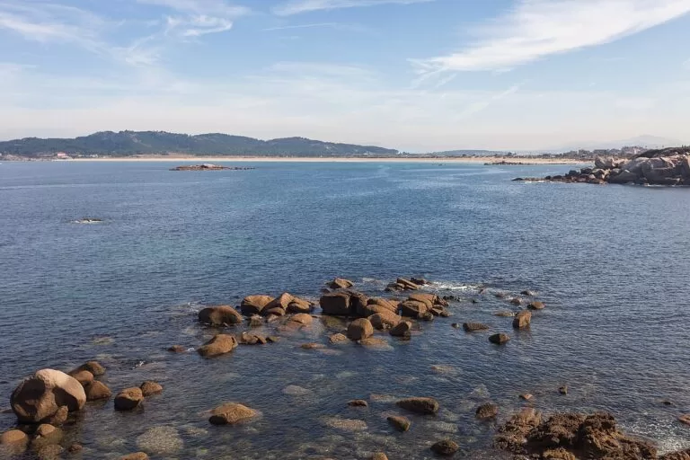
A Guarda, the last town on the coast, is a fishing port whose old centre is laid out round the harbour, with sections of medieval wall, the Torre do Reló and indiano houses (Turismo Rías Baixas). Above it, Monte Santa Trega has one of the largest hillforts in Galicia (Turismo Rías Baixas); see our Monte Santa Trega guide. A 3.6 km Blue Trail follows the shore from the port to the mouth of the Miño (Turismo Rías Baixas).
Tui and the Baixo Miño
The Miño estuary, about 15 km long, forms the border with Portugal (Turismo Rías Baixas), and the Baixo Miño protected area takes in A Guarda, O Rosal, Oia, Tui and Tomiño (Turismo Rías Baixas). Upriver, Tui faces Valença in Portugal: a walled town with a fortress cathedral begun in 1120, the only Gothic cloister of any Galician cathedral, an iron bridge of 1886 and the start of the Portuguese Way in Spain. See our Tui guide.
Beaches and coves
Turismo de Galicia counts this ría among the places with some of Galicia’s best beaches: Barra and Nerga in Cangas, Samil and O Vao in Vigo, Praia América in Nigrán and Rodas on the Cíes (Turismo de Galicia). Details are as the official sources give them, checked in November 2026.
Rodas
The beach joining two of the islands, named the best beach in the world by The Guardian. Boats from Vigo, Cangas or Baiona, after a free Xunta authorisation (Turismo Rías Baixas).
See the Cíes guide →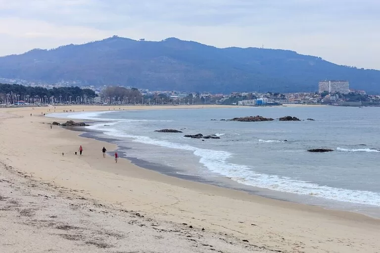
Samil
1,250 m of golden sand facing the Cíes, with a promenade, pools, playgrounds and a pine grove; high occupancy and moderate to strong waves (spain.info).
See the beach guide →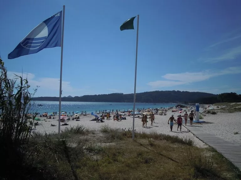
Nerga
700 m of white sand with dunes behind and views of the Cíes; toilets, showers and footbaths; moderate waves and wind (spain.info).
See the Cabo Home guide →
Praia América
A long urban beach on the bay of Baiona, joined to Panxón by a dune trail through restored dunes (Turismo Rías Baixas).
See the beach guide →- Barra (Cangas) – about 750 m of fine white sand between dunes and pines on the Costa da Vela, a nudist beach, windy, with excellent water quality (Turismo Rías Baixas).
- Canido (Vigo) – a shell-shaped bay of fine white sand and calm water between Toralla island and Punta de los Pinos (Turismo Rías Baixas).
- Area Grande (A Guarda) – a town beach of fine golden sand facing the Atlantic, sheltered with moderate waves, within walking distance of the centre (Turismo Rías Baixas).
Things to do
Nature: the Cíes, the capes and the Miño
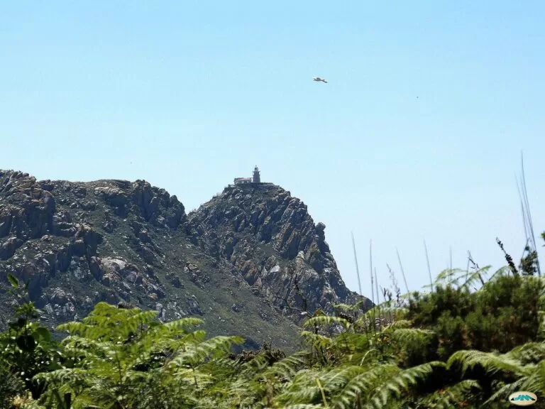
The Cíes Islands belong to the Atlantic Islands National Park; a Blue Trail between the lighthouses crosses Rodas, its dunes and lagoon, and passes a bird observatory (Turismo Rías Baixas). The two capes that close the ría are viewpoints: Cabo Home, and Cabo Silleiro, with a wooden balcony about 100 m above the sea and a lighthouse first lit in 1866 (Turismo Rías Baixas). Inland, Monte Aloia above Tui was Galicia’s first natural park, in 1978 (Turismo Rías Baixas).
History: hillforts, fortresses and a treasure fleet
The hillfort on Santa Trega was lived in from the 4th century BC to the 1st century AD, inside a wall enclosing 700 m by 300 m; about a fifth is open to visitors (Turismo Rías Baixas). Smaller hillforts crown O Castro in Vigo and Monte do Facho in Cangas, where 161 votive altars once stood (Turismo Rías Baixas). Later centuries added Monterreal, Oia monastery and Tui cathedral.

Food: oysters, fish and empanada
As Spain’s most important fishing port, Vigo eats well, says Turismo de Galicia: have oysters at A Pedra, and in Redondela try the empanada de chocos (Turismo de Galicia). Spain.info adds the oysters of Arcade (spain.info).
Where to stay by town
Vigo
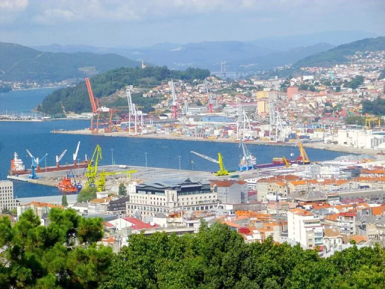
The transport hub, with the airport, trains and boats. Stay near the old town for food and nightlife, or by Samil for the beach.
City and ferries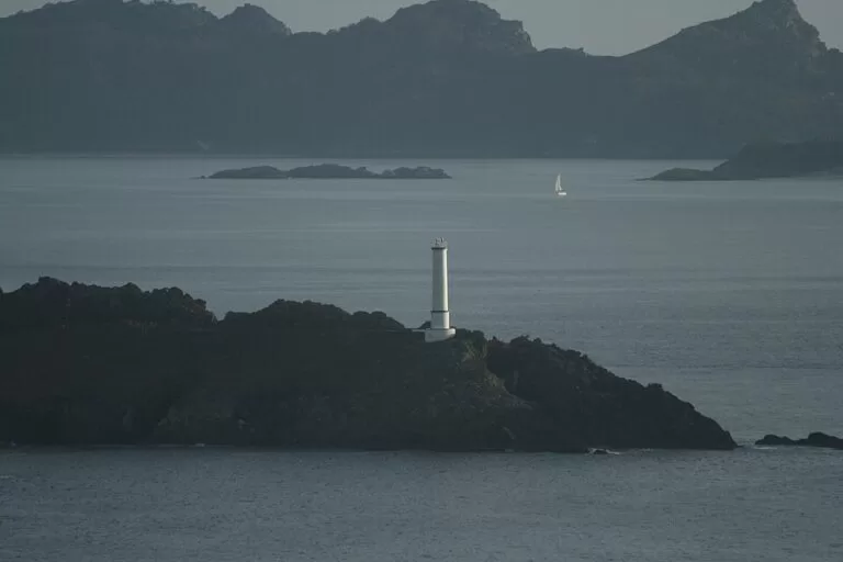
Cangas
A town with an authentic seaside atmosphere, in Turismo de Galicia’s words, across the ría from Vigo, with the beaches of the Costa da Vela and boats to the Cíes.
Beaches and walks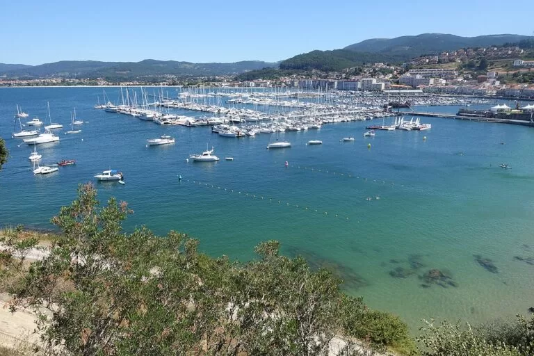
Baiona
A walled old town with the Monterreal parador, near Praia América and with boats to the Cíes.
Historic port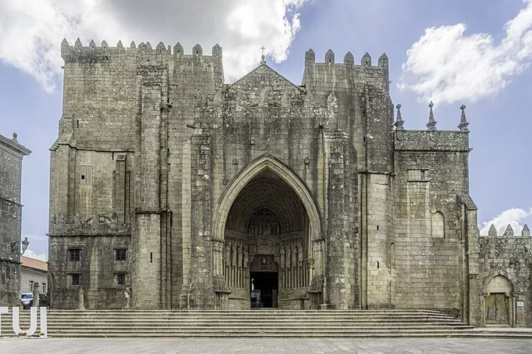
Tui
The cathedral town on the Miño and start of the Portuguese Way in Spain.
History and CaminoSpain.info points to the paradors of Baiona, in the Monterreal fortress, and of Tui, set among mountains and rivers (spain.info).
Getting there and around
By air
Vigo Airport (VGO) has direct flights to Madrid, Barcelona, Bilbao, Valencia and Palma and seasonal routes such as London. Santiago (SCQ) is 70 km away and Porto (OPO) 167 km (Turismo Rías Baixas).
By train and car
Vigo-Urzáiz and Vigo-Guixar have trains from Madrid, high-speed trains to Santiago and A Coruña, and the Celta train from Porto. The AP-9 runs north to Santiago and the A-55 links Vigo with Tui and Valença (Turismo Rías Baixas).
By boat
From Vigo’s maritime station, ferries cross to Cangas and Moaña and, in season, sail to the Cíes (spain.info). Cíes boats also leave from Cangas and Baiona; first get the free Xunta authorisation, then the ticket (Turismo Rías Baixas).
A two-day route
By car and ferry. Day 1 stays around the ría; day 2 follows the coast about 40 km south to A Guarda and then up the Miño to Tui.
Day 1
Vigo, the Cíes or Cabo Home
Start on O Castro for the view, then walk down through the old town and O Berbés to A Pedra for oysters. With a Cíes authorisation and ticket, take the boat to Rodas and walk to the Monte Faro lighthouse. Otherwise take the ferry to Cangas, drive to Cabo Home and Monte do Facho, and watch the sun set behind the Cíes.
Day 2
Baiona, Oia, A Guarda and Tui
Walk Praia América or climb Monteferro, then walk the walls of Monterreal in Baiona. Follow the open coast past Cabo Silleiro to the monastery of Oia, climb Monte Santa Trega above A Guarda for the mouth of the Miño, and end at the cathedral in Tui.
FAQ
What is there to do in Vigo?
Walk the old town and O Berbés, eat oysters in A Pedra, climb O Castro, visit Castrelos Park and the Museo do Mar, spend a day at Samil and take the boat to the Cíes.
How do I get to the Cíes Islands from Vigo?
By boat from Vigo, Cangas or Baiona. Access is limited: first get the free Xunta authorisation, then buy a ferry ticket. Our Cíes guide gives the dates.
Can you take a ferry from Vigo to Cangas?
Yes. Ferries leave Vigo’s maritime station for Cangas and Moaña on the other side of the ría.
What are the best beaches near Vigo?
Rodas on the Cíes, Samil and O Vao in Vigo, Barra and Nerga in Cangas and Praia América in Nigrán, all named by Turismo de Galicia among Galicia’s best.
Is Baiona worth visiting?
Yes. Its old town is a Historic-Artistic Site, the Monterreal fortress has 3 km of walls, and it is the port where the Pinta brought the news of the discovery of America.
Where does the Portuguese Camino enter Spain?
At Tui, across the Miño from Valença. From there the Portuguese Way runs 118.8 km to Santiago, passing through Redondela.
Other areas of the Rías Baixas
Rías Baixas
The whole coast from Muros to A Guarda, with the map, island permits, weather and routes.
Rías Baixas guide →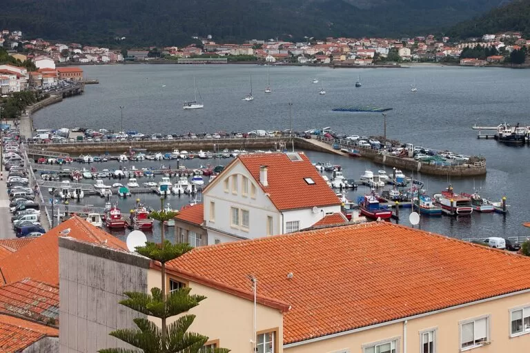
Muros e Noia and the Ría de Arousa
Muros, Noia, the dunes of Corrubedo, Cambados and O Grove.
Muros and Arousa guide →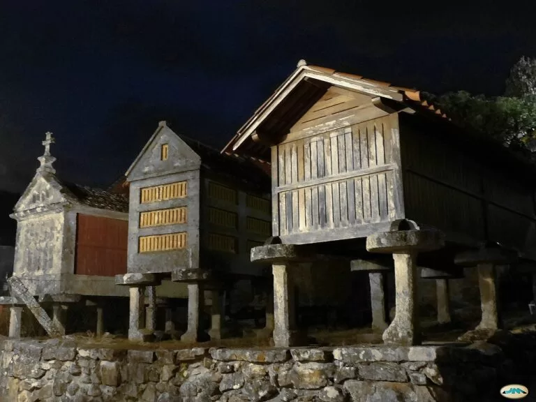
Ría de Pontevedra
Sanxenxo, A Lanzada, the hórreos of Combarro, Pontevedra old town and Ons Island.
Ría de Pontevedra guide →Sources and freshness
Checked 9 November 2026. Turismo Rías Baixas pages on the Ría de Vigo, Baixo Miño, each town and sight, the beaches and trails (all linked above) and how to get there. Turismo de Galicia on the Ría de Vigo and Vigo. Spain.info on Vigo, Samil and Nerga. Not confirmed: ferry timetables, bus routes, opening hours and prices; the Vigo, Cangas and Tui town hall sites could not be reached.