
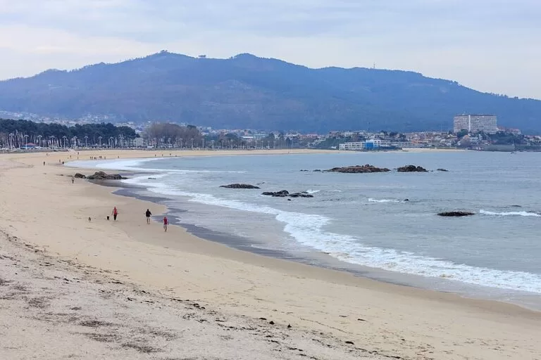
Samil Beach (Praia de Samil) is the longest beach in Vigo: about 1,250 m of golden sand on the south shore of the Ría de Vigo, around 5 km south-west of the old town, with the Cíes Islands straight ahead across the water. A seafront promenade, swimming pools, playgrounds and a pine grove run along the back of it, and you reach it by car on the coast road towards Baiona or by city bus along Avenida de Samil. It suits families, walkers and anyone staying in Vigo who wants a full-service city beach; skip it if you want quiet, because Spain’s official tourism site rates its occupancy as high.
Quick facts
- Names: Praia de Samil in Galician, Playa de Samil in Castilian; Samil Beach in English.
- Where: Avenida de Samil, Navia district, Vigo (Pontevedra), on the south shore of the Ría de Vigo.
- Coordinates: 42.2127, -8.7770.
- Size: 1,250 m long and 60 m wide, golden sand (spain.info). The Rías Baixas tourist board calls it the longest beach in the city.
- Setting: urban, with a promenade along the whole length (Turismo Rías Baixas); spain.info rates it semi-urban.
- Waves: moderate, sometimes strong (spain.info); moderate swell (Turismo Rías Baixas).
- Occupancy: high (spain.info).
- Entry: free.
Access and parking
By car: spain.info lists the nearest road as the Vigo–Baiona road along the coast, and says the beach is easy to reach on foot or by car. The council runs a string of surface car parks behind the promenade, numbered P01 to P10 on OpenStreetMap. The largest are P10 by the Verbum museum (268 spaces), P06 at the southern end (242), P05 (182, marked free) and P03 (179); there is also roadside parking along Avenida de Samil and reserved spaces for disabled drivers near the main car parks. We could not confirm whether any of the council car parks charge in summer.
By bus: Vitrasa, Vigo’s city bus company, has a line of stops along Avenida de Samil, from “Praia da Punta” at the northern end past “Verbum” and “Dunas” to “Polideportivo” at the south (OpenStreetMap). We could not confirm which lines serve them or how often; check with Vitrasa before you travel.
By boat: the nearest marina is at Bouzas, about 3 km away (spain.info).
On foot or by bike: the promenade runs the length of the beach, with bicycle stands at the southern end (OpenStreetMap).
What to expect
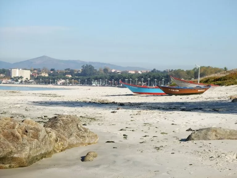
Spain.info describes Samil as an enormous beach with all kinds of facilities. Travelling vendors set up stalls along the promenade, and behind the sand there is a playground with swimming pools and a large pine grove. The view is the point: the Cíes Islands sit opposite the beach, and Toralla island is on the left as you face the sea.
The Rías Baixas tourist board adds green spaces, shaded picnic areas, playgrounds, pools and many outdoor activities (Turismo Rías Baixas). OpenStreetMap names three of the pools behind the promenade (Piscina Ocho, Piscina Catarata and Piscina Ponte de Rande), a beach-football pitch, a fitness station, the children’s parks San Remo and Ría de Vigo, and the ruins of an old stone windmill on the hill behind the southern end.
Samil is one of several beaches on this stretch. To the north, small beaches such as Praia do Pincho do Gato and Praia da Espedrigada continue towards the city; to the south the coast runs on to Praia da Calzoa and O Vao (OpenStreetMap). Turismo de Galicia lists “spending a day at the beach in Samil” among the simple pleasures of the city, next to oysters in A Pedra and the view from O Castro (Turismo de Galicia).
Practical details
- Services listed by spain.info: water-craft rental, toilets, showers, tourist office, litter bins, cleaning, telephone, sports area and children’s play area.
- Services listed by the tourist board: promenade, public toilets, picnic and recreation area, children’s facilities, a campsite, lifeguard, showers and footbaths, litter bins and cleaning (Turismo Rías Baixas, Spanish page).
- Showers and water: OpenStreetMap shows free showers on the promenade and several drinking fountains.
- Water quality: the tourist board gives the bathing water classification as “sufficient”. Check the latest result before you swim.
- Food and fun: OpenStreetMap maps a pub and a bowling alley on Avenida de Samil.
- Camping: OpenStreetMap shows a campsite, Camping Playa Samil, behind the southern end; we could not confirm its season.
- Museum: Verbum – Casa das Palabras, a council museum about words and language, stands behind the beach. OpenStreetMap lists Tuesday–Friday 17:00–20:00 and weekends 12:00–14:00, with a fee; we could not confirm these hours with the city.
Accessibility and safety
The tourist board lists adapted infrastructure and information, volunteer support staff, amphibious chairs for getting into the water and accessible signage at Samil (Turismo Rías Baixas, Spanish page); we could not confirm the dates of the assisted-bathing service. The promenade is flat. Spain.info warns of moderate and sometimes strong waves, and the Atlantic is cold: the weather box on its page showed a water temperature of 16 °C when we checked in November 2026. Swim where the lifeguard can see you; OpenStreetMap shows a Local Police beach post in the middle of the promenade.
Best time to visit
July and August are the beach months, and the busiest: arrive early for parking. Outside summer the promenade is a good walk at sunset, when the light falls behind the Cíes. On windy days the waves get bigger and the beach suits walkers more than swimmers.
Nearby alternatives
- Vigo Old Town and Monte do Castro, 5 km north-east: the fishermen’s quarter of O Berbés, oysters in A Pedra and the hill-top fort.
- Praia América (Nigrán), 9 km south-west: a long urban beach on the bay of Baiona with a dune trail.
- Cíes Islands, 10 km west: Praia de Rodas and the national park, by ferry from Vigo with a free Xunta permit in high season.
- Baiona, 12 km south-west: the Monterreal fortress and the La Pinta replica.
- Cabo Home and the Costa da Vela, 9 km north-west across the ría: lighthouses, cliffs and wild beaches facing the Cíes.
Distances are in a straight line from the middle of the beach.
FAQ
Is there parking at Samil Beach?
Yes. The council has several surface car parks behind the promenade, the largest with 268, 242, 182 and 179 spaces, plus roadside parking on Avenida de Samil (OpenStreetMap).
How do I get to Samil Beach from Vigo centre?
Drive south-west on the coast road towards Baiona, about 5 km in a straight line from the old town, or take a Vitrasa city bus to the stops on Avenida de Samil.
Can you swim at Samil?
Yes. There are lifeguards in season, but expect moderate to strong waves and cold Atlantic water. The bathing water was classed “sufficient” by the tourist board, so check the latest result.
Are there swimming pools at Samil?
Yes. Spain.info and the tourist board both mention pools behind the beach, next to the playground and the pine grove; we could not confirm their season or prices.
Can you see the Cíes Islands from Samil?
Yes. The islands are directly opposite the beach, about 10 km away, with Toralla island on the left.
Sources and freshness
Checked 9 November 2026 · 3 sources Show
Checked 9 November 2026. Official:
- spain.info, Samil beach (Vigo) (size, sand, waves, occupancy, services, access)
- Turismo Rías Baixas, Playa de Samil and its Spanish page (setting, services, accessibility, water quality)
- Turismo de Galicia, Vigo. Car parks, bus stops, pools, showers, police post, museum hours, campsite and distances: OpenStreetMap contributors (ODbL). The Vigo tourism site could not be reached. Photos: Wikimedia Commons, licences as credited
How this page is made. CostaMap is written with an AI editorial system run by Ebizapple. This page is based on the sources listed above. Last updated 9 November 2026. Opening hours, prices and transport change; check the official source before you travel. How we work · Partner links and ads