
Tossa de Mar to Lloret de Mar walk (GR 92, Costa Brava)
Hiking trailThe Tossa de Mar to Lloret de Mar walk is stage 11 of the GR 92 coastal trail on the Costa Brava: a waymarked route of 14.37 km from Tossa’s walled old town to Lloret beach. The Catalan tourist board gives 3 h 35 min, 669 m of climbing and 670 m of descent, and rates it for beginners, all year round. Only parts of it follow the old camí de ronda (coast path): a long section climbs inland along the GI-682 road and through housing estates. It suits walkers who want a full day linking two towns with a bus back; skip it if you only want a short, flat cliff path.
Quick facts
- Names: GR 92 stage 11, Tossa de Mar–Lloret de Mar (GR 92 etapa 11, de Tossa de Mar a Lloret de Mar). Often searched as the camí de ronda Tossa–Lloret.
- Where: the southern Costa Brava, between Tossa de Mar and Lloret de Mar (la Selva, Girona).
- Start coordinates: 41.7187, 2.9333 (Platja Gran, Tossa de Mar, below the Vila Vella; from OpenStreetMap). The stage ends at Lloret beach, 41.6983, 2.8482.
- Distance: 14.37 km one way (catalunya.com).
- Height: +669 m / −670 m.
- Time: 3 h 35 min.
- Difficulty: beginners, on foot, according to the tourist board’s route sheet.
- Waymarking: yes, GR 92 (the Mediterranean long-distance trail).
- Season: all year round.
- Entry: free.
Access and parking
Start in Tossa: the stage begins in Tossa de Mar by the Vila Vella. OpenStreetMap shows several paid surface car parks in the town centre a few hundred metres behind the Platja Gran, plus the underground Ancora car park. Tossa’s bus station is about 0.5 km from the beach.
Getting back: this is a one-way walk. OpenStreetMap maps a bus route, line L9, between Tossa de Mar and Lloret de Mar, and Lloret’s bus station is about 0.6 km inland from the end of the stage. We did not check timetables, so look them up before you set off. You can also walk it the other way, from Lloret to Tossa.
Tourist offices: the route sheet lists the tourist offices of Tossa de Mar and Lloret de Mar as contacts.
What to expect
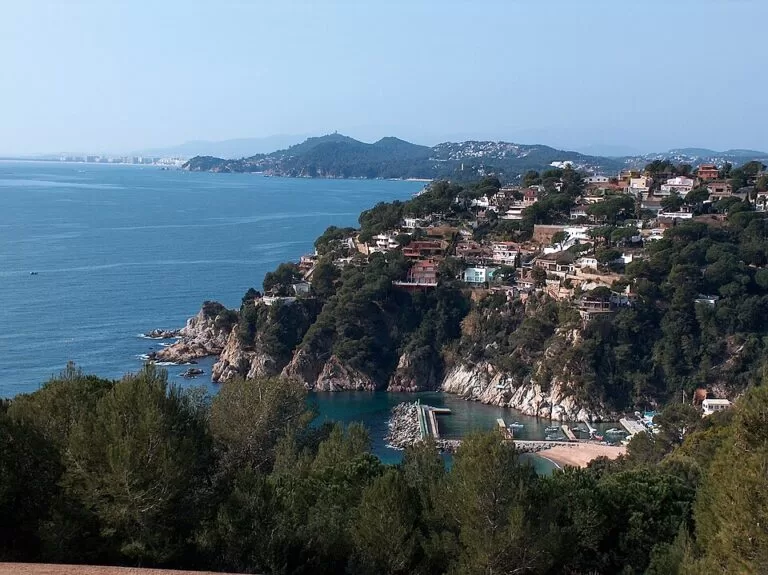
The official stage description suggests leaving time before the start for the Vila Vella, Tossa’s walled old town, built as a defence against the pirates who raided this coast. The trail leaves town on the camí de ronda but soon turns away from the water to reach the GI-682 road and go around the Santa Maria de Llorell estate. From up here you see the sea from height and at a distance.
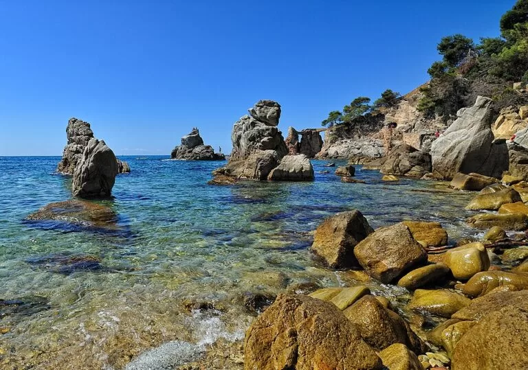
The path then comes back towards the coast through the Playa Brava estate and returns to the shore at Canyelles beach. It crosses the Canyelles area and the La Montgoda estate, where it picks up the camí de ronda again. The rocky coves of Cala Trons and Cala Frares follow, then Sa Caleta, a small patch of sand covered in boats, before the stage ends on Lloret beach. Points of interest named on the sheet include the church of Sant Romà and the modernist cemetery in Lloret de Mar.
Expect a mix: sea views and coves at both ends, and road verges and residential streets in the middle. It is a stage of a long-distance trail, not a continuous cliff path.
Practical details
- What to bring: the route sheet advises suitable footwear, water and snacks, sun protection (above all in summer) and a torch in case it gets dark.
- Navigation: follow the GR 92 waymarks and carry a map; the sheet warns that your phone may fail where there is no signal.
- Swimming: the route passes Canyelles beach and the coves of Cala Trons, Cala Frares and Sa Caleta, so bring swimwear. We found no information on lifeguards at the smaller coves.
- Toilets: OpenStreetMap shows free public toilets by the Platja Gran in Tossa.
- Next stages: the tourist board also describes stage 10, from Sant Feliu de Guíxols to Tossa de Mar, and stage 12, from Lloret de Mar to Tordera.
Accessibility and safety
The tourist board rates this stage for beginners, but with 669 m of climbing over 14 km it is a full day on foot. Parts of the route run along the GI-682 road, so take care with traffic. In summer, carry plenty of water and sun protection, as the sheet advises. We could not confirm step-free access to any part of the route, so do not plan on it with a wheelchair or pushchair.
Best time to visit
The route sheet lists the stage as walkable all year round. In hot weather, start early and plan a swim at Canyelles or one of the coves near Lloret.
Nearby alternatives
- Tossa de Mar, at the start: the town, its beach and the walled Vila Vella.
- Cala Pola (Tossa de Mar), 2.2 km away: a cove on the coast north-east of Tossa.
- Water World Lloret, 8.9 km away: the water park above Lloret de Mar.
- Camí de Ronda S’Agaró to Platja d’Aro, 13 km away: a shorter coast path further north on the Costa Brava.
- Camí de Ronda: Calella to Tamariu, 28 km away: another coast path guide on the Costa Brava, in Palafrugell.
Distances are in a straight line from the start in Tossa de Mar.
FAQ
How long is the walk from Tossa de Mar to Lloret de Mar?
The GR 92 stage is 14.37 km one way, with 669 m of climbing. The Catalan tourist board gives 3 h 35 min of walking.
Is the Tossa to Lloret walk all along the coast?
No. It starts and ends on the camí de ronda, but in between it climbs inland along the GI-682 road and through the Santa Maria de Llorell, Playa Brava and La Montgoda estates.
How do I get back from Lloret de Mar to Tossa?
OpenStreetMap maps bus line L9 between Lloret de Mar and Tossa de Mar. Check the current timetable before you start.
Where can I park in Tossa de Mar?
OpenStreetMap shows several paid car parks in the centre of Tossa, a few hundred metres behind the Platja Gran, including the underground Ancora car park.
Can you swim along the way?
Yes. The route passes Canyelles beach and the coves of Cala Trons, Cala Frares and Sa Caleta before ending on Lloret beach.
Sources and freshness
Checked 6 November 2026 · 3 sources Show
Checked 6 November 2026. Official: Catalan Tourist Board (catalunya.com) GR 92 stage 11, Tossa de Mar to Lloret de Mar (distance, time, height, difficulty, season, waymarking, route description, tips) and Camins de ronda. Location, car parks, bus stations, bus line, toilets and distances: OpenStreetMap contributors (ODbL). Photos: Wikimedia Commons, licences as credited.
This place is part of our Costa Brava travel guide: Cadaqués, the Palafrugell coves and Tossa de Mar — see every town, beach and cove we have mapped on that coast.
How this page is made. CostaMap is written with an AI editorial system run by Ebizapple. This page is based on the sources listed above. Last updated 6 November 2026. Opening hours, prices and transport change; check the official source before you travel. How we work · Partner links and ads