
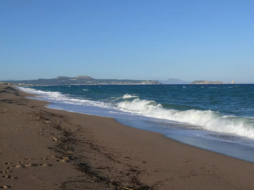
Platja de Pals (Pals beach) is a long, open sandy beach on the Costa Brava, about 3.5 km of golden sand between the Begur headland and the mouth of the Daró, some 5 km east of the medieval village of Pals. You reach it by car on the GI-V6502 or by the Palafrugell–Pals bus, and it has full summer services, a Red Cross post and plenty of room. It suits families, windsurfers and kitesurfers and anyone who wants space on the sand; skip it if you want a sheltered cove with calm water, because east winds bring big waves here.
Quick facts
- Names: Platja de Pals (Catalan), Playa de Pals (Spanish); the official tourism site also calls its main stretch Platja Gran. The northern part runs into the Grau beach and the southern end, the Platja del Racó, belongs to Begur (Catalunya.com).
- Where: municipality of Pals, Baix Empordà (Girona), on the straight coast south of the mouth of the Ter and opposite the Medes Islands.
- Coordinates: 41.9929, 3.2011 (middle of the beach).
- Length: sources differ: 3,500 m long and 70 m wide according to Spain.info and the Catalan text of Catalunya.com; “more than four kilometres” in the English text of Catalunya.com and on Spain.info’s Pals page.
- Surface: golden sand, backed by dunes and pine groves.
- Conditions: Spain.info gives strong waves and wind; it has a surf practice area.
- Services: showers, toilets, Red Cross lifeguard and first-aid posts, water-sports rental, several beach bars and access ramps for people with reduced mobility, mostly on the right-hand (southern) side.
- Entry: free.
Access and parking
By car: the official tourism site gives the GI-V6502 road as the way in (Catalunya.com). Spain.info lists the beach as accessible on foot and by car. We found no official information on the number of parking spaces or on summer parking charges; check the signs when you arrive.
By public transport: the nearest railway station is Flaçà, on the Barcelona–Portbou line, and the Palafrugell–Pals intercity bus serves the area (Catalunya.com). Catalunya.com’s Pals page adds that buses link Pals with Palafrugell, Torroella and Girona, especially in summer. We could not open the operator’s timetables.
On foot: behind the rocks of Punta Espinuda, at the southern end, a coastal path leads to Sa Riera, passing the naturist cove of L’Illa Roja (Catalunya.com).
What to expect
A wide, straight beach with plenty of space even in summer, very different from the small rocky coves of Begur and Palafrugell further south. Spain.info describes it as two beaches separated by a sand bank, with an anchoring area for boats and a campsite nearby. Its occupancy is rated high, but there is more room to spread out than on most of the central Costa Brava.
For more than fifty years the beach was dominated by the huge antennas of the Radio Liberty station, which broadcast to the countries behind the Iron Curtain during the Cold War. They were demolished in 2006 (Catalunya.com).
When strong easterly winds blow, fairly big waves build up, which is why the beach is popular for windsurfing and kitesurfing (Catalunya.com). On calm days it is an easy family beach with a sandy bottom.
Behind the sand, the Pals countryside has wetlands, the Basses d’en Coll at the old mouth of the Daró, old dunes now covered by pine groves, and rice fields you can explore on foot or by bicycle. The Platja de Pals golf course was built in 1966 on pine-covered dunes near the beach and is the oldest on the Costa Brava (Catalunya.com, Pals).
Practical details
- Food and drink: several beach bars (quiosquets) on the sand in season, according to the official tourism site.
- Water sports: water-craft rental and a surf practice area (Spain.info).
- Campsites on CostaMap: Alannia Neptuno about 1 km away, Interpals Eco Resort about 1.3 km away and Talaia Plaza Ecoresort about 2.8 km away.
- Tourist information: the Pals tourist office is listed by Catalunya.com on +34 972 637 380 (info@pals.cat).
- Dogs: we found no official dog rule for Platja de Pals; check the signs at the access points.
Accessibility and safety
Catalunya.com lists access ramps for people with reduced mobility, and Red Cross lifeguard and first-aid posts, most of them on the southern side of the beach. We could not confirm the season or hours of the lifeguard service. This is an exposed beach: with east winds the sea gets rough and Spain.info rates the swimming conditions as strong waves and wind, so watch the flags, keep children close and swim near a lifeguard post.
Best time to visit
June and September for swimming with summer services but fewer people. July and August are the busiest months. Windsurfers and kitesurfers come when the easterly blows. In October the Pals rice harvest festival is one of the main events of the municipality (Catalunya.com), a good reason to combine the beach with the old village.
Nearby alternatives
- Sa Riera (Begur), 2.4 km away: Begur’s largest beach, a sheltered sandy bay with fishermen’s houses, reached by the coastal path.
- Begur, 4.3 km away: the hilltop village with its castle and coves.
- Cala Sa Tuna (Begur), 4.3 km away: a small pebble cove in an old fishing hamlet.
- Pals Old Town, 5.3 km away: the restored Gothic quarter on the hill, with the Torre de les Hores.
- Illes Medes (L’Estartit), 6.3 km away: the marine reserve islands offshore to the north.
- Peratallada, 9.3 km away: a medieval village inland.
Distances are in a straight line from the middle of the beach.
FAQ
How long is Pals beach?
About 3.5 km according to Spain.info and the Catalan page of the Catalan tourist board; other official texts say more than four kilometres, probably counting the Grau and Racó ends.
How do I get to Platja de Pals?
By car on the GI-V6502 road from the Pals area. Without a car, take a train to Flaçà and the Palafrugell–Pals bus, which runs more often in summer.
Is Pals beach good for swimming?
Yes on calm days, with a sandy bottom and lifeguards in season. With east winds the waves get big, so follow the flags.
Can you windsurf or kitesurf at Pals?
Yes. The official tourism site says the beach is ideal for windsurfing and kitesurfing when the easterly blows, and Spain.info lists a surf practice area and water-craft rental.
What were the antennas on Pals beach?
The masts of the Radio Liberty station, which broadcast to Eastern Europe during the Cold War for more than fifty years. They were demolished in 2006.
Sources and freshness
Checked 6 November 2026 · 6 sources Show
Checked 6 November 2026. Official: Catalunya.com on Platja de Pals (English) and in Catalan (length, services, Radio Liberty, wind, access, transport) and on the municipality of Pals (dunes, wetlands, rice fields, golf, buses, rice festival); Spain.info on Pals beach and Pals. The Pals town and tourism websites were not reachable from here. Location: OpenStreetMap (ODbL). Photo: Wikimedia Commons, licence as credited.
How this page is made. CostaMap is written with an AI editorial system run by Ebizapple. This page is based on the sources listed above. Last updated 6 November 2026. Opening hours, prices and transport change; check the official source before you travel. How we work · Partner links and ads