
Costa del Azahar · Centre
Torreblanca, Oropesa and Benicàssim travel guide: the central Costa del Azahar
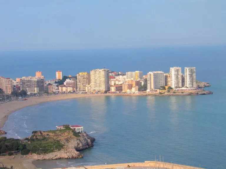
The middle of the Castellón coast, from the Prat de Cabanes-Torreblanca wetland past the cape of Oropesa to the beaches and summer villas of Benicàssim, with the Desert de les Palmes mountains behind.
The bay of La Concha and the cape of Oropesa · Photo: A. www.viajar24h.com, CC BY 2.0
Part of the Costa del Azahar guide · Centre: Torreblanca, Oropesa and Benicàssim
The central Costa del Azahar is the stretch of Castellón’s coast between Torrenostra, the seaside district of Torreblanca, and the southern edge of Benicàssim, covering the coast of Torreblanca, Cabanes, Oropesa del Mar and Benicàssim. It runs from a protected coastal wetland, the Prat de Cabanes-Torreblanca, past the cape and coves of Oropesa to Benicàssim’s long town beaches and Belle Époque villas, with the Desert de les Palmes natural park rising behind (Turisme Comunitat Valenciana). This guide covers each town from north to south, the beaches, what to do, where to base yourself, how to get there and a two-day route.
At a glance
- Where the centre of the Costa del Azahar in Castellón province, from Torrenostra in the north to the Torre de Sant Vicent beach in Benicàssim, about 23 km apart in a straight line.
- Towns Torreblanca and Torrenostra, the coast of Cabanes at Torre de la Sal, Oropesa del Mar, and Benicàssim.
- Best for family beaches with every service, quiet natural beaches in a wetland, birdwatching, an easy coastal greenway, mountain walks with sea views, Art Nouveau villas and a summer music festival.
- Getting there Castellón Airport lies 11 km from Torreblanca and 17 km from Benicàssim in a straight line; Torreblanca, Oropesa and Benicàssim have railway stations on the Valencia–Castellón–Vinaròs line, and the N-340 and AP-7 run behind the coast.
- On CostaMap guides to Torreblanca, Oropesa del Mar, Benicàssim, the Prat de Cabanes-Torreblanca, the Desert de les Palmes, the Arch of Cabanes, the Vía Verde del Mar, the Villa Route, La Concha beach and Aquarama.
Map of Torreblanca, Oropesa and Benicàssim
The map shows the places in this stretch that have a CostaMap page. Tick a place type to filter, and click a marker to see the place in the panel.
Place type
Area · next level
 Area map
Torreblanca, Oropesa and Benicàssim
Click a marker to see the place here. From the Prat de Cabanes wetland past the cape of Oropesa to Benicàssim and the Desert de les Palmes.
Towns and villagesTowns and villages
From north to south. Torreblanca and Cabanes share the wetland, Oropesa sits on its cape, and Benicàssim closes the stretch before Castelló.
Torreblanca and Torrenostra
Torreblanca, 36 km from Castelló de la Plana, has two centres: the inland town and Torrenostra on the coast, about 3 km away (Spain.info). In the old town, a zigzag path with Stations of the Cross climbs to El Calvario, and the 17th-century church of San Bartolomé stands in the centre. On the way to the coast is the crenellated Torre de Doña Blanca, from the 16th and 17th centuries (Turisme Comunitat Valenciana). Torrenostra takes its name from the Torre Nostra, a 17th-century tower on the seafront between the sea and the Albalat lagoon, nine metres tall with walls a metre thick (Turisme Comunitat Valenciana). Read our Torreblanca guide.
Cabanes, Torre de la Sal and the Prat
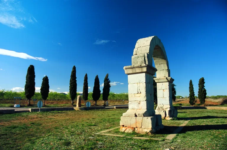
Cabanes, 26 km from Castelló, is an inland town with a walled medieval core and the coast of the Ribera de Cabanes, a natural beach of almost 7 km (Spain.info). The walled old town keeps the Sitjar and San José gateways and a Baroque church; the castles of Albalat and Miravet stand nearby (Turisme Comunitat Valenciana). Its best-known monument is the Arch of Cabanes, a Roman arch 5.8 m tall on a roundabout of the CV-157, beside the route of the old Via Augusta. On the coast, the hamlet of Torre de la Sal keeps its fishermen’s houses and a square watchtower about six metres a side, listed as an Asset of Cultural Interest. North of it lies the wetland: see our Prat de Cabanes-Torreblanca guide.
Oropesa del Mar
Oropesa del Mar (Orpesa) grew up on a small bay, with the beaches of La Concha and Morro de Gos, a string of coves and a marina (Spain.info). The town has 12 km of coast. The old town on the hill keeps the ruins of an Islamic castle that El Cid took in 1090 and James I in 1233, and the church of the Virgen de la Paciencia, with 18th-century tiles from L’Alcora; the old jail now holds the town museum (Turisme Comunitat Valenciana). On the cape stands the Torre del Rey, built in 1413 to defend the coast against pirates, given walls four metres thick in 1534 and bought by Philip II in 1568. The big July festival is the Virgen del Carmen, with a procession of boats at sea. See our Oropesa del Mar guide and the Oropesa del Mar place page.
Benicàssim
Benicàssim has about six kilometres of sandy beaches, sheltered from the wind by the mountains of the Desert de les Palmes behind (Spain.info). Down on the beach, the Torre de San Vicente was built between 1597 and 1599 against Barbary pirates and helped the town’s resettlement under its charter of 1603 (Turisme Comunitat Valenciana). From the late 19th century wealthy families built summer villas along the shore; the oldest still standing, Villa Pilar, dates from 1860, says Spain.info. Today they form the Villa Route. The town is also known for Carmelitano liqueur and for the FIB music festival, next held from 15 to 17 July 2027. Read our Benicàssim guide and the Benicàssim place page.
Beaches and coves
From north to south. Lengths and services are as the regional tourist board lists them, checked November 2026; we could not confirm 2026 Blue Flags or lifeguard dates.
Torrenostra and the Prat beaches
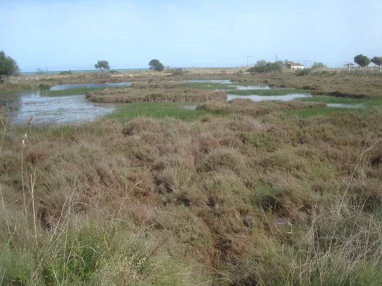
Norte beach in Torrenostra is 720 m long and 30 m wide, with lifeguards, toilets and a wooden walkway over the dunes to the Laguna del Fartet bridge (Turisme Comunitat Valenciana). South of it, El Prat beach inside the park is smoke-free. Quartell Vell, over 3 km of sand, pebbles and rock, is a naturist beach with no services or lifeguards, and Torre de la Sal beach, about 2 km long, mixes sand and loose stones in front of the fishermen’s houses (Turisme Comunitat Valenciana).
See the wetland guide →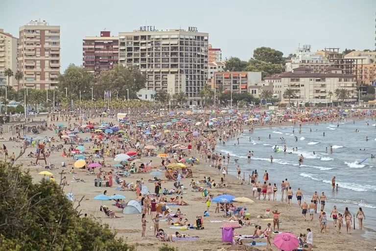
La Concha and Morro de Gos
La Concha is 700 m of fine golden sand in a sheltered, shell-shaped bay, shallow and calm, with swings and slides for children and lifeguards in high season. Dogs are allowed on a lead from 1 November to 28 February (Turisme Comunitat Valenciana). North of the cape, Morro de Gos runs for 2,000 m of wide, quiet sand with almost no waves and a Red Cross post (Turisme Comunitat Valenciana).
See the La Concha guide →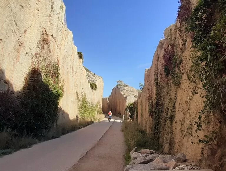
The coves south of Oropesa
Just south of La Concha, the Cala d’Orpesa la Vella (120 m) has shallow water and Spain’s first water swing; the Cala del Retor (70 m), below the Iberian site and the marina, became the first smoke-free beach in the Region of Valencia in 2019. Further on, La Renegà is 1,270 m of small sandy and rocky coves under pines, reached by car or on the Vía Verde; Les Platgetes de Bellver (350 m) is a naturist beach behind a breakwater (Turisme Comunitat Valenciana).
Walk the Vía Verde →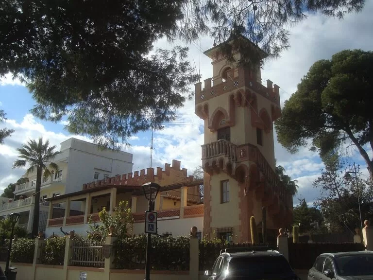
Voramar to Torre de Sant Vicent
Voramar (600 m) is backed by the villas of the late 19th and early 20th centuries, which earned the town the name “Valencian Biarritz”. L’Almadrava (600 m) has floating wheelchairs and staff to help people with disabilities bathe. Els Terrers, 1,700 m between breakwaters that form two sheltered inlets, has the Generalitat’s sailing school, and Torre de Sant Vicent (750 m) lies below the 16th-century watchtower (Turisme Comunitat Valenciana).
See the Villa Route →Things to do
Nature: a wetland, a greenway and a mountain park
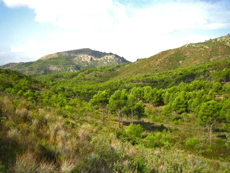
The Prat de Cabanes-Torreblanca is a narrow coastal marsh that is home to the samaruc and fartet toothcarps and the peacock mantis shrimp, with three flat marked routes of 3.5, 4.5 and 8 km and the Gola del Trenc viewpoint (Turisme Comunitat Valenciana). Between Oropesa and Benicàssim, the Vía Verde del Mar follows the old coastal railway for 5.7 km past coves and watchtowers. Behind Benicàssim, the Desert de les Palmes takes its name from the Discalced Carmelites, who called this retreat a “desert”, and from its fan palms; its highest summits are El Bartolo (729 m) and the Mola del Morico (694 m), and the information centre is at La Bartola on the CV-147 (Turisme Comunitat Valenciana).
History: a Roman arch, castles and pirate towers
The Arch of Cabanes, from the 2nd century, is 5.8 m tall and 6.92 m wide and is thought to be a private funerary monument beside the Via Augusta (Turisme Comunitat Valenciana). Montornés Castle, built in the 10th century on Roman remains as part of a Moorish defence system, keeps sections of wall, cisterns and two towers, with views over La Plana and the sea (Turisme Comunitat Valenciana). Along the shore, watchtowers from Torre Nostra to San Vicente guarded against pirates. In Benicàssim, the Villa Route has panels outside most villas and an online audio guide.
Food, festivals and family days
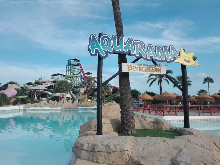
In Benicàssim you can taste Carmelitano liqueur on a guided tour of a distillery (Turisme Comunitat Valenciana). The festive year runs from San Antonio Abad on 17 January, with bonfires, to the Santo Tomás de Villanueva fiestas in September, with Paella Day in between (Turisme Comunitat Valenciana). Oropesa celebrates San Juan and San Pedro in June, the Virgen del Carmen and San Jaime in July, and its patron saint in October (Turisme Comunitat Valenciana). For families, Aquarama at the southern exit of Benicàssim has WOW, a 210 m tube slide, and pools for small children (Turisme Comunitat Valenciana).
Where to stay by town
The towns we would base a trip in, north to south. We name no hotels; compare locations on the map.
Torrenostra
A small seaside district with Norte beach, a campsite and the wetland on the doorstep. Quiet, and the closest base to Castellón Airport; Torreblanca station is in the inland town.
Quiet beach and natureOropesa del Mar
Beaches on both sides of the cape, a promenade of hotels and apartments at La Concha, the coves to the south and its own station. The regional tourist board notes the largest group of campsites near Les Amplaries beach.
Families and coastal walksBenicàssim
The most services in the stretch: six kilometres of beaches, the villas, restaurants on the promenade, a station and buses to Castelló.
Beaches, villas and festivalsGetting there and around
By air
Castellón Airport, at Benlloc, is 11 km from Torreblanca, 14 km from Oropesa and 17 km from Benicàssim in a straight line (OpenStreetMap). Our Costa del Azahar guide covers its flight-timed buses and the shuttle to Torreblanca station, and Valencia Airport, about 80 km from Benicàssim.
By train
Torreblanca, Oropesa del Mar and Benicàssim have stations on the line between Valencia, Castelló and Vinaròs. Oropesa station is about 1.1 km from La Concha; Benicàssim station is about 1.7 km from the villas (OpenStreetMap). Check Renfe for times.
By car and bus
The N-340 and the AP-7 run behind the coast; the Prat is reached by the N-340 turn-off for the Ribera de Cabanes or the AP-7 at Oropesa, and the Desert de les Palmes by the CV-147 from Benicàssim. Autos Mediterráneo buses link Castelló with Benicàssim, including a route through the villas, and serve the coast north to Oropesa (OpenStreetMap).
A two-day route
By car, based in Oropesa del Mar or Benicàssim.
Day 1
The wetland, the Roman arch and Oropesa
Start early at Torre de la Sal and walk the Red Route (3.5 km) through the Prat, or drive to Torrenostra for the Yellow Route (4.5 km) and the Gola del Trenc viewpoint. Drive inland to the Arch of Cabanes on the CV-157. In the afternoon, climb to Oropesa’s castle and the Virgen de la Paciencia church, then swim at La Concha and walk out to the Torre del Rey at sunset.
Day 2
Vía Verde, the villas and the Desert de les Palmes
Walk or cycle the 5.7 km Vía Verde del Mar from La Concha to Benicàssim, with a swim at La Renegà on the way. Follow the Villa Route along Voramar and L’Almadrava, then have lunch on the promenade. In the late afternoon drive up the CV-147 into the Desert de les Palmes for the walk to Montornés Castle and the view over La Plana and the sea.
FAQ
Is Oropesa del Mar or Benicàssim better to stay in?
Benicàssim has more services, the villas and the mountain park behind it. Oropesa del Mar suits families who want calm bays like La Concha and coves within walking distance.
How do you get from Benicàssim to Oropesa del Mar?
On foot or by bike along the 5.7 km Vía Verde del Mar, by train between the two stations, or by car on the N-340.
What is the Prat de Cabanes-Torreblanca?
A protected coastal wetland between Torreblanca and Oropesa del Mar, with flat marked routes, bird hides and natural pebble and sand beaches. Entry is free.
Is there a nudist beach near Benicàssim or Oropesa?
Yes. Les Platgetes de Bellver in Oropesa del Mar and Quartell Vell in Cabanes are naturist beaches, according to the regional tourist board.
When is the FIB festival in Benicàssim?
Spain.info lists the next edition from 15 to 17 July 2027. Check the festival’s own website for tickets and the final programme.
What is the nearest airport to Benicàssim?
Castellón Airport at Benlloc, about 17 km away in a straight line. Valencia Airport is about 80 km away.
Other areas of the Costa del Azahar
Costa del Azahar
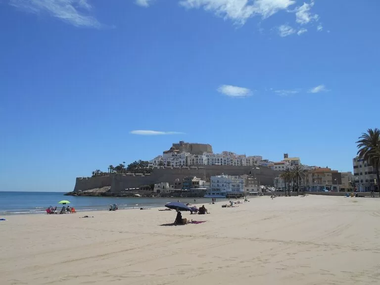
The whole Castellón coast from Vinaròs to Almenara, with the map, campsites, weather, Morella and itineraries.
Costa del Azahar guide →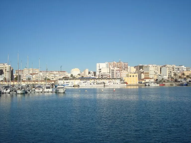
Vinaròs and Benicarló
King prawns and coves in Vinaròs, artichokes and the MUCBE museum in Benicarló.
Vinaròs and Benicarló guide →Peñíscola and the Serra d’Irta
Pope Luna’s castle on its rock, Playa Norte and the wild coast of the Irta park to Alcossebre.
Peñíscola and Serra d’Irta guide →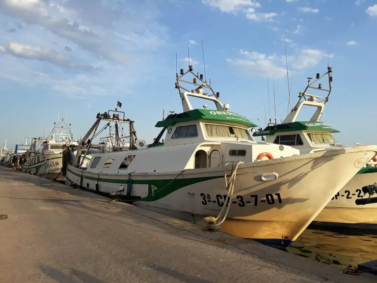
Castelló and the Plana
Castelló’s co-cathedral and El Grao, then the long beaches and wetlands of the Plana down to Almenara.
Castelló and the Plana guide →Just north of the Prat, Alcossebre begins the Serra d’Irta coast, about 11 km from the centre of the wetland.
Sources and freshness
Checked 7 November 2026. Turisme Comunitat Valenciana: Torreblanca, Torre Nostra, Norte beach, El Prat beach, Cabanes, the Prat de Cabanes-Torreblanca, Torre de la Sal beach, Quartell Vell, the Roman arch, Oropesa del Mar, its castle, the Torre del Rey, festivals and the beaches of La Concha, Morro de Gos, Orpesa la Vella, El Retor, La Renegà and Les Platgetes de Bellver; Benicàssim, the Villa Route, the Torre de San Vicente, Montornés Castle, the Desert de les Palmes, festivals, Aquarama and the beaches of Voramar, L’Almadrava, Els Terrers and Torre de Sant Vicent. Spain.info on Torreblanca, Cabanes, Oropesa del Mar and Benicàssim (with the FIB 2027 dates). Map data and distances: OpenStreetMap. Photos (Wikimedia Commons): hero A. www.viajar24h.com, CC BY 2.0; Prat and Villa de la Torre Juan Emilio Prades Bel, CC BY-SA 4.0; La Concha JavierMunozF, CC BY 4.0; Vía Verde Bronstein, CC BY-SA 4.0; Desert de les Palmes Espencat, public domain; Arch of Cabanes Maro001, CC BY-SA 3.0 es; Aquarama Artistosteles, CC BY-SA 4.0; area cards as credited on the hub. Not confirmed: 2026 Blue Flags, lifeguard dates, train and bus timetables, Aquarama’s 2026 season; town hall and natural park websites could not be reached from here.