
Cedeira is a fishing town on a small ría of the same name on the north coast of A Coruña, in the Rías Altas of Galicia, and the gateway to the sanctuary of San Andrés de Teixido and the cliffs of the Serra da Capelada. It is about 42 km north-east of A Coruña in a straight line; you arrive by road from Ferrol, and there is a bus station about 800 m from the town hall. It suits travellers who want a working harbour, sheltered beaches and the Capelada cliffs; skip it if you need nightlife.
Quick facts
- Names: Cedeira in both Galician and Castilian. English Wikipedia says the name comes from the Latin cetaria, linked to whales or large fish; the oldest documented mention is from 868.
- Where: municipality of Cedeira, comarca of Ferrol, province of A Coruña, Galicia, at the mouth of the River Condomiñas.
- Coordinates (town hall): 43.6608, -8.0565.
- Population: 6,547 in 2025 (IGE, via Galician Wikipedia); the municipality covers 84 km².
- The ría: the smallest in the province of A Coruña (Galician Wikipedia), ringed by cliffs that Turismo de Galicia gives as 600 metres high.
- Known for: goose barnacles (percebes), the sanctuary of Santo André de Teixido and the Capelada cliffs.
- Main events: the Festa do Percebe in July or early August, held since 2003; the patron saint festival of the Virxe do Mar, with its main day on 15 August.
Getting there and parking
By car: Galician Wikipedia gives the road links as the C-646 towards Ferrol and the C-642 towards Ortigueira.
By bus: OpenStreetMap places the bus station about 800 m south-east of the town hall, beside the Magdalena beach road. We could not confirm current routes and times.
Parking: OpenStreetMap shows several surface car parks along the harbour and the river, the nearest about 100 m from the town hall, and free street-side parking near Magdalena beach.
What to see
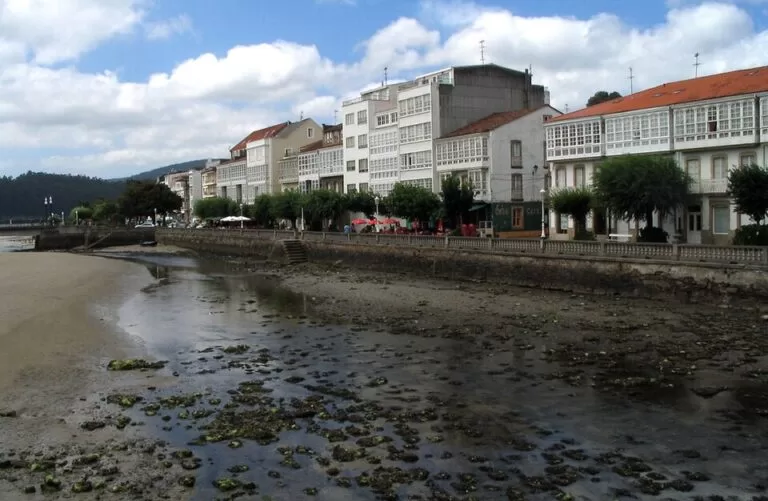
The old town. Cedeira’s historic centre, on the right bank of the Condomiñas, was walled in the Middle Ages; a small stretch of wall remains. Turismo de Galicia calls its narrow streets delightful for strolling, and Galician Wikipedia notes coats of arms of noble families such as the Andrade and Pardo on some houses, and houses with glazed galleries along the harbour wall.
Santa María do Mar. The parish church at the top of the old town dates from the 15th century, in the local seafaring Gothic style, with a tower added in 1839. Inside is the tomb of the knight Alonso de Pyñeiro, dated 1450 (Galician Wikipedia).
Castelo da Concepción. At the end of the port, on a cliff about 1.2 km from the town hall, is an 18th-century hexagonal fort built after an English attack to defend the ría. Galician Wikipedia says it once had fifteen cannon and now holds a district museum and a viewpoint over the mouth of the ría and the beaches of A Magdalena and Pantín. We could not confirm its opening hours.
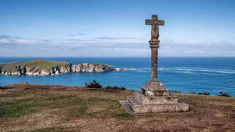
Santo Antón de Corveiro. Facing the fort, a chapel begun in 1661 looks over the entrance to the ría, with a Baroque altarpiece and a stone cross in its field (Galician Wikipedia).
The harbour. Galician Wikipedia calls Cedeira one of the most important ports of the Rías Altas, landing hake, megrim, octopus and barnacles. The ría is a marine reserve of fishing interest.
Beaches
A Magdalena is the town beach, about 800 m south-east of the town hall: sheltered, with fine sand (Turismo de Galicia).
Vilarrube, about 2.5 km south-west across the ría, is the one Turismo de Galicia calls the most spectacular, crescent-shaped. It lies just over the line in the municipality of Valdoviño and is about 1,420 m of fine sand, listed as sheltered.
We could not confirm lifeguard seasons for either beach.
The Capelada cliffs and Teixido
Turismo de Galicia’s route from Cedeira to Cabo Ortegal starts at the Praza do Peixe and covers just over 20 km of road with views over some of the highest cliffs in western Europe. It climbs the Condomiñas valley to the Chao do Monte lookout, the first view of Teixido. The sanctuary of Santo André de Teixido, with pilgrimages documented since the 14th century, is about 8 km from town; Turismo de Galicia calls it the heart of Cedeira and perhaps of Galicia. Vixía Herbeira, at 615 metres the highest point of the Capelada range, has cliffs with slopes of over 80 per cent and a maritime lookout post rebuilt in 1805.
Food and festivals
A Galician saying quoted on English Wikipedia sends you to Cedeira for shellfish. The Festa do Percebe, held since 2003 in July or early August, celebrates the goose barnacle, and since 2025 Cedeira has also hosted a Goose Barnacle World Championship for the percebeiros who harvest them. Galician Wikipedia lists the Curro da Capelada, when the free-roaming horses are rounded up, in July; the patron saint festival of the Virxe do Mar in August, with its main day on 15 August; and the Santo André festivities in September.
Accessibility and safety
The harbour front and the promenade are flat; the old town climbs up narrow, steep streets, and we could not confirm step-free routes. The roads on the Capelada range are narrow and steep, with free-roaming animals and frequent fog; Turismo de Galicia asks drivers to take care with livestock. Keep back from the cliff edges at the viewpoints.
Best time to visit
July and August bring the barnacle festival, the Curro da Capelada and the patron saint festival; September the Teixido festivities. Spring and autumn are quieter for the cliff road. OpenStreetMap lists the tourist office, by the river near the town hall, as open Monday to Friday 09:00–13:30 and 17:00–19:00 and Saturday mornings; we could not confirm this.
Nearby alternatives
- San Andrés de Teixido, about 8 km north-east: the cliffside sanctuary and wishing fountain.
- Garita de Herbeira and Cabo Ortegal, about 11 km north-east: lookout at 615 m over the Capelada cliffs.
- Estaca de Bares, about 33 km north-east: the northernmost point of Spain.
- Viveiro, about 37 km east: walled port town on its ría.
- A Coruña, about 42 km south-west: city beaches, old town and the Tower of Hercules.
Distances are in a straight line from the town hall. For the whole stretch see our Rías Altas and A Mariña guide.
FAQ
What is Cedeira known for?
Goose barnacles, celebrated at the Festa do Percebe, its fishing port, and its position at the foot of the Serra da Capelada, with the sanctuary of San Andrés de Teixido about 8 km away.
What is the best beach in Cedeira?
Turismo de Galicia calls Vilarrube, a 1,420 m crescent of fine sand across the ría, the most spectacular. A Magdalena is the sheltered town beach.
How far is Cedeira from San Andrés de Teixido?
About 8 km in a straight line, by a road that climbs through the Condomiñas valley to the Chao do Monte lookout.
How do I get to Cedeira?
By car from Ferrol on the C-646, or by bus to the station near Magdalena beach. A Coruña is about 42 km away in a straight line.
When is the Festa do Percebe in Cedeira?
In July or early August; it has been held since 2003. Check the exact date each year.
Sources and freshness
Checked 9 November 2026 · 7 sources Show
Checked 9 November 2026. Official: Turismo de Galicia, Ría de Cedeira (cliffs, Vilarrube, Teixido), Cedeira to Cabo Ortegal route (old town, Praza do Peixe, Chao do Monte, Herbeira, livestock), Vilarrube beach and A Magdalena beach. Background: Wikipedia in English (name, festivals) and Galician (population, roads, monuments, port, festivals). The town hall website could not be reached. Town hall, bus station, car parks, tourist office and distances: OpenStreetMap contributors (ODbL). Photos: Wikimedia Commons, licences as credited.
How this page is made. CostaMap is written with an AI editorial system run by Ebizapple. This page is based on the sources listed above. Last updated 9 November 2026. Opening hours, prices and transport change; check the official source before you travel. How we work · Partner links and ads