
Costa de Cantabria · Eastern Cantabria
Noja, Santoña and Castro Urdiales travel guide: the east coast of Cantabria
Long surf beaches, an anchovy port under Monte Buciero, the marshes of Santoña, medieval Laredo and the Gothic harbour of Castro Urdiales, from Cabo de Ajo to the Basque border.
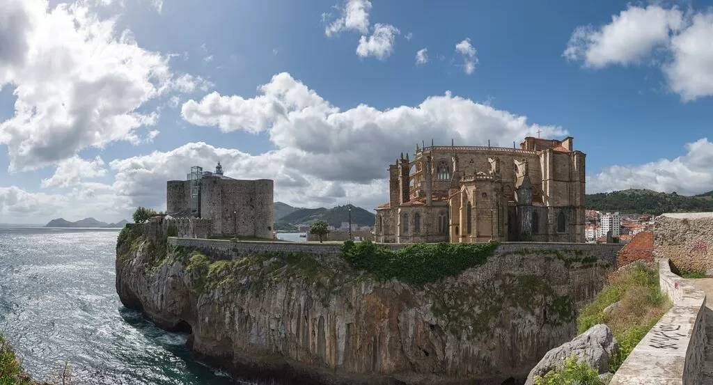
Castro Urdiales · Photo: Giorgio Galeotti, CC BY-SA 4.0
Part of the Costa de Cantabria guide · Other areas: San Vicente, Comillas and Suances · Santillana, Santander and Somo
The east coast of Cantabria runs from Cabo de Ajo, the northernmost point of the region, to the border with the Basque Country beyond Castro Urdiales, almost 40 km in a straight line. It takes in the beach resort of Noja, the anchovy port of Santoña and its marshes, Laredo with the 4,250 m La Salvé, the cliffs of Liendo and Islares, and Castro Urdiales, the Roman Flavióbriga. This guide covers the towns, beaches, things to do, bases and a short route.
At a glance
- Where the eastern coast of Cantabria, from Cabo de Ajo (Bareyo) through Isla, Noja, Santoña, Laredo and Liendo to Castro Urdiales and the Basque border.
- Main towns Noja, Santoña, Laredo and Castro Urdiales, with Ajo, Isla, Colindres, Liendo, Islares and Oriñón.
- Nature the Santoña, Victoria and Joyel Marshes Natural Park, Monte Buciero above Santoña and Monte Candina above Liendo and Oriñón.
- Best for long beaches and surf, anchovies and seafood, birdwatching, coastal walks and old harbour towns.
- Getting there the A-8 motorway follows the whole stretch; Santander airport is 33 km west of Laredo and Bilbao airport about 45 km from Castro Urdiales.
- On CostaMap 4 places: Noja, Santoña, Laredo and Castro Urdiales.
Map of Noja, Santoña and Castro Urdiales
The places in this area with a CostaMap page. Tick a place type to filter, and click a marker to see the place in the panel.
Place type
Area · next level
 Area map
Noja, Santoña and Castro Urdiales
Click a marker to see the place here. The beaches of Noja and Laredo, the port of Santoña and the old harbour of Castro Urdiales.
Towns and villagesTowns and villages
From west to east. Populations are for the whole municipality (INE 2025, via Wikipedia).
Ajo and Isla
Ajo is the main village of Bareyo. Just north of it, Cabo de Ajo is the northernmost and most exposed point of the Cantabrian coast, with a lighthouse whose beam reaches 17 nautical miles (Wikipedia). On its east side, Cuberris is a busy 250 m beach with a small promenade and surfers, and a five-minute path from its far end leads to Antuerta, a 100 m cove sheltered by hills and used by nudists (Spain.info) (Spain.info). Next door, Arnuero, which includes the village of Isla, has turned its four villages into the Ecoparque de Trasmiera, an open-air museum with a tide mill on the Soano marsh and a cliff path at Isla (Wikipedia).
Noja
Noja (2,661 inhabitants) is the resort of the stretch: about 96 per cent of its homes are second homes, and its summer population is estimated at 70,000 to 80,000 (Wikipedia). Spain.info sums it up as beaches and marshes known for birdwatching. Trengandín runs for 3,700 m under the hills of Brusco, Miravalles and Mijedo, and Ris, the town beach, is 2,200 m long and suits surfing and canoeing (Spain.info). Behind the sand are stone mansions such as the Torre de los Velasco, and OpenStreetMap shows a bird hide on the Victoria marsh beside the promenade.
Santoña
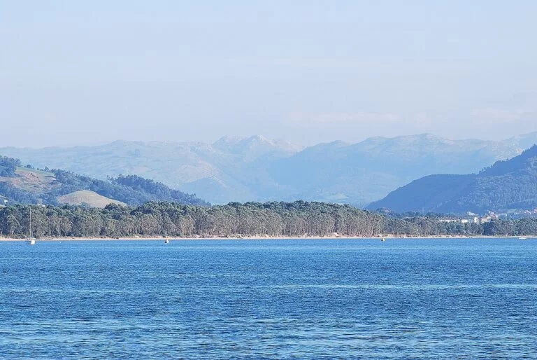
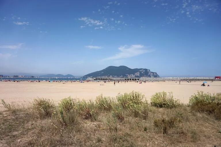
Santoña is the major canning port of the Cantabrian coast, known for tuna and anchovies in olive oil (Spain.info). The town lies on the plain below Monte Buciero, a 376 m headland with forts, cliff paths and two lighthouses; the Faro del Caballo, at the foot of the cliffs, is reached down a stairway of about 685 steps (Wikipedia). The Romanesque church of Santa María del Puerto has 15th-century Flemish paintings, and the forts of San Martín, San Carlos and Mazo, or Napoleón, survive (Spain.info). On the open sea, Berria beach is 2,000 m long (Spain.info).
Colindres
Across the Asón estuary from Santoña, Colindres is a crossroads where the A-8, the N-634 and the N-629 road from Burgos meet. It is the third fishing port of Cantabria, and its canneries work mainly with anchovies, in salt or oil (Wikipedia). Its marshes belong to the same natural park. Most visitors only pass through on the way to Laredo.
Laredo
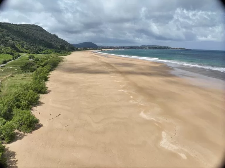
Laredo (10,698 inhabitants) sits between the Treto estuary and the bay of Santoña and is one of the main resorts of the coast. Spain.info calls La Salvé an immense five-kilometre sandbank (Spain.info); its beach sheet gives 4,250 m, with lifeguards and every service (Spain.info). Above the old port, the Puebla Vieja was declared historic-artistic in 1970: walls, alleys, mansions from the 16th to 18th centuries and the Gothic church of Santa María de la Asunción with a Flemish altarpiece. The town holds its Battle of Flowers on the last Friday of August.
Liendo
Liendo (1,218 inhabitants) is a green farming valley of thirteen hamlets behind the highest cliffs in Cantabria, rather than a beach town. Its coast has two small coves under Monte Candina, 489 m: San Julián, reached on foot from the hamlet of Iseca Vieja, and Valdearenas or Sonabia, which is reached from Oriñón (Wikipedia). Spain.info lists San Julián as 100 m of sand, good for surfing and fishing, with difficult access on foot and few visitors (Spain.info).
Oriñón and Islares
These two villages belong to Castro Urdiales. At Oriñón the river Agüera flows into the sea beside a 1,100 m beach of golden sand popular for surfing and canoeing (Spain.info), below Monte Candina, which has a colony of vultures (Wikipedia). Islares, 8 km from Castro, stands on limestone karst with holm oak and laurel woods; it has the early 16th-century church of San Martín and the ruins of the 16th-century Hospital of Vera Cruz (Wikipedia). Its beach, Arenillas, is only 50 m long, with calm water and few visitors (Spain.info).
Castro Urdiales
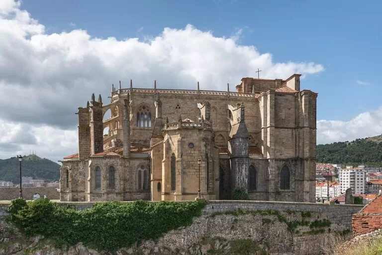
Castro Urdiales, the largest town of the stretch, was the Roman Flavióbriga, whose remains lie about two metres under the present town. Its medieval centre, with rows of glazed wooden balconies, became a historic site in 1978. On the harbour headland stand the church of Santa María, 13th to 15th centuries, the most significant example of Gothic architecture in Cantabria, and the castle-lighthouse, visible from everywhere in town (Spain.info). The cave of Peña del Cuco has Upper Palaeolithic drawings of deer, horses and goats.
Mioño and the border
East of Castro the coast turns steep towards Biscay. Near Mioño, Dícido is a 300 m beach of pebbles, gravel and sand with strong waves and few visitors, reached by car (Spain.info). The Castro Urdiales municipality has almost 20 km of coast, the longest in Cantabria, and borders the Basque province of Biscay; beyond it the A-8 continues to Bilbao and the Costa Vasca.
Beaches and coves
Lengths, conditions and services are as Spain.info, the national tourism portal, gives them, checked in November 2026. Most beaches on this open coast have waves and wind; swim where lifeguards are on duty.
Trengandín
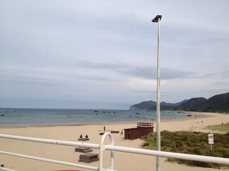
3,700 m of golden sand, 200 m wide, under wooded hills, with a campsite nearby, moderate waves and sun lounger and water craft rental (Spain.info).
See Noja →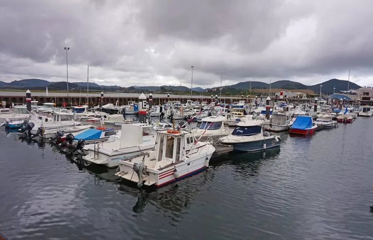
Berria
2,000 m of sand between wooded hills on the open sea, with easy parking along its length, surfing and beach volleyball (Spain.info).
See Santoña →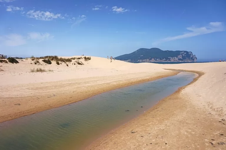
La Salvé
4,250 m by 120 m, the town beach of Laredo, with windsurfing and surfing, a long promenade to El Puntal and lifeguards (Spain.info).
See Laredo →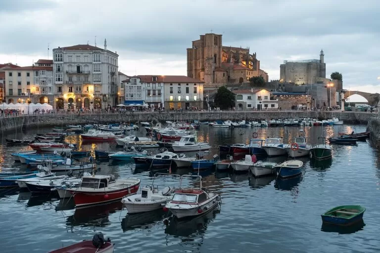
Ostende and Brazomar
Ostende is 800 m of thick grey sand with a promenade and lifeguards; Brazomar, 300 m, has a walkway to the port and a cordoned bathing area (Spain.info) (Spain.info).
See Castro Urdiales →Also on this stretch, from west to east:
- Cuberris and Antuerta (Ajo): a 250 m surf beach with easy parking and restaurants, and a 100 m cove five minutes away on foot (Spain.info).
- Ris (Noja): 2,200 m, often windy, with full services and high occupancy in summer (Spain.info).
- Helgueras (Noja): 2,200 m of almost unspoilt sand backed by dunes in the natural park, uncrowded because of waves and wind, with lifeguards in summer (Spain.info).
- Regatón (Laredo): 2,900 m along the Treto estuary in calm water, with the marina at its end and a campsite behind (Spain.info).
- Oriñón (Castro Urdiales): 1,100 m at the mouth of the Agüera, for surfing and canoeing (Spain.info).
Things to do
Marshes, birds and Monte Buciero
The Santoña, Victoria and Joyel Marshes Natural Park covers 6,678 hectares around the Asón estuary and the marshes of Noja and Arnuero. It is the main wetland of the Cantabrian coast, with more than 120 species of water birds recorded, and a stopover for migrating spoonbills (Wikipedia). Autumn and winter are the best seasons.
Monte Buciero, above Santoña, has marked paths: the longest, past the Faro del Caballo and the Faro del Pescador, is about 12 km, and a short climb leads to the cross on Pico Ganzo, the summit (Wikipedia).
Surf and beach days
Spain.info lists surfing at Cuberris, Berria, La Salvé, Ris, Oriñón and San Julián, and recommends Ris for canoeing and Trengandín for diving (Spain.info). La Salvé adds windsurfing and a surf practice area (Spain.info).
History: Romans, sailors and forts
Laredo and Castro Urdiales were two of the Four Towns of the Coast, the medieval ports of Castile. Laredo’s Puebla Vieja keeps its six original streets inside a wall of about 160 by 140 m (Wikipedia). Castro Urdiales has the Roman site of Flavióbriga under its streets and its Gothic church on the harbour (Spain.info). In Santoña, the forts of San Martín and San Carlos were built by 1689 to close the bay, and Napoleon’s army added more (Wikipedia).
Anchovies and seafood
The anchovy is the product of this coast. Santoña is the major canning port of the Cantabrian coast (Spain.info), and the industry grew there from the late 19th century with Italian salters (Wikipedia); Colindres, across the estuary, is the third fishing port of Cantabria and also cans anchovies (Wikipedia). In Noja, Spain.info suggests the nécora, a small local crab (Spain.info).
Where to stay by town
We do not recommend individual hotels. These are the bases that make the most sense, from west to east.
Noja
Holiday flats near two long beaches; Spain.info notes a campsite very close to Trengandín. Very quiet out of season.
Beach holidaysSantoña
A working port with the best food and walks of the stretch, the marshes on the doorstep and a boat to Laredo.
Food and walkingLaredo
The widest choice of rooms, a bus station, an old town and 4 km of beach. Busy in July and August.
Central baseCastro Urdiales
A real town with a historic harbour, the closest base to Bilbao and its airport, and buses to Bilbao.
Town and BilbaoGetting there and around
By air
Santander airport (Seve Ballesteros) lies in Camargo, 33 km in a straight line west of Laredo (OpenStreetMap). From the east end of the stretch, Bilbao airport is about 45 km from Castro Urdiales (see our Castro Urdiales guide).
By car
The A-8, the Autovía del Cantábrico, and the N-634 run the length of the stretch through Laredo, Liendo and Castro Urdiales (Wikipedia). Noja, Santoña and Ajo are reached by short local roads north of the motorway, such as the CA-141 (Spain.info).
By bus and boat
Laredo has a bus station at the edge of the Puebla Vieja, and Castro Urdiales has buses to Bilbao and ALSA services along the coast; there is no railway on this stretch. A small passenger boat crosses the bay between El Puntal in Laredo and the Santoña promenade; OpenStreetMap notes sailings about every 15 minutes from 09:00 to 18:00, which we could not confirm with the operator.
A 1–2 day route
Day 1: Noja, Santoña and Laredo
Start early on Noja‘s Trengandín at low tide, then stop at the Victoria marsh hide. Drive to Santoña for the forts and Monte Buciero; fit walkers can go down the steps to the Faro del Caballo (check whether booking is needed in July and August). Have anchovies for lunch, then walk to the pier and take the boat across to El Puntal. Walk La Salvé into Laredo and up through the Puebla Vieja to the church of Santa María de la Asunción.
Day 2: the cliffs to Castro Urdiales
Drive east on the N-634 through the valley of Liendo; walkers can head down to the cove of San Julián. Stop at Oriñón for the beach under Monte Candina and at Islares for the ruins of the Vera Cruz hospital. Spend the afternoon in Castro Urdiales: the Gothic church, the castle-lighthouse and the harbour, then Ostende or Brazomar beach.
FAQ
Where is the east coast of Cantabria?
It is the stretch of the Costa de Cantabria in northern Spain from Cabo de Ajo and Noja east through Santoña, Laredo and Liendo to Castro Urdiales and the border with the Basque Country.
Is Noja or Laredo better for a beach holiday?
Both have very long beaches. Noja is a quieter resort of holiday flats around Trengandín and Ris; Laredo is a bigger town with La Salvé, an old town, a bus station and more services.
How do you get from Laredo to Santoña?
By road round the bay, or on the small passenger boat between El Puntal at the end of La Salvé and the Santoña promenade.
What is Santoña famous for?
Anchovies in olive oil: Spain.info calls it the major canning port of the Cantabrian coast. It also has Monte Buciero, the Faro del Caballo, its forts and the marshes.
How far is Castro Urdiales from Bilbao?
About 26 km in a straight line. Buses run to Bilbao, and Bilbao airport is about 45 km away.
Other areas of the Costa de Cantabria
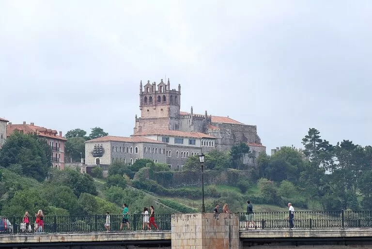
San Vicente, Comillas and Suances
The estuary town of San Vicente de la Barquera, the dunes of Oyambre, Gaudí’s Comillas and the surf at Suances.
West guide →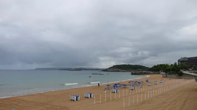
Santillana, Santander and Somo
Medieval Santillana del Mar and Altamira, the dunes of Liencres, the beaches of Santander and the surf of Somo.
Centre guide →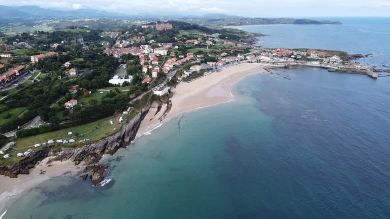
Costa de Cantabria
The full guide to the coast of Cantabria, with the caves, weather, itineraries and practical information.
Costa de Cantabria guide →Sources and freshness
Checked 9 November 2026. Spain.info on Noja, Santoña, Laredo and Castro Urdiales, and its beach sheets for Cuberris, Antuerta, Trengandín, Ris, Helgueras, Berria, La Salvé, Regatón, San Julián, Oriñón, Arenillas, Ostende, Brazomar and Dícido (linked in the text). Background from Wikipedia (Spanish) on the municipalities, Cabo de Ajo, the Ecoparque de Trasmiera, Monte Buciero, the Faro del Caballo, the forts of Santoña, the Puebla Vieja of Laredo and the marshes natural park (linked in the text). Stations, piers, the airport and straight-line distances are from OpenStreetMap. The Cantabria tourism website (turismodecantabria.com) blocked automated access and the town hall websites could not be reached, so opening hours, ferry times and bus timetables are not confirmed.
Photo credits · 12 photos from Wikimedia Commons Show
Photos from Wikimedia Commons, not altered except for cropping: Castro Urdiales by Giorgio Galeotti (CC BY-SA 4.0); Santoña by Ignacio Pérez Anguio (CC BY-SA 3.0); Trengandín, Noja by rpacho (CC BY 3.0); Santoña by Tiia Monto (CC BY-SA 3.0); La Salvé, Laredo by Tiia Monto (CC BY-SA 3.0); Castro Urdiales by Edmundo Sáez (CC BY-SA 4.0); Helgueras, Noja by Luis Fermín TURIEL PEREDO (CC BY-SA 4.0); Castro Urdiales by Giorgio Galeotti (CC BY-SA 4.0); Laredo by Tiia Monto (CC BY-SA 3.0); San Vicente de la Barquera by Ignacio Pérez Anguio (CC BY-SA 3.0); El Sardinero, Santander by Carlos Cunha (CC BY-SA 3.0); Comillas by Luis Fermín TURIEL PEREDO (CC BY-SA 4.0).