
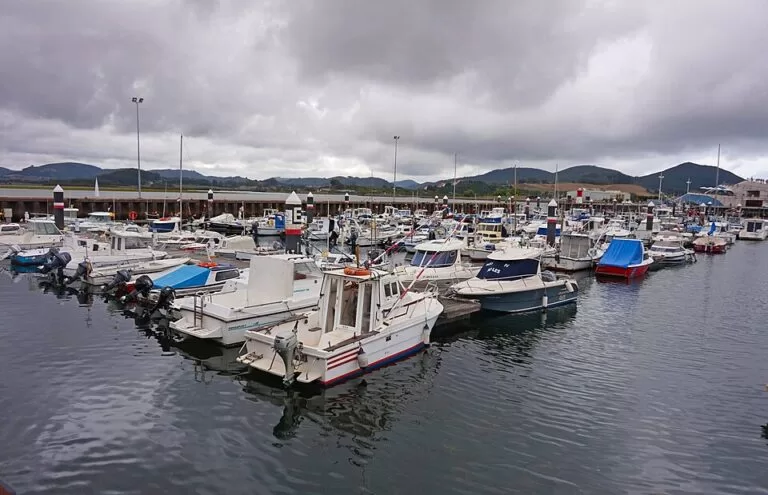
Santoña is a fishing and canning town on the east coast of Cantabria, on a low isthmus between the bay of Santoña and Monte Buciero, about 48 km east of Santander by road. It is the place to eat Cantabrian anchovies, walk the Buciero to the Faro del Caballo, see the Napoleonic forts and watch birds in the marshes, and from the promenade a small passenger boat crosses the bay to Laredo. It suits walkers, food travellers and birdwatchers; skip it if you only want a quiet beach village, as Santoña is a working port town.
Quick facts
- Names: Santoña in Spanish; in the Middle Ages the town was called Puerto or Puerto de Santoña (Wikipedia). English speakers often write Santona.
- Where: eastern Cantabria, in the historic district of Trasmiera, at the mouth of the Asón estuary, facing Laredo across the bay.
- Coordinates: 43.4418, -3.4554 (the municipal tourist office on Calle Santander, in the town centre, OpenStreetMap).
- Known for: Spain.info calls it the major canning port of the Cantabrian coast, known above all for tuna and anchovies in olive oil.
- Main sights: the church of Santa María del Puerto, the forts of San Martín, San Carlos and Mazo (Napoleón), Monte Buciero and the Faro del Caballo, the marshes and Berria beach.
- Beaches: Berria on the open sea, 2,000 m long and 150 m wide, and San Martín on the bay side.
Getting there and parking
By car: Santoña is about 48 km from Santander (Wikipedia). Leave the A-8 for the CA-141 coast road, which Spain.info lists as the nearest main road to Berria beach (Spain.info). The road into town crosses the marshes.
By boat from Laredo: OpenStreetMap shows a passenger ferry between the Embarcadero on the Santoña promenade and the jetty at El Puntal, the sandy tip of Laredo’s La Salvé beach. Its notes say boats run about every 15 minutes from 09:00 to 18:00 and carry bicycles and dogs (OpenStreetMap); we could not confirm the timetable or fares with the operator, so check on the pier.
Parking: Spain.info says it is easy to park along the length of Berria beach (Spain.info). In the centre, expect the streets near the harbour to be busy on summer weekends.
What to see
The port and the anchovies. The fishing port is the heart of the local economy, and the canning industry grew around it from the late 19th century, helped by Italian salters who settled in the town (Wikipedia).
Santa María del Puerto. The Romanesque church grew out of the medieval monastery of Santa María del Puerto. Spain.info dates it to between the 13th and 17th centuries and notes its reredos of San Bartolomé with 15th-century Flemish paintings. It has been a protected monument since 1931 (Wikipedia).
The forts. Military works around Monte Buciero show how much the port mattered. Spain.info says the forts of San Martín, San Carlos and Mazo (also called Napoleón) are still in good condition. San Martín and San Carlos were built by 1689 to guard the entrance to the bay; the French added more fortifications during the Napoleonic occupation, and the forts and batteries were declared a protected cultural site in 1992 (Wikipedia). San Martín, restored by the town, is now a cultural centre.
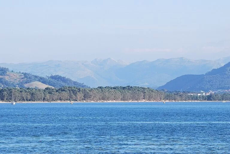
Monte Buciero and the lighthouses. The wooded headland rises to 376 m at Pico Ganzo and is crossed by marked paths. The longest, the lighthouses and cliffs route, is about 12 km including the descent to the Faro del Caballo (Wikipedia). That lighthouse, at the foot of the cliffs at the mouth of the bay, worked from 1863 to 1993; it is reached by a stairway of about 685 steps built by inmates of the nearby El Dueso prison, and a visit needs booking in July and August (Wikipedia). We could not confirm the booking system on an official page. The Faro del Pescador, on the north side, is reached by a 2 km road.
The marshes. The town sits in the Santoña, Victoria and Joyel Marshes Natural Park, 6,678 hectares across eleven municipalities and the main wetland of the Cantabrian coast. More than 120 species of water birds have been recorded, and the marshes are a key stopover for migrating spoonbills (Wikipedia). Autumn and winter are best for birds.
Berria. North of the town, past the Brusco woodland that separates it from Noja’s Trengandín, Berria is a long sandy beach between wooded hills, with moderate waves, surfing and beach volleyball, and sun loungers, toilets, showers and a children’s play area (Spain.info).
Practical details
- Tourist office: Calle Santander, in the town centre. OpenStreetMap lists opening hours, but we could not confirm them with the town (OpenStreetMap). The Manzanedo palace, which houses town hall offices, has the tourist office and exhibition rooms according to Wikipedia.
- Festivals: the sailors’ Carnival in February, a fiesta of tourist interest, ends with the mock trial and burning of a sea bream on the bay; the patron saint, the Virgen del Puerto, is celebrated in early September with a sea procession (Wikipedia).
- History: Santoña was the birthplace of Juan de la Cosa, the cartographer who sailed with Columbus (Wikipedia).
Accessibility and safety
The town centre and the promenade are flat. The Buciero paths are steep in places and the Faro del Caballo stairway is long, with no other way down by land, so it is not for people with limited mobility or in wet, slippery weather. OpenStreetMap marks both ferry piers as not wheelchair accessible. Berria has moderate waves and wind; swim where there is a lifeguard and follow the flags.
Best time to visit
June and September suit walking on the Buciero and the beach without the summer crowds. July and August are busiest, and that is when the lighthouse visit needs booking. February brings the Carnival. Autumn and winter are the season for birdwatching in the marshes; bring rain gear at any time of year.
Nearby alternatives
- Laredo, 4.9 km away across the bay: the medieval Puebla Vieja and the 4,250 m La Salvé beach.
- Noja, 6.8 km away: the beaches of Trengandín and Ris and the Victoria marsh.
- Castro Urdiales, 20.4 km away: the Gothic church and castle-lighthouse on the harbour headland.
- Isla de Santa Marina, 22.4 km away: the largest island of the Cantabrian Sea, off Loredo.
- Santander, 28.2 km away: the regional capital, its bay and El Sardinero.
Distances are in a straight line from the tourist office in Santoña.
FAQ
How do you get from Laredo to Santoña?
By road round the bay, or on foot to El Puntal at the end of La Salvé beach and across on the small passenger boat to the Santoña promenade. OpenStreetMap gives sailings about every 15 minutes from 09:00 to 18:00; confirm on the pier.
Can you visit the Faro del Caballo?
Yes, on foot from Monte Buciero down a stairway of about 685 steps. The return climb is hard. According to Wikipedia, visits need booking in July and August; we could not confirm the system on an official page.
What is Santoña famous for?
Canned anchovies in olive oil and tuna, its forts, Monte Buciero and the marshes, which are among the most important wetlands for birds in northern Spain.
Does Santoña have a beach?
Yes. Berria, on the open sea north of town, is 2,000 m long with facilities and surfing; San Martín lies on the bay side.
Sources and freshness
Checked 9 November 2026 · 8 sources Show
Checked 9 November 2026. Official: Spain.info, Santoña (canning port, church, forts) and Spain.info, Berria beach (size, facilities, access). The Cantabria tourism website (turismodecantabria.com) blocked automated access and the town hall website could not be reached while checking, so opening hours, lighthouse bookings and ferry times are not confirmed. Background: Wikipedia (Spanish) on Santoña, the forts, Monte Buciero, Faro del Caballo and the marshes. Location, piers, ferry notes and the tourist office: OpenStreetMap contributors (ODbL). Photos: Wikimedia Commons, licences as credited.
How this page is made. CostaMap is written with an AI editorial system run by Ebizapple. This page is based on the sources listed above. Last updated 9 November 2026. Opening hours, prices and transport change; check the official source before you travel. How we work · Partner links and ads