
Somo beach (Ribamontán al Mar)
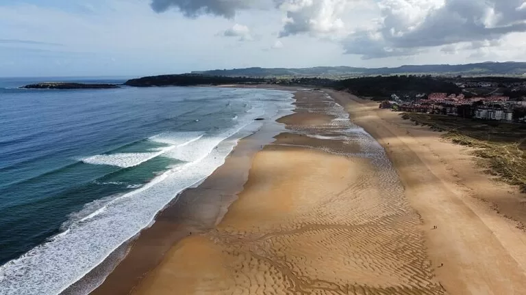
BeachSomo beach (Playa de Somo) is a 2,000 m surf beach in Ribamontán al Mar, on the east side of the Bay of Santander, facing Santander across the water about 6 km away. You get there by car on the CA-141 or, more simply, by the passenger boat from Santander, which lands at the Somo jetty a few minutes’ walk from the sand. It suits surfers and learners, families who like a long beach with a lifeguard, and anyone who wants a day out from Santander; skip it if you want calm water or a quiet cove.
Quick facts
- Names: Playa de Somo (Spanish). It is the middle of three linked beaches: El Puntal to the west, Somo, and Loredo to the east.
- Where: the village of Somo, municipality of Ribamontán al Mar, Cantabria, at the mouth of the Bay of Santander.
- Coordinates: 43.4595, -3.7314 (OpenStreetMap).
- Size: 2,000 m long and 80 m wide, golden sand, semi-urban (spain.info). El Puntal, Somo and Loredo together form over 8 km of sand, the longest in Cantabria.
- Sea: spain.info rates swimming conditions as “strong waves, windy”.
- Surf status: in 2012 Ribamontán al Mar became the first municipality in Spain declared a surf reserve, according to Europa Press as cited on Wikipedia.
- Entry: free.
Access and parking
By boat from Santander: spain.info lists the boat as one way to reach the beach. OpenStreetMap shows a ferry route Santander–Pedreña–Somo landing at the Embarcadero de Somo, about 700 m from the beach centre, and it lists both Los Reginas and Alsa as operators. We could not confirm the current operator, timetable or fares from an official page; check at the boat stop on the Santander waterfront before you go.
By car: the nearest main road is the CA-141 (spain.info). Spanish Wikipedia gives 32 km by road from Santander to Ribamontán al Mar, because the road has to go round the bay; in a straight line Somo is about 6 km from the centre of Santander.
Parking: spain.info lists a car park at the beach. OpenStreetMap maps several surface car parks in Somo within 200–450 m of the sand, some paid and some free, plus private car parks for flats. In July and August the closest ones fill early.
By bus: OpenStreetMap shows a bus stop named Somo about 450 m from the beach. We could not confirm routes or timetables.
What to expect
Somo is one long, open stretch of sand on the Cantabrian Sea. spain.info describes it as the second of the three beaches that make up the most extensive area of sand in Cantabria, with waves much appreciated by surfers and a surf school on the beach. OpenStreetMap marks a Centro de Surf about 200 m from the sand, and Spanish Wikipedia notes that the town council built a surf centre and a skatepark as part of a surf tourism plan.
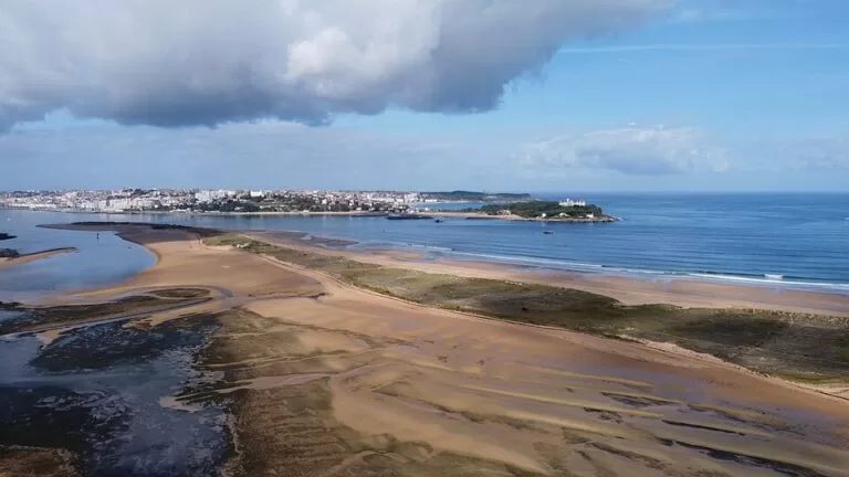
The views are the other draw. Opposite the beach is the lighthouse on the Isla de Mouro, and you look across to the Magdalena Palace and the whole of Santander (spain.info). Just offshore to the east lies the Isla de Santa Marina. spain.info also notes that the village has a number of ceramics workshops.
West of Somo the sand runs on into El Puntal, a 4,500 m spit of sand and dunes at the entrance to the bay. spain.info calls it the most unspoilt of the three beaches: there is nothing built behind it, only the Cubas river, and you reach it on foot or by boat; its only listed service is cleaning. East of Somo, Loredo adds another 1,400 m, with showers and a car park and a campsite at its right-hand end. All three share the view of Santander and the Magdalena Palace.
Practical details
- Facilities at Somo: toilets, showers, footwashes, a tourist office, bins, a cleaning service and a sports area (spain.info), and a lifeguard service. OpenStreetMap marks free wheelchair-accessible toilets about 200 m from the beach.
- Surfing: there is a surf school on the beach (spain.info). Learners should book a lesson rather than go out alone in big swell.
- Food: OpenStreetMap shows more than 20 bars, cafés and restaurants in Somo within 600 m of the beach; El Puntal has none.
- Dogs: we found no official dog rule for this beach; follow the signs at the entrances.
Accessibility and safety
The waves at Somo are strong and the beach is windy (spain.info). It has a lifeguard, so swim where the flags show, and do not swim at El Puntal, which has no services. Do not try to swim across the mouth of the bay towards the Magdalena peninsula: it is the narrow channel that ships use to enter the bay. Spanish Wikipedia lists Somo as an accessible beach and OpenStreetMap shows wheelchair-accessible toilets nearby, but we could not confirm a ramp, walkway or amphibious chair from an official page.
Best time to visit
Summer is the main beach season and the busiest time. Surfers come all year. In spring and September the beach is quieter and still pleasant for walking the 8 km of sand from El Puntal to Loredo.
Nearby alternatives
- Isla de Santa Marina, 1.5 km away: the island off Somo and Loredo.
- Isla de Mouro, 2.5 km away: the lighthouse islet at the mouth of the bay, seen from the beach.
- El Sardinero, 4.7 km away: Santander’s city beach, across the mouth of the bay.
- Santander, 5.9 km away: the city centre, the Centro Botín and the boat back.
- Liencres Dunes, 18.6 km away: the dunes and long beach of Valdearenas west of Santander.
Distances are in a straight line from Somo beach.
FAQ
How do I get from Santander to Somo?
The easiest way is the passenger boat across the bay, which OpenStreetMap shows sailing Santander–Pedreña–Somo. By car it is the CA-141 round the bay. Check the boat timetable on the day.
Is Somo good for surfing?
Yes. spain.info says its waves are much appreciated by surfers and there is a surf school on the beach; Ribamontán al Mar was declared Spain’s first surf reserve in 2012.
Is there parking at Somo beach?
Yes. spain.info lists a car park, and OpenStreetMap shows several paid and free car parks within 450 m of the sand.
Is Somo beach safe for swimming?
The waves are strong and it is windy, but there is a lifeguard service. Swim between the flags and stay out of the channel by El Puntal.
How long is the beach at Somo?
Somo itself is 2,000 m. With El Puntal and Loredo it is part of more than 8 km of continuous sand.
Sources and freshness
Checked 9 November 2026 · 7 sources Show
Checked 9 November 2026. Official: spain.info (Turespaña) beach sheets for Somo (size, sand, waves, services, access, views; Spanish version), El Puntal and Loredo. The Cantabria tourist board site blocked our requests and the Ribamontán al Mar council site could not be reached. Background: Wikipedia, Playa de Somo and Ribamontán al Mar (surf reserve, surf centre, boat line, road distance). Location, ferry route and jetty, car parks, toilets and bus stop: OpenStreetMap contributors (ODbL). Photos: Wikimedia Commons, licences as credited.
How this page is made. CostaMap is written with an AI editorial system run by Ebizapple. This page is based on the sources listed above. Last updated 9 November 2026. Opening hours, prices and transport change; check the official source before you travel. How we work · Partner links and ads