
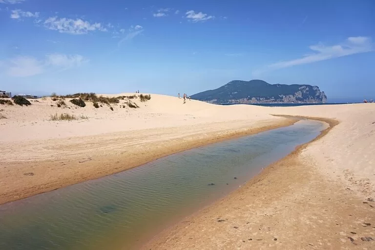
Laredo is a seaside town on the east coast of Cantabria, between the Treto estuary and the bay of Santoña, 47 km east of Santander off the A-8. It is known for La Salvé, a sand beach of more than four kilometres, and for the Puebla Vieja, the walled medieval quarter climbing the hill above the old port. Come for a long beach with every facility, an old town to walk in an hour or two and the Battle of Flowers in late August; skip it in high summer if you dislike crowds, because Laredo is one of the busiest resorts in Cantabria.
Quick facts
- Names: Laredo; locals are laredanos, also nicknamed pejinos (Wikipedia). The beach is La Salvé, the old town the Puebla Vieja.
- Where: eastern Cantabria, capital of the Costa Oriental district, facing Santoña across the bay.
- Coordinates: 43.4103, -3.4125 (the tourist office on Plaza de Cachupín, at the foot of the Puebla Vieja, OpenStreetMap).
- Population: 10,698 registered residents (INE 2025, via Wikipedia).
- Beach: La Salvé, 4,250 m long and 120 m wide (Spain.info); it continues as Regatón along the estuary.
- Old town: declared a historic-artistic site in 1970 (Spain.info).
Getting there and parking
By car: the A-8 Autovía del Cantábrico and the N-634 cross the municipality, and the town is 47 km from Santander (Wikipedia).
By bus: the bus station is on Avenida del Duque de Ahumada, at the edge of the Puebla Vieja (OpenStreetMap). We could not open the bus operators’ timetables.
By boat from Santoña: a small passenger ferry crosses the bay between the Santoña promenade and the jetty at El Puntal, the tip of La Salvé. OpenStreetMap notes sailings about every 15 minutes from 09:00 to 18:00 (OpenStreetMap); we could not confirm times or fares with the operator.
Parking: the long avenues behind La Salvé are the obvious place to look; in July and August, arrive early.
What to see
La Salvé. Spain.info’s town page calls it an immense five-kilometre sandbank (Spain.info); its beach sheet gives 4,250 m of golden sand with moderate waves, a long promenade, lifeguards and a full set of services, from sun lounger and water craft rental to a surf area. Windsurfing and surfing are popular, and nudism is common at the far end near El Puntal (Spain.info). Behind El Puntal, Regatón runs 2,900 m along the Treto estuary in calmer water, with a campsite behind it and the marina at its end (Spain.info).
The Puebla Vieja. The original medieval town keeps parts of its walls and a grid of alleys with mansions from the 16th to 18th centuries, among them the houses of the Mar family, the Marchioness of Arcentales, the Condestable, Hoz and Gutiérrez Rada (Spain.info). It was laid out on six streets, the seis rúas, after Alfonso VIII granted the town its charter in 1200, inside a wall of about 160 by 140 m; two gates survive (Wikipedia).
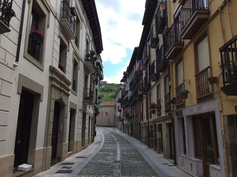
Santa María de la Asunción. At the top of the old town stands the Gothic parish church with a Flemish altarpiece (Spain.info). Begun in the 13th century, it has an unusual plan of four naves and has been a national monument since 1931 (Wikipedia).
The Atalaya tunnel. A 221 m tunnel dug under the Atalaya hill in 1863 for a harbour wall that storms destroyed before it was finished; at its far end the Mirador del Abra looks along the coast (Wikipedia). On the same hill are the remains of the Rastrillar fort, which guarded the bay together with the forts of Santoña.
The marina. Marina de Laredo opened in 2011 with 1,043 berths, close to 30 per cent of Cantabria’s leisure moorings (Wikipedia).
Practical details
- Tourist office: Plaza de Cachupín (OpenStreetMap). Spain.info links to the Laredo tourist board website, laredoturismo.es, which we could not open.
- Battle of Flowers: held on the last Friday of August, a parade of floats covered in flowers (Spain.info). It started in 1908 and was declared of national tourist interest in 1965 (Wikipedia).
- Charles V: the emperor landed at Laredo in 1556 on his way to retire at Yuste; the event is recreated on the third weekend of September (Wikipedia).
- Town layout: the Puebla Vieja, the Ensanche up to Plaza de Carlos V, which is the commercial centre, and three long parallel avenues from there to El Puntal (Spain.info).
Accessibility and safety
The promenade and the avenues behind La Salvé are flat and long. The Puebla Vieja climbs a hill on cobbled streets with steps in places. OpenStreetMap marks the ferry piers as not wheelchair accessible. La Salvé has moderate waves and can be windy; swim within the supervised areas. Regatón lies on a tidal estuary with currents, so take care there too.
Best time to visit
June and September give long beach days with fewer people. July and August are the peak, with the Battle of Flowers on the last Friday of August. Out of season the old town and the walk along La Salvé to El Puntal are pleasant on a dry day.
Nearby alternatives
- Santoña, 4.9 km away across the bay: anchovies, forts, Monte Buciero and the Faro del Caballo.
- Noja, 11.7 km away: the beaches of Trengandín and Ris.
- Castro Urdiales, 16.2 km away: the Gothic church and castle-lighthouse on the harbour.
- Isla de Santa Marina, 26.6 km away: the island off Loredo.
- Santander, 32.1 km away: the regional capital and its bay.
Distances are in a straight line from the tourist office in Laredo.
FAQ
How long is La Salvé beach?
Spain.info’s beach sheet gives 4,250 m by 120 m; its town page rounds it to five kilometres. Together with Regatón along the estuary it forms the longest stretch of sand in Cantabria.
Is there a ferry from Laredo to Santoña?
Yes, a small passenger boat from El Puntal at the end of La Salvé to the Santoña promenade. OpenStreetMap lists sailings about every 15 minutes from 09:00 to 18:00; check on the pier.
When is the Battle of Flowers in Laredo?
On the last Friday of August.
What is there to see in Laredo?
La Salvé beach, the Puebla Vieja with its walls and mansions, the Gothic church of Santa María de la Asunción, the Atalaya tunnel and the marina.
How far is Laredo from Santander and Bilbao?
Laredo is 47 km from Santander by road. Bilbao is further east along the A-8, past Castro Urdiales.
Sources and freshness
Checked 9 November 2026 · 6 sources Show
Checked 9 November 2026. Official: Spain.info on Laredo (old town, mansions, church, layout, Battle of Flowers), La Salvé and Regatón (sizes, conditions, services). The Cantabria tourism website blocked automated access and laredoturismo.es could not be reached, so opening hours, ferry times and fares are not confirmed. Background: Wikipedia (Spanish) on Laredo and the Puebla Vieja. Location, bus station, tourist office and piers: OpenStreetMap contributors (ODbL). Photos: Wikimedia Commons, licences as credited.
How this page is made. CostaMap is written with an AI editorial system run by Ebizapple. This page is based on the sources listed above. Last updated 9 November 2026. Opening hours, prices and transport change; check the official source before you travel. How we work · Partner links and ads