
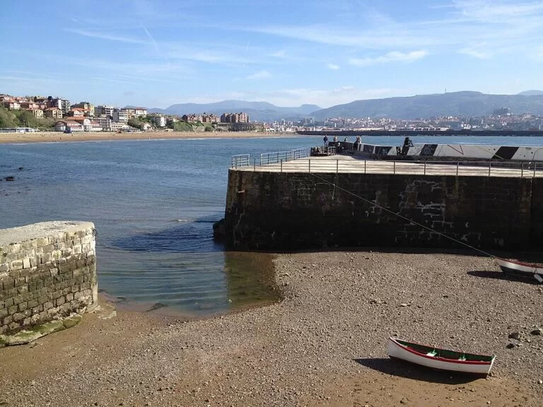
Getxo is the seaside town at the mouth of the Bilbao estuary, about 10 km in a straight line from central Bilbao, with town beaches on the bay of the Abra, the fishermen’s houses of the Old Port of Algorta and cliffs running north to Sopela. Metro Bilbao line 1 crosses the town with six stations, so it is an easy base or day trip from the city without a car. Come for the beaches, the waterfront walks, the Bizkaia Bridge and a coastal path along the cliffs; skip it if you want a quiet fishing village, as this is a busy town of more than 76,000 people.
Quick facts
- Names: Getxo is the official Basque name. Its districts often go by Spanish names too: Areeta is Las Arenas, and the Old Port (Portu Zaharra) is the Puerto Viejo.
- Where: on the right bank of the mouth of the Bilbao estuary, in the Uribe Kosta area of Bizkaia, Basque Country (Basque tourism board).
- Coordinates: 43.3432, -3.0076 (the town hall, OpenStreetMap).
- Size: 11.64 km² and 76,319 inhabitants (Basque tourism board).
- Districts: Andra Mari, Algorta, Las Arenas (Areeta), Neguri and Romo.
- Coast: about 10 km of cliffs, shore and beaches facing the bay of the Abra.
- Beaches: Las Arenas, Ereaga, Arrigunaga and, shared with Sopela, Barinatxe.
Getting there and around
By metro: line 1 of Metro Bilbao runs through Getxo, with stations at Areeta, Gobela, Neguri, Aiboa, Algorta and Bidezabal (OpenStreetMap), and continues to Sopela and Plentzia. The tourist office on Ereaga beach is nearest to Neguri and Algorta stations (Basque tourism board).
From Portugalete: cross the estuary on the gondola of the Bizkaia Bridge, or on the small passenger ferry next to it.
From the airport: Bilbao Airport is about 8 km southeast of Getxo town hall in a straight line (OpenStreetMap); we could not confirm a direct bus.
By car and parking: OpenStreetMap maps a car park at Ereaga, between the beach and the Old Port. In summer, beach parking fills quickly, and the metro is the easier choice. We found no official parking information.
The districts
Las Arenas (Areeta)
The southern district, by the Bizkaia Bridge. English Wikipedia describes an affluent residential area built in the early 20th century over the sands where the Gobela creek met the estuary. It has the small Las Arenas beach next to the Churruca quay, a long-established sailing club and the José Luis de Ugarte sailing school, with courses from age eight (Basque tourism board). The hermitage of Santa Ana, one of the oldest neo-Gothic buildings in Bizkaia, stands here, and the Zugazarte promenade runs north past the Churruca palace and the Bake-Eder mansion.
Neguri
The district between Las Arenas and Algorta, with the Getxo marina on the waterfront below it (OpenStreetMap). The Basque tourism board’s walking route continues here from Las Arenas, past the church of Nuestra Señora de las Mercedes, which has a four-keyboard organ.
Algorta and the Old Port
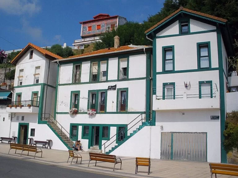
Algorta is the main shopping centre, around the Metro Plaza on Telletxe street (English Wikipedia), and its Old Port (Puerto Viejo, Portu Zaharra) is the part most visitors come to see: a cluster of narrow, typical fishermen’s houses on a slope above the water, which shows how much fishing once mattered here (Basque tourism board). Ereaga beach starts just below it.
Andra Mari and La Galea
The northern district, around the church of Andra Mari, which has 18th-century Baroque features. Beyond it the land rises to the cliffs of La Galea, with the Aixerrota windmill and the 18th-century Galea fort; the Punta Galea promenade follows the cliff edge from Getxo to Sopela (Basque tourism board).
Beaches
- Ereaga: more than 800 m of fine sand between the Old Port of Algorta and the Arriluze breakwater, well equipped in summer and known for its beach football tournaments. It is sheltered from the northwest wind, so surf breaks here only in big seas (Basque tourism board).
- Las Arenas: a small urban beach next to the bridge, used for sailing, canoeing and windsurfing. English Wikipedia notes its water can be polluted, so check the flags.
- Arrigunaga: below the cliffs of La Galea, with views of the Abra and the Aixerrota mill. The seabed is sand and rock, and points of rock appear at low tide (Basque tourism board).
- Barinatxe (La Salvaje): the wild beach on the border with Sopela, open to the swell, with a nudist area, dunes and the well-known surf wave La Triangular (Basque tourism board).
All four have lifeguards from 11:00 to 20:00 in summer, according to the Basque tourism board.
Things to do
- Cross the Bizkaia Bridge in the gondola, or ride the lift to the walkway on top, for the view down the estuary.
- Walk the Punta Galea cliffs from Arrigunaga towards Sopela, past the Aixerrota mill and the Galea fort.
- Water sports: the tourist office books sailing trips, surf lessons, canoeing, horse riding and paragliding from the cliffs, as well as dramatised guided walks (Basque tourism board).
- Festivals: Getxo hosts international folk, jazz and blues festivals and a craft fair (Basque tourism board).
Practical details
- Tourist office: Playa de Ereaga s/n, 48992 Getxo, tel. +34 944 910 800. From 1 October to 31 May, Monday to Saturday 09:30–14:30 and 15:00–18:00, Sunday 09:30–14:30; from 1 June to 30 September, daily 09:30–14:30 and 15:30–18:30; closed 24, 25 and 31 December and 1 and 6 January (Basque tourism board, checked November 2026). Dogs allowed.
- Beach services: Ereaga has toilets, showers, a beach bar, surf courses, bicycle parking and parking; Arrigunaga has toilets, showers, changing rooms and sports facilities (Basque tourism board).
Accessibility and safety
The Getxo tourist office has a counter adapted for people with reduced mobility, tactile flooring for blind and partially sighted visitors and hearing loops (Basque tourism board). The Old Port is on a steep slope with steps. Barinatxe and the open beaches get heavy swell and currents; swim only within lifeguard hours and flags. Arrigunaga has rocks under the water at low tide. Keep back from the cliff edges on the Galea walk.
Best time to visit
July and August are the beach season, with lifeguards and the summer opening hours at the tourist office, but also the busiest time. Spring and autumn are quieter. Surfers aim for the bigger autumn and winter swells, when even the sheltered beaches can produce waves.
Nearby alternatives
- Bizkaia Bridge, 2.4 km away: the UNESCO-listed transporter bridge to Portugalete.
- Bilbao, 10.2 km away: the Guggenheim and the Old Town, on the same metro line.
- Castro Urdiales, 17.4 km away: the first harbour town in Cantabria.
- Bakio, 18.9 km away: a surf beach and the txakoli museum, at the eastern end of this coast.
- San Juan de Gaztelugatxe, 21.4 km away: the hermitage on a rock island reached by a long stairway.
Distances are in a straight line from Getxo town hall.
FAQ
How do I get from Bilbao to Getxo?
Take Metro Bilbao line 1 towards Plentzia. Get off at Areeta for the Bizkaia Bridge, at Neguri or Algorta for Ereaga beach and the tourist office, or at Algorta for the Old Port.
What is the best beach in Getxo?
Ereaga is the main town beach, with more than 800 m of sand and full summer services. For surf and a wilder setting, Barinatxe (La Salvaje) on the Sopela border is the one to choose.
Is Getxo worth visiting?
Yes, for the Old Port of Algorta, the Bizkaia Bridge, the beaches and the cliff walk to Sopela. It is a residential town rather than a resort, so expect city life more than village charm.
Is there parking at Ereaga beach?
OpenStreetMap shows a car park at Ereaga, and the Basque tourism board lists parking among the beach services. It fills quickly on summer days.
Can you swim at Las Arenas beach?
There are lifeguards from 11:00 to 20:00 in summer, but the beach is inside the estuary and English Wikipedia notes the water can be polluted. Check the flags, or use Ereaga instead.
Sources and freshness
Checked 9 November 2026 · 9 sources Show
Checked 9 November 2026. Official: Basque tourism board on Getxo (districts, sights, size, festivals), the beaches of Ereaga, Las Arenas, Arrigunaga and Barinatxe, and the Getxo tourist office (address, hours, activities, accessibility). The town’s own website (getxo.eus) was not reachable. Background: English Wikipedia on Las Arenas and Algorta. Location, metro stations, car park, marina and distances: OpenStreetMap contributors (ODbL). Photos: Wikimedia Commons, licences as credited.
How this page is made. CostaMap is written with an AI editorial system run by Ebizapple. This page is based on the sources listed above. Last updated 9 November 2026. Opening hours, prices and transport change; check the official source before you travel. How we work · Partner links and ads