
Costa de Cantabria · Western Cantabria
San Vicente de la Barquera to Suances travel guide: Oyambre, Comillas and the west coast
Estuary towns, the dunes and marshes of the Oyambre park, Gaudí in Comillas and the surf beaches of Suances, on the western coast of Cantabria.
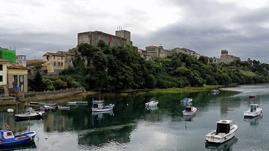
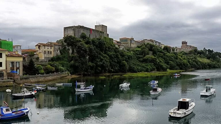
San Vicente de la Barquera · Photo: Pacodonderis, CC BY-SA 4.0
Part of the Costa de Cantabria guide · Western Cantabria
The western coast of Cantabria runs from San Vicente de la Barquera, a fishing town on two estuaries, past the beaches and marshes of the Oyambre Natural Park and Gaudí’s Comillas to Suances at the mouth of the Saja, about 30 km further east in a straight line. Santander is 50 to 60 km away by road, and the A-8 motorway and the coastal CA-131 tie the stretch together (Spain.info). This guide covers each town from west to east, the beaches, what to do, where to base yourself, how to get there and a two-day route.
At a glance
- Where the west coast of Cantabria, from the Deva estuary at Unquera on the Asturian border and San Vicente de la Barquera to Suances on the Saja estuary.
- Towns Unquera and Pechón, San Vicente de la Barquera, La Rabia and Oyambre, Comillas, Ruiloba, Cóbreces and Suances.
- Best for long sandy beaches and surf, an estuary natural park with birdlife, Modernist architecture in Comillas, a medieval fishing town and seafood.
- Getting there Santander airport is about 60 km from San Vicente; the A-8 runs the length of the stretch and FEVE trains stop at Unquera and La Acebosa.
- On CostaMap guides to San Vicente de la Barquera, Playa de Oyambre, Comillas and Suances.
Map of western Cantabria
The map shows the places between San Vicente de la Barquera and Suances that have a CostaMap page. Tick a place type to filter, and click a marker to see the place in the panel.
Place type
Area · next level
 Area map
San Vicente to Suances
Click a marker to see the place here. From San Vicente de la Barquera and the Oyambre park to Comillas and the beaches of Suances.
Towns and villagesTowns and villages
From west to east. The coast is divided between seven municipalities: Val de San Vicente, San Vicente de la Barquera, Valdáliga, Comillas, Ruiloba, Alfoz de Lloredo and Suances.
Unquera and Pechón (Val de San Vicente)
Val de San Vicente is the westernmost municipality on the Cantabrian coast, where the Deva and Nansa rivers reach the sea in the estuaries of Tina Mayor and Tina Menor; the Deva is the border with Asturias (Wikipedia). Unquera, on Tina Mayor, is the road gateway to the Hermida gorge and the Liébana valley along the N-621, and it is known for corbatas, a puff-pastry sweet (Wikipedia). Pechón sits on the headland between the two estuaries, 70 m above the sea. Spain.info lists two small beaches here, Las Arenas (200 m, hard to reach on foot) and El Sable (340 m, backed by pines).
San Vicente de la Barquera
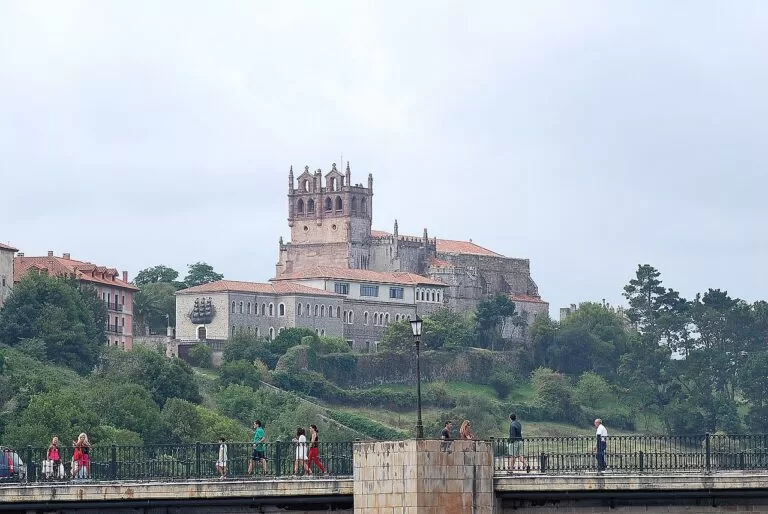
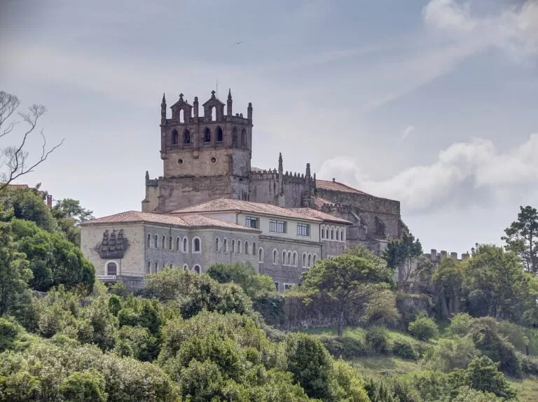
An old fishermen’s refuge that spain.info calls one of the most picturesque sights on the Cantabrian coast, with the Picos de Europa behind. The old town, declared of Cultural Interest in 1987, holds the Gothic church of Santa María de los Ángeles, built between the 13th and 16th centuries, the castle and remains of the wall; the Maza bridge, with 28 arches, dates from the 16th century (Spain.info). The town received its charter in 1210, the last of the four medieval “Villas de la Costa”. Its beaches run from El Rosal, across the bridge, to the 2,500 m Merón. Read our San Vicente de la Barquera guide.
Oyambre and La Rabia (Valdáliga and Comillas)
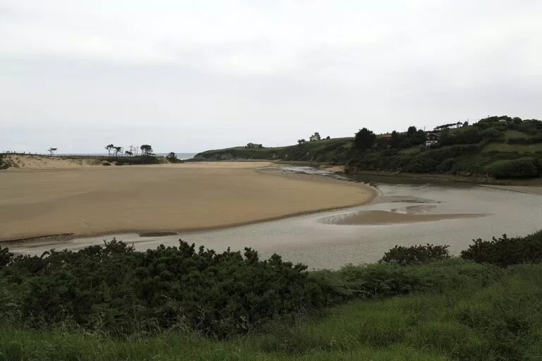
East of Merón the coast becomes the heart of the Oyambre Natural Park, protected since 1988. Its 5,738 hectares take in the estuaries of San Vicente and La Rabia, cliffs of 10 to 50 metres, open beaches, marshes and dunes, and parts of Comillas, San Vicente, Udías, Valdáliga and Val de San Vicente (Spain.info). Playa de Oyambre, 1,800 m of sand in Valdáliga, has restaurants and a golf course alongside, and a bird observatory near the hamlet of La Rabia, on the estuary that marks the Comillas boundary (Spain.info). See our Playa de Oyambre guide.
Comillas
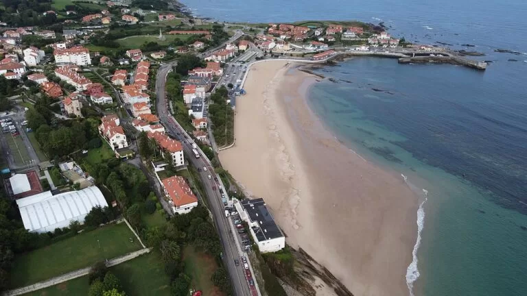
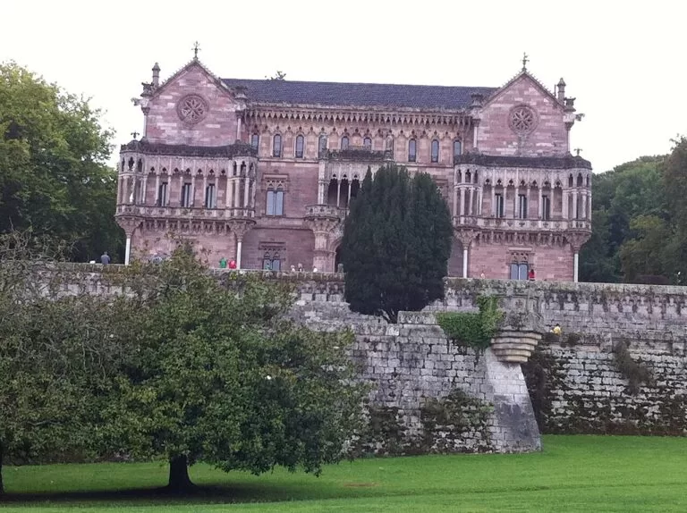
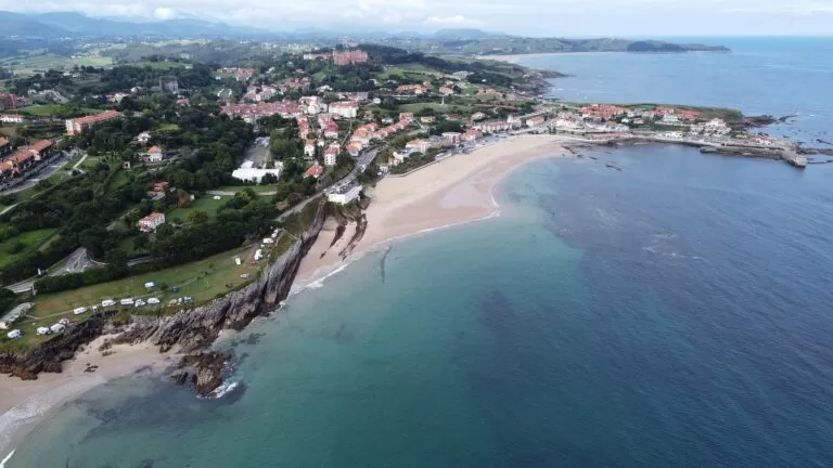
Comillas, 50 km from Santander, is a designated historic-artistic site of cobbled streets and squares with ancestral houses, towers and Modernist buildings. Spain.info picks out El Capricho by Antoni Gaudí, the Neo-Gothic Sobrellano Palace and the Pontifical University, which dominates the village (Spain.info). The town beach is 900 m of sand with the fishing port at one end, a large car park with reserved disabled spaces and ramps to the sand (Spain.info). The tourist office is under the town hall at Calle Joaquín del Piélago 1. Read our Comillas guide.
Ruiloba
A small rural municipality of around seven hundred people between Comillas and Alfoz de Lloredo, named after the “river of the she-wolf”. Its coast has three points, Miradorio, La Corneja and Ruiloba, and the cove of Fonfría. The Nuestra Señora de los Remedios chapel at Liandres, built in 1883–1888, stands on a rise facing the coast (Wikipedia). The stream of La Conchuga marks the border with Cóbreces at Luaña beach.
Cóbreces and Novales (Alfoz de Lloredo)
Cóbreces is a village of under six hundred people on the coastal Camino de Santiago, with Luaña, the only beach of Alfoz de Lloredo (Wikipedia). Spain.info describes Luaña as 400 m of sand between Luaña and Cóbreces, with a bar-restaurant, a campsite right next to the beach, space to park and a surf practice area; the Monastery of Viaceli, 1 km away, was built in 1889 and is home to some 30 monks (Spain.info). Novales, the municipal capital 3 km inland, sits in a sheltered valley with a mild microclimate and is known for its lemons, with an estimated 17,000 lemon trees (Wikipedia). Santillana del Mar lies just east of here; it is covered in our Santillana to Somo guide and our Santillana del Mar guide.
Suances
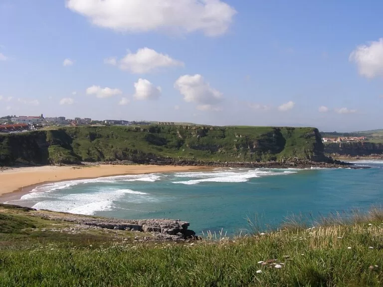
Suances is a beach town at the confluence of the Saja and Besaya, which spain.info calls the former Portus Blendium of the Romans. It grew around a series of beaches grouped at Punta del Dichoso, a natural harbour backed by cliffs: Tagle for sunsets, La Tablía, the kilometre-long La Concha, La Ribera and La Riberuca, and Los Locos, which spain.info calls ideal for surfing (Spain.info). The sea wall of 1878 let the town grow down to the shore, and the 17th-century Torco batteries still stand on the headland (Wikipedia). Read our Suances guide.
Beaches and coves
From west to east. Lengths and services are as Spain.info lists them on its beach pages; lifeguard dates for 2026 could not be confirmed.
Oyambre
1,800 m of golden sand in a bay at the mouth of the La Rabia estuary, inside the natural park. Toilets, showers and a tourist office; moderate waves, windy (Spain.info). Our guide.
Comillas
900 m of sand below the town, with the fishing port at one end, a large car park with disabled spaces, ramps to the sand, and bars and restaurants. High occupancy in summer (Spain.info).
Los Locos
350 m of sand and pebbles under cliffs beyond Punta del Dichoso, with a surf practice area and a promenade with open-air bars. Strong waves and windy (Spain.info).
- El Rosal (San Vicente) – 180 m on the bay, the closest beach to town, with an adapted toilet and a ramp (Spain.info).
- Merón (San Vicente) – 2,500 m of white sand with full services; strong waves and windy (Spain.info).
- La Fuente (San Vicente) – a 150 m cove of pebbles and sand near Santillán, low occupancy (Spain.info).
- Luaña (Cóbreces) – 400 m with a campsite beside it and a surf practice area (Spain.info).
- La Concha (Suances) – the 1,000 m town beach, shell-shaped, with dunes at one end (Spain.info).
- La Ribera and La Riberuca (Suances) – 120 m and 300 m of calm water inside the estuary, by the fishing port (Spain.info).
- Cuchía (Miengo) – 300 m across the Saja from Suances, with wheelchair ramps and reserved parking (Spain.info).
Things to do
Nature: the Oyambre park and the caves
Spain.info counts six landscapes in the Oyambre park: cliffs, open beaches, inland estuary beaches, the estuaries themselves, the marshes, which are the richest for wildlife, and the dunes. Peregrine falcons nest on the cliffs and migratory birds stop in the marshes. The interpretation centre for Oyambre and Saja-Nansa is in the Punta de la Silla lighthouse at San Vicente, tel. +34 942 712 019 (Spain.info). Inland, reached from this coast, El Soplao in Rionansa and Valdáliga has some 20 km of natural passages; a recreated mine train takes visitors inside for a guided visit of about an hour, and an adventure tour of two and a half hours is open to people over 12 (Spain.info). The El Chufín cave in the Nansa valley, World Heritage since 2008, has paintings dated between 16,000 and 11,500 BC and is visited by booking, tel. +34 942 598 425 (Spain.info).
History: a Gothic fishing town and Gaudí’s Comillas
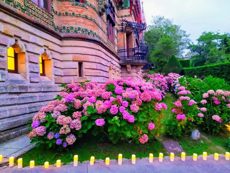
In San Vicente de la Barquera, the church of Santa María de los Ángeles is in the Gothic style of the region, with three naves under high pointed vaults, a tower and two Romanesque doors; inside is the tomb of the Inquisitor Antonio del Corro (Spain.info). In Comillas, El Capricho, in the Sobrellano park, is an early Gaudí building that mixes Arabesque tiles and brickwork with neo-Gothic elements; its cylindrical tower is clad in sunflower ceramics and its windows show animals playing instruments. Contact: tel. +34 942 720 365, elcaprichodegaudi.com (Spain.info). We could not confirm 2026 opening hours or prices.
Food and festivals
San Vicente’s dish is sorropotún, a stew of tuna and potatoes (Spain.info), handed out on the beach during the La Barquera festivities on 8–9 September. La Folía, usually on the second Sunday after Easter, is a Festival of National Tourist Interest (Wikipedia). Unquera makes corbatas, puff-pastry sweets, and Novales is known for its lemons. Cóbreces dances the picayos at its summer festivals in late July and August (Wikipedia).
Where to stay by town
The towns we would base a trip in, west to east.
San Vicente de la Barquera
The largest town at the western end, with a bus station, a tourist office, the old town and Merón beach a short drive away. Good for the Oyambre park.
Harbour town and beaches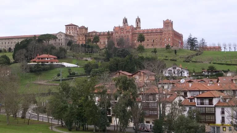
Comillas
The middle of the stretch, with a town beach, El Capricho and the old centre on foot, and Oyambre beach about 4 km and Luaña about 6 km away in a straight line.
Architecture and a town beach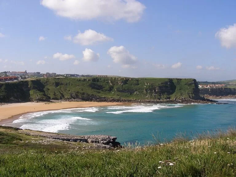
Suances
The eastern end, with six beaches within walking distance, buses to Torrelavega and Santander, and Santillana del Mar about 6 km away.
Surf and family beachesSpain.info notes a campsite next to Luaña beach at Cóbreces and one near La Concha in Suances. The nearest campsite with a CostaMap page is Camping Santillana del Mar, just east of the stretch.
Getting there and around
By air
Santander airport is the nearest, about 60 km from San Vicente de la Barquera; Bilbao and Asturias airports are both about 160 km away (Wikipedia).
By car
The A-8 and the N-634 cross San Vicente de la Barquera and Valdáliga, and the CA-131 follows the coast from San Vicente through Comillas towards Barreda. The CA-132 reaches Suances from Viveda, and the N-621 leaves the coast at Unquera for Liébana. A car is the practical way to reach Oyambre, Luaña and El Soplao.
By train and bus
The FEVE Santander–Oviedo line stops at La Acebosa, in the municipality of San Vicente, and at Unquera. San Vicente has a bus station served by ALSA, La Cantábrica and Palomera, and ALSA’s Avilés–Irún line stops at Unquera; Suances has buses from Torrelavega (Casanova) and Santander (La Cantábrica) (Wikipedia). Check times with the operators.
A two-day route
By car, west to east. Day 1 stays within about 10 km of San Vicente; day 2 covers about 21 km in a straight line from Comillas to Suances.
Day 1
San Vicente de la Barquera and the Oyambre park
Start in San Vicente: walk up through the old town to the church of Santa María and the castle, then back down across the Maza bridge to El Rosal. Drive out to the Punta de la Silla lighthouse for the park’s interpretation centre, then spend the afternoon on Merón or Oyambre, ending at the bird observatory by La Rabia. Eat sorropotún or fish back in town.
Day 2
Comillas, Cóbreces and Suances
Spend the morning in Comillas: El Capricho and the Sobrellano Palace, the cobbled centre and the view of the Pontifical University, then the port end of the beach. Follow the coast east through Ruiloba to Luaña beach at Cóbreces. Finish in Suances with a walk round Punta del Dichoso from La Concha to Los Locos at sunset.
FAQ
What is the best town to stay in on the western Cantabria coast?
Comillas is the most central, with a town beach and El Capricho. San Vicente de la Barquera is better placed for the Oyambre park and Liébana, and Suances for surf and family beaches.
What are the best beaches between San Vicente de la Barquera and Suances?
Merón and Oyambre for long sandy beaches in the natural park, Comillas for a town beach, Luaña for a quieter beach with a campsite, and Los Locos in Suances for surfing.
Is the Oyambre Natural Park worth visiting?
Yes, if you like beaches with dunes and birdlife. It covers 5,738 hectares of cliffs, estuaries, marshes and dunes, with a bird observatory near La Rabia and an interpretation centre in the Punta de la Silla lighthouse.
Can you surf on the west coast of Cantabria?
Yes. Spain.info lists surf practice areas at Los Locos in Suances and Luaña in Cóbreces, and rates Merón as strong waves and windy.
How far is Comillas from San Vicente de la Barquera?
About 9 km in a straight line, linked by the coastal CA-131 road past Oyambre.
Can you get to San Vicente de la Barquera without a car?
Yes. ALSA, La Cantábrica and Palomera buses use the town bus station, and FEVE trains stop at La Acebosa, outside the town.
Other areas of the Costa de Cantabria
Costa de Cantabria
The whole coast of Cantabria, from the Asturian border to Castro Urdiales, with the caves of Altamira and Puente Viesgo.
Costa de Cantabria guide →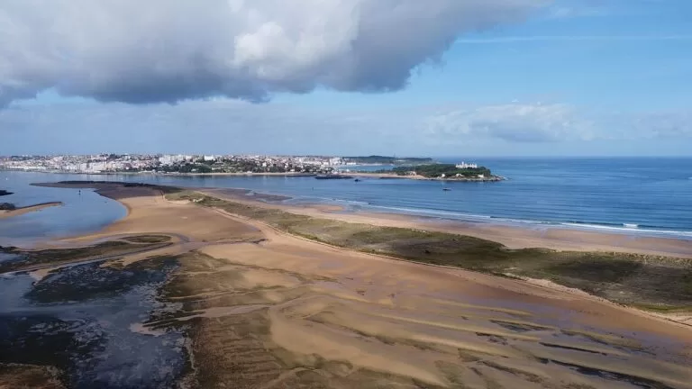
Centre: Santillana to Somo
Medieval Santillana del Mar and the Altamira Museum, the dunes of Liencres, Santander and the surf of Somo.
Santillana to Somo guide →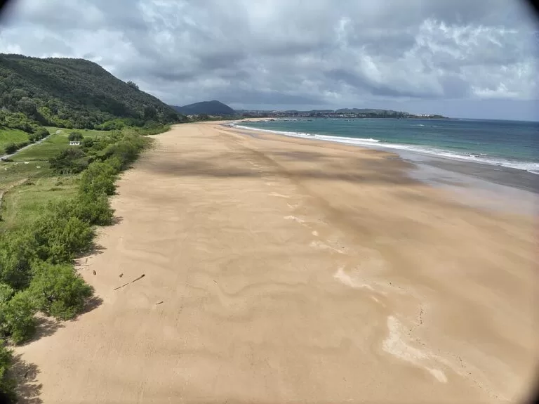
East: Noja to Castro Urdiales
The long beaches of Noja and Laredo, the anchovy port of Santoña and the harbour of Castro Urdiales.
Noja to Castro Urdiales guide →Across the Deva in Asturias, Llanes is about 29 km west of San Vicente de la Barquera.
Sources and freshness
Checked 9 November 2026. Spain.info on San Vicente de la Barquera, Comillas, Suances, the Oyambre Natural Park, El Capricho, the church of Santa María, the caves of El Soplao and El Chufín, the Comillas tourist office and the beaches of Las Arenas and El Sable (Val de San Vicente) and those linked above. Background from Wikipedia on San Vicente de la Barquera, Val de San Vicente, Unquera, Pechón, Valdáliga, Ruiloba, Alfoz de Lloredo, Cóbreces and Suances. Map data and straight-line distances: OpenStreetMap. The Cantabria tourist board and the town websites could not be reached from our research tools. Not confirmed: bus and train times, opening hours and prices of El Capricho and the caves, and 2026 lifeguard dates.
Photos from Wikimedia Commons: San Vicente castle by Pacodonderis (CC BY-SA 4.0); Oyambre by Falk2 (CC BY-SA 4.0); Comillas beach and aerial view by Luis Fermín TURIEL PEREDO (CC BY-SA 4.0); Los Locos by Daniel Escudero (CC BY-SA 3.0); El Capricho by Emilio Gómez Fernández (CC BY-SA 4.0); Pontifical University by José Luis Filpo Cabana (CC BY 3.0); Sobrellano Palace by Manuel1964 (CC BY-SA 3.0 es); San Vicente town by Ignacio Pérez Anguio (CC BY-SA 3.0); Santa María church by Sergio Segarra (CC BY-SA 2.0); El Puntal and Helgueras by Luis Fermín TURIEL PEREDO (CC BY-SA 4.0).