
Barranc de l’Infern (Vall de Laguar)
Hiking trailThe Barranc de l’Infern (Hell’s Gorge) is a limestone gorge in the Vall de Laguar, inland from Dénia on the Costa Blanca, and the PR-CV 147 trail that crosses it is known as the “Cathedral of Hiking”. The circular route starts in Fleix, drops into the gorge on old stone steps, climbs out to Benimaurell and returns to Fleix: 14.4 km and about 6 h 45 min, according to Dénia’s tourist office. It suits fit, experienced walkers with a full day; skip it with small children, in heat or if rain is forecast.
Quick facts
- Names: Barranc de l’Infern in Valencian, Barranco del Infierno in Spanish. The trail is the PR-CV 147, signposted “La catedral del senderismo”, and also called Les Escales dels Moros (the Moors’ Steps).
- Where: between the Vall de Laguar and the Vall d’Ebo, Marina Alta (Alicante). The trail starts in Fleix, one of the villages of the Vall de Laguar.
- Coordinates (gorge): 38.7831, -0.1280, on the river bed about 1.1 km north of Benimaurell.
- Length and time: 14.4 km circular, about 6 h 45 min (Dénia tourist office leaflet, 2025). The regional tourism site gives “more than 14 km” and “about 15 km”.
- Steps: 6,873 by the Dénia leaflet’s count; other official pages round it to 6,000 or 6,600.
- Difficulty: high for the Dénia leaflet and one Comunitat Valenciana page; another calls it moderate but long.
- Fees: none of the official pages we checked mentions a fee or booking for walking the PR-CV 147.
Access and parking
By car: the Vall de Laguar lies in the hills of the Marina Alta. Its villages are Campell, Fleix, where the town hall is, and Benimaurell, at the top of the valley. Dénia’s leaflet says to take the road from Fleix towards Benimaurell to the Fleix school, where the PR-CV 147 begins, and to park near the school and start walking from there.
Without a car: we found no official bus information for the Vall de Laguar, so plan on a car or taxi.
What to expect
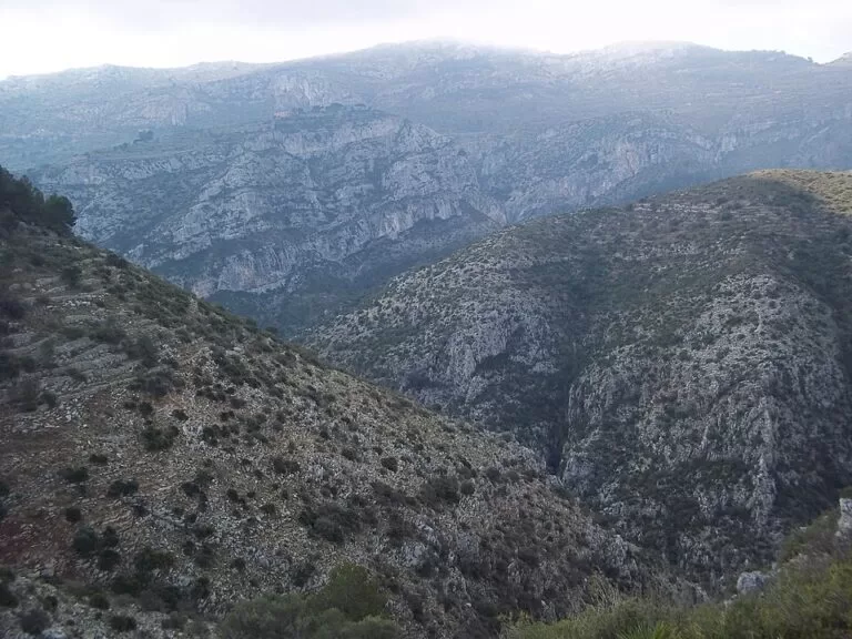
The gorge was carved by the Girona river, which separates the Serra de la Carrasca (or d’Ebo), about 1,000 m high, from the Serra del Migdia, and runs on to the Isbert reservoir (Wikipedia, Spanish). On the other side of the valley rises the Serra del Cavall Verd.
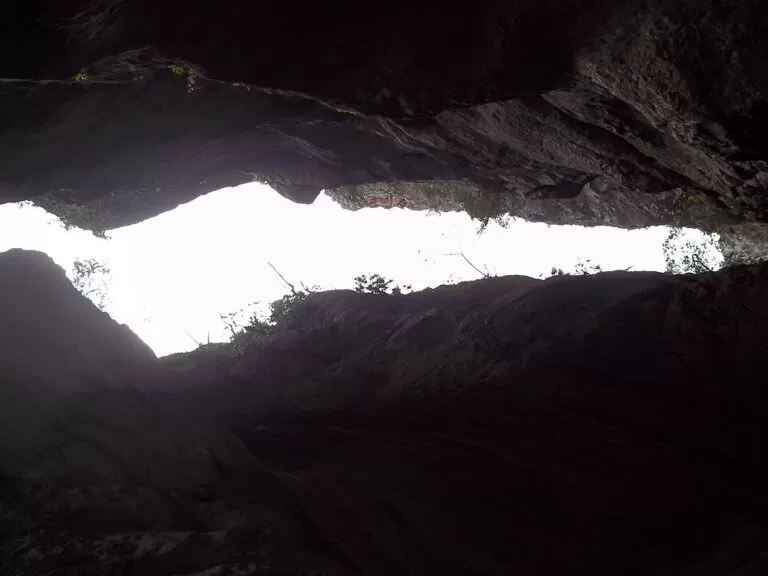
The route is mostly steps. Old stone stairways zig-zag down into the gorge, across the river bed and up the far side. The regional tourism board describes the profile: from Fleix and Benimaurell at about 400 m you drop to about 200 m, then climb to about 550 m, where a large hole through a rock gives a view of the gorge (Comunitat Valenciana). Along the way you pass old wash-houses and springs, among them the Font Grossa in Fleix, the Font del Reinós and the Font dels Olbis, and the farm terraces of Les Juvees, which Dénia’s leaflet calls a welcome rest area. The loop ends in Benimaurell, with viewpoints towards the sea, and a fairly easy walk back to Fleix (Comunitat Valenciana).
The gorge also holds rock shelters with Levantine, schematic and macro-schematic rock art, and is the best-known canyoning gorge in the Valencia region; the first full descent, on 19 May 1968, took a team from the Centre Excursionista d’Alcoi 12 hours (Wikipedia, Catalan). Canyoning is a separate, technical activity; the PR-CV 147 is a footpath.
History in brief
The Vall de Laguar was the last stronghold of the Valencian Moriscos’ revolt. They surrendered in November 1609 and were expelled to North Africa; at that point the valley had 180 Morisco houses, and it was resettled in 1611 (Wikipedia, Spanish). The three villages each have an 18th-century church, which you pass if you walk through Fleix and Benimaurell.
Practical details
- Start: Fleix school, on the road from Fleix to Benimaurell (Dénia leaflet). The route is waymarked as PR-CV 147 (shown as PR V-147 in the leaflet).
- Bring: proper walking shoes, plenty of water, food and sun protection, as the regional tourism board advises. Fill your bottle at the Font Grossa before you set off.
- Start early: the official advice is to begin first thing, because the route takes most of a day.
- Longer option: the PR-CV 147 links with the PR-CV 181, a 25 km route of about 11 hours (Dénia leaflet).
Accessibility and safety
Dénia’s tourist office classes the Barranc de l’Infern as a high-difficulty route for very experienced hikers, to be walked only in fine weather, and says hiking there is prohibited on rainy days. Thousands of steps make it hard on knees, and there is no step-free access. There are no services in the gorge, so turn back if you are short of time or water. In December 2004 four walkers had to be rescued after being trapped in the gorge (Wikipedia, Catalan).
Best time to visit
Choose a dry, mild day in spring or autumn and start early. In spring the valley’s cherry trees flower; the Vall de Laguar is part of the Muntanya d’Alacant cherry designation. Avoid hot summer days and any day with rain forecast.
Nearby alternatives
- Sierra de Bernia, 14 km: ridge walk with a fort and a rock tunnel.
- Algar Waterfalls, 14 km: river pools and falls near Callosa d’en Sarrià.
- El Castell de Guadalest, 13 km: castle village above a reservoir.
- Puig Campana, 20 km: the big summit walk behind Benidorm.
- Benissa, 17 km: old town between the hills and the coast.
Distances are in a straight line from the gorge.
FAQ
How long is the Barranc de l’Infern walk?
The circular PR-CV 147 from Fleix is 14.4 km and takes about 6 h 45 min, according to Dénia’s tourist office. Allow a full day with breaks.
Where does the Barranc de l’Infern route start?
At the school in Fleix, on the road towards Benimaurell, in the Vall de Laguar. Park near the school.
How many steps are there?
Dénia’s leaflet counts 6,873; the regional tourism site says about 6,000 or 6,600, depending on the page.
Is the Barranc de l’Infern hard?
Yes. Dénia’s tourist office rates it high difficulty, for very experienced hikers in fine weather only.
Can you walk it when it rains?
No. Dénia’s tourist office says hiking in the gorge is prohibited on rainy days.
Sources and freshness
Checked 6 November 2026 · 6 sources Show
Checked 6 November 2026. Official: Dénia tourist office, routes through the Marina leaflet (2025) (start, parking, length, time, steps, difficulty, rain ban, PR-CV 181); Comunitat Valenciana tourism, Barranc de l’Infern route and Vall de Laguar, cathedral of hiking (route, profile, steps, advice). Background: Barranc de l’Infern, Catalan Wikipedia (rock art, canyoning, 1968 descent, 2004 rescue) and Vall de Laguart, Spanish Wikipedia (villages, sierras, 1609, cherries). Location and trail: OpenStreetMap, PR-CV 147 (ODbL). Photos: Wikimedia Commons, licences as credited.
This place is part of our Costa Blanca, Spain: towns, beaches and where to stay — see every town, beach and cove we have mapped on that coast.
How this page is made. CostaMap is written with an AI editorial system run by Ebizapple. This page is based on the sources listed above. Last updated 6 November 2026. Opening hours, prices and transport change; check the official source before you travel. How we work · Partner links and ads