
Cabo Cope and Puntas de Calnegre Regional Park (Águilas and Lorca)
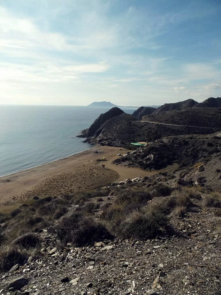
Natural parkCabo Cope and Puntas de Calnegre Regional Park is the protected stretch of wild coast between Águilas and Mazarrón in the Region of Murcia: about 1,093 hectares of coastal hills, cliffs, fossil dunes and coves shared by the municipalities of Águilas and Lorca. You reach the eastern beaches from the N-332 and the RM-D21 to the hamlet of Puntas de Calnegre, and the western end from Águilas by the road to Calabardina and Cabo Cope; most coves beyond that are reached on dirt tracks. It suits walkers, snorkellers and people who want a quiet beach without high-rises; skip it if you need shade, shops and lifeguards at every cove.
Quick facts
- Names: Parque Regional de Calnegre y Cabo Cope (Spanish); the regional tourist board also uses “Cabo Cope and Puntas de Calnegre Natural Park” in English.
- Where: the coast between Calabardina (Águilas) in the south-west and Puntas de Calnegre (Lorca) in the north-east, Region of Murcia.
- Coordinates: 37.5110, -1.4580 (the park map board on the RM-D20 at El Cantar, OpenStreetMap).
- Type and size: regional park, 1,093 hectares (Murcia regional tourism).
- Landscape: limestone at Cabo Cope, tillites at Calnegre, fossil dunes, beaches and cliffs.
- Landmark: the 16th-century Cope watchtower (Torre de Cope).
- Entry: free; we found no booking or access fee on the official pages.
- Information points: 968 228 937 and 968 228 925 (environmental information, Region of Murcia).
Access and parking
Eastern side (Calnegre): the Lorca tourism information on the regional site says to take the RM-11 from Lorca towards Águilas, then the RM-332 towards Ramonete and, at km 15, the RM-D21. From there a track leads to the eastern beaches and coves (Murcia regional tourism). Puntas de Calnegre beach lies on the Puntas de Calnegre road off the N-332, with roadside parking. Cala de Calnegre is about 1 km from the RM-D21: an unsurfaced track goes to the coast and a natural path to the sand, and there is a reserved parking area with two spaces for disabled drivers (Murcia regional tourism).
Western side (Cabo Cope): continue to Águilas and take the turning for Calabardina and Cabo Cope; a dirt track starts there and leads to the western beaches and coves. The Cope tower stands at km 9 of the Cope–Calabardina road (Murcia regional tourism).
Without a car: we found no bus to the park beaches on the official pages. Águilas has a train and a bus station; from there you need a car, a bike or a long walk.
What to expect
The regional tourist board describes the park as a piece of the coastal ranges where many rocks and structures meet: limestone at Cabo Cope, tillites at Calnegre, fossil dunes, beaches and cliffs. Plants include sabina juniper, cornical, arto, salicornia, lavender and wild asparagus. Among the animals are the spur-thighed (black-headed) tortoise, the Iberian skink, Bonelli’s eagle, the eagle owl, the peregrine falcon and the trumpeter finch. Small plots of dry farming, with fig and carob trees, survive inside the park (Murcia regional tourism).
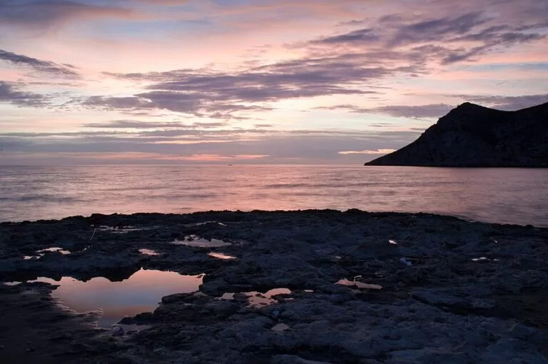
Lorca’s share of the coast is presented as underpopulated and wild, with virgin coves, a few beach bars and quiet beaches such as Playa Larga, Los Hierros and Baño de las Mujeres (Murcia regional tourism, Lorca). The Águilas page suggests coming at sunrise, visiting the watchtower and swimming from the lonely beaches (Murcia regional tourism, Águilas). Spain.info counts the rocky seabed around Cape Cope among the best scuba diving areas on the Mediterranean coast (spain.info).
The Cope tower: Charles V ordered a tower at Cope in 1539; it was handed over in 1576, destroyed by the Turks in 1578 and rebuilt the next year. It was repaired in 1702, changed again in 1756 and remodelled for the last time in 1801. With the end of piracy it was abandoned in the 19th century; it has now been rebuilt in its 18th-century form (Murcia regional tourism).
Beaches and coves
Figures from the regional beach pages, checked November 2026:
- Puntas de Calnegre: 1,100 m long, 30 m wide, medium sand and gravel; a semi-urban beach by the fishing hamlet, with beach bars, restaurants, toilets, a play area and a tourist information point (source).
- Cala de Calnegre: 190 m by 38 m, fine golden sand, calm water, beach bar, first aid and wooden walkways (source). The Lorca tourism text says Playa Calnegre holds the Blue Flag.
- Baño de las Mujeres: 40 m of sand and gravel, reached by a path (source).
- Playa Larga: 600 m, narrow, fine sand and gravel, about 3.5 km from the RM-D20 on a dirt track (source).
- Los Hierros and Cala Blanca: small, hard-to-reach coves on the western side, reached on the track from the Cabo Cope road; Los Hierros is 380 m long with a picnic area, Cala Blanca 75 m of coarse sand and boulders (source).
Just outside the park to the south-west, Calabardina is a 450 m beach of fine grey sand on the site of an old tuna fishery, sheltered by Cabo Cope; its old pier is used by small boats and diving clubs (source).
Practical details
- Apart from Puntas de Calnegre and Cala de Calnegre, the regional site advises bringing food and water in a backpack to the other coves.
- Stay on marked tracks and park only in the parking areas: this is a protected regional park.
- The park has a walking-trail leaflet (“Senderos Parque Regional Calnegre y Cabo Cope”) linked from the regional beach pages; we could not open it, so routes and lengths are not given here.
Accessibility and safety
Cala de Calnegre has two reserved parking spaces and walkways, but the regional assessment rates it as not practicable for wheelchair users, partly equipped. Most other coves are reached on dirt tracks and paths. There is little shade, the hills are steep and rocky, and lifeguards could not be confirmed outside the main beaches. In an emergency call 112.
Best time to visit
Spring and autumn for walking, when the heat is lower; early morning in summer, both for the light the tourist board recommends and to find a parking space. Swimming is calm on the sheltered coves in settled weather.
Nearby alternatives
- Gredas de Bolnuevo – wind-carved sandstone above Bolnuevo beach, 9.7 km north-east of Puntas de Calnegre.
- Puerto de Mazarrón – the nearest resort town, with town beaches and a fishing port, 13.8 km from Puntas de Calnegre.
- Phoenician Shipwrecks of Mazarrón – the wreck site off Playa de la Isla and its interpretation centre.
- Isla del Fraile – a diving island off Águilas, 6.4 km from the Cope tower.
- Castillo de San Juan de las Águilas – the 18th-century fortress above the port of Águilas, 9.3 km from the Cope tower.
- Cuatro Calas walk – four protected coves south-west of Águilas, 13.6 km from the Cope tower.
Distances are straight-line from OpenStreetMap coordinates. For the whole coast from Mazarrón to Águilas, see our Mazarrón and Águilas guide.
FAQ
How do I get to Calnegre beach?
From Lorca or the motorway take the RM-332 towards Ramonete and, at km 15, the RM-D21 to Puntas de Calnegre. Cala de Calnegre is about 1 km from the RM-D21 on an unsurfaced track, with a parking area.
Is there parking at Cabo Cope?
The coves are reached on a dirt track from the Calabardina–Cabo Cope road, and the official beach pages list parking in reserved areas. Arrive early in summer.
Can you swim at Calnegre and Cabo Cope?
Yes. The regional beach pages describe calm or peaceful water on most beaches, with services only at Puntas de Calnegre and Cala de Calnegre.
Is the Cope tower open to visitors?
The tower has been rebuilt in its 18th-century form, but the official page gives no opening hours, so check with the Águilas tourist office before planning to go inside.
Sources and freshness
Checked 9 November 2026 · 4 sources Show
- Checked 9 November 2026. Murcia regional tourism on the regional park, the Cope tower, Lorca, Águilas and the beach pages linked above
- spain.info: Águilas
- Águilas tourism: nature
- locations and distances from OpenStreetMap (ODbL). Photos from Wikimedia Commons
This place is part of our Costa Cálida — the honest guide to Spain's warm coast — see every town, beach and cove we have mapped on that coast.
How this page is made. CostaMap is written with an AI editorial system run by Ebizapple. This page is based on the sources listed above. Last updated 9 November 2026. Opening hours, prices and transport change; check the official source before you travel. How we work · Partner links and ads