
Gredas de Bolnuevo
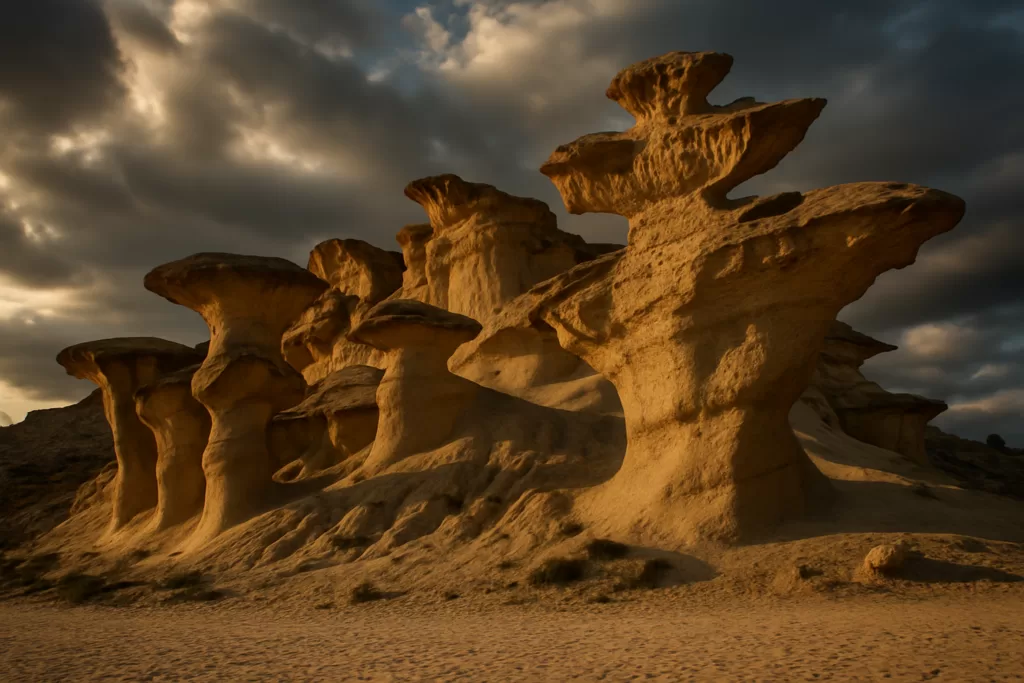
ViewpointThe Gredas de Bolnuevo, also called the Ciudad Encantada (Enchanted City) or the erosiones de Bolnuevo, are eroded sandstone forms up to 10 m tall beside Bolnuevo beach in Mazarrón. They have been a Natural Monument since 29 March 2019, and OpenStreetMap shows a free car park about 200 m away. Skip it if you hoped to walk among the rock mushrooms: since 2020 a 1 m wooden fence keeps visitors back from the formations.

Quick facts
- What they are: the most representative example of differential erosion in the Region of Murcia, with forms up to 10 m high.
- Protection: a Natural Monument since 29 March 2019, the region’s second after Monte Arabí in Yecla, and a Site of Geological Interest.
- Age: the sedimentary rocks are just under 5 million years old.
- Fence: 1 m high, of wooden sleepers, finished in August 2020 at a cost of €47,500.
- Airport: Región de Murcia International at Corvera, about 31 km away in a straight line.
Access and parking
By car: Spain’s official tourism portal puts Bolnuevo about an hour by car from the city of Murcia, and lists parking, a bus stop and a children’s play area at the beach (spain.info).
Parking: OpenStreetMap marks a free surface car park about 190 m from the formations, with more parking spaces next to it.
Without a car: the nearest stop on OpenStreetMap is Bolnuevo, by the hermitage, about 740 m east. We found no published timetable for it, so check routes locally before you travel.
On foot: spain.info suggests walking to the gredas from Bolnuevo, and paths continue to the coves of Bolnuevo, spread along 9 km of coast.
What to expect
How they formed: wind and water have shaped a Pliocene outcrop of sandstone, fine conglomerates and shelly sandstone that rests on the limestone rocks of the Sierra de las Moreras. The harder conglomerates resist wear better than the soft sandstone, which crumbles more easily, leaving sharp ledges with the coarser rock on top. The honeycomb pattern of this alveolar erosion gave the place its popular name (Murcia Natural, Gredas de Bolnuevo).

The name: greda is a sandy clay, traditionally used for crafts such as pottery. Millions of years ago these rocks lay under the sea; as it retreated they were left exposed to wind and waves, and they are still changing (spain.info).
The fence: the regional government finished a perimeter fence of wooden sleepers on 6 August 2020, so that the landscape can be seen without risk to the rocks or to visitors. The Ayuntamiento de Mazarrón looks after it (Murcia Natural, August 2020). The rocks also hold abundant fossils (Murcia Natural, June 2020).

Around them: Bolnuevo is a district of Mazarrón at the foot of the Sierra de las Moreras. It was once a small fishing village, and its population grows a great deal in summer, and Bonelli’s eagles nest on the highest crags of the sierra (Wikipedia (es)). The beach in front has beach bars and a promenade, and the Sierra de las Moreras behind is a protected natural area (spain.info). The Torre de los Caballos is one of Mazarrón’s old watchtowers (Murcia Turística, Mazarrón).
Practical details
- Rules: do not touch or climb the gredas, which can be seriously damaged. Leave the fossils where they are, and do not pick plants or take animals (Murcia Natural, checked Oct 2026).
- Injured wildlife: call 112 if you see an injured or dead animal.
- Toilets: OpenStreetMap lists free public toilets about 160 m away, marked as wheelchair accessible.
- Cost: neither the regional page nor spain.info mentions a ticket or opening hours; the formations are seen from the fence.
Accessibility and safety
Stay behind the fence: the formations crumble easily, and the fence is there to protect both the rocks and visitors. The official pages give no information on step-free paths, although the toilets nearby are marked as wheelchair accessible on OpenStreetMap. Heavy rain can be dangerous here: on 7 September 1989 a flash flood in the Rambla de las Moreras swept away the Bolnuevo campsite and carried dozens of people into the sea (Wikipedia (es)).
Best time to visit
The formations get many visitors, especially in summer, according to the regional government. In November, the Romería de la Purísima carries the Virgin from the church in Mazarrón to a small hermitage in Bolnuevo, and the day goes on with a sardine feast on the beach. It recalls a miracle said to have saved Mazarrón from Barbary pirates on 17 November 1585 (Wikipedia (es)).
Nearby alternatives
- Mazarrón travel guide: the town Bolnuevo belongs to.
- Phoenician Shipwrecks of Mazarrón, about 4 km away.
- Puerto de Mazarrón, about 5 km away.
- Águilas travel guide: the next coastal town guide to the south-west.
- For the whole coast, see our Costa Cálida guide.
Distances are in a straight line from the pin.
FAQ
Can you walk among the Gredas de Bolnuevo?
No. Since August 2020 a 1 m wooden fence keeps visitors away from the formations, which you see from outside it.
How old are the Gredas de Bolnuevo?
The sedimentary rocks are just under 5 million years old, from the Pliocene, according to the Region of Murcia.
Where do you park for the Gredas de Bolnuevo?
OpenStreetMap shows a free car park about 190 m from the formations, and spain.info lists parking at Bolnuevo beach.
Sources and freshness
Checked 3 October 2026. Official: Murcia Natural (Region of Murcia) on the Natural Monument, the start of the fence works and their completion; Spain’s tourism portal spain.info; Murcia Turística on Mazarrón. Bolnuevo, the 1989 flood and the romería: Wikipedia (es). Airport: OurAirports. Location, car park, toilets and distances: OpenStreetMap contributors (ODbL). Photos: Wikimedia Commons, licences as credited.
Find Gredas de Bolnuevo on the map
On the map: Monumento Natural Gredas de Bolnuevo · Free car park · Public toilets · Bus stop Bolnuevo · Torre de los Caballos · Playa de Bolnuevo · 37.56480, -1.31338. The pin is in the middle of the protected area. The free car park is about 190 m south-east of it, the public toilets about 160 m south, and the Bolnuevo bus stop and the Torre de los Caballos about 730–740 m east.
Nearby on CostaMap: Phoenician Shipwrecks of Mazarrón (4 km) · Puerto de Mazarrón (4.8 km).
Place type
Area · next level
 Costa Cálida
Gredas de Bolnuevo
Sandstone forms up to 10 m high beside Bolnuevo beach in Mazarrón, a Natural Monument since 2019. A 1 m wooden fence keeps visitors back; free car park about 200 m away.
Nearby
Places worth knowing
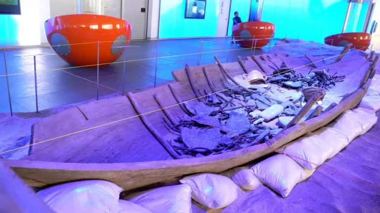 Costa CálidaPhoenician Shipwrecks of MazarrónThe Mazarrón shipwrecks yielded the earliest true anchor ever found in the Mediterranean, and a construction technique still debated as Phoenician or local Iberian.Read more →
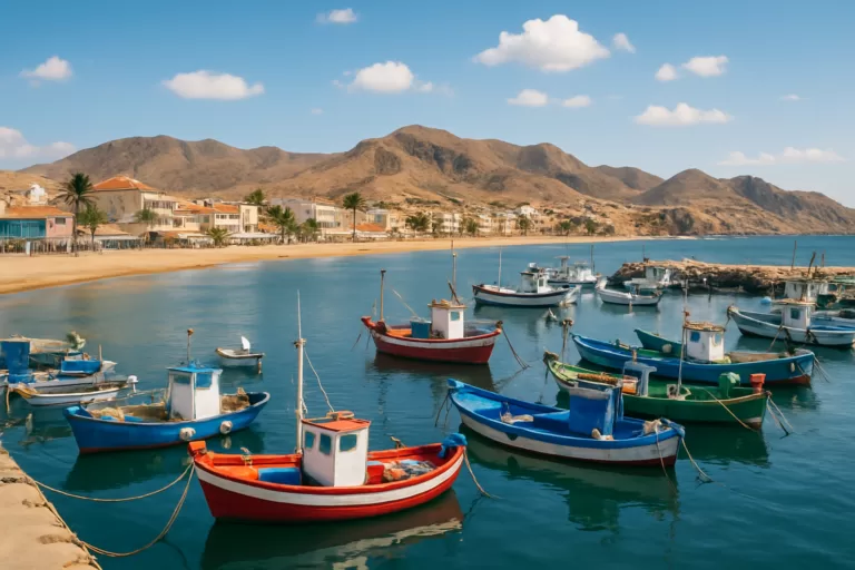 Costa CálidaPuerto de MazarrónPuerto de Mazarrón is a working fishing town with sandy bays and lively summer nights, just north of the Bolnuevo […]Read more →
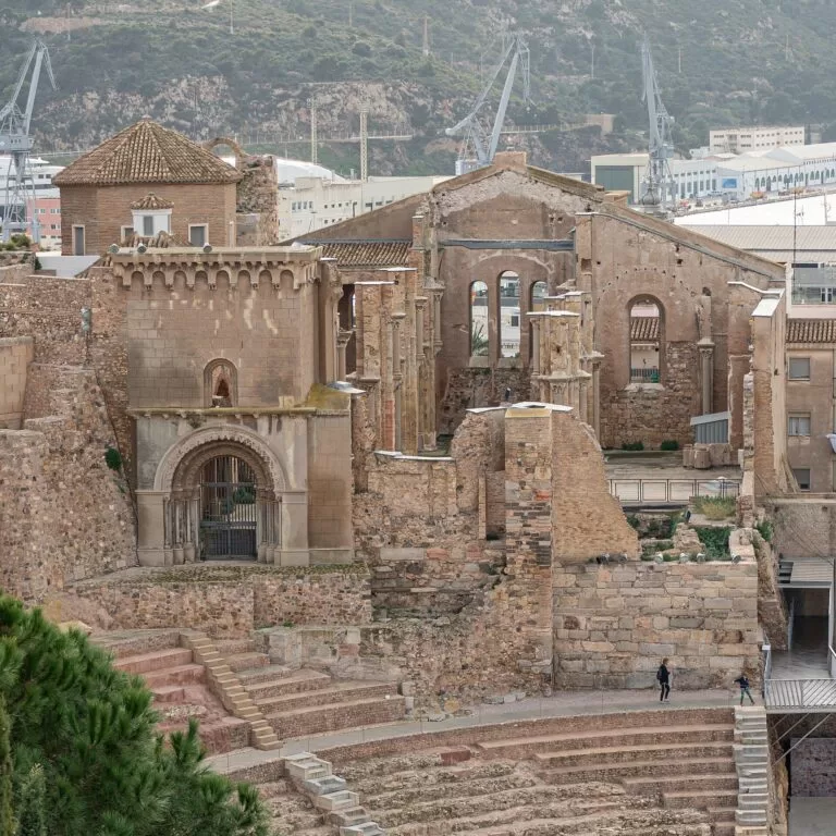 Costa CálidaCartagena CathedralCartagena Cathedral lost its own religious authority to Murcia in 1291, then was shelled into ruin by its own country’s army in 1939.Read more →
 Costa CálidaRoman Theatre of CartagenaCartagena’s 7,000-seat Roman theatre was completely unknown until a construction crew stumbled onto it by accident in 1988.Read more →
This place is part of our Costa Cálida — the honest guide to Spain's warm coast — see every town, beach and cove we have mapped on that coast.
How this page is maintained. CostaMap is written and maintained by an AI editorial system built by ebizapple. Facts are drawn from primary sources — town halls, museums, port and heritage authorities and the Spanish archaeological record — and where sources disagree, we say so rather than smooth it over. Photographs marked as ours are taken on location. This page was last reviewed on 3 October 2026. Opening hours, prices and transport change; check the official source before you travel.