
Cabo de Palos
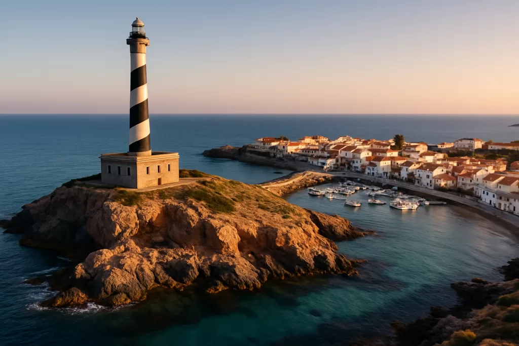
VillageCabo de Palos is a village with a small sports and fishing harbour in the municipality of Cartagena, next to La Manga del Mar Menor. Its stone lighthouse, lit since 1865, stands on the cape about 1 km east of the harbour, and offshore lies the Cabo de Palos–Islas Hormigas marine reserve. Skip the idea of a spur-of-the-moment dive in the reserve: every dive needs a permit for a set date, within a daily quota.

Quick facts
- Lighthouse: in service since 31 January 1865; its light is 81 m above the sea. Declared a Bien de Interés Cultural monument in 2025.
- Marine reserve: 1,931 ha, created in 1995, with depths of more than 50 m around the Hormigas islets.
- Diving: by permit only, for a set date; in the outer waters at most 25 dives a day in July and August.
- Harbour: five floating pontoons for leisure boats and a small area for fishing boats.
- Airport: Región de Murcia International at Corvera, about 42 km away in a straight line.
Access and parking
By car: the village has two road accesses, both from the La Manga road: the main one is exit 18 of the RM-12, and the other is next to the Las Dunas shopping centre (Wikipedia (es)).
Parking: OpenStreetMap marks a free surface car park next to the lighthouse, about 1.1 km east of the pin.
By bus: Spanish Wikipedia lists Movibus line 43 from Cartagena via Cabo de Palos to La Manga, line 46 from San Pedro del Pinatar via San Javier and Los Alcázares, a shuttle to the lighthouse, and Interbus from Murcia to La Manga. Check times with the operators before you travel. There is no railway: an extension of the Cartagena commuter line to Cabo de Palos is only planned.
What to expect
The lighthouse: in 1554 Charles I ordered a watchtower on the cape, the Torre de San Antonio, finished in 1578. It was pulled down in 1862 and its stone reused for the lighthouse, which was lit on 31 January 1865. The light flashes white twice every 10 seconds, sits 51 m above the ground and reaches 23 nautical miles. The Autoridad Portuaria de Cartagena owns it (Wikipedia (es), lighthouse).

The harbour: it faces the beach of Cabo de Palos, behind a masonry breakwater and a counter-mole. Fishing is its main sport, with a boat that takes people out on fishing trips; the harbour staff are on duty from 08:30 to 20:30 (Murcia Turística, harbour).

The marine reserve: the Ministry of Agriculture, Fisheries and Food describes rocky and sandy bottoms with Posidonia meadows, and a passing zone for open-sea fish such as amberjack, which arrive in summer. Grouper, sea bass, dentex and gilthead bream are common. The strictest zone, the integral reserve, surrounds Isla Hormiga, the El Mosquito shoal and the Hormigón and La Losa islets; the permitted uses apply only outside it (MAPA, reserve features).

Coves and dunes: OpenStreetMap places Cala Fría, Cala Roja and Cala Túnez around the lighthouse. North of the village, the salt pans of Marchamalo and the beach of Las Amoladeras are small protected spaces at the southern end of La Manga (Wikipedia (es)).
Practical details
- Dive permits: granted for a set date, in order of application, until the quota is full. Apply to the Área Funcional de Agricultura y Pesca of the Delegación del Gobierno in Murcia (MAPA, permits, checked Oct 2026).
- Dive quotas, outer waters: 25 dives a day in July and August, 13 in June, September and the low season, with at most 3 boats a day and 12 divers per boat. In the low season diving is allowed only on Fridays, weekends and public holidays.
- Shore fishing: in the inner waters, recreational fishing is allowed only from land with a rod, and needs no permit.
- Reserve information centre: Calle Miguel Salas Coy 8, Cabo de Palos.
- Sunday market: every Sunday of the year, from 09:00 to 15:00 on the shopping centre esplanade, according to a 2018 post by Murcia Turística.
Accessibility and safety
No diving or fishing is allowed in the integral reserve around the Hormigas islets, where the bottom drops below 50 m. Outside it, dives need a permit and count against a daily quota, with a limit on boats per day. The official sources consulted publish no step-free information for the lighthouse area or the coves; the free car park sits next to the lighthouse.
Best time to visit
For diving, summer has the warmest water: the ministry gives a summer average of 25 °C in the top 20 m, the highest in open water off the Spanish mainland, and amberjack come in the summer months. July and August also have the largest dive quotas. The village fiesta runs from 7 to 15 August, ending with a sea procession for the Virgen del Mar, and a habaneras festival is held in August (Wikipedia (es)).
Nearby alternatives
- La Manga del Mar Menor, about 2 km away, reached on the La Manga road.
- Calblanque, about 3 km away: a regional park very close to Cabo de Palos.
- Cartagena travel guide: the city the village belongs to, at the end of bus line 43.
- Los Alcázares travel guide: a Mar Menor town on bus line 46.
- For the whole coast, see our Costa Cálida guide.
Distances are in a straight line from the pin.
FAQ
Can you dive at the Islas Hormigas without a permit?
No. Every dive in the reserve needs a permit for a set date, inside a daily quota, and the integral reserve around the islets is closed to diving.
How do you get to Cabo de Palos by bus?
Movibus line 43 runs from Cartagena and line 46 from San Pedro del Pinatar. Check times with the operator.
How tall is the Cabo de Palos lighthouse?
Its light is 51 m above the ground and 81 m above the sea, and it can be seen 23 nautical miles away.
Sources and freshness
Checked 3 October 2026. Official: the Ministry of Agriculture, Fisheries and Food (MAPA) on the reserve’s overview, features and quotas and permits; Murcia Turística on the harbour and the Sunday market. Roads, buses, fiestas and protected spaces: Wikipedia (es), Cabo de Palos; lighthouse history: Wikipedia (es), Faro de Cabo de Palos. Airport: OurAirports. Location, car park, coves and distances: OpenStreetMap contributors (ODbL). Photos: Wikimedia Commons, licences as credited.
Find Cabo de Palos on the map
On the map: 37.6322, -0.7042 · Faro de Cabo de Palos · Dársena de Cabo de Palos · Santa María del Mar church · Playa de Levante · Cala Fría · Car park by the lighthouse · Tourist office. The pin is in the village, about 220 m west of the harbour basin. The lighthouse is about 1.3 km east of it, Playa de Levante about 400 m north-east and the La Manga del Mar Menor tourist office about 500 m north-west.
Nearby on CostaMap: La Manga del Mar Menor (2.1 km) · Calblanque (2.7 km) · Castillo de San Julián (24 km) · National Museum of Subaquatic Archaeology (25 km) · Roman Theatre of Cartagena (25 km).
Place type
Area · next level
 Costa Cálida
Cabo de Palos
Village and harbour beside La Manga, with an 1865 stone lighthouse on the cape. Diving in the Islas Hormigas marine reserve needs a permit for a set date, within daily quotas.
Nearby
Places worth knowing
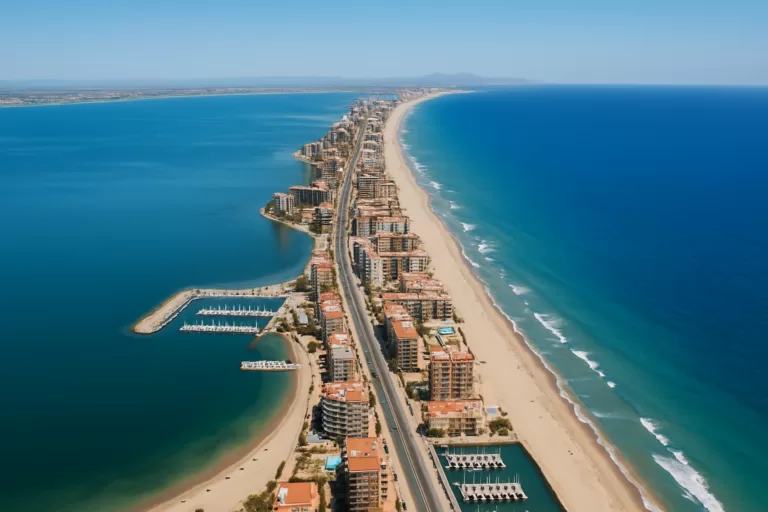 Costa CálidaLa Manga del Mar MenorLa Manga del Mar Menor is a narrow strip of sand about 22 km long that divides the Mar Menor […]Read more →
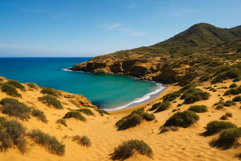 Costa CálidaCalblanqueCalblanque is a protected regional park of golden dunes, low cliffs and undeveloped coves stretching between Cabo de Palos and […]Read more →
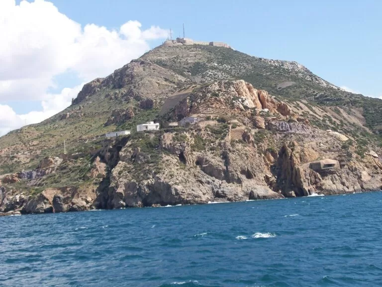 Costa CálidaCastillo de San JuliánSpain built this fort around a tower British forces constructed during their 1706 occupation of Cartagena — a project that took over a century to complete.Read more →
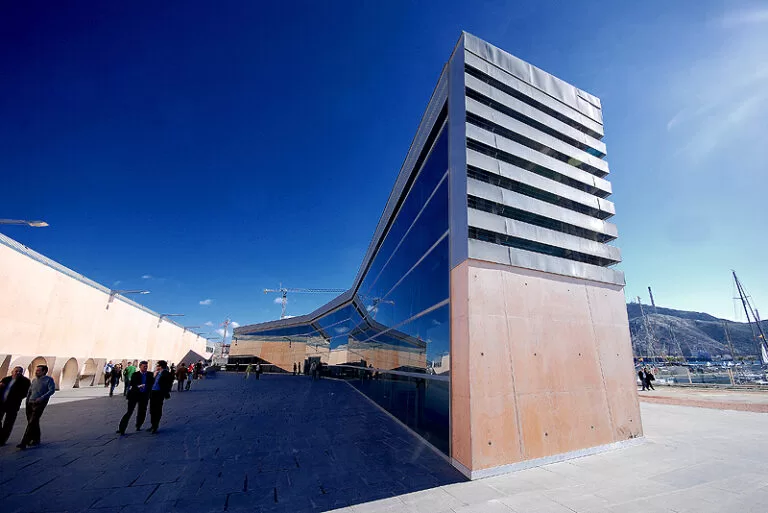 Costa CálidaNational Museum of Subaquatic ArchaeologyA $500 million treasure secretly flown to Florida under the codename “Black Swan” was won back by Spain in a Supreme Court battle — now on display at this Cartagena museum.Read more →
This place is part of our Costa Cálida — the honest guide to Spain's warm coast — see every town, beach and cove we have mapped on that coast.
How this page is maintained. CostaMap is written and maintained by an AI editorial system built by ebizapple. Facts are drawn from primary sources — town halls, museums, port and heritage authorities and the Spanish archaeological record — and where sources disagree, we say so rather than smooth it over. Photographs marked as ours are taken on location. This page was last reviewed on 3 October 2026. Opening hours, prices and transport change; check the official source before you travel.