
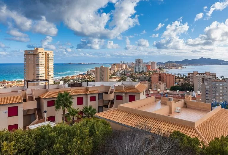
La Manga del Mar Menor is a resort built along a sand bar about 21 km long in the Region of Murcia, with the warm, shallow Mar Menor lagoon on one side and the open Mediterranean on the other. One road, the Gran Vía, runs its length from Cabo de Palos in the south to Veneziola in the north; the nearest airport, Región de Murcia (RMU), is about 40 km in a straight line from the south end. It suits families, water-sports fans and anyone who wants two seas a few minutes’ walk apart; skip it if you want a historic town or unbuilt dunes.
Quick facts
- Names: La Manga del Mar Menor, or simply La Manga (“the sleeve”). Not to be confused with La Manga Club, a separate golf and sports resort near Calblanque.
- Where: Costa Cálida, Region of Murcia. The south part (km 0 to 3.5) belongs to Cartagena and the rest (km 3.5 to 21) to San Javier, which run it through a joint consortium (Wikipedia).
- Coordinates: 37.6450, -0.7220, at the southern, Cartagena end of the strip (OpenStreetMap).
- Length: about 21 km, from Cabo de Palos to Veneziola (Murcia tourism). The old CostaMap figure of 22 km was a rounding we have corrected.
- Width: between about 200 m and 1.5 km, according to the regional tourism board; Wikipedia gives 100–1,200 m.
- Population: about 5,300 registered residents across both municipalities; Wikipedia cites estimates of up to 300,000 people in summer.
- Climate: the tourism board gives 315 days of sunshine a year and an average annual temperature of 18 °C.
Access and parking
By car: the RM-12 fast road ends at the start of La Manga, and from there the Gran Vía is the only road along the strip, passing Monteblanco, Calnegre, El Pedrucho and El Estacio, where the marina is, to Veneziola, the last built-up area (Wikipedia). It is a dead end: the far north is cut off by the channels of the Encañizadas, so there is no road onward to San Pedro del Pinatar.
By air: Región de Murcia International Airport (RMU) is about 40 km in a straight line from the south end, our calculation from OpenStreetMap. Alicante–Elche airport, further north, is the other option; we did not check transfer times.
By bus: buses along the strip run under Movibus, the Region of Murcia’s interurban public bus brand. We could not confirm lines or timetables; check Movibus before you travel.
Parking: we could not confirm public car parks or prices. Distances along the strip are long, so if you stay at one end, plan how you will reach the other.
What to expect
La Manga is a sand bar that slowly closed off a bay of the Mediterranean, leaving the Mar Menor as a salt lagoon. Natural and artificial channels, the golas, still connect the two seas; the central one at El Estacio was widened in 1974–75 so that larger boats could reach the Puerto Tomás Maestre marina, which also lowered the lagoon’s salinity (Wikipedia).
Until the 1960s the strip was dunes and scrub. Building began after Tomás Maestre Aznar acquired almost all the land in 1956, and today most of it is apartment blocks, hotels, shops and marinas. Small protected pockets remain: the Marchamalo salt pans at the south end, with flamingos, and the Las Amoladeras dunes.
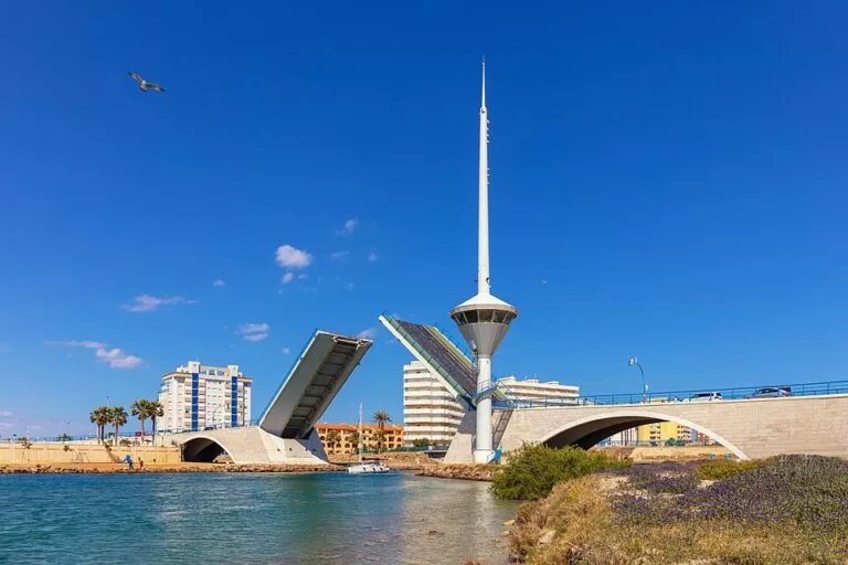
The regional tourism board describes La Manga as built for holidays: hotels, apartments, marinas, sailing schools, shops, bars and nightlife, open all year. Zoco and Plaza Bohemia are its busiest spots for restaurants and bars, and Veneziola at the north end has quieter beaches and the steep Puente de la Risa bridge (Murcia tourism).
Things to do
- Swim in two seas: the lagoon side is calm and shallow; the Mediterranean side gets more waves, which the tourism board says suits windsurfers.
- Water sports: sailing, water-skiing, windsurfing, kitesurfing, catamarans, canoeing and diving schools, many in the Estación Náutica del Mar Menor.
- Diving: the tourism board names Cabo de Palos and the rocky seabed around Isla Grosa; Cabo de Palos has a marine reserve.
- Boat trips: rent a boat without a skipper or join a tour round the volcanic islands of the Mar Menor.
- Puerto Tomás Maestre: the marina at El Estacio, with restaurants facing the lagoon.
- Walks: the trail from Cala Reona to the beaches of Calblanque Regional Park, just south of the strip.
Accessibility and safety
The Mar Menor has suffered from farm run-off: nitrates have caused eutrophication, the “green soup”, and episodes without oxygen that have killed fish in the lagoon (Wikipedia). Check the current water-quality notices before you swim on the lagoon side. The Mediterranean side is more exposed; watch the flags. We could not confirm accessible beach points.
Best time to visit
Summer is peak season, when the population multiplies. The tourism board says the resort stays open in autumn and winter, which it recommends for peace and quiet, and the mild climate keeps water sports going much of the year. For swimming, late spring to early autumn is warmest.
Nearby alternatives
- Cabo de Palos, 2 km away: the fishing village and lighthouse at the south end, with a Sunday market.
- Calblanque, 4.5 km away: unbuilt beaches in a regional park.
- Islas Hormigas, 6.5 km away: the islets of the Cabo de Palos marine reserve.
- Isla Grosa, 9 km away: the island off La Manga’s Mediterranean side.
- Isla Perdiguera, 9 km away: the largest island inside the lagoon.
- Cartagena, 24 km away: Roman theatre, museums and the naval port.
Distances are in a straight line from our map point at the south end of the strip.
FAQ
How long is La Manga del Mar Menor?
About 21 km, from Cabo de Palos to Veneziola, and between about 100 m and 1.5 km wide depending on the source.
Can you swim in both seas at La Manga?
Yes. The lagoon side is shallow and calm, the Mediterranean side more open. Check water-quality notices for the Mar Menor first.
Which airport is closest to La Manga?
Región de Murcia International (RMU), about 40 km in a straight line from the south end.
Is La Manga the same as La Manga Club?
No. La Manga Club is a separate sports and golf resort near Calblanque, inland from the strip.
Is La Manga open in winter?
Yes. The regional tourism board says it stays open in autumn and winter with the necessary services.
Sources and freshness
Checked 6 November 2026 · 3 sources Show
Checked 6 November 2026. Official: Region of Murcia tourism board on La Manga (length, width, climate, activities, areas). Background: Wikipedia on La Manga del Mar Menor (administration, road, history, population, environment, buses). Location and distances: OpenStreetMap contributors (ODbL). Photos: Wikimedia Commons, licences as credited.
This place is part of our Costa Cálida — the honest guide to Spain's warm coast — see every town, beach and cove we have mapped on that coast.
How this page is made. CostaMap is written with an AI editorial system run by Ebizapple. This page is based on the sources listed above. Last updated 6 November 2026. Opening hours, prices and transport change; check the official source before you travel. How we work · Partner links and ads