
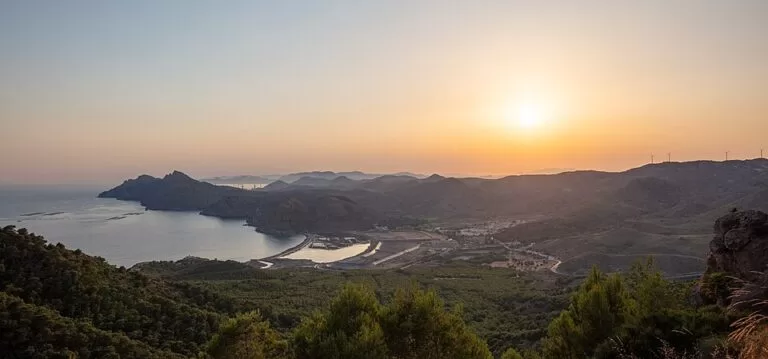
Portmán is a small village on a bay of the Mediterranean, the coastal district of La Unión, about 4 km south of La Unión town and 12 km east of Cartagena’s old town in a straight line. It is reached by the road from Los Belones or from La Unión, and by the La Unión–Portmán bus. Its bay was filled with mine waste in the second half of the 20th century; it also has a 950 m beach, a Roman mosaic museum and the Calblanque coast next door. It suits travellers interested in mining history; skip it if you want a classic resort beach.
Quick facts
- Names: Portmán (also written Portman). The Romans called it Portus Magnus, “great harbour”.
- Where: municipality of La Unión, Region of Murcia, at the foot of the Sierra Minera de Cartagena–La Unión.
- Coordinates: 37.5904, -0.8520 (village centre).
- Population: 956 (INE 2025, as recorded on OpenStreetMap).
- Beach: Playa de Portmán, 950 m long and about 110 m wide, fine golden sand, medium crowds (regional tourist board).
- Museum: Museo Arqueológico de Portmán, in an 1892 miners’ hospital, open Saturdays and Sundays 10:00–13:00, €3 (checked November 2026).
- Part of La Unión since: 1860, when it separated from Cartagena.
Access and parking
By car: the regional tourist board gives the beach at km 6.5 of the Carretera de Portmán, the road from Los Belones (near Cabo de Palos and La Manga) to Portmán (Region of Murcia tourism, Portmán beach). From La Unión, the road climbs over the Sierra Minera and down to the bay.
Parking: the tourist board says parking is near the beach. OpenStreetMap shows a car park in the village by Calle Caridad, about 350 m from the museum, and two free dirt car parks of about 70 and 20 spaces on the east side of the bay, near the Playa del Lastre.
By bus: the beach has a stop on the La Unión–Portmán line (tourist board). OpenStreetMap shows stops at the health centre (Consultorio), at “Transportes” and on the Los Belones road. From La Unión there are trains to Cartagena on the Cercanías C-1 line (see our La Unión guide).
What to expect
Portmán was a Roman port close to the mines of the Sierra Minera, and the hills around it are full of old mine workings (Wikipedia). Mining boomed again from the mid-19th century. The regional tourist board puts it plainly: the mining history decided the shape of this short stretch of coast, and the colours of the minerals give the landscape its unusual look (Cartagena coast and La Unión).
The bay itself is the reason Portmán is known in Spain. From 1957 the mining company Peñarroya worked the sierra in open-cast quarries and, with official permission, piped the waste from its ore washeries into the sea. Wikipedia gives some 315 million tonnes of mine waste for 1957–1987 and describes how the tailings silted up the bay and the old harbour. A regeneration project was approved in 2011 and work began in October 2016, but we could not confirm on an official site how far it has got. Wikipedia describes a shore now dominated by large storage basins built for the clean-up, which block the view of the old bay. OpenStreetMap marks one tailings pond as a contamination hazard: keep to paths and do not let children dig in the sediment.
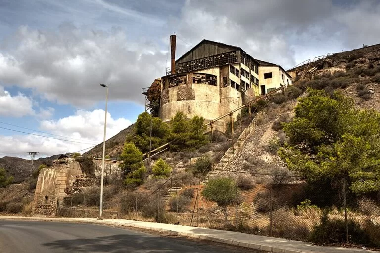
The village is small; OpenStreetMap shows a few restaurants and a supermarket. The Casa del Tío Lobo, or Casa Zapata, the house of the mining businessman Miguel Zapata, is a listed building near the museum; the architect Víctor Beltrí added its upper floor in 1913. Above the village stands the ruined Lavadero Roberto, one of the old ore washeries.
The Archaeological Museum
The Museo Arqueológico de Portmán occupies the old Charity Hospital, built in 1892 to treat injured miners and now a listed monument. The building has a rectangular plan with a central chapel crowned by an octagonal tower and a dome. Inside are mosaics and painted stucco from the Roman villa of El Paturro (1st–3rd century AD), found just east of the village; the opus tessellatum mosaics show a peacock and a woman’s face (Region of Murcia tourism, museum).
- Opening: Saturdays and Sundays, 10:00–13:00.
- Entry: €3 single rate.
- Groups: by booking with the La Unión tourist office, 968 541 614.
Hours and price as listed by the regional tourist board, checked November 2026.
Beaches
The tourist board lists Playa de Portmán as a semi-urban beach of fine golden sand, 950 m long and about 110 m wide, with moderate bathing conditions, medium crowds and beach bars. Wikipedia names two main beaches, San Bruno (the pedestrian beach of the bay) and the Playa del Lastre on the east side, and the cove of Cola del Caballo west of the bay, beside El Gorguel, towards Cartagena. The open coast east of Portmán belongs to the Calblanque, Monte de las Cenizas y Peña del Águila regional park.
Accessibility and safety
The tourist board publishes no accessibility data for Portmán beach. The old mining paths in the hills are rough and steep and pass old mine workings: stay on marked routes. Wikipedia notes high levels of heavy metals such as cadmium and lead in the tailings; swim from the beach the tourist board lists, not from the sediment plain. Summers are very hot, so walk early and carry water.
Best time to visit
A weekend visit lets you see the museum, which opens only on Saturday and Sunday mornings. Spring and autumn suit walks in the Sierra Minera and the Calblanque park; in summer go early. The village festivals are Santiago on 25 July and the sea procession of the Virgen del Carmen on 16 July (Wikipedia).
Nearby alternatives
- La Unión town guide, 3.7 km away: the Mining Museum, the Parque Minero and the Cante de las Minas flamenco festival in August.
- Calblanque, 10.8 km away: the regional park of dunes and unspoilt beaches between Portmán and Cabo de Palos.
- Cala Cortina, 10.9 km away: Cartagena’s town beach, reached through a tunnel.
- Roman Theatre of Cartagena, 11.7 km away: the Augustan theatre and Rafael Moneo’s museum.
- Cabo de Palos, 13.8 km away: the lighthouse village and diving base by the Islas Hormigas.
Distances are in a straight line from the village centre.
FAQ
Where is Portmán?
On the Mediterranean coast of the Region of Murcia, in the municipality of La Unión, between Cartagena and Cabo de Palos. The village lies at the foot of the Sierra Minera, about 4 km south of La Unión town.
Can you swim at Portmán?
The regional tourist board lists Playa de Portmán as a bathing beach of fine sand with moderate conditions. Do not swim or dig in the mine-waste sediment of the inner bay.
Why is Portmán Bay polluted?
From 1957 to the late 1980s mine waste from the ore washeries of the Sierra Minera was piped into the bay, and the tailings filled much of it. A regeneration project began in 2016; we could not confirm its current stage.
When is the Portmán Archaeological Museum open?
On Saturdays and Sundays from 10:00 to 13:00, with a single ticket of €3 (checked November 2026). Groups book through the La Unión tourist office.
How do I get to Portmán?
By car on the road from Los Belones or from La Unión; by bus on the La Unión–Portmán line. The nearest train station is in La Unión.
Sources and freshness
Checked 7 November 2026 · 6 sources Show
Checked 7 November 2026. Official: Region of Murcia tourist board on Portmán beach (size, sand, bus, directions; Spanish version), the Archaeological Museum (building, mosaics, hours, price) and the Cartagena coast and La Unión. The La Unión town hall site could not be reached for this update. Background: Wikipedia, Portmán (Roman name, 1860, beaches, mine waste and regeneration, Casa del Tío Lobo, festivals). Location, population tag, car parks, bus stops and distances: OpenStreetMap contributors (ODbL). Photos: Wikimedia Commons, licences as credited.
How this page is made. CostaMap is written with an AI editorial system run by Ebizapple. This page is based on the sources listed above. Last updated 9 November 2026. Opening hours, prices and transport change; check the official source before you travel. How we work · Partner links and ads