
The Camí de Cavalls is the coastal path that goes all the way round Menorca: 185 km in 20 stages, waymarked as the long-distance trail GR 223. It starts and ends at the port of Maó, follows the north coast to Ciutadella and returns along the south coast, and as a loop it can be started at any point. You can walk it over several days or pick single stages. It suits walkers who are happy on rocky paths; skip it if you need a smooth surface or step-free access.
Quick facts
- Names: Camí de Cavalls, Catalan for “horse path”; in Spanish Camino de Caballos. Official name GR-223 Camí de Cavalls.
- Where: the whole coast of Menorca (Balearic Islands), through Maó, Ciutadella and the island’s other coastal municipalities.
- Coordinates: 39.8908, 4.2600 (the route at Maó, from OpenStreetMap).
- Distance: 185 km, circular, in 20 stages of about 5 to 13 km each (spain.info). Measured along the GR 223 route on OpenStreetMap: 184.9 km.
- Stages: stages 1 to 10 run along the north coast from Maó to Ciutadella; stages 11 to 20 return along the south coast from Ciutadella to Maó.
- Waymarking: red and white GR marks and wooden posts, with information panels at the start of stages.
- Who can use it: walkers, cyclists and horse riders.
- Entry: free. The path is a public right of way under a Balearic law of 2000 (Wikipedia).
Access and parking
Getting to Menorca: the airport is 4.5 km from Maó, and ferries run from Mallorca, Valencia and Barcelona (spain.info).
Reaching a stage: the stages link beaches, coves, lighthouses and villages around the coast. The official advice is that public buses exist but a car is more convenient, and that you plan how to get back to your accommodation before you set out. A common pattern is to walk one stage out in the morning and back in the afternoon.
Parking: there is no single car park for the route; it depends on the stage. We could not confirm current parking rules or prices at individual coves, so check locally.
What to expect
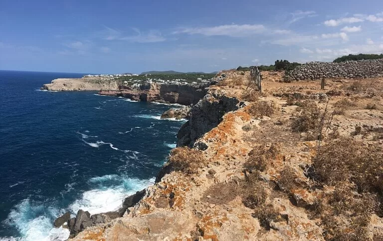
The path links most of Menorca’s sights on the coast. On the north coast (stages 1–10) you pass the beaches of Sa Mesquida and Es Grau, the S’Albufera des Grau Natural Park, the lighthouses of Cap de Favàritx, Cavalleria and Punta Nati, the coves of Binimel·la and El Pilar, and the cliffs and prehistoric burial caves of Cala Morell. The landscape changes between woodland, dunes and bare rock.
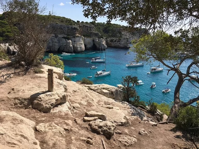
On the south coast (stages 11–20) the path dips in and out of ravines and reaches coves such as Cala Blanca, Son Saura, Cala en Turqueta, Macarella and Macarelleta, then Cala Galdana and Son Bou, the island’s longest beach, with a dune system. Further east come Cales Coves, with its Talaiotic necropolis, and the watchtower of Alcalfar. Spain.info counts more than 50 coves and beaches on the way.
The route is old. Some sections may go back to the 14th century, and it was used to patrol the coast and link the watchtowers. After a long public campaign, the Balearic parliament passed a law for the path in 2000, it reopened along its whole length in 2010 after waymarking, and it was approved as the GR 223 in 2012 (Catalan Wikipedia). Many sections cross farmland, so expect gates.
Practical details
- Planning: stage lengths of 5 to 13 km mean most stages are a half-day or a short day on foot. You can do the whole loop over several days or pick single stages.
- Footwear: wear proper walking shoes: much of the trail is rocky.
- What to carry: plenty of water, food and snacks; in summer a sun hat, sun cream and a swimsuit. Pack a raincoat or warm layer in the cooler months.
- Navigation: follow the waymarks. Spain.info offers a GPX download of the route, and the line is mapped on OpenStreetMap.
- Gates: close every gate behind you; the path crosses working farms.
We could not open the island council’s official Camí de Cavalls website from here, so stage-by-stage distances, times and any current closures are not listed. Check them on the official site before you go.
Accessibility and safety
The Camí de Cavalls is not suitable for wheelchairs or pushchairs over most of its length: the surface is mainly rock, earth and sand, with ravines on the south coast. Short stretches near villages are on tracks or streets. Carry enough water, especially in summer. Wind matters on this island: check the forecast and pick the sheltered coast.
Best time to visit
In summer, start early and bring a swimsuit. Spain.info suggests walking the north coast when the wind blows from the south and the south coast in a north wind, and walking east to west to keep the sun behind you.
Nearby alternatives
- Maó Harbour, 0.8 km away: the long natural harbour where the route starts and ends.
- Naveta des Tudons, 34 km away: the prehistoric burial building near Ciutadella, a short drive from the north-west stages.
- Serra de Tramuntana, 130 km away on Mallorca: the mountain range with Mallorca’s long-distance walking routes.
Distances are in a straight line from the route at Maó.
FAQ
How long is the Camí de Cavalls?
185 km, split into 20 stages of about 5 to 13 km. Measured on OpenStreetMap, the GR 223 line is 184.9 km.
Where does the Camí de Cavalls start?
Officially at the port of Maó. It is a loop, so you can start at any stage; stages 1–10 follow the north coast to Ciutadella and 11–20 return along the south coast.
Do you need a permit or ticket for the Camí de Cavalls?
No. It is a free public path for walkers, cyclists and riders.
How do I get to the start of a stage?
By car or by local bus; spain.info says a car is more convenient. Plan your return before you set off.
Can you swim along the Camí de Cavalls?
Yes. The path passes more than 50 coves and beaches, including Macarella, Cala en Turqueta and Son Bou. Pack a swimsuit in summer.
Sources and freshness
Checked 6 November 2026 · 3 sources Show
Checked 6 November 2026. Official: spain.info, Camí de Cavalls trail (Spain’s national tourist board: length, stages, places on the way, transport, tips). The Menorca island council’s own trail website and visitmenorca.com could not be reached from our research tools. Background (history, law of 2000, GR status, km 0): Catalan Wikipedia. Route length, coordinates and distances: OpenStreetMap, GR 223 relation (ODbL). Photos: Wikimedia Commons, licences as credited.
This place is part of our Balearic Islands travel guide: Mallorca, Menorca, Ibiza and Formentera — see every town, beach and cove we have mapped on that coast.
How this page is made. CostaMap is written with an AI editorial system run by Ebizapple. This page is based on the sources listed above. Last updated 6 November 2026. Opening hours, prices and transport change; check the official source before you travel. How we work · Partner links and ads