
La Isleta del Moro (Cabo de Gata)
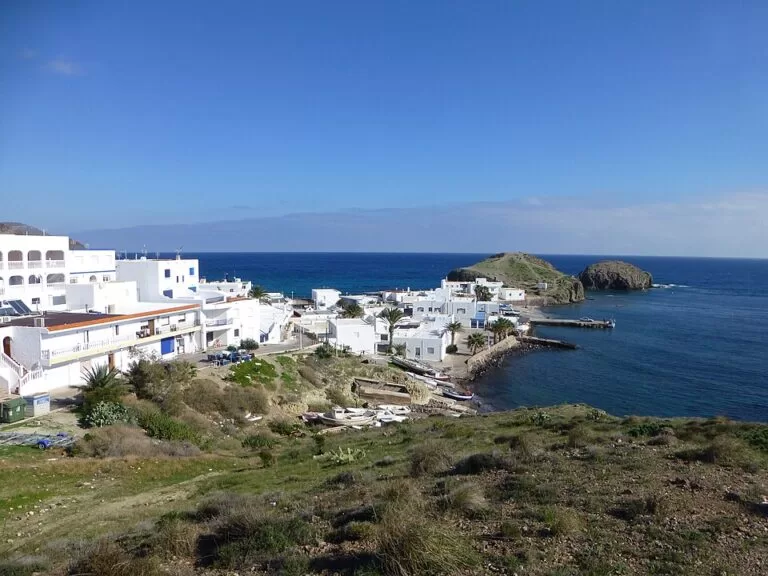
VillageLa Isleta del Moro is a tiny fishing village in the Cabo de Gata-Níjar Natural Park in Almería, built around a small harbour beside the rocky islet that gives it its name, between Los Escullos and the Mirador de la Amatista. It is about 36 km east of Almería city in a straight line and is reached by road on the coast route between San José and Rodalquilar; a bus stop and free car parks are mapped in the village. It suits people who want fish restaurants, snorkelling and a quiet night in a whitewashed hamlet; skip it if you need a long sandy beach, shops or nightlife.
Quick facts
- Names: La Isleta del Moro, La Isleta del Moro Arráez or simply La Isleta. The islet itself is the Isleta del Moro Arráez.
- Where: a pedanía (village district) of the municipality of Níjar, Almería, inside the Cabo de Gata-Níjar Natural Park; Los Escullos is 1.6 km south-west and Rodalquilar 4.2 km north.
- Coordinates: 36.8147, -2.0533.
- Population: 203 according to Spanish Wikipedia; OpenStreetMap gives 194 for 2025.
- Name origin: a refuge of Barbary pirates, named by the corsair leader Mohamed Arráez after the islet off the shore (Spanish Wikipedia).
- Beach: Playa del Peñón Blanco, 240 m by 30 m of golden sand, on the north side of the village (spain.info).
- Entry: free; the village has no barrier or fee.
Getting there and parking
By car: Spanish Wikipedia puts the village 40 km from Almería on the AL-3115 route. In a straight line it is about 36 km from Almería city and 28 km from Almería airport, 7.8 km from San José and 8.5 km from Las Negras. OpenStreetMap shows three free surface car parks: one by the playground at the west end and two near Playa del Peñón Blanco.
By bus: a sheltered bus stop named “Isleta del Moro” is mapped on the main street, next to the drinking-water tap (OpenStreetMap). We could not open a current timetable; check before you travel.
On foot: the coast is part of the Senda Azul de Cabo de Gata walking route on OpenStreetMap. The Mirador de la Amatista lies 1.9 km north along the road towards Rodalquilar.
What to expect
Andalucía’s official tourism site describes a small fishing and tourist settlement near Los Escullos, next to a huge rock and the islet that gives it its name: a small group of white houses where people have lived from fishing for as long as anyone remembers (andalucia.org). Today, Spanish Wikipedia says, tourism and restaurants are the main income, with dive schools and walking routes, and fishing now only a small part.
The village is a few streets of whitewashed houses above a concrete quay. The islet rises to 22 m (OpenStreetMap). There are two lookouts over the harbour, and a geology board called “Los abanicos aluviales de la isleta” explains the alluvial fans the village sits on. Spain.info’s guide to the park’s unspoilt coves uses the village as its cover image and lists it on the coast route from Carboneras to Cabo de Gata (spain.info).
La Isleta is also a film set. Spanish Wikipedia lists El pájaro de la felicidad, Un día sin fin, Víctor Erice’s short Sea-Mail, episodes of the 2020 series Veneno and scenes of Terminator: Dark Fate, filmed around May 2018.
Beaches and coves
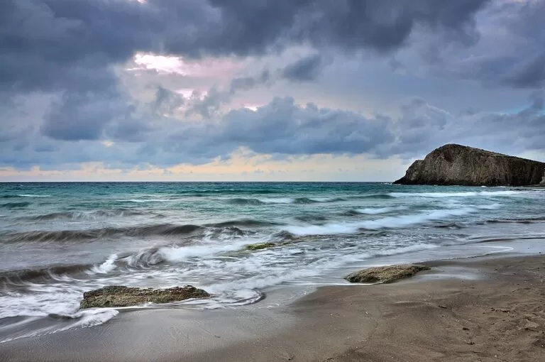
- Playa del Peñón Blanco: the beach north of the village, 240 m long and 30 m wide, golden sand, calm water, showers, low occupancy, with areas used for nude sunbathing; the Isleta rock stands opposite (spain.info).
- The harbour coves: small sandy patches beside the quay, where the boats are pulled up (OpenStreetMap).
- Playa del Arco, Los Escullos: 350 m by 40 m of golden sand 1.6 km south-west, with high rocks on its south side (spain.info). Los Escullos is a small fishing and tourist village under the Cerro del Fraile, with fossil dunes and the 18th-century Castillo de San Felipe, a coastal battery on an 8 m limestone cliff (andalucia.org).
Practical details
- Eating: OpenStreetMap maps several restaurants in the village, including fish restaurants by the harbour; opening seasons could not be checked.
- Shop: one small convenience shop (OpenStreetMap); for supermarkets go to San José or Las Negras.
- Diving: two dive centres are mapped by the harbour, and Spanish Wikipedia mentions dive schools.
- Water and toilets: a public drinking-water tap by the bus stop and free public toilets near the beach, not wheelchair accessible (OpenStreetMap).
- Camping: wild camping is banned throughout the natural park (Spanish Wikipedia).
Accessibility and safety
The streets are short but some are steep, and one lane is a flight of steps. A defibrillator is mapped by the fountain on the main street (OpenStreetMap). The public toilets are tagged as not wheelchair accessible. For a beach with amphibious chairs and adapted toilets go to San José (andalucia.org). No lifeguard service is listed for Peñón Blanco.
Best time to visit
Spring and autumn are quiet and good for walking to the Amatista lookout and Los Escullos. In summer the car parks are small, so arrive early. Evening light over the islet and the harbour is the classic photo.
Nearby alternatives
- Mirador de la Amatista – the cliff-top lookout on the road north; 1.9 km.
- Rodalquilar – the old gold-mining village; 4.2 km.
- San José – the park’s main resort, with the marina and Blue Flag beach; 7.8 km.
- Las Negras – the larger fishing village to the north-east; 8.5 km.
- Los Genoveses walk from San José – the long natural bay south of San José; 8.0 km.
- Playa de Mónsul – the park’s famous film beach; 12.4 km.
Distances are straight-line from the village centre.
FAQ
How do I get to La Isleta del Moro?
By car on the coast road between San José and Rodalquilar, about 40 km from Almería. A bus stop is mapped in the village; check the timetable before you rely on it.
Is there parking in La Isleta del Moro?
Yes. OpenStreetMap shows three free surface car parks, one at the west end and two near Playa del Peñón Blanco. They are small.
Is there a beach at La Isleta del Moro?
Yes. Playa del Peñón Blanco, just north of the village, has 240 m of golden sand and calm water; Playa del Arco at Los Escullos is 1.6 km away.
Why is it called La Isleta del Moro?
After the islet off the shore and the Barbary corsair Mohamed Arráez, who used it as a refuge, according to Spanish Wikipedia.
Which films were made in La Isleta del Moro?
Among others Un día sin fin, El pájaro de la felicidad, the series Veneno and Terminator: Dark Fate.
Sources and freshness
Checked 9 November 2026 · 5 sources Show
- Checked 9 November 2026. andalucia.org: La Isleta del Moro, Los Escullos and Castillo de San Felipe
- spain.info: Peñón Blanco, El Arco and Almería’s unspoilt coves
- Spanish Wikipedia: La Isleta del Moro (population, name, economy, films)
- OpenStreetMap (coordinates, car parks, bus stop, toilets, islet height
- ODbL). Níjar town hall and the park’s website could not be reached, so bus times and restaurant seasons are not confirmed
How this page is made. CostaMap is written with an AI editorial system run by Ebizapple. This page is based on the sources listed above. Last updated 9 November 2026. Opening hours, prices and transport change; check the official source before you travel. How we work · Partner links and ads